
Jillson, Willard Rouse (sold)

Willard Rouse Jillson (May 28, 1890 - October 4, 1975) was an American geologist, historian, author, and academic best known for his extensive contributions to the study of Kentucky's geology and history. Born in Syracuse, New York, Jillson worked briefly in the Midwest before moving to Kentucky in 1917, drawn by the rapidly expanding oil and gas industry. He joined the faculty of the University of Kentucky in Lexington in 1918 and later taught at Transylvania University beginning in 1947. In 1919, Jillson was appointed State Geologist of Kentucky, eventually serving as director of the Sixth Kentucky Geological Survey; in 1924, he became Commissioner of Kentucky Parks. His long public career also included service as Curator of the State Museum, and in the private sector he helped develop Kentucky oil and gas fields. A prolific scholar, Jillson authored numerous works on Kentucky geology, natural resources, history, and political figures, becoming one of the foremost chroniclers of the Commonwealth's geological and historical heritage.
Gigantic geological map of Kentucky.
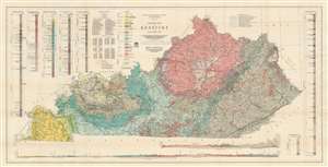
Geologic Map of Kentucky.
sold
- Digital Map Information
- Suitable for large format printing
- File Size: 81.68 MB
- File Type: ZIP / TIFF
- ICC color profile embedded
- Delivered instantly via download link
This is a gigantic 1929 Willard Rouse Jillson geological map of Kentucky. The map locates seventeen geological zones with distinct colors and patterns, each defined in legend in the upper right. Fault lines are also noted and traced in green. As are resources: coal mines, rock asphalt mines, and oil and gas fields. Oil and gas fields are numerically identified and correspond with an index in the upper left. Five different geologic cores are also included in the upper left and right. Two profile sections illustrating layered geological formations are included along the bottom border. (more details)
Gigantic geological map of Kentucky.
Geologic Map of Kentucky.
sold
- Digital Map Information
- Suitable for large format printing
- File Size: 83.35 MB
- File Type: ZIP / TIFF
- ICC color profile embedded
- Delivered instantly via download link
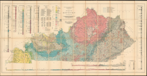
This is a gigantic 1929 Willard Rouse Jillson geological map of Kentucky. The map locates seventeen geological zones with distinct colors and patterns, each defined in the legend in the upper right. Fault lines are also noted and traced in green. As are resources: coal mines, rock asphalt mines, and oil and gas fields. Oil and gas fields are numerically identified and correspond with an index in the upper left. Five different geologic cores are also included in the upper left and right. Two profile sections illustrating layered geological formations are included along the bottom border. (more details)