
Keere, Pieter van den (sold)

Pieter van den Keere (1571 - c. 1646) was a Dutch engraver and cartographer active in London and Amsterdam in the late 16th and early 17th centuries. Keere, who is alternatively known as Kaerius or Coerius, was born in Gent, the son of printer and type founder Hendric van den Keere. Religious persecution in the Low Countries forced Keere, with many others, to take refuge in London, where they established themselves. There Keere married the sister of Jodocus Hondius, also a refugee in London, and it was most likely through Jodocus that he mastered engraving and mapmaking. Keere is responsible for numerous maps, most of which are associated with the Hondius firm. Some of his most notable works include numerous county maps of the British Isles that were later compiled into Camden's Britannia. Keere also engraved many of the maps included in the Jansson Atlas Minor.
Classic single-sheet world map on Mercator's projection... celebrated as one of the supreme examples of the map maker's art. - Shirley
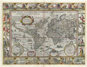
Nova Totius Terrarum Orbis Geographica ac Hydrographica Tabula.
sold
- Digital Map Information
- Suitable for large format printing
- DPI: 600
- File Size: 28.22 MB
- File Type: ZIP / TIFF
- ICC color profile embedded
- Delivered instantly via download link
A striking example of Dutch Golden Age cartography, this is Pieter van de Keere's 1628 carte-á-figures map of the world on the Mercator projection surrounded by allegorical imagery. The cartography embraces many of the common misconceptions of the period, including general confusion regarding the cartography of North America, the polar regions, the interior of Africa, and East Asia. (more details)
Uncommon early map of Bermuda.
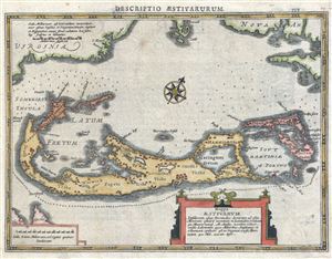
Mappa Aestivarum Insularum Alias Bermudas Dictarum ad Ostia Mexicane …
sold
- Digital Map Information
- Suitable for large format printing
- Full resolution TIFF file
- ICC color profile embedded
- Delivered instantly via download link
A scarce c. 1630 small format map of Bermuda by Johannes Cloppenburg. Based upon an earlier maps by Gerard Mercator and John Speed, this map shows the whole of Bermuda. Around the edges of the map parts of neighboring islands and the mainland of North America ... (more details)
Korea represented as an Island.
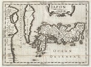
Iapon.
sold
- Digital Map Information
- Suitable for large format printing
- DPI: 300
- File Size: 2.93 MB
- File Type: ZIP / TIFF
- ICC color profile embedded
- Delivered instantly via download link
A rare map of Japan and Korea drawn by Johannus Cloppenburgh and engraved by Pieter van den Keere (Kaerius) in 1700. Cartographically this map is a reduced form Hondius' of Japan from the same period. This is second edition prepared for Martineau de Plessis' ... (more details)
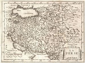
La Perse.
sold
- Digital Map Information
- Suitable for large format printing
- DPI: 300
- File Size: 2.94 MB
- File Type: ZIP / TIFF
- ICC color profile embedded
- Delivered instantly via download link
An uncommon and unusual map of Persia issued for Martineau du Plessis in 1700. Covering from the Capsian Sea to the Persian Gulf and from Armenia to India and Tartary, this is most likes a re-engraving of Kaerius' c. 1628 map of the region. Cartographically ... (more details)