
Lang and Laing (sold)

Lang and Laing (fl. 1861 – August 16, 1862) were New York City based publishers and lithographers active in the middle part of the 19th century. The firm was founded by founded by William Lang and Joseph Laing and maintained offices at 117 Fulton Street, New York City. They specialized in transferring copper and steel plates to lithographic stone for more economical printing. Their most significant cartographic work is the Jacob de Cordova and Robert Creuzbaur map of Texas. The firm was dissolved in August of 1862. Lang went on to partered with Henry Pooley Cooper, and continued to publish under the Lang and Cooper imprint until 1864.
Rare advertising broadsheet issued to capitalize on interest in the Second Italian War of Independence.
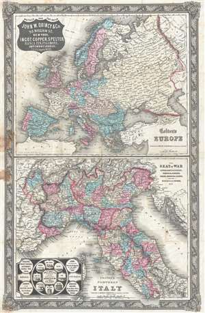
The Seat of War Lombardy and Venice, Sardinia, Tuscany, Parma, Modena, Lucca, and the States of the Church, 1859. / Colton's Northern Italy. / Colton's Europe.
sold
- Digital Map Information
- Suitable for large format printing
- File Size: 15.03 MB
- File Type: ZIP / TIFF
- ICC color profile embedded
- Delivered instantly via download link
This is a rare separately issued 1859 appropriation of Colton's c. 1855 maps of Italy and Europe to promote the interests of the John W. Quincy hardware and ironworks company. This map was issued in 1859 to capitalize on general interest in the Second Italian War ... (more details)
First large-scale commercial map of the Confederacy.
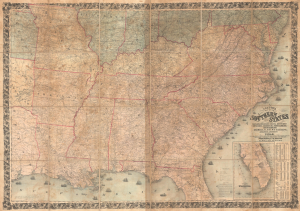
Colton's Map of the Southern States, including Maryland, Delaware, Virginia, Kentucky, Tennessee, Missouri, North Carolina, South Carolina, Georgia, Alabama, Mississippi, Arkansas, Louisiana, and Texas. Showing Also Part of Adjoining States and Territories Locating the Forts and Military Stations of the U. States and Showing all the Rail Roads, R.R. Stations, and other Internal Improvements.
sold
- Digital Map Information
- Suitable for large format printing
- File Size: 198.45 MB
- File Type: ZIP / TIFF
- ICC color profile embedded
- Delivered instantly via download link
This is an 1861 J. H. Colton map of the Confederacy published in the first year of the American Civil War (1861 - 1865). This is the first large-scale commercial map of the Confederacy, published early in 1861, in the immediate wake of the Secession. (more details)
Ports in War.
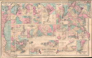
Colton's Plans of U.S. Harbors Showing the Position and Vicinities of the Most Important Fortifications on the Sea-Board and in the Interior.
sold
- Digital Map Information
- Suitable for large format printing
- File Size: 41.48 MB
- File Type: ZIP / TIFF
- ICC color profile embedded
- Delivered instantly via download link
This is a separate issue 1862 J. H. Colton map of the United States focusing on its many harbors and their fortifications during the American Civil War (1861 - 1865). The map details the key cities and theaters of the Civil War, but is specifically significant for its detailed coverage of the Mississippi River and its ports. (more details)