
Magyar Királyi Állami Térképészet (sold) (M. Kir. Állami Térképészet)
Magyar Királyi Állami Térképészet (1867 - 1952), translated 'Royal Hungarian State Cartography,' was a Hungarian government map publishing house active in the early 20th century. The organization can trace its origins to the Austro–Hungarian Compromise of 1867, which gave Hungary marginal independence with the right to establish its own civil cartography - thus issuing tourist maps, school maps, cadastral plans, etc. Austria retained jurisdiction over more detailed topographical cartography. This changed in 1918, during World War I (1914 - 1918), when Hungarian military leadership commissioned Colonel Lajos Hajts (1866 - 1933), professor of the Ludovika Military Academy, to lay the framework for a Hungarian State Cartography. This led to the formation of the Hungarian Military Mapping Group (Magyar Katonai Térképező) on February 4, 1919. This organization followed the Austrian Militärgeographisches Institut model. In 1922, the name changed to Magyar Királyi Katonai Állami Térképezet (Royal Hungarian State Mapping Institute). In 1938, the name changed again to Magyar Királyi Honvéd Térképészeti Intézet (Royal Hungarian Institute of Military Cartography). The Honvéd Térképészeti Intézet was folded into the Soviet-style Ministry of Defense in 1952.
AKA: M. Kir. Állami Térképészet
Art, zoology, and cartography, conceived by pioneering Hungarian female educator Baloghné Hajós Terézia.
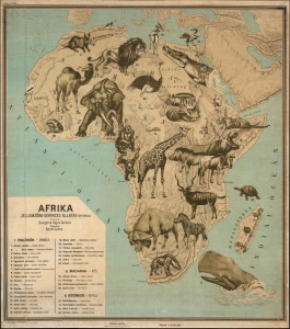
Afrika. Jellemzöbb Gerinces Állatai.
sold
- Digital Map Information
- Suitable for large format printing
- Full resolution TIFF file
- ICC color profile embedded
- Delivered instantly via download link
This spectacular 1927-28 Hungarian pictorial zoological wall map of Africa was conceived by pioneering female educator Baloghné Hajós Terézia and illustrated by Bálint János. Part of an extraordinary series depicting the characteristic wildlife of the world's continents, the map represents an innovative approach to teaching natural history through cartography. Bold, colorful, and visually arresting, the series prioritizes curiosity and discovery over strict zoological precision. Conceived as powerful pedagogical tools, these maps transform the classroom wall into a window on the natural world, inviting students to explore, question, and investigate. (more details)
Harnessing bold imagery and monumental scale to make natural history vivid, memorable, and engaging.
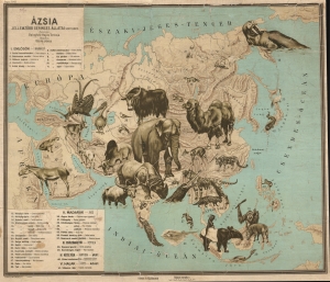
Ázsia. Jellemzöbb Gerinces Állatai.
sold
- Digital Map Information
- Suitable for large format printing
- Full resolution TIFF file
- ICC color profile embedded
- Delivered instantly via download link
This spectacular 1927-28 Hungarian pictorial zoological wall map of Asia was conceived by pioneering female educator Baloghné Hajós Terézia and illustrated by Bálint János. Part of an extraordinary series depicting the characteristic wildlife of the world's continents, the map represents an innovative approach to teaching natural history through cartography. Bold, colorful, and visually arresting, the series prioritizes curiosity and discovery over strict zoological precision. Conceived as powerful pedagogical tools, these maps transform the classroom wall into a window on the natural world, inviting students to explore, question, and investigate. (more details)
Zoological wall map reflecting a pioneering Hungarian female educator's innovative approach to teaching through curiosity and cartography.
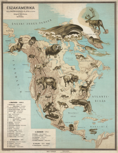
Északamerika. Jellemzöbb Gerinces Állatai.
sold
- Digital Map Information
- Suitable for large format printing
- Full resolution TIFF file
- ICC color profile embedded
- Delivered instantly via download link
This spectacular 1927-28 Hungarian pictorial zoological wall map of North America was conceived by pioneering female educator Baloghné Hajós Terézia and illustrated by Bálint János. Part of an extraordinary series depicting the characteristic wildlife of the world's continents, the map represents an innovative approach to teaching natural history through cartography. Bold, colorful, and visually arresting, the series prioritizes curiosity and discovery over strict zoological precision. Conceived as powerful pedagogical tools, these maps transform the classroom wall into a window on the natural world, inviting students to explore, question, and investigate. (more details)