
Mallet, Alain Manesson (sold)
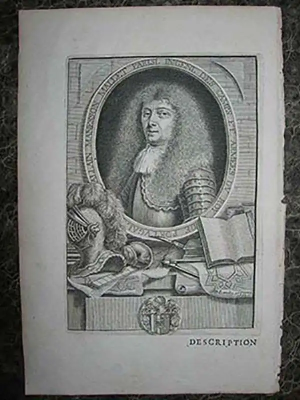
Alain Manesson Mallet (1630-1706) was a French cartographer, grammarian, engineer and mathematician, active in the mid to late 17th century. Despite being born in France, as a young man Mallet joined the Portuguese - yes Portuguese - army where he served as a Sergeant-Major. Later he was able to levy his war experience into a career as Inspector of Fortifications for Louis XIV of France. It was in this position, where his work entailed examining and sketching various fortresses, that Mallet developed his cartographic interests. His most important work is his monumental five volume opus Description de L'Univers, published in 1683. This impressive work described the cultures, governments, lands, and customs of all the known peoples of the earth and included numerous maps and engravings. At the time, the Description was the largest and most comprehensive work of its kind ever published. A year later, in 1684, he published his 3 volume Les Travaux de Mars ou l'Art de la Guerre. Mallet is also known for his invention of the "dumpy bubble", a telescopic sight incorporating a level bubble used for surveying and astronomical observations.
One of the most celebrated miniature maps of California as an island.
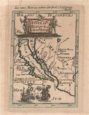
das neue Mexica nebens der Insel Californien. / Nouveau Mexique et Californie.
sold
- Digital Map Information
- Suitable for large format printing
- DPI: 600
- File Size: 2 MB
- File Type: ZIP / TIFF
- ICC color profile embedded
- Delivered instantly via download link
This is a 1683 Alain Manesson Mallet map of California as an island in its much scarcer German edition. The map depicts the region from the Pacific Ocean to Santa Fe (Real de Nueva Mexico) and the Suala Mountains and from Rey Coromedo to Mexico (Nouvelle Espagne). One of the most celebrated miniature maps of California as an island, Mallet employs a unique projection, making this an essential piece for any collector of maps illustrating California as an island. Most maps that include California as an island depict the entirety of North America, making a map of this scope a rare find, and this is one of the earliest. (more details)
Featuring a mighty sea battle!
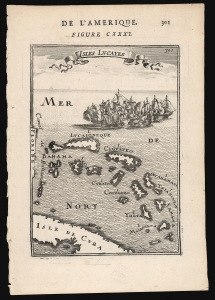
Isles Lucayes.
sold
- Digital Map Information
- Suitable for large format printing
- DPI: 600
- File Size: 6.07 MB
- File Type: ZIP / TIFF
- ICC color profile embedded
- Delivered instantly via download link
This is a 1683 Alain Manesson Mallet map of the Bahamas: one of the earliest maps to focus on the archipelago. The map pictures the islands separated from Florida by the 'Canal de Bahama', and with part of the island of Cuba marking the map's southern extreme. The islands are presented and named after the c.1631 chart of the Dutch Hessel Gerritsz, whose depiction of the Caribbean provided the main model for the region followed by virtually every cartographer of the 17th century.
The engraving is attractively done: the plate is topped with a flowing title banner, and is decorated with a mighty sea battle: after all, the Canal de Bahama was the safe passage out of the Gulf of Mexico used by the Spanish treasure fleets, and the Bahamas provided Dutch, English and French pirates ample safe harbor in which to lie in wait for the fat Spanish galleons. (more details)
The engraving is attractively done: the plate is topped with a flowing title banner, and is decorated with a mighty sea battle: after all, the Canal de Bahama was the safe passage out of the Gulf of Mexico used by the Spanish treasure fleets, and the Bahamas provided Dutch, English and French pirates ample safe harbor in which to lie in wait for the fat Spanish galleons. (more details)
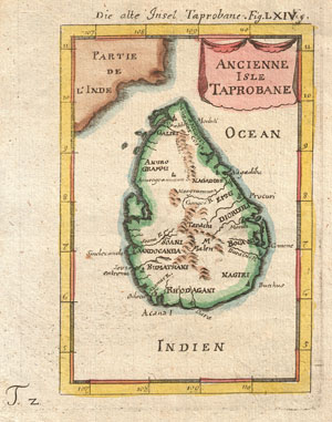
Ancienne Isle Taprobane. Die alte Insel Tabrobane.
sold
- Digital Map Information
- Suitable for large format printing
- Full resolution TIFF file
- ICC color profile embedded
- Delivered instantly via download link
A beautiful miniature 1683 map of Ceylon, Sri Lanka, or Taprobane by Alain Mallet. This stunning little map covers the island of Ceylon as well as parts of adjacent India. Mallet first introduced this map in the 1683 though it was republished several time in the ... (more details)
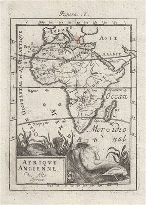
Afrique Ancienne das Alte Africa.
sold
- Digital Map Information
- Suitable for large format printing
- Full resolution TIFF file
- ICC color profile embedded
- Delivered instantly via download link
An attractive 1719 miniature map of Africa by Alain Manesson Mallet. Map covers the entire continent of Africa as well as adjacent parts of Europe, Asia, and Arabia. Attempts to illustrate Africa in Antiquity. Shows the Nile according to the Ptolemaic model ... (more details)
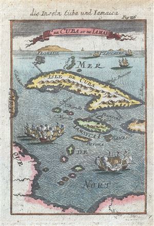
Die Inseln Cuba und Iamiaica / De Cuba et de Iamaica.
sold
- Digital Map Information
- Suitable for large format printing
- DPI: 300
- File Size: 1.34 MB
- File Type: ZIP / TIFF
- ICC color profile embedded
- Delivered instantly via download link
This is an attractive c. 1719 view and map of Cuba from the German edition of Mallet's Description . This map combines the virtues of a traditional map and a view. Cuba and Jamaica, the subject matter at hand, are illustrated in map format while Florida and ... (more details)