
Mannevillette, Jean-Baptiste d'Après de

Jean-Baptiste Nicolas Denis d'Après de Mannevillette (February 11, 1707 - March 1, 1780) was a French sailor, navigator, and hydrographer active in the mid-18th century. Mannevillette was born in Le Havre to a family of wealthy seafarers. He completed his first major voyage at 12, when he accompanied his father, Jean-Baptiste-Claude d'Après de Blangy, a captain of the Compagnie des Indes (French East India Company) vessel Solide to Bengal. On his return to France, he he studied mathematics and navigation in Paris under Joseph Nicholas De L'Isle (1688 - 1768) before returning to the sea at 19 as a fourth officer as on the merchant vessel Marechel d'Estrees. Mannevillette himself eventually attained the rank of Captain with the Compagnie des Indes. In the course of numerous voyages around Africa to India and China, Mannevillette collected and revised numerous nautical charts. His sophisticated use of the most modern instruments, most specifically the Octant or English Quarter, and keen mathematical mind, enabled Mannevillette to correct many significant errors common to earlier maps. These updates were eventually compiled and published in Mannevillette's most significant work, the 1745 Le Neptune Oriental. The 1745 Neptune Oriental was commissioned by the Compagnie des Indes and its production earned Mannevillette admission into the Academy of Sciences. The atlas was well received, but shortly after publication, most unsold examples were destroyed by the French Admiralty, who considered the secrets of East Indian navigation too dangerous for dissemination. In 1762 the Compagnie des Indes appointed Mannevillette director of chart at Lorient. In 1767 King Louis XV conferred the Order of St. Michael upon him and made him an associate of the Royal Marine Academy. In the 30 years following his first publication of Le Neptune Oriental, Mannevillette worked doggedly with his lifelong friend, Alexander Dalrymple (1737 - 1808) to update his original work with new and improved charts. In 1775, he republished his opus in a greatly expanded format - by this time nautical information was less tightly guarded. Mannevillette died on March 1, 1780 at 75 years of age.
Suppressed and groundbreaking first edition!
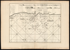
Plan de l'Archipel de Mergui depuis la pointe de Tsavaye jusqu'aux Isles Ste. Susane.
$1,800.00
Acquire
- Digital Map Information
- Suitable for large format printing
- File Size: 29.95 MB
- File Type: ZIP / TIFF
- ICC color profile embedded
- Delivered instantly via download link
This is the 1745 first edition of D'Après de Mannevillette's groundbreaking map of the Mergui archipelago on the coast of southern Burma - this nautical chart is so significant that it and all other maps in the 1745 edition were immediately censored with most examples systematically destroyed, making this a find of the utmost rarity not to be confused with the more common 1775 Mannevillette charts. It is the first printed map to show the region in detail and to include evidence of firsthand navigation. For Southeast Asia, in particular, Mannevillette's 1745 nautical atlas was 'immediately recognised as being superior to all previous maps of Southeast Asian coasts' (Suárez, p.238). (more details)
Suppressed and groundbreaking first edition!
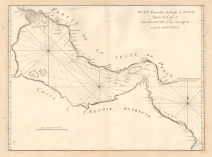
Plan Particulier du Golfe de Perse depuis le Caps de Rosalgatte et de Jasque, jusqu'à Bassora.
$2,500.00
Acquire
- Digital Map Information
- Suitable for large format printing
- DPI: 600
- File Size: 15.3 MB
- File Type: ZIP / TIFF
- ICC color profile embedded
- Delivered instantly via download link
This is the suppressed and thus extremely rare 1745 first edition of D'Après de Mannevillette's (1707 - 1780) groundbreaking map of the Persian Gulf. It is perhaps the earliest European map of the Persian Gulf based on actual navigation and is nearly unobtainable to the collector. (more details)
Extremely rare, suppressed first edition of a groundbreaking chart.
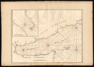
[Untitled chart of the Gulf of Aden].
$950.00
Acquire
- Digital Map Information
- Suitable for large format printing
- DPI: 600
- File Size: 75.74 MB
- File Type: ZIP / TIFF
- ICC color profile embedded
- Delivered instantly via download link
This is the extremely rare 1745 first edition of D'Après de Mannevillette's groundbreaking nautical chart of the Gulf of Aden. Although censured by the French Admiralty and thus exceedingly scarce, this map represents one of the earliest scientific measurements of these coastlines. (more details)
Suppressed and groundbreaking first edition!
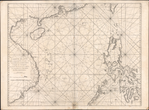
Carte Plate Qui comprend les Coste de Tsiompa, de la Cochinchine, le Golfe de Tunquin, une partie des Costes de la Chine aves une partie de l'Archipel des Isles Philippines.
$5,500.00
Acquire
- Digital Map Information
- Suitable for large format printing
- File Size: 47.63 MB
- File Type: ZIP / TIFF
- ICC color profile embedded
- Delivered instantly via download link
This is the exceedingly rare 1745 nautical map of the South China Sea and the Philippines, which appeared in Mannevillette's banned first edition of his groundbreaking nautical atlas, the Neptune Oriental. When published, this chart represented the finest available cartography of the South China Sea, Southeast China Coast, and the Philippines - thus defining the Canton-Macao-Manila triangle. It was so accurate that French authorities, fearing for the security of their colonial empire, ordered all examples banned and destroyed. The map is additionally notable for its early and idiosyncratic inclusion of various islands, banks, and atolls in the area, many of which have become hotly disputed in recent decades. (more details)
Censored Map: One of the first specific printed maps of the Gulf of Thailand and Cambodia.
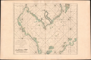
Carte plate qui comprend le Golfe de Siam, les costes de Cambodia, de Tsiompa et les Isles adjacentes, avec une partie de l'Isle Bornéo.
$2,300.00
Acquire
- Digital Map Information
- Suitable for large format printing
- Full resolution TIFF file
- ICC color profile embedded
- Delivered instantly via download link
This is a rare 1745 d'Après de Mannevillette nautical chart or maritime map of the South China Sea and the Gulf of Thailand. It is one of the first specific printed maps of the Gulf of Thailand and Cambodia. This map, and others from the 1745 edition of Mannevillette, were censured by the French Admiralty, and mostly destroyed - making them both exceedingly rare and poorly understood. (more details)
Earliest Printed Chart of Jeddah Harbor. (Makkah)
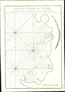
Plan de la Rade de Gedda, situee a la Cote D'Arabie sur la mer Rouge.
$1,500.00
Acquire
- Digital Map Information
- Suitable for large format printing
- File Size: 7.88 MB
- File Type: ZIP / TIFF
- ICC color profile embedded
- Delivered instantly via download link
This is the earliest specific chart of the port of Jeddah, Arabia. It was produced by Jean-Baptiste Nicolas Denis d'Après de Mannevillette for inclusion in his 1775 Neptune Oriental. Now the second-largest city in Saudi Arabia, Jeddah was for centuries the most critical port on the Red Sea of the Arabian Peninsula and the primary water gateway for Muslim pilgrims en route to Mecca. Despite its importance for European traders reaching eastwards, non-Muslim access to the city was strictly limited, resulting in the absence of printed charts or views of the city itself prior to this work. (more details)
Key Port in the Indian Ocean.
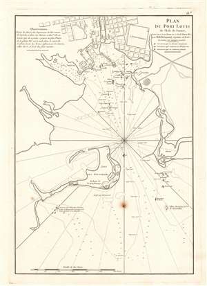
Plan du Port Louis de l'Isle de France, Levé en 1771 et Revu en 1775, de basse Mer, par M. de Boisquenay Capitaine de Brulot.
$950.00
Acquire
- Digital Map Information
- Suitable for large format printing
- DPI: 600
- File Size: 32.96 MB
- File Type: ZIP / TIFF
- ICC color profile embedded
- Delivered instantly via download link
This is a 1775 harbor chart of Port Louis, a critical port in northwest Mauritius for the Indian Ocean trade. At the time Mauritius was a French possession known as l'Isle de France. (more details)
18th century French nautical chart of the Trincomalee, Ceylon or Sri Lanka.
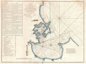
Carte de la Baye et du Port de Trinquemalay dans L'Isle de Ceylan.
$650.00
Acquire
- Digital Map Information
- Suitable for large format printing
- DPI: 300
- File Size: 14.24 MB
- File Type: ZIP / TIFF
- ICC color profile embedded
- Delivered instantly via download link
An extremely attractive large format 1775 maritime map or nautical chart of the port of Trincomalee, Ceylon (Sri Lanka) by Jean-Baptiste d'Après de Mannevillette. Trincomalee is natural deep water port on the east coast of Sri Lanka, about 110 miles northeast of ... (more details)
Charting the coasts of Pegu.
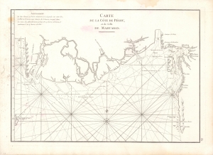
Carte de la Cote de Pegou et de Celle de Martaban.
$400.00
Acquire
- Digital Map Information
- Suitable for large format printing
- DPI: 600
- File Size: 9.28 MB
- File Type: ZIP / TIFF
- ICC color profile embedded
- Delivered instantly via download link
A scarce 1775 nautical chart or maritime map of the coast of Burma (Myanmar) in the Pegu (Bago) region composed by Jean-Baptiste d'Apres de Mannevillette for the 1775 edition of his magisterial Le Neptune Oriental. (more details)
Rare chart of the Singapore Strait.
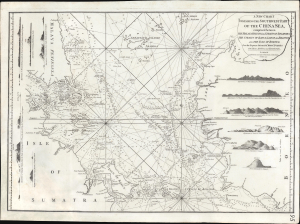
A New Chart Containing the Southwest Part of the China Sea, comprised between The Malaya Peninsula, Straits of Sincapore andc, The Straits of Banca, Gaspar and Billiton, and The Isle of Borneo.
$2,800.00
Acquire
- Digital Map Information
- Suitable for large format printing
- Full resolution TIFF file
- ICC color profile embedded
- Delivered instantly via download link
A scarce 1794 Laurie and Whittle nautical chart or maritime map of the southern tip of the Malay Peninsula, including the island of Singapore (the city had not yet been founded), the Straits of Malacca, and adjacent parts of Sumatra and Borneo. Cartographically, this chart is a vastly updated variant of Jean-Baptiste d'Après de Mannevillette's earlier chart issued in the Neptune Oriental. (more details)