
Mannevillette, Jean-Baptiste d'Après de (sold)

Jean-Baptiste Nicolas Denis d'Après de Mannevillette (February 11, 1707 - March 1, 1780) was a French sailor, navigator, and hydrographer active in the mid-18th century. Mannevillette was born in Le Havre to a family of wealthy seafarers. He completed his first major voyage at 12, when he accompanied his father, Jean-Baptiste-Claude d'Après de Blangy, a captain of the Compagnie des Indes (French East India Company) vessel Solide to Bengal. On his return to France, he he studied mathematics and navigation in Paris under Joseph Nicholas De L'Isle (1688 - 1768) before returning to the sea at 19 as a fourth officer as on the merchant vessel Marechel d'Estrees. Mannevillette himself eventually attained the rank of Captain with the Compagnie des Indes. In the course of numerous voyages around Africa to India and China, Mannevillette collected and revised numerous nautical charts. His sophisticated use of the most modern instruments, most specifically the Octant or English Quarter, and keen mathematical mind, enabled Mannevillette to correct many significant errors common to earlier maps. These updates were eventually compiled and published in Mannevillette's most significant work, the 1745 Le Neptune Oriental. The 1745 Neptune Oriental was commissioned by the Compagnie des Indes and its production earned Mannevillette admission into the Academy of Sciences. The atlas was well received, but shortly after publication, most unsold examples were destroyed by the French Admiralty, who considered the secrets of East Indian navigation too dangerous for dissemination. In 1762 the Compagnie des Indes appointed Mannevillette director of chart at Lorient. In 1767 King Louis XV conferred the Order of St. Michael upon him and made him an associate of the Royal Marine Academy. In the 30 years following his first publication of Le Neptune Oriental, Mannevillette worked doggedly with his lifelong friend, Alexander Dalrymple (1737 - 1808) to update his original work with new and improved charts. In 1775, he republished his opus in a greatly expanded format - by this time nautical information was less tightly guarded. Mannevillette died on March 1, 1780 at 75 years of age.
One of the earliest nautical charts to show the coasts near Kuala Lumpur, Malaysia.
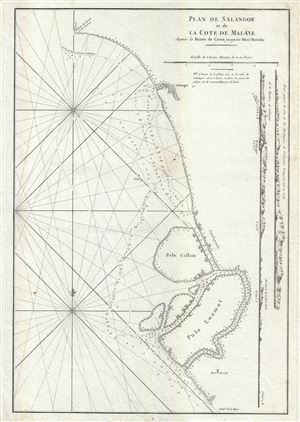
Plan de Salangor et de La Cote de Malaye depuis al Pointe de Caran jusqu au Mont Parcelar.
sold
- Digital Map Information
- Suitable for large format printing
- Full resolution TIFF file
- ICC color profile embedded
- Delivered instantly via download link
A scarce 1775 map of the coasts of Malay (modern day Malaysia) in the vicinity of Kuala Lumpur. This is a fine example Jean-Baptiste d'Apres de Mannevillette 1775 nautical chart or maritime map of Selangor and the Strait of Malacca on the western coast of ... (more details)
18th century French nautical chart of the Ceylon or Sri Lanka.
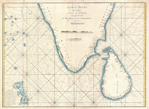
Carte Plate qui Comprend L'Isle de Ceylan, et une partie des Cotes de Malabar et de Cormandel.
sold
- Digital Map Information
- Suitable for large format printing
- DPI: 300
- File Size: 15.93 MB
- File Type: ZIP / TIFF
- ICC color profile embedded
- Delivered instantly via download link
An extremely attractive large format 1775 maritime map or nautical chart of southern India and Ceylon by Jean-Baptiste d'Après de Mannevillette. This chart covers the southern tip of India including the Malabar and Coromandel coasts as well as the Island ... (more details)
18th century French nautical chart of the Cape of Good Hope.
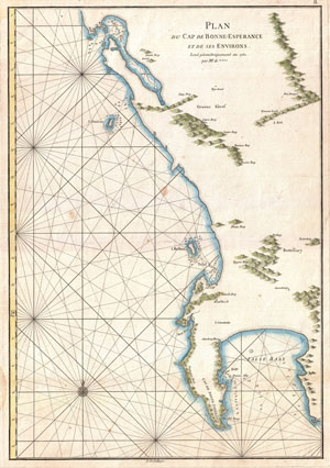
Plan du Cap de Bonne-Esperance et de ses Environs.
sold
- Digital Map Information
- Suitable for large format printing
- DPI: 300
- File Size: 6.85 MB
- File Type: ZIP / TIFF
- ICC color profile embedded
- Delivered instantly via download link
This is a very attractive 1752 nautical chart of the Cape of Good Hope and Cape Town region of South Africa. This maritime map covers from False Bay past the Cape of Good Hope northwards past Cape Town and Isle Robben as far as Saldanha Bay. Offers ... (more details)
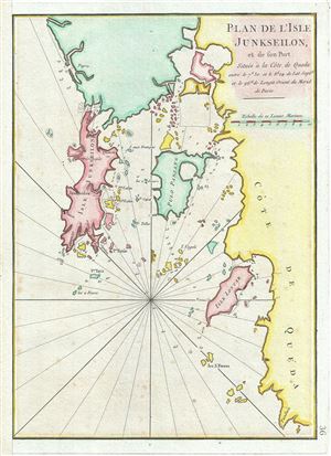
Plan de l'Isle Junseilon, et de son Port.
sold
- Digital Map Information
- Suitable for large format printing
- Full resolution TIFF file
- ICC color profile embedded
- Delivered instantly via download link
This is a scarce 1775 nautical chart or maritime map of the port and harbor of the Island of Phuket, Thailand by Jean-Baptiste d'Apres de Mannevillette. It details the Island of Phuket or Junk Ceylon along with its harbors and the coast of Queda ... (more details)
One of the few early maps to detail the original seven islands of Bombay.
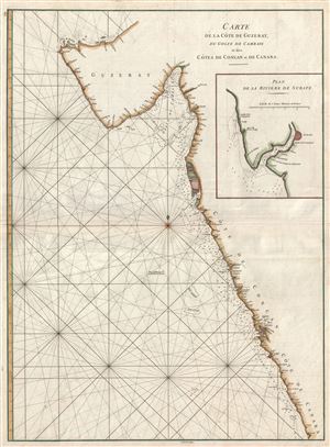
Carte de la Cote de Guzerat, du Golfe de Cambaye et des Cots de Concan et de Canara.
sold
- Digital Map Information
- Suitable for large format printing
- Full resolution TIFF file
- ICC color profile embedded
- Delivered instantly via download link
A scarce 1775 nautical chart or maritime map of the coasts of western Indian in the vicinity of Bombay (Mumbai) and Goa. Composed by Jean-Baptiste d'Apres de Mannevillette, this map covers from Gujarat and the Konkan coasts, from the Bay of ... (more details)
Among the earliest accurate charts of the Bay of Bengal.
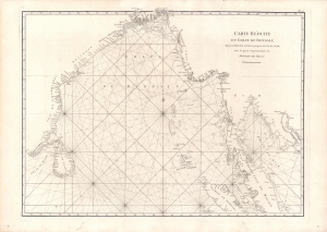
Carte Reduite du Golfe de Bengale, depuis L'Isle de Ceyland jusqu'au Golfe de Siam avec la partie Septentrionale du Detroit de Malac.
sold
- Digital Map Information
- Suitable for large format printing
- Full resolution TIFF file
- ICC color profile embedded
- Delivered instantly via download link
An important 1775 chart of the Bay of Bengal issued for Jean-Baptiste Nicolas Denis d'Après de Mannevillette's La Neptune Oriental, the most influential work of hydrography dealing with Asia in its time. (more details)
Scarce nautical chart of the coast of Myanmar.
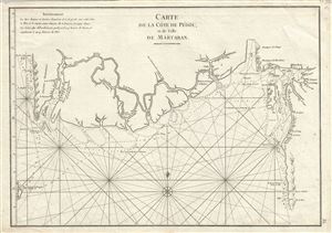
Carte de la Cote de Pegou et de Celle de Martaban.
sold
- Digital Map Information
- Suitable for large format printing
- Full resolution TIFF file
- ICC color profile embedded
- Delivered instantly via download link
This is a scarce 1775 nautical chart or maritime map of the coast of Burma or Pegu or Myanmar. Composed by Jean-Baptiste d'Apres de Mannevillette, this map covers the Gulf of Martaban and the coast of Myanmar from the Ayeyarwady region east as ... (more details)
Nautical chart for one of the most isolated archipelagic island chains in the world.
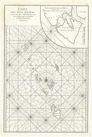
Carte des Isles Nicobar.
sold
- Digital Map Information
- Suitable for large format printing
- DPI: 300
- File Size: 6.77 MB
- File Type: ZIP / TIFF
- ICC color profile embedded
- Delivered instantly via download link
This is a beautiful 1775 maritime map or nautical chart of the Nicobar Islands of India. The map covers from the Car Nicobar Island south to the Great Nicobar Island and includes Little Nicobar, Katchal, Nancowry, Trinket Island, Camorta, ... (more details)
1779 William Herbert Map of the Pirate Refuge of Ile Sainte-Marie (Libertalia / Nosy Boraha), Madaga
Exceptional English map of the Legendary Pirate republic of Libertalia where Kidd's galley, the Adventure, was recently discovered.
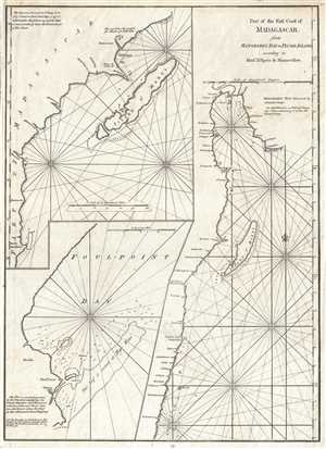
Part of the East Coast of Madagascar from Manghabey Bay to Plumb Island according to Mons. D'Apres de Mannevillette.
sold
- Digital Map Information
- Suitable for large format printing
- Full resolution TIFF file
- ICC color profile embedded
- Delivered instantly via download link
One of the most enjoyable maps we have had the privilege of cataloging, this is William Herbert's map of the island of Île Sainte-Marie, St. Mary's Island, or as it is known today, Nosy Boraha, Madagascar. During the 17th and 18th ... (more details)
18th century nautical chart of the coast of Taiwan or Formosa.
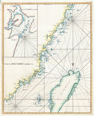
Carte de la coste orientale de la Chine depuis Amoy, jusqu'a Chusan avec une partie de l'Isle Formose. [untitled]
sold
- Digital Map Information
- Suitable for large format printing
- Full resolution TIFF file
- ICC color profile embedded
- Delivered instantly via download link
A scarce c.1780 British edition of D'Apres de Mannevillette's nautical chart or map of Taiwan (Formosa) and the mainland Fujian Coast, China. The map offers rich detail including countless depth soundings, notes on the seafloor, ... (more details)
An extremely scarce nautical chart of the waters around Singapore.

A New Chart Containing the Southwest Part of the China Sea, comprised between The Malaya Peninsula, Straits of Sincapore &c, The Straits of Banca, Gaspar and Billiton, and The Isle of Borneo.
sold
- Digital Map Information
- Suitable for large format printing
- DPI: 300
- File Size: 14.78 MB
- File Type: ZIP / TIFF
- ICC color profile embedded
- Delivered instantly via download link
A scarce 1794 nautical chart or maritime map of the southern tip of the Malay Peninsula, including the island of Singapore (the city had not yet been founded), the Straits of Malacca, and adjacent parts of Sumatra and Borneo. ... (more details)