
Ottens, Joachim (Joshua Ottens, Renier Ottens, I. Ottens)
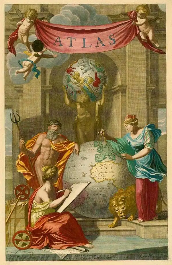
Ottens (fl. c. 1680 - 1785) was a prominent Amsterdam map publishing family active for nearly 100 years. Joachim Ottens (1663 - 1719) was born in Amsterdam to a family of seafarers and educated in Amsterdam's Evangelical Lutheran community. He likely learned copperplate engraving under Frederick de Wit (1629 - 1706), for whom he worked until about 1710. In 1710, he was admitted to the Sint-Lucasgilde (Guild of St. Luke) and, in 1711, Joachim founded his own firm. Although Joachim died only a few years later, in 1719, his widow continued the business, either publishing as either 'I. Ottens', 'Ottens', or 'In de Wereldcaert' [In the World Map]. In 1726, Joachim Otten's sons, Renier (1698 - 1750) and Joshua (1698 - 1750), established a partnership and generally published as 'R. and I. Ottens'. Although they ran separate shops, on Nieuwendijk and Kalverstraat, they worked jointly as a singular business until Renier's death in 1750, at which point Joshua assumed full control. After Joshua's death in 1765, his widow continued the firm with their son, Renier II, changing the imprint to 'Joshua and Reinier Ottens.' Joshua's widow, Johanna de Lindt, held an auction sale of their engraved plates in 1784. Ottens' work stands out in that all of their maps were separate issues, though often found compiled into special, made-to-order multi-volume composite Atlas factice works, such as the Atlas. Some examples of the Atlas include over 800 separately issued maps. Because they were not uniformly issued in standard atlases, Ottens maps are often of the utmost rarity and are notable for their exceptionally rich engraving.
AKA: Joshua Ottens, Renier Ottens, I. Ottens
Glorious Return of Exiles to the Waldensian Valleys following the Piedmontese Easter.
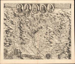
Nieuwe Caerte der Valleyenin Piemont Door de Waldensen etc. Tegen alle Gewelt Beschernt. / Nouvelle Carte Des Vallees De Pieomont Etc, Vaillamment Defendues, Contre Toute Laviolenge Des Francois, Par Les Vaudois Reformes, Etc.
$5,500.00
Acquire
- Digital Map Information
- Suitable for large format printing
- File Size: 28.95 MB
- File Type: ZIP / TIFF
- ICC color profile embedded
- Delivered instantly via download link
An extraordinary discovery of great rarity, the is the 1691 Malet / Ottens separate-issue map of the Piedmontese Alps illustrating the 1689 Glorieuse Rentrée of the Waldensians to their traditional Alpine valleys following their exile in the wake of the 1655 ethnic cleansing known as the Piedmontese Easter. (more details)
Bold, detailed rarity of Spain and Portugal.
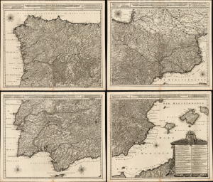
Novissima, et Accuratissima Tabula, qua Gallaeciae et Legionis Regna, Asturiarum Principatus. Portugalliae Tractus Septentrionalis et Utriusque Castellae, Extremadurae et Biscajae Partes./ ... Regnorum Arragoniae et Navarre, Principatus Cataloniae, nec non Partium con Conterminarum, Biscajae Utriusque Castellae ac Valentiae./ ... Regnorum Vandalitiae, Granatae, et Algarbiae; Tractuum, Meridionalium Portugalliae Extremadurae ac Castellae Novae./... Regnorum Valentiae et Murciae, Insularum Majorcae, Minorcae, et Ivicae qua etiam Vicinorum Regnorum Finitime Partes.
$8,500.00
Acquire
- Digital Map Information
- Suitable for large format printing
- Full resolution TIFF file
- ICC color profile embedded
- Delivered instantly via download link
This is a superb, rare example of Joachim Ottens' large, beautifully engraved c. 1719 four-sheet map of Spain and Portugal that notably references battles during the War of the Spanish Succession (1701 - 1714). The map was printed to four sheets for inclusion in folio atlases, but could be joined together to make a wall map. The plates had a convoluted, yet narrow publication history; any state of this map is a rare find. (more details)
Superb chart of the Pas de Calais and the mouth of the Thames.
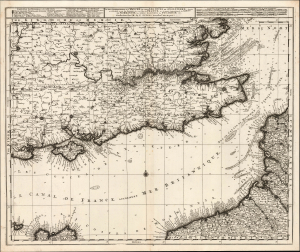
La Plus Grande Partie de la Manche: qui contient Les Côtes De Angleterre...
$1,100.00
Acquire
- Digital Map Information
- Suitable for large format printing
- Full resolution TIFF file
- ICC color profile embedded
- Delivered instantly via download link
This is Luggert van Anse's c. 1690 map of the English Channel, southeastern England, and the Pas-de-Calais. It was subsequently published by Renier and Josue Ottens in about 1730, whose imprint appears on this example. This is a superb work, combining granular inland detail with what had been state-of-the-art nautical charting of both the Channel and the mouth of the Thames River. This combination of detailed charting and inland mapping is unusual in maps of this period. (more details)
Celebrating the Glorious Revolution.
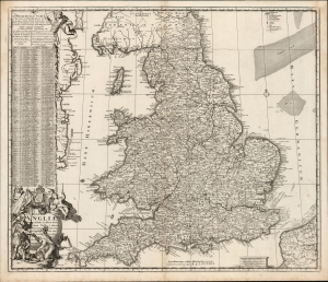
Regni Angliae Nova Tabula, Exhibens Principatum Walliae et aliarum Provinciarum, Civitatum, Oppidorum, una cum itineribus ab uno in aliam civitatem.
$550.00
Acquire
- Digital Map Information
- Suitable for large format printing
- Full resolution TIFF file
- ICC color profile embedded
- Delivered instantly via download link
This is Johannes de Ram's c. 1689 map of the kingdom of England. The present example is the third state, published c. 1730 by Renier and Josue Ottens, whose imprint appears at bottom-center. The map was published in the wake of the Glorious Revolution (1688 - 1689), the deposition of King James II, and his replacement by Mary II and William III of Orange. This Dutch-produced map celebrates the Revolution as a Dutch triumph; nonetheless, the extensive English text suggests it was intended for a British audience. (more details)
First scientific charting of the River Don, by Peter The Great's Handpicked Admiral.
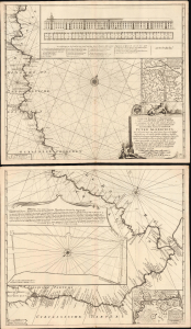
Nieuwe zeer Accurate, en Naauwkeurige Caart vande Rivierde Don of Tanais, Met aanwijzinge van alle des Selfs Dieptens, Droogtens etc. afgemeeten in 't Iaar 1699.
$3,250.00
Acquire
- Digital Map Information
- Suitable for large format printing
- Full resolution TIFF file
- ICC color profile embedded
- Delivered instantly via download link
This is Cornelis Cruys' rare, two-sheet chart of the Don River, the first modern astronomical survey of that waterway, based on his 1699 observations made while accompanying Peter the Great and the new Russian Black Sea Fleet from Voronezh to Azov. The plates were engraved by Hendrick Doncker for inclusion in Cruys' 1704 atlas of the Don; the present example is of the c. 1729 state, updated and printed by the Ottens firm for inclusion in their atlases. All states of the chart are rare, with the Doncker all but unacquirable. (more details)
Rare, Detailed Corfu.
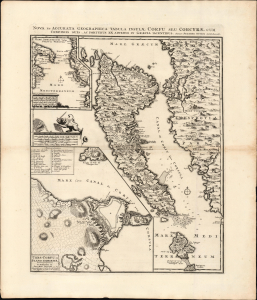
Nova et Accurata Geographica Tabula Insulae Corfu seu Corcyrae cum Confinis suis ac Portubus ex Adverso in Graecia Iacentibus. Auctore Joachimo Ottens Amstelodami.
$1,750.00
Acquire
- Digital Map Information
- Suitable for large format printing
- File Size: 25.62 MB
- File Type: ZIP / TIFF
- ICC color profile embedded
- Delivered instantly via download link
This is Joachim Ottens' rare, beautiful 1717 map of Corfu. It was published in the wake of the famous 1716 Siege of Corfu; the victory is alluded to with the decorative element of the Venetian Lion of Saint Mark, sword upraised while kicking aside an Ottoman scimitar and turban. Ottens' map proved the canonical mapping of Corfu for the rest of the century. (more details)
Transylvania after the Great Turkish War.
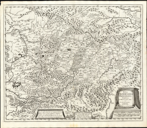
Nova Transilvaniae Principatus Tabula. Novissima descriptia editia Per R. et I. Ottens. Amstelodami Cum Priviligeo.
$1,600.00
Acquire
- Digital Map Information
- Suitable for large format printing
- File Size: 26.04 MB
- File Type: ZIP / TIFF
- ICC color profile embedded
- Delivered instantly via download link
This is Josue and Renier Ottens / Danckerts c. 1725 map of Transylvania. The map was published in the wake of the Great Turkish War (1683 - 1699) during a period of German migration into Transylvania and the Banat. (more details)
Strahlenberg's stolen 1715 map of Asiatic Russia and the Tatar Empire.
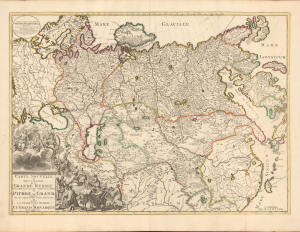
Carte nouvelle de tout l'Empire de la Grande Russie dans l'estat ou il s'est trouvé à la mort de Pierre le Grand. Dressée sur des observations toutes nouvelles et dedoée à l'immortelle memoire de ce Grand Monarque Avec Privilege à Amsterdam.
$3,500.00
Acquire
- Digital Map Information
- Suitable for large format printing
- DPI: 600
- File Size: 29.44 MB
- File Type: ZIP / TIFF
- ICC color profile embedded
- Delivered instantly via download link
This rare, separately issued map of the Russian Empire was printed by Renier and Josua Ottens c. 1730, but the map is based on the work of Philipp Johann von Strahlenberg. It is that mapmaker's first map of Russia and Siberia, stolen from him in 1715. Strahlenberg (1677 - 1747) would rebound to produce his superb 1730 Tattariae Magnae, one of the largest, most groundbreaking, and unique maps of Russia to appear in the first half of the 18th century. This beautiful engraving represents the first complete expression of Strahlenberg's efforts at his seminal mapping of Siberia and the Russian Arctic. (more details)
Magnificent chart with masterful engraving.
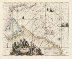
Occidentalior Tractus Indiarum Orientalium à Promontorio Bonae Spei ad C. Comorin.
$825.00
Acquire
- Digital Map Information
- Suitable for large format printing
- DPI: 600
- File Size: 24.08 MB
- File Type: ZIP / TIFF
- ICC color profile embedded
- Delivered instantly via download link
This is Frederic De Wit's map of Africa, Arabia, and part of India, in a handsome example of its scarce 1745 edition printed by Renier and Joshua Ottens. The map represents a key passage in the East India trade routes across the Indian Ocean. It is, moreover, a fine example of the highpoint of Dutch engraving - the work of master engraver Romeyn De Hooghe. (more details)