
Peyrounin, Abraham (sold)

Abraham Peyrounin (c. 1620 - c. 1666) was a French engraver active in Paris during the middle part of the 17th century. Peyrounin is best known for engraving maps for the preeminent French geographers of the period, Nicolas Sanson and his partner Pierre Mariette.
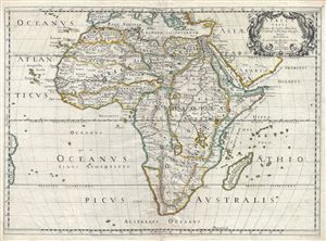
Africa Vetus.
sold
- Digital Map Information
- Suitable for large format printing
- DPI: 300
- File Size: 13.94 MB
- File Type: ZIP / TIFF
- ICC color profile embedded
- Delivered instantly via download link
An uncommon old color first edition example of Nicolas Sanson's map of Africa, prepared an issued separately in 1650. Sanson's map covers Africa in full with adjacent parts of Europe and Arabia represented in part. Sanson, a historian as well as a cartographer, ... (more details)
The Leading Light of French Mapmaking Applies the Ancients to Modern Geography
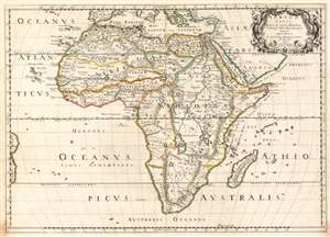
Africa Vetus.
sold
- Digital Map Information
- Suitable for large format printing
- DPI: 600
- File Size: 19.05 MB
- File Type: ZIP / TIFF
- ICC color profile embedded
- Delivered instantly via download link
Nicolas Sanson's 1650 map of Africa, in a very attractive contemporary color example. The map combines modern topography with toponymy drawn from classical geographers. Sanson, a historian as well as a cartographer, intended this map to illustrate Africa as it may have appeared prior to European discovery and exploration. Although the general shape of the continent as well as the surrounding islands and oceans reflect European cartography of the era, Sanson has turned to the Alexandrian cartographer of antiquity, Claudius Ptolemy, to fill in the interior. The southernmost labeled place on the coast is Prassum Promont, a location identified by Ptolemy as the southernmost limit of geographical knowledge. He also follows Ptolemy in his depiction of the White Nile River and its dual lake sources at the base of the Maintains of the Moon. The Ptolemaic mapping of the Nile remained a common feature of Africa maps well into the early 19th century when the explorations of Livingstone and Speake provided new and reliable reconnaissance. The southernmost extreme of Africa he as identified as Anthropophagi Aethiopes (Cannibals). (more details)
Elegant Edition of the First French Atlas of Asia.
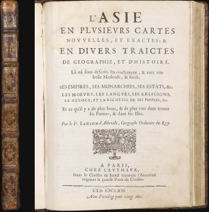
L'Asie en Plusiers Cartes Novelles, et Exactes; et en Divers Traictes de Geographie, et D'Histoire....
sold
This is a handsome example of the first French atlas of Asia, printed in 1662 by Nicolas Sanson, the father of French mapmaking. An encyclopedic atlas, the work contains 17 maps and 100 pages of historical and descriptive text. It was intended to educate the curious reader about the wonders of parts of the world they would likely never see themselves. (more details)
Uncommon map of North America showing California as an Island.
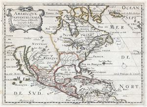
Americque Septentrionale. Par le Sr. Sanson d'Abbeville Geograph du Roy.
sold
- Digital Map Information
- Suitable for large format printing
- DPI: 300
- File Size: 12.05 MB
- File Type: ZIP / TIFF
- ICC color profile embedded
- Delivered instantly via download link
A very attractive 1662 Nicolas Sanson map of North America. Sanson's map covers all of North America from Baffin Bay and Greenland, south to include all of Central America, the West Indies, and parts of the Spanish Main, it similarly extends from California ... (more details)