
Pownall, Thomas (sold)
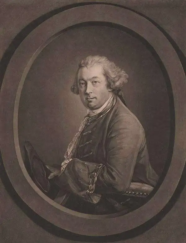
Thomas Pownall (1722 - February 5, 1805) was a British scholar, statesman and soldier active in the colonial administration of North America just prior to the American Revolutionary War. Pownell was born in England and educated at Trinity College, Cambridge. After graduation he was employed by his brother, John Pownall, at the office of the Lord's Commissioners of Trade and Plantations, which oversaw British economic interests in its North American colonies. In 1753, Pownall was appointed secretary to the governor of New York, Sir Danvers Osborne. Osborne, himself having be only recently appointed to the position, committed suicide shortly after taking office. Despite this setback, Pownall remained in America and devoted himself to studying and researching the colonies. In the process Pownall became close lifelong friends with Benjamin Franklin and other New World luminaries. He also published several notable works on the colonial administration of North America. In 1757 Pownall was appointed Governor of the Massachusetts Bay colony. In this position he frequently found himself at odds with the restrictive policies of the Board of Trade. It was not long before he was pushed out of office and, declining the governorship of Jamaica, reassigned to South Carolina. Despite nominally holding the governorship of South Carolina, Pownall never visited the colony. Instead he returned to England where he eventually became a member of Parliament. In Parliament, he advocated for reduced taxes towards the colonies - had he been heeded, the American Revolution may have never happened. Pownall retired from public life around 1780, but continued to pursue his scholarly interests. Pownall's research contributed significantly to several important maps and scholarly work on North America.
Capital of New England - one of the earliest views of Boston based on actual observation.
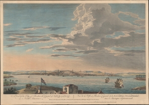
A View of the City of Boston the Capital of New England, in North America. / Vue de la Ville de Boston Capitale de la Nouvelle Angleterre, dans l'Amérique Septemtrionale.
sold
- Digital Map Information
- Suitable for large format printing
- DPI: 600
- File Size: 387.91 MB
- File Type: ZIP / TIFF
- ICC color profile embedded
- Delivered instantly via download link
This is the rare Thomas Pownall view of Boston, published in 1768. It is one of the earliest obtainable views of Boston offering a look at the city shortly after the French and Indian War (1754 - 1763). (more details)
First edition to name the United States.
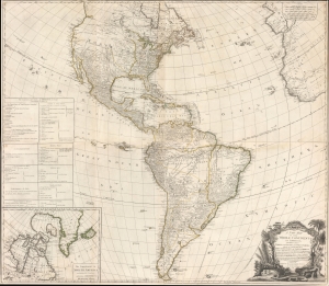
A New Map of the Whole Continent of America, divided into North and South and West Indies, wherein are exactly Described the United States of North America as well as the Several European Possessions according to the Preliminaries of the Peace singed at Versailles Jan. 20 1783.
sold
- Digital Map Information
- Suitable for large format printing
- DPI: 600
- File Size: 97.78 MB
- File Type: ZIP / TIFF
- ICC color profile embedded
- Delivered instantly via download link
A scarce 1783 Sayer and Bennett wall map of America issued shortly after the American Revolutionary War (1775 - 1783). This map followed closely on the Treaty of Versailles, which ended the Revolutionary War and established British recognition of the independent United States. This is the first issue of this map to name the United States - here, including all territory north of Florida, South of the Great Lakes (except Michigan), and east of the Mississippi. (more details)
One of the best maps of the Mississippi and Ohio River Valleys issued after the Revolutionary War.
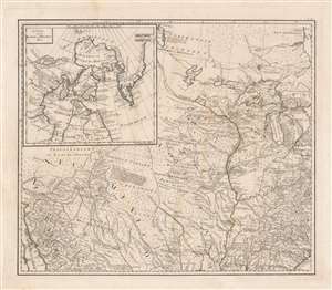
[Mississippi Valley].
sold
- Digital Map Information
- Suitable for large format printing
- DPI: 600
- File Size: 39.05 MB
- File Type: ZIP / TIFF
- ICC color profile embedded
- Delivered instantly via download link
This is the northwestern sheet from Franz Anton Schraembl's 1788 edition of Generalkarte von Nord America samt den Westindischen inseln depicting the central part of North America. Although derived from a larger wall map, the present map is a stand-alone piece and one of the first detailed maps of this region to appear after the American Revolutionary War (1775 - 1783). Concentrating on the Mississippi Valley, the map extends from the Gulf of California to the Pacific near Savannah, Georgia, and from Lake Winnipeg (Ouinpigon) to Mobile Bay. (more details)
An early, rarely seen, wall map of North America.
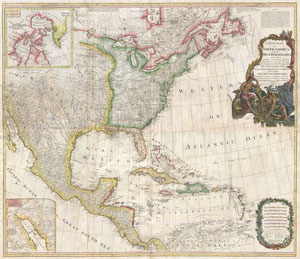
A New Map of North America with the West India Islands, divided according to the Preliminary Articles of Peace, Singed at Versailles, 20, jan 1783, wherein are particularly Distinguished The United States, and the Several Provinces, Governments & ca which Compose the British Dominions, Laid down according to the Latest Surveys, and Corrected from teh Original Materials of Goverr. Pownall, Membr. of Parlimt.
sold
- Digital Map Information
- Suitable for large format printing
- DPI: 300
- File Size: 62.52 MB
- File Type: ZIP / TIFF
- ICC color profile embedded
- Delivered instantly via download link
An extraordinary monumentally proportioned 1794 map of North American by Governor Pownell. Issued shortly after the end of the American Revolutionary War, this map details the newly formed United States, the British dominions in Canada, the French territory of ... (more details)
Uncommon map of the Americas from the first Austrian world atlas.
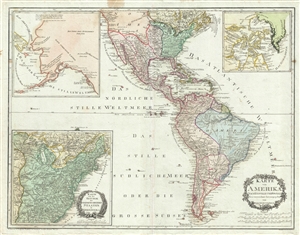
Karte Von Amerika Nach D'Anville Und Pownall.
sold
- Digital Map Information
- Suitable for large format printing
- DPI: 300
- File Size: 25.53 MB
- File Type: ZIP / TIFF
- ICC color profile embedded
- Delivered instantly via download link
A dramatic 1795 large format map of North American and South America by the Austrian cartographer Franz Johann Joseph von Reilly. Depicting American shortly after the end of the American Revolutionary War, this map covers from Hudson Bay to Tierra de Fuego. ... (more details)