
Robinson, G. and J. (sold)

G. and J. Robinson (fl. 1785 - 1818) were Scottish book, magazine, and map publishers active in the late 18th and early 19th centuries. The firm was based at 25 Paternoster Row, London. From about 1809, it was run exclusively by G. Robinson. The firm, at various points, consisted of George Robinson (the elder) the 'King of Booksellers', George Robinson (the younger), John Robinson, and James Robinson. It was George Robinson, the younger, who continued to run the firm solo after 1909.
An early map of the California and Oregon coasts.
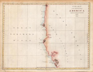
Chart of the North West Coast of America Explored by the Boussole and Astrolabe in 1786. 3rd Sheet.
sold
- Digital Map Information
- Suitable for large format printing
- Full resolution TIFF file
- ICC color profile embedded
- Delivered instantly via download link
An important early chart of the coasts of Northern California and Oregon, undertaken by the ill-fated French voyage led by La Perouse in 1786. This rare hand-colored example of the map came from the first English edition of the text and plates recounting La Perouse's voyage, published in London by J. and G. Robinson in 1798. (more details)
Early, English Edition of the First Acquirable Chart of San Francisco Bay.
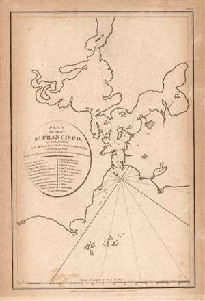
Plan of Port St. Francisco in California.
sold
- Digital Map Information
- Suitable for large format printing
- Full resolution TIFF file
- ICC color profile embedded
- Delivered instantly via download link
This is the 1798 English edition of La Pérouse's seminal 1797 map of San Francisco Bay. It is the first acquirable chart of these waters to be printed in English; La Pérouse's original of the previous year is the earliest acquirable overall. The 1798 John Robinson (1752 - 1813) edition of La Pérouse's travels was one of the earliest, and best, works to bring to English audiences the discoveries of this French circumnavigator's ill-fated voyage. (more details)