
Heinrich Scherer (sold)

Heinrich Scherer (1628 - 1704) was a Jesuit cartographer, geographer, and professor. Scherer served as a Professor of Hebrew, Ethics, and Mathematics at the University of Dillingen in Germany until around 1680 when he became the Official Tutor to the Royal Princes of Mantua and Bavaria in Munich. During his time in Munich, Scherer's work as a cartographer gained recognition and acclaim. His atlas, the Atlas Novus was first published between 1702 and 1710 and subsequently reissued between 1730 and 1737. The Atlas Novus is recognized as a revolutionary work that highlighted the highly sophisticated cartographical work accomplished by Jesuits during the early 18th century. The atlas featured maps from all over the known world and included the religious tendencies of the given region, along with the desire to promulgate the Catholic faith.
Nova Et Vera Exhibitio Geographica Insularum Marianarum Cum Insulis De Pais Marianis ad Austrum Obiectis Nuperrime Inventis.
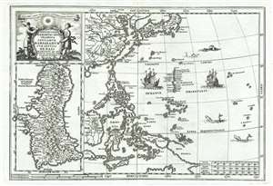
Nova Et Vera Exhibitio Geographica Insularum Marianarum Cum Insulis De Pais Marianis ad Austrum Obiectis Nuperrime Inventis.
sold
- Digital Map Information
- Suitable for large format printing
- DPI: 300
- File Size: 4.52 MB
- File Type: ZIP / TIFF
- ICC color profile embedded
- Delivered instantly via download link
A stunning 1703 map of the Philippines, South China Sea, western Pacific, and Guam by Heinrich Scherer. Essentially two maps on a single sheet, the primary map, appearing at right, covers from Korea to New Guinea and from Borneo to the Marinara Islands, including China, southern Japan, the Philippines, the Marinara Islands, and parts of Indonesia and New Guinea. The left had map is a detailed study of Guam - which has recently converted to Christianity. It bears a Jesuit themed title cartouche and exhibits several ships (Magellan?) and various sea creatures in the Pacific. (more details)
A wonderfully engraved map of the East Indies.
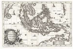
Insulae Indicae Cum Terris Circumvicinis.
sold
- Digital Map Information
- Suitable for large format printing
- DPI: 300
- File Size: 4.83 MB
- File Type: ZIP / TIFF
- ICC color profile embedded
- Delivered instantly via download link
This is a c. 1703 Heinrich Scherer map of Southeast Asia and the East Indies. The map depicts the region from India and Sri Lanka to the Marianas and New Guinea and from Hainan to northern Australia. Islands throughout the region are labeled, including Luzon, ... (more details)