
Snyder and Black (sold)

Snyder and Black (1845 - c.1968) was a publishing firm based in New York City. It began publishing maps as early as 1845 from their offices at 87 Fulton Street. By 1876, the company had moved its operations to 92 William Street in New York, and would later buy a building at 200 William Street. The New York Department of Commerce honored Snyder and Black in 1952 along with over 250 other companies that had been in New York since their founding. Snyder and Black was mentioned often in the New York Times Advertising column as a point-of-sale specialist between 1947 and 1968. By March 1960, however, the company is referred to by the New York Times in that same Advertising column as Snyder and Black and Schlegel.
An interesting 1876 reprint of a 1782 map of Manhattan.
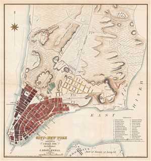
City of New York. Surveyed by J. Hills, 1782. Re-Published by J. Disturnell. 1876.
sold
- Digital Map Information
- Suitable for large format printing
- File Size: 3.26 MB
- File Type: ZIP / TIFF
- ICC color profile embedded
- Delivered instantly via download link
This is an 1876 John Disturnell republication of a 1782 J. Hills city map or plan of New York City. The map depicts the lower half of Manhattan and a small part of Long Island, including Brooklyn. Most of Manhattan is undeveloped. Streets are labeled from the ... (more details)
An interesting 1876 reprint of a 1782 map of Manhattan.
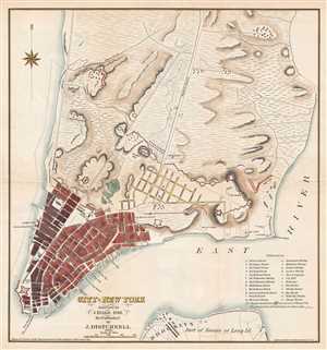
City of New York. Surveyed by J. Hills, 1782. Re-Published by J. Disturnell. 1876.
sold
- Digital Map Information
- Suitable for large format printing
- Full resolution TIFF file
- ICC color profile embedded
- Delivered instantly via download link
This is an 1876 John Disturnell republication of a 1782 J. Hills city map or plan of New York City. The map depicts the lower half of Manhattan and a small part of Long Island, including Brooklyn. Most of Manhattan is undeveloped. Streets are labeled from the ... (more details)
'Brooklyn's first Public Park' - AIA Guide
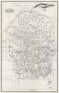
Green-Wood Cemetery.
sold
- Digital Map Information
- Suitable for large format printing
- Full resolution TIFF file
- ICC color profile embedded
- Delivered instantly via download link
This is an 1878 Snyder and Black map of Green-Wood Cemetery, Brooklyn. The AIA considers Greenwood Cemetery 'Brooklyn's first public park'. Celebrated for its design, and known for its notable monuments and mausoleums, today Green-Wood remains an active cemetery but also has become a cultural institution and an outdoor museum. (more details)