
Stephenson, John (sold)

John Stephenson (fl. c. 1790 - 1836) was a British engraver active in the London nautical chart trade in the late 19th and early 19th century. There is some speculation by Lawrence Worms, Baynton-Williams, and other map scholars, that Stephenson apprenticed with the stationer Charles John Downes. Stephenson engraved for the nautical chart firm of John Hamilton Moore until 1793, when he moved on to the firm of William Heather. Heather's firm was subsequently inherited, along with Stephenson, by John William Noire. Stephenson's characteristic style, involving strong lines, elaborate typographic embellishment, and finely-engraved detail, it is commonly associated with John Noire.
Exceedingly rare, highly decorative, and important map of the Cape of Good Hope.
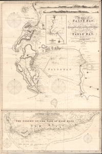
A Chart of False Bay Surveyed by Order of Rear Admiral Stopford, Commander in Chief at the Cape of Good Hope, by P. W. Gawthorpe, Master of His Majesty's Ship Lion, 1812; to which is added Table Bay, with Cape Town and its Environs.
sold
- Digital Map Information
- Suitable for large format printing
- File Size: 37.11 MB
- File Type: ZIP / TIFF
- ICC color profile embedded
- Delivered instantly via download link
A remarkable and rare 1819 / 1827 J. W. Norie commercial nautical chart of False Bay and the Cape of Good Hope, South Africa. The chart was issued shortly after the 1814 Treaty of Vienna when British sovereignty over the Cape Colony was internationally recognized. Norie issued it as False Bay and Simon's Town were emerging as key British naval and commercial winter shelters and resupply depots - marking them as strategic stopping points on voyages to Asia. (more details)
The quintessential early 19th century English blueback nautical chart.
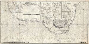
A New Chart of the Coast of Brazil from Maranham to Rio Janeiro.
sold
- Digital Map Information
- Suitable for large format printing
- DPI: 300
- File Size: 45.42 MB
- File Type: ZIP / TIFF
- ICC color profile embedded
- Delivered instantly via download link
An extraordinary 1819 John Norie nautical chart or portolan map of the coast of Brazil. This fantastic map, a quintessential example of early 19th century British chart making, covers the eastern coastline of South America from the mouth of the Amazon River at ... (more details)
Beautiful, rare, and important, this blueback chart of Jamaica was issued in the year of the Great Jamaican Slave Revolt or Baptist War.
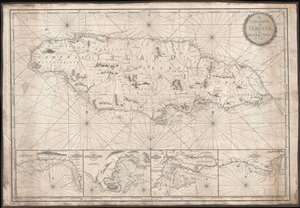
The Island of Jamaica, by W. Heather.
sold
- Digital Map Information
- Suitable for large format printing
- Full resolution TIFF file
- ICC color profile embedded
- Delivered instantly via download link
This is a rare and stunning 1832 blueback nautical chart or map of Jamaica by William Heather and John W. Norie. As a working chart, it bears all of the hallmarks of a shipboard chart and a life at sea. The map details all of Jamaica with four inset detail harbor maps along the bottom, from left: Savanna, Portland Point, Kingston, Morant. Sounding along the south coast, and in the insets, in fathoms.
Unlike many British blueback charts, the present map actually offers considerable inland detail. Here Jamaica is divided into three counties (Cornwall, Middlesex and Surry), each of which is in turn subdivided into Parishes. The chart includes significant topographical detail, including roads, rivers, mountains, towns, churches, military camps, and more. (more details)
Unlike many British blueback charts, the present map actually offers considerable inland detail. Here Jamaica is divided into three counties (Cornwall, Middlesex and Surry), each of which is in turn subdivided into Parishes. The chart includes significant topographical detail, including roads, rivers, mountains, towns, churches, military camps, and more. (more details)
Extremely rare nautical chart of the Kattegat and Baltic Seas.
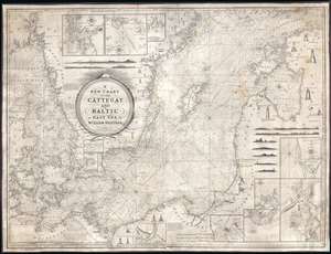
A New Chart of the Cattegat and Baltic or East Sea.
sold
- Digital Map Information
- Suitable for large format printing
- DPI: 300
- File Size: 45.15 MB
- File Type: ZIP / TIFF
- ICC color profile embedded
- Delivered instantly via download link
This is an extremely rare and extraordinarily beautiful 1837 William Heather and John William Norie blueback nautical chart or maritime map of the Kattegat and Baltic Seas. The map depicts the region from Norway and Denmark (Jutland) to the Baltic States of Estonia and Latvia (Eastland, Livonia, Courland) and from Norway and the Gulf of Finland to northern Europe. The map is highly detailed with numerous cities are labeled, including Copenhagen, Stockholm (Christiana), Gdańsk (Danzig), Talinn (Revel), and Riga. Myriad depth soundings are indicated, particularly in the Kattegat Sea and along the coastlines. Numerous inset maps are included along three of the four sides. Along the top border, three inset maps situated and illustrate the entrances to Gothenburg, the principal entrance to Stockholm, and the harbor of Sleete or Slitehamn, on the island of Gottland. Along the right side and bottom border, inset maps depict the entrance to Klaipėda (Memel), Lithuania, Riga, Rogerwyck, the entrance to Szczecin (Stettin), Poland, Baltiysk, Poland, and a second inset map illustrating the entrance to Szczecin. Manuscript notations in yellow ink throughout the map mark the locations of lighthouses and other lights used for navigation. Twenty-eight different lighthouses are illustrated in profile, along with notes concerning others. One such note, located on the Jutland Peninsula, informs the viewer that a striped flag is hoisted from the Scaw lighthouse if ice in the Kattegat impedes navigation. Other notes inform the viewer on improvements to harbors, or when the lighthouses in certain parts of the region are lit. Several coastal views are also illustrated, allowing a mariner to have a better understanding of what they should be seeing when passing a given stretch of coastline. An extremely decorative title cartouche is situated slightly to the left of center. (more details)