
Welcke, Robert Alexander (sold)
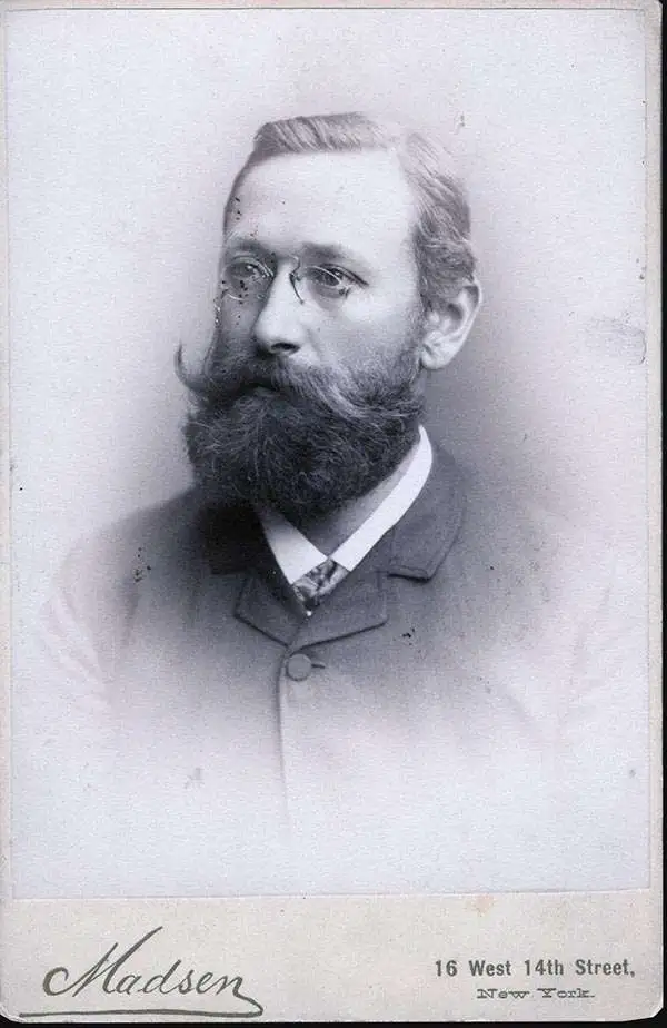
Robert Alexander Welcke (November 24, 1848 - January 27, 1936) was a photolithographer active in New York in the latter part of the 19th century and early 20th century. Welcke was born in Wronke, today in Poland, but then part of Prussia. He emigrated to New York City in 1869. After settling, Welcke entered the lithography business with his brother, Edward Welcke, who had arrived a decade earlier. After a split between the brothers during the economic depression of the late 1870s, Robert Welcke continued in business on his own. Welcke's firm, Robert A. Welcke Offset Company, was based at 176 William Street. His corpus ranges from real estate maps of New York and Connecticut to illustrations on Flemish Renaissance interiors to government maps and brochures to decorative sheet music covers. Following Welcke's death, the firm was taken over by his daughter, Olga Welcke, who, alongside William Jugens, managed it until the outbreak of World War II (1939 - 1945).
The only known example of this interesting broadside Brooklyn street directory and map of Prospect Park
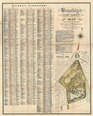
Brooklyn Street Directory Showing Width & Location of Streets & c. with Map o Prospect Park and Horse Car & Elevated Rail Roads Routes.
sold
- Digital Map Information
- Suitable for large format printing
- File Size: 12.78 MB
- File Type: ZIP / TIFF
- ICC color profile embedded
- Delivered instantly via download link
An extremely 1880 rare pocket map of Prospect Park, Brooklyn, with a street directory of Brooklyn by Mathew Dripps. The directory, which occupy the left 2/3rd of the map features a list of all Brooklyn streets and the street width. For example, our street, Putnam ... (more details)
Flushing on the Eve of Consolidation.
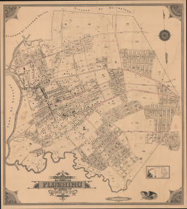
Map of the Village of Flushing Queens County New York.
sold
- Digital Map Information
- Suitable for large format printing
- File Size: 42.12 MB
- File Type: ZIP / TIFF
- ICC color profile embedded
- Delivered instantly via download link
This is Gustave Roullier's extremely rare 1894 city map of Flushing, now part of the borough of Queens in New York City. Replete with ghosted streets and planned developments, it demonstrates the rapid growth of the village at the end of the 19th century and the eve of consolidation into New York City. (more details)
Very Rare, Evocative Map of a Bucolic Corner of New York City.
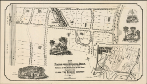
Map of the Along the Hudson Park Spuyten Duyvil Hill, Borough of the Bronx, City of New York. Property of the Along The Hudson Company.
sold
- Digital Map Information
- Suitable for large format printing
- Full resolution TIFF file
- ICC color profile embedded
- Delivered instantly via download link
This is a separately issued William Klein 1909 broadsheet map of the northern part of New York City's Spuyten Duyvil neighborhood, promoted here as 'Along the Hudson Park.' This neighborhood had long been - and largely remains - an enclave of residences that were picturesque and oddly remote despite being situated within the city limits. (more details)
Very Rare, Evocative Map of a Bucolic Corner of New York City
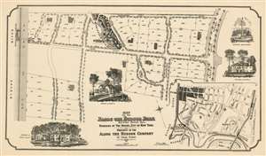
Map of the Along the Hudson Park Spuyten Duyvil Hill, Borough of the Bronx, City of New York. Property of the Along The Hudson Company.
sold
- Digital Map Information
- Suitable for large format printing
- File Size: 29.21 MB
- File Type: ZIP / TIFF
- ICC color profile embedded
- Delivered instantly via download link
This is a separately issued 1909 broadsheet map of the northern part of New York City's Spuyten Duyvil neighborhood, promoted here as 'Along the Hudson Park.' The development extends from about W. 227th up to W. 232nd, and from the Spuyten Duyvil Parkway (now the Henry Hudson) to the Hudson River. This neighborhood had long been - and largely remains - an enclave of residences that were picturesque and oddly remote despite being situated within the city limits. At the beginning of the 20th century urban life steadily encroached on these pockets of pastoral living. As early as 1901, local citizens led by attorney John Jay McKelvey began protesting the overflow into their neighborhoods of tuberculosis patients wandering off from nearby Seton Hospital. Thereafer, McKelvey litigated and legislated against what what he referred to as The City Ugly (in a mordant reference to the 'City Beautiful' movement.) The 'Along the Hudson Company' was one such effort: the company bough properly protectively - often backed by other owners - selling it to those thought to be congenial neighbors, and limiting strictly the use of those lots in the terms of sale. If at least 15,000 square feet, the lot could have a stable, but otherwise construction on these lots were restricted to single-family homes. The neighborhood was advertised in Country Life magazine in 1910:
If you are a person of character and responsibility, with tastes which center about your home and family, and if you have felt the narrowness of City life, then we will gladly show you Something Different. Along-the-Hudson Park on Spuyten Duyvil Hill. A Bit of the Adirondacks Set Within the City Gates and Permanently Restricted. It costs from $20,000 to $40,000 to be a dweller in Along-the-Hudson-Park, but is work it.(more details)
First Map of Jamaica Estates.
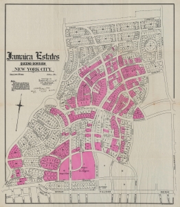
Jamaica Estates Queens Borough New York City.
sold
- Digital Map Information
- Suitable for large format printing
- File Size: 48.63 MB
- File Type: ZIP / TIFF
- ICC color profile embedded
- Delivered instantly via download link
This 1911 map by Metropolis Engineering is the earliest map of Jamaica Estates, Queens, New York - the childhood home of former U.S. President Donald Trump. Today, as intended, Jamaica Estates, designed in the Garden City Ethic, remains one of the most attractive planned communities in New York. The map is signed by Albert Thomson, the architect behind many of the houses of Jamaica Estates, as well as the 71st Regiment Armory in Manhattan. (more details)