
Young, William Mark (sold)

William Mark Young (March 18, 1881 – January 1, 1946) was an American etching artist, muralist, and commercial draughtsman active in Chicago during the first half of the 20th century. Young was born in Upper Alton, where he attended Upper Alton High School before moving on to Washington University's school of fine arts in St. Louis. His first business venture was a commercial arts firm in St. Louis. In time he moved to Chicago where his most substantial work was produced. Young is known for commercial art etching and painting, advertising, murals, and illustrations. His most impressive works were the murals issued for the Ohio Exhibit at the 1933 Chicago 'Century of Progress' World's Fair. These murals were subsequently relocated to the Ohio State Capital Building. In addition, young illustrated children's books, including a 1939 edition of Dickens' A Christmas Carol, and several books for Whitman Publishing Company in the Big Little Books and Better Little Books series. Young died on New Year's day, 1946.
100 years of progress.
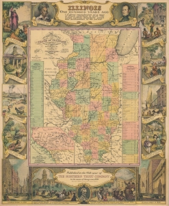
Illinois One Hundred Years Ago.
sold
- Digital Map Information
- Suitable for large format printing
- File Size: 28.5 MB
- File Type: ZIP / TIFF
- ICC color profile embedded
- Delivered instantly via download link
This is a 1934 Northern Trust Company and William Mark Young pictorial map of Illinois. A pictorial border surrounds a historic map of the state created by J. H. Young and published by S. A. Mitchell. (more details)
Unusual and rare pictorial map illustrating the old Northwest Territory.
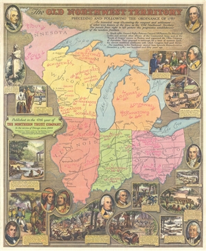
The Old Northwest Territory Preceding and Following the Ordinance of 1787.
sold
- Digital Map Information
- Suitable for large format printing
- File Size: 16.97 MB
- File Type: ZIP / TIFF
- ICC color profile embedded
- Delivered instantly via download link
A rare 1936 pictorial map of Illinois by William Mark Young illustrating the land that comprised the old 'Northwest Territory,' essentially those lands northwest of the Ohio River. Centered on Chicago, the map covers from Minnesota and Lake Superior to the ... (more details)
Unusual and rare pictorial map illustrating the life and times of Abraham Lincoln.
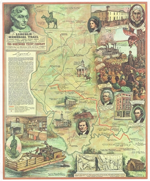
Lincoln Memorial Trail. Lincoln Circuit *** Lincoln Douglas Debates ** Black Hawk War Trail **
sold
- Digital Map Information
- Suitable for large format printing
- File Size: 15.54 MB
- File Type: ZIP / TIFF
- ICC color profile embedded
- Delivered instantly via download link
A rare 1940 pictorial map of Illinois by William Mark Young illustrating the travels and life of Abraham Lincoln. The map covers from Wisconsin's Bad Axe River to the confluence of the Ohio and Mississippi Rivers and Quincy, Illinois to Louisville, ... (more details)