
Unusual mapping of the Indian Ocean in antiquity.
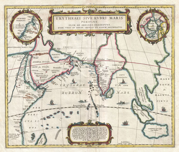
Erythraei Sive Rubri Maris Periplus.
sold
- Digital Map Information
- Suitable for large format printing
- DPI: 300
- File Size: 11.69 MB
- File Type: ZIP / TIFF
- ICC color profile embedded
- Delivered instantly via download link
An unusual and attractive 1658 map of the Indian Ocean, or Erythraean Sea, as it was in antiquity. Composed by Jan Jansson after a similar 1597 map published by A. Ortelius in his Parergon . Covers from Egypt and the Nile valley eastward past Arabia and India, ... (more details)
An exceptional mapping of the ancient world.

Orbis Terrarus Veteribus Cogniti Typus Geographicus.
sold
- Digital Map Information
- Suitable for large format printing
- DPI: 300
- File Size: 13.6 MB
- File Type: ZIP / TIFF
- ICC color profile embedded
- Delivered instantly via download link
An exceptional 1650 map of the world as it was known to the ancients by Jan Janssonius. Such maps, which filled in contemporary geography with ancient place names, were popular in the post-Renaissance period. Scholars digging through rediscovered Greek and ... (more details)
One of the earliest and most important wind rose or anemographic charts.
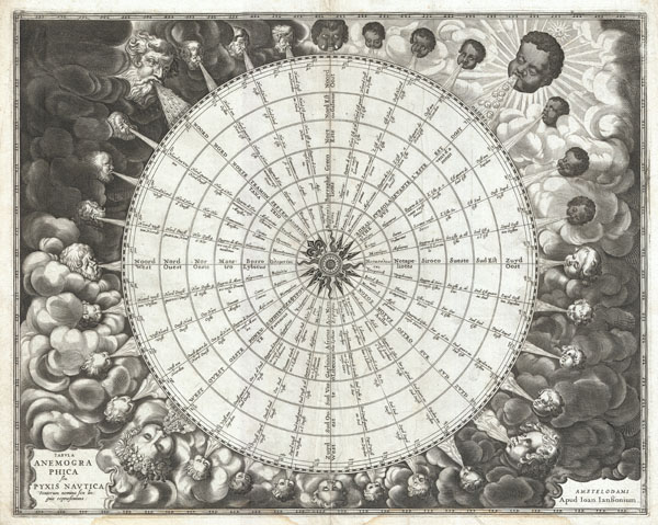
Tabula Anemographica seu Pyxis Nautica Ventorum Nomina Sex Linguis Repraesentans.
sold
- Digital Map Information
- Suitable for large format printing
- Full resolution TIFF file
- ICC color profile embedded
- Delivered instantly via download link
An exceptionally rare example of one of the earliest and most significant anemographic, or wind rose, charts to appear in the 17th century. This unusual chart represents a transitional point in the perception of direction, or to be precise, the transition ... (more details)
A quintessential pirate's nautical map.

Ocean Atlantique ou Mer du Nord.
sold
- Digital Map Information
- Suitable for large format printing
- DPI: 300
- File Size: 20.75 MB
- File Type: ZIP / TIFF
- ICC color profile embedded
- Delivered instantly via download link
This is a rare and remarkable 1693 nautical chart of the Atlantic Ocean by Pierre Mortier. Covers the North Atlantic from rough 5 degree south latitude to roughly 56 degrees north latitude. Includes much of North America, all of the West Indies and ... (more details)
Rare plan detailing Christopher Wren's proposed reconstruction following the 1666 Great Fire of London.
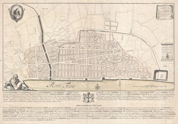
Ichnographia urbis Londinii… (A Plan of the City of London, after the great FIRE, in the Year of Our Lord 1666.)
sold
- Digital Map Information
- Suitable for large format printing
- DPI: 300
- File Size: 17.58 MB
- File Type: ZIP / TIFF
- ICC color profile embedded
- Delivered instantly via download link
An extremely scarce 1744 map of London showing Sir Christopher Wren's plan for reconstructing the city following the 1666 Great Fire of London. In 1666 the Great Fire swept through the old Roman portions of London, laying waste to most of the ... (more details)

Johnson's Turkey in Asia Persia, Arabia & Co.
sold
- Digital Map Information
- Suitable for large format printing
- File Size: 8.95 MB
- File Type: ZIP / TIFF
- ICC color profile embedded
- Delivered instantly via download link
A very nice example of A. J. Johnson's 1866 map of Arabia, Persia and Turkey in Asia. Covers from the Mediterranean and Egypt eastwards as far as the Mouths of the Indus River, as well as southward as far as the Horn of Africa and northwards to ... (more details)
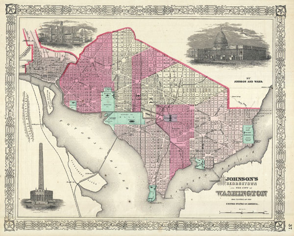
Johnson's Georgetown and the City of Washington The Capitol of the United States of America.
sold
- Digital Map Information
- Suitable for large format printing
- File Size: 8.7 MB
- File Type: ZIP / TIFF
- ICC color profile embedded
- Delivered instantly via download link
A beautiful example of A. J. Johnson's 1866 map of Washington D.C. and Georgetown. Offers a fascinating snapshot of the nation's capitol shortly after the close of the American Civil War. Shows the city in considerable detail with color coding ... (more details)

(A) A Plat Exhibiting the State of the Surveys in the State of Florida with References.
sold
- Digital Map Information
- Suitable for large format printing
- Full resolution TIFF file
- ICC color profile embedded
- Delivered instantly via download link
An exceptional example of the 1853 Land Survey Map of Florida. This map represents the state of the Land Survey in Florida as of September 30, 1853. Shows the state divided into several hundred numbered plats, some of which are marked with ... (more details)

Koos Bay, Oregon.
sold
- Digital Map Information
- Suitable for large format printing
- File Size: 10.02 MB
- File Type: ZIP / TIFF
- ICC color profile embedded
- Delivered instantly via download link
A very nice example of the U.S. Coast Survey's 1865 map or chart of Coos Bay (Koos Bay), Oregon. Details the' S' shaped inlet as far as the Coos River. Identifies Empire City, Marshfield Point, and other destinations. Marshfield was later ... (more details)

Barnegat Inlet, New Jersey.
sold
- Digital Map Information
- Suitable for large format printing
- File Size: 5.89 MB
- File Type: ZIP / TIFF
- ICC color profile embedded
- Delivered instantly via download link
This is the U.S. Coast Survey's attractive 1865 map or chart of Barnegat Inlet, New Jersey. Barnegat Inlet is the opening between the New Jersey barrier Islands of Long Beach Island and Island Beach State Park. Historically this important ... (more details)
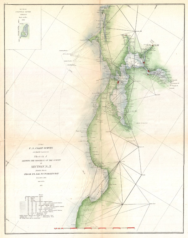
Sketch J Showing the Progress of the Survey in Section No. X (middle sheet) From pt. Sal to Tomales Bay.
sold
- Digital Map Information
- Suitable for large format printing
- File Size: 4.62 MB
- File Type: ZIP / TIFF
- ICC color profile embedded
- Delivered instantly via download link
A rare nautical triangulation chart of the California coast from Pt. Sal to Tomales Bay, including the San Francisco Bay area, by the U. S. Coast Survey, 1865. Depicts the much of the shoreline of southern California with numerous ... (more details)

New York, From a Balloon. Pictorial Map of New York and Vicinity, Showing the Suburban Town, and Railroad and Water Communications.
sold
- Digital Map Information
- Suitable for large format printing
- File Size: 15.99 MB
- File Type: ZIP / TIFF
- ICC color profile embedded
- Delivered instantly via download link
A spectacular 1871 view of Manhattan issued in the May 6th supplement edition of Harper's Weekly Magazine. To quote from the document itself: In studying this pictorial map the spectator is supposed to be stationed somewhere in ... (more details)
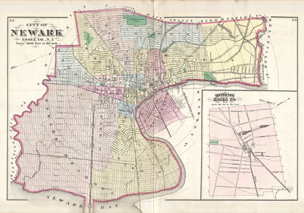
City of Newark Essex Co., N.J.
sold
- Digital Map Information
- Suitable for large format printing
- File Size: 11.43 MB
- File Type: ZIP / TIFF
- ICC color profile embedded
- Delivered instantly via download link
A fine example of the 1872 map of Newark, New Jersey by F. W. Beers. Covers the center of Newark from Elizabeth to Belleville and from Bloomfield to Newark Bay and the Passaic River. Shows streets, city wards, canals, parks, ... (more details)
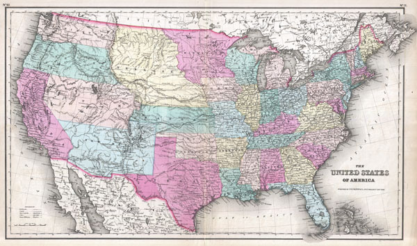
The United States of America.
sold
- Digital Map Information
- Suitable for large format printing
- File Size: 16.85 MB
- File Type: ZIP / TIFF
- ICC color profile embedded
- Delivered instantly via download link
A beautiful example of Colton's 1857 map of the United States. Depicts a rare ephemeral statehood configuration - particularly in the western part of the country. Nebraska Territory extends from the Kansas border ... (more details)

Johnson's Italy.
sold
- Digital Map Information
- Suitable for large format printing
- File Size: 7.38 MB
- File Type: ZIP / TIFF
- ICC color profile embedded
- Delivered instantly via download link
A beautiful example of A. J. Johnson's 1866 map of Italy. Johnson first introduced this map in his 1863 atlas and it represents a substantial re-engraving of his original two part plate. Johnson's reconsideration ... (more details)

Johnson's Western Hemisphere. / Johnson's Eastern Hemisphere.
sold
- Digital Map Information
- Suitable for large format printing
- File Size: 18.62 MB
- File Type: ZIP / TIFF
- ICC color profile embedded
- Delivered instantly via download link
This is A. J. Johnson's fine 1866 map of the world on a hemispherical projection. Offers a fascinating snapshot of the world during a period of rapid globalization and discovery. This is one of the first ... (more details)

Johnson's West Indies.
sold
- Digital Map Information
- Suitable for large format printing
- File Size: 13.23 MB
- File Type: ZIP / TIFF
- ICC color profile embedded
- Delivered instantly via download link
A beautiful example of A. J. Johnson's 1866 map of the West Indies. Covers from Florida to Venezuela and from Honduras to Barbados. Includes the Bahamas, Cuba, Jamaica, Santo Domingo (Hispaniola), Porto ... (more details)

Johnson's Virginia, Delaware, Maryland and West Virginia.
sold
- Digital Map Information
- Suitable for large format printing
- File Size: 19.28 MB
- File Type: ZIP / TIFF
- ICC color profile embedded
- Delivered instantly via download link
A beautiful example of A. J. Johnson's 1866 map of Virginia, West Virginia, Maryland and Delaware. This map offers a fascinating snapshot of these secessionist states shortly following the close of the ... (more details)

Johnson's North Carolina and South Carolina.
sold
- Digital Map Information
- Suitable for large format printing
- File Size: 16.46 MB
- File Type: ZIP / TIFF
- ICC color profile embedded
- Delivered instantly via download link
A beautiful example of A. J. Johnson's 1866 map of North Carolina and South Carolina. Offers a fascinating snapshot of these states shortly following the close of the American Civil War. Map shows both ... (more details)
One of the first maps to include the provisional territory of Wyoming.
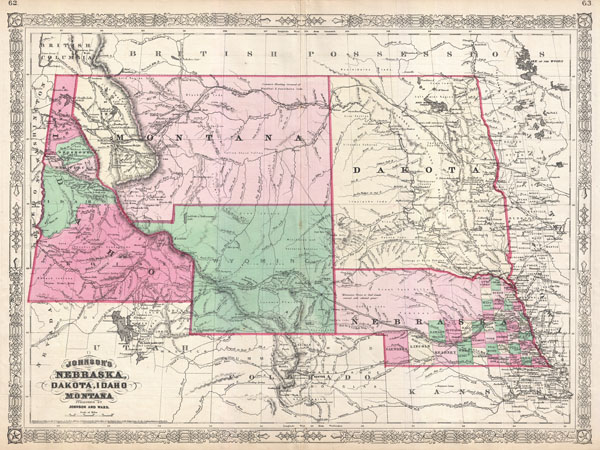
Johnson's Nebraska, Dakota, Idaho and Montana.
sold
- Digital Map Information
- Suitable for large format printing
- File Size: 14.94 MB
- File Type: ZIP / TIFF
- ICC color profile embedded
- Delivered instantly via download link
This is Johnson and Ward's significant 1866 map of the Idaho, Montana, Wyoming, Dakota and Nebraska. Johnson first introduced this map in 1865 to accommodate a renewed interested in this region ... (more details)