

New York and Environs.
sold
- Digital Map Information
- Suitable for large format printing
- File Size: 9.09 MB
- File Type: ZIP / TIFF
- ICC color profile embedded
- Delivered instantly via download link
A stunning and rare 1868 view of the island of Manhattan, New York City by W. C. Rogers. View depicts the entire island of Manhattan with Hoboken as well as parts of Brooklyn and Queens. Important buildings, especially churches are depicted with considerable ... (more details)

Northern Regions.
sold
- Digital Map Information
- Suitable for large format printing
- File Size: 8.05 MB
- File Type: ZIP / TIFF
- ICC color profile embedded
- Delivered instantly via download link
A rarely seen variant state of Colton's map of the North Pole or Arctic. Covers from Lake Baikal, the Hudson Bay, the British Isles and Kamchatka north to the Pole. Generally gives an excellent overview of the state Arctic exploration and discovery to about ... (more details)

Southern Regions.
sold
- Digital Map Information
- Suitable for large format printing
- File Size: 4.61 MB
- File Type: ZIP / TIFF
- ICC color profile embedded
- Delivered instantly via download link
A rarely seen variant state of Colton's map of the South Pole, Antarctica, or the Southern Polar Regions. Shows the great southern continent with both solid and tentatively sketched in borders. Notes the travels of important Antarctic explorers of the ... (more details)

Colton's Map of New Yor and the Adjacent Cities.
sold
- Digital Map Information
- Suitable for large format printing
- File Size: 16.29 MB
- File Type: ZIP / TIFF
- ICC color profile embedded
- Delivered instantly via download link
This is a beautiful J. H. Colton map of New York City and vicinity, including Manhattan as well as parts of Brooklyn, Jersey City, Hoboken, and Queens. This is the fourth state of the Colton New York City map in which Central Park is depicted ... (more details)

Nouveau Plan des Environs de Paris d'apres les Nouvelles Observations de M.M. de l'Academie Rle. Des Sciences.
sold
- Digital Map Information
- Suitable for large format printing
- DPI: 300
- File Size: 32.04 MB
- File Type: ZIP / TIFF
- ICC color profile embedded
- Delivered instantly via download link
A stunning 1775 pocket map of the environs of Paris, France by the firm of Esnauts & Rapilly. Covers the greater Paris area from Chartres in the southwest to La Ferte in the northeast and from Vernon in the northwest to Bray in the ... (more details)
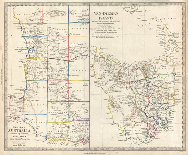
Van Diemen Island. Western Australia Containing the Settlements of Swan River and King George's Sound from Surveys sent to the Colonial Office.
sold
- Digital Map Information
- Suitable for large format printing
- DPI: 300
- File Size: 6.48 MB
- File Type: ZIP / TIFF
- ICC color profile embedded
- Delivered instantly via download link
This is the c. 1849 Edward Stanford edition of the Society for the Diffusion of Useful Knowledge's historic map of Western Australia and Tasmania or Van Diemen's Land. Essentially two maps on one sheet. The leftmost map details ... (more details)

Plan de la Ville de Boston et ses Environs.
sold
- Digital Map Information
- Suitable for large format printing
- DPI: 300
- File Size: 2.9 MB
- File Type: ZIP / TIFF
- ICC color profile embedded
- Delivered instantly via download link
This hand colored map is a c. 1756 map of Boston, Massachusetts. Attributed to French cartographer Jacques-Nicholas Bellin, this map was issued for the French edition of Provost's Histoire des Voyages…. Beautifully rendered in ... (more details)
A stunning map with gold foiling. Made for kings.

Mappe-monde Geo-Hydrographique ou Description Generale du Globe Terrestre et Aquatique en Deux-Plans-Hemipsheres ou son Exactement Remarquees en General Toutes les Parties de la Terre et de L'Eau, suivant les Relations les plus Nouvelles, par le S. Sanson Geographe Ordinaire du Roy 1691.
sold
- Digital Map Information
- Suitable for large format printing
- DPI: 300
- File Size: 30.64 MB
- File Type: ZIP / TIFF
- ICC color profile embedded
- Delivered instantly via download link
An extraordinary map of monumental proportions, this Sanson and Jaillot's 1691 decorative map of the world on a double hemisphere projection. This is the first state of the fourth plate of this map. Covers the entire world ... (more details)

Plan de Paris
sold
- Digital Map Information
- Suitable for large format printing
- File Size: 33.32 MB
- File Type: ZIP / TIFF
- ICC color profile embedded
- Delivered instantly via download link
This is a large format folding map of Paris dating to 1892. Covers the old walled city of Paris plus surrounding areas from the Bois de Boulogne to the Bois de Vincennes. Names countless important buildings, gardens and ... (more details)

Carte de la Guinee contenant les Isles du Cap Verd, le Senegal, la Cote de Guinee proprement dite, les Royaumes de Loango, Congo, Angola, et Benguela avec les Pays voisins autant qu'ils sont connus.
sold
- Digital Map Information
- Suitable for large format printing
- DPI: 300
- File Size: 5.91 MB
- File Type: ZIP / TIFF
- ICC color profile embedded
- Delivered instantly via download link
A beautiful example of Rigobert Bonne's c. 1770 decorative map of western Africa. Covers from the Cape Verde Islands eastward to the coasts of Africa and the western mouth of the Niger River. Includes the modern day ... (more details)
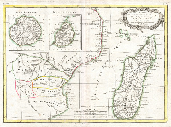
Partie de la Cote Orientale D'Afrique avec L'Isle de Madagascar et les Cartes particulieres des Isles de France et de Bourbon.
sold
- Digital Map Information
- Suitable for large format printing
- DPI: 300
- File Size: 6.46 MB
- File Type: ZIP / TIFF
- ICC color profile embedded
- Delivered instantly via download link
A beautiful example of Rigobert Bonne's c. 1770 decorative map of southeastern Africa and Madagascar. Roughly covers the territory current incorporated into Mozambique and Madagascar. Also includes inset map of the ... (more details)
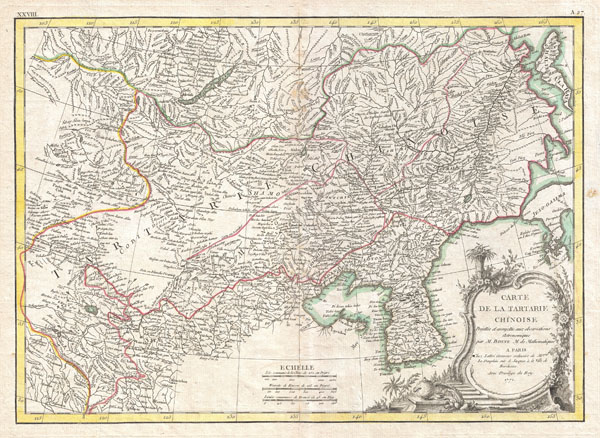
Carte deLa Tartarie Chinoise.
sold
- Digital Map Information
- Suitable for large format printing
- DPI: 300
- File Size: 8.69 MB
- File Type: ZIP / TIFF
- ICC color profile embedded
- Delivered instantly via download link
A beautiful example of Rigobert Bonne's 1770 decorative map of Chinese Tartary. Covers from the Lop Nor region eastward to Korea, Manchuria, Sakalin and Jeso-Gasima (Hokkaido). Includes both Inner Mongolia and ... (more details)

Guinee IIe. Feuille.
sold
- Digital Map Information
- Suitable for large format printing
- DPI: 300
- File Size: 7.14 MB
- File Type: ZIP / TIFF
- ICC color profile embedded
- Delivered instantly via download link
A beautiful example of Rigobert Bonne's 1770 decorative map of West Africa. Covers from the Gold Coast (modern day Ghana), south around the Bight of Benin (Biafara) to Gabon, Congo and Angola. Includes the ... (more details)

Indes IIe. Feuille.
sold
- Digital Map Information
- Suitable for large format printing
- DPI: 300
- File Size: 7.08 MB
- File Type: ZIP / TIFF
- ICC color profile embedded
- Delivered instantly via download link
A beautiful example of Rigobert Bonne's 1770 decorative map of southern India. Covers both the Malabar and Coromandel coasts as well as the Maldives, Ceylon (Sri Lanka), the Andaman Islands, and parts of ... (more details)

Indes Iere. Feuille.
sold
- Digital Map Information
- Suitable for large format printing
- DPI: 300
- File Size: 7.76 MB
- File Type: ZIP / TIFF
- ICC color profile embedded
- Delivered instantly via download link
A beautiful example of Rigobert Bonne's 1770 decorative map of northern India. Covers the subcontinent from Kandahar east as far as Burma (Pegu) and south to just past Goa. Names countless important ... (more details)
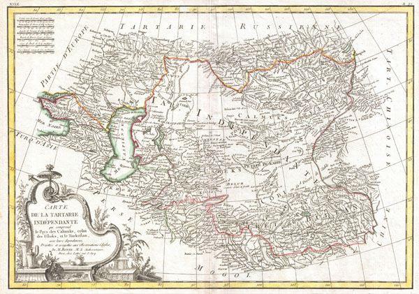
Carte de la Tartarie Independante qui comprend le Pays de Calmuks, celui des Usbeks, et le Turkestan avec leurs dependances.
sold
- Digital Map Information
- Suitable for large format printing
- DPI: 300
- File Size: 8.37 MB
- File Type: ZIP / TIFF
- ICC color profile embedded
- Delivered instantly via download link
A beautiful example of Rigobert Bonne's 1770 decorative map of Central Asia. Covers from the Black Sea south to China, north to Russia, and south to Persia and India. Includes the modern day nations ... (more details)

Carte de L'Empire de Perse.
sold
- Digital Map Information
- Suitable for large format printing
- DPI: 300
- File Size: 8.07 MB
- File Type: ZIP / TIFF
- ICC color profile embedded
- Delivered instantly via download link
A beautiful example of Rigobert Bonne's 1771 decorative map of the Persia. Covers from the Black Sea south to the Persian Gulf and east past the Caspian Sa to the Indus Valley. Includes the modern ... (more details)

Carte deL'Arabie qui se divise en Arabie Petree, Deserte et Heureuse, Projettee en assujettie aux Observations Celestes.
sold
- Digital Map Information
- Suitable for large format printing
- DPI: 300
- File Size: 7.03 MB
- File Type: ZIP / TIFF
- ICC color profile embedded
- Delivered instantly via download link
A beautiful example of Rigobert Bonne's 1771 decorative map of the Arabian Peninsula. Covers from the Mediterranean to the Indian Ocean and from the Red Sea to the Persian Gulf. Includes the ... (more details)

Indes IVe. Feuille.
sold
- Digital Map Information
- Suitable for large format printing
- DPI: 300
- File Size: 7.99 MB
- File Type: ZIP / TIFF
- ICC color profile embedded
- Delivered instantly via download link
A beautiful example of Rigobert Bonne's 1771 decorative map the East Indies. Covers from the Gulf of Siam (Gulf of Thailand) and Malacca (Malaysia) eastward to include parts of Sumatra, Java, ... (more details)
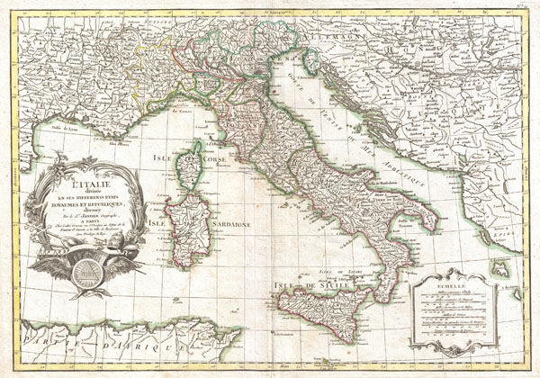
L'Italie divisee en ses differents etats Royaumes et Republiques.
sold
- Digital Map Information
- Suitable for large format printing
- DPI: 300
- File Size: 8.32 MB
- File Type: ZIP / TIFF
- ICC color profile embedded
- Delivered instantly via download link
A beautiful example of Le Sieur Janvier's 1770 decorative map of Italy. Covers from the Gulf of Eyon eastward to include all of Corsica, Sardinia, Italy, the Adriatic, and parts of Hungary ... (more details)