

L'Italie divisee en ses differens Etats dress d'apres les meilleurs Cartes appuyee sur les Observations Astromom'.
sold
- Digital Map Information
- Suitable for large format printing
- DPI: 300
- File Size: 15.14 MB
- File Type: ZIP / TIFF
- ICC color profile embedded
- Delivered instantly via download link
A beautiful example of Rizzi-Zannoni's 1770 two sheet decorative map of Italy. The upper sheet covers from Lake Geneva and the Venetian States south to include Rome, Corsica, and Capitana. Also includes the Gulf of Venice and the states of Dalmatia, Herzegovina ... (more details)

L'Asie divisee en ses Principaux Etats.
sold
- Digital Map Information
- Suitable for large format printing
- DPI: 300
- File Size: 7.98 MB
- File Type: ZIP / TIFF
- ICC color profile embedded
- Delivered instantly via download link
A beautiful example of Le Sieur Janvier's 1771 map of Asia. Covers from Africa and the Mediterranean east to Bering Strait (Detroit du Norte ou d'Anian) and south as far as Java and New Guinea. This map is most interesting in its rendering of the largely ... (more details)
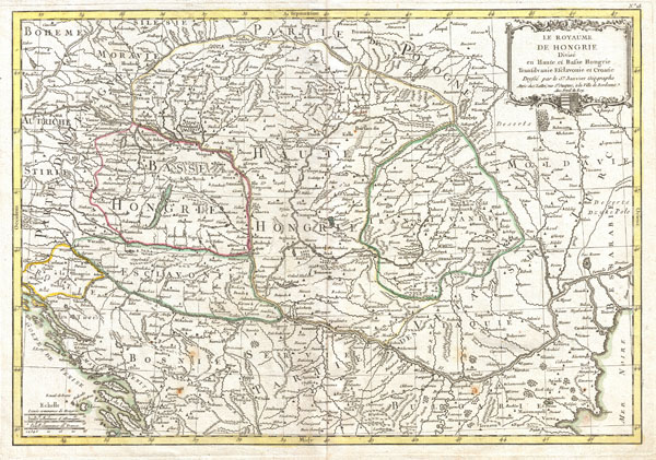
The Royaume de Hongrie Divisee en Haute et Basse Hongrie, Transilvanie, Esclavonie et Croatie.
sold
- Digital Map Information
- Suitable for large format printing
- DPI: 300
- File Size: 9.29 MB
- File Type: ZIP / TIFF
- ICC color profile embedded
- Delivered instantly via download link
A beautiful example of Le Sieur Janvier's 1771 map of southeastern Europe. Covers much of modern Hungary, Romania, Transylvania, Moldova, Bosnia, Serbia, Croatia, Bulgaria, and parts of Austria, Poland, and Greece. A decorative title cartouche bearing ... (more details)

Nubie et Abissinie Projettee en assujettie aux observations Astronomiques.
sold
- Digital Map Information
- Suitable for large format printing
- DPI: 300
- File Size: 6.81 MB
- File Type: ZIP / TIFF
- ICC color profile embedded
- Delivered instantly via download link
A beautiful example of Rigobert Bonne's 1771 map of Nubia and Abyssinia. Covers from Aswan, Egypt south along the Nile river to include all of modern day Sudan, Ethiopia, Eretria, Djibouti and Somalia. Also includes parts of neighboring Arabia across the ... (more details)

L'Empire de la Chine d'Apres L'Atlas Chinois avec Les Isles du Japon.
sold
- Digital Map Information
- Suitable for large format printing
- DPI: 300
- File Size: 8.02 MB
- File Type: ZIP / TIFF
- ICC color profile embedded
- Delivered instantly via download link
A beautiful example of Rigobert Bonne's c. 1770 decorative map of China, Korea (Corea), Japan and Formosa (Taiwan). Extends from Tibet and Chinese Tartary east to Japan and south to Hainan. China is divided into various provinces with major cities, lakes, ... (more details)
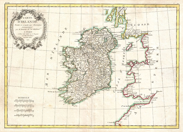
Carte D'Irlande Projelle de assujettie aux Observation Astronomiques.
sold
- Digital Map Information
- Suitable for large format printing
- DPI: 300
- File Size: 6.75 MB
- File Type: ZIP / TIFF
- ICC color profile embedded
- Delivered instantly via download link
A beautiful example of Rigobert Bonne's 1771 decorative map of Ireland. Includes all of Ireland as well as parts of neighboring England and Scotland. An elaborate decorative title cartouche appears in the upper left quadrant. Drawn by R. Bonne 1771 for ... (more details)

Carte des Douze Tribus D'Israel.
sold
- Digital Map Information
- Suitable for large format printing
- DPI: 300
- File Size: 6.55 MB
- File Type: ZIP / TIFF
- ICC color profile embedded
- Delivered instantly via download link
A beautiful example of Rigobert Bonne's c. 1770 decorative map of Israel or the Holy Land on both sides of the Jordan River. Covers the region as it existed in Biblical times with divisions for each of the Twelve Tribes of Israel. Notes on the ... (more details)
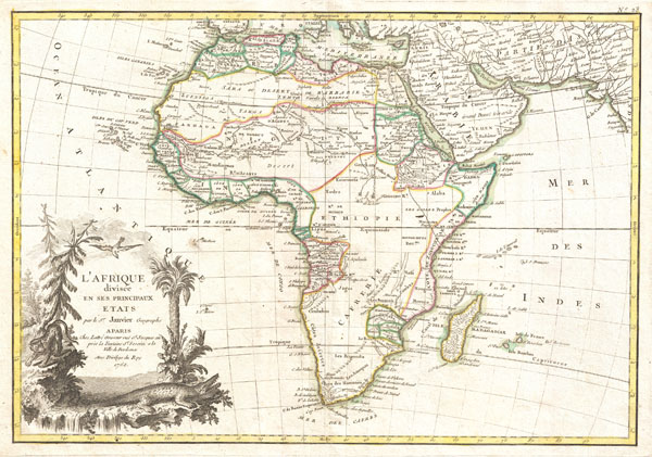
L'Afrique divisee en ses Principaux Etats.
sold
- Digital Map Information
- Suitable for large format printing
- DPI: 300
- File Size: 6.93 MB
- File Type: ZIP / TIFF
- ICC color profile embedded
- Delivered instantly via download link
A beautiful example of Jean Janvier's 1762 map of Africa. Covers the entire continent as well as the Island of Madagascar and adjacent parts of Persia and Arabia. Divided into various regions with color-coding according to the colonial power ... (more details)

Preliminary Chart of the Entrance to Matagorda Bay, Texas. / Sub-Sketch Part of Matagorda and Lavaca Bays. / Sub-Sketch Part of Lavaca Bay.
sold
- Digital Map Information
- Suitable for large format printing
- File Size: 12.09 MB
- File Type: ZIP / TIFF
- ICC color profile embedded
- Delivered instantly via download link
This is an uncommon 1857 U.S. Coast Survey Chart or Map of Matagorda Bay and Lavaca Bay in Texas. Essentially three maps in one. The primary map, occupying the left portion of the sheet, details the Entrance to Matagorda Bay Offers excellent ... (more details)
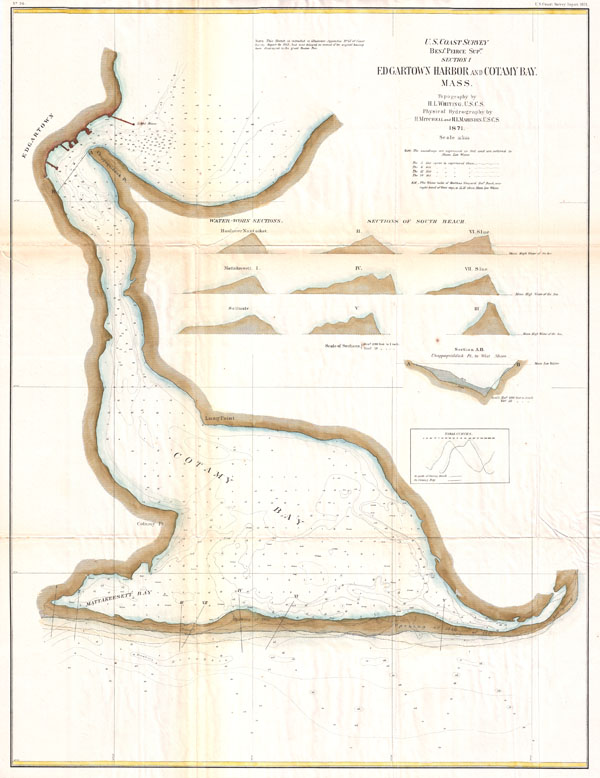
Section I, Edgartown Harbor and Cotamy Bay, Mass.
sold
- Digital Map Information
- Suitable for large format printing
- File Size: 9.75 MB
- File Type: ZIP / TIFF
- ICC color profile embedded
- Delivered instantly via download link
A very rare 1872 U.S. Coast Survey Map of Edgartown and Cotamy Bay on Martha's Vineyard (Marthas Vineyard), Massachusetts. Depicts from Edgartown south to Mattakeesett Bay and east to the 'Opening of 1846.' Offers a countless depth soundings ... (more details)

Les Indes Orientales et leur archipel. Assujettie aux observations astronomiq(u)es combinees avec les itineraires anciens et modernes, et avec les routes des navigateurs.
sold
- Digital Map Information
- Suitable for large format printing
- DPI: 300
- File Size: 8.3 MB
- File Type: ZIP / TIFF
- ICC color profile embedded
- Delivered instantly via download link
A beautiful example of Rigobert Bonne's c. 1770 map of India, Southeast Asia and the East Indies. Covers from Kandahar and the Maldives in the west eastward to include all of India, Southeast Asia (modern Burma, Thailand or Siam, Malaysia, ... (more details)

Carte geo-hydrographique du Golfe du Mexique et de ses isles. Construit d'apres les memoires les plus recens, et assujeties, pour l'emplacement de ces principales positions aux latitudes et longitudes, determinées par observation.
sold
- Digital Map Information
- Suitable for large format printing
- Full resolution TIFF file
- ICC color profile embedded
- Delivered instantly via download link
A beautiful example of Zannoni's 1762 map of the West Indies, Florida and Central America. Covers from the Gulf of Mexico to the lesser Antilles including all of the West Indies, Florida and Central America, with parts of Louisiana, Mexico ... (more details)

Carte du Mexique ou de la Nlle. Espagne Contenant aussi le Nouveau Mexique, la Californie, avec une Partie des Pays adjacents.
sold
- Digital Map Information
- Suitable for large format printing
- DPI: 300
- File Size: 7.22 MB
- File Type: ZIP / TIFF
- ICC color profile embedded
- Delivered instantly via download link
A beautiful example of Rigobert Bonne's 1771 map of Mexico and Florida. Covers from Baja California eastward to Florida and Carolina, extend northwards as far as the mouth of the Chesapeake Bay and southwards to Panama. Bonne, being a ... (more details)
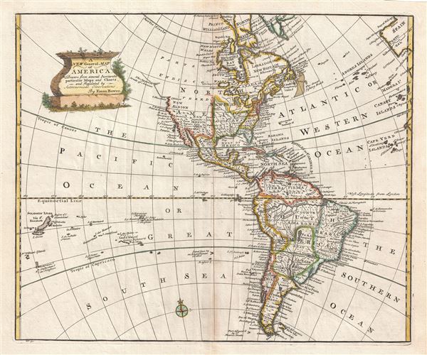
A New General Map of America Drawn from several Accurate particular Maps and Charts and Regulated by Astronomical Observations.
sold
- Digital Map Information
- Suitable for large format printing
- DPI: 300
- File Size: 8.75 MB
- File Type: ZIP / TIFF
- ICC color profile embedded
- Delivered instantly via download link
A stunning 1747 decorative map of the Western Hemisphere by E. Bowen. Covers North and South America as well as much of the Pacific and the Atlantic as far as Spain and the Canary Islands. Details America during the Colonial Period. ... (more details)
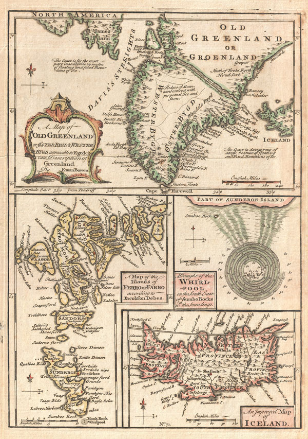
A Map of Old Greenland or Oster Bygd & Wester Bygd, agreeable to Egede’s late Description of Greenland. A Map of the Islands of Ferro or Farro according to Jacobson Debes. A Draught of the Whirlpool on the South East of Sumbo Rocks w.th the Soundings. An Improved Map of Iceland
sold
- Digital Map Information
- Suitable for large format printing
- DPI: 300
- File Size: 4.78 MB
- File Type: ZIP / TIFF
- ICC color profile embedded
- Delivered instantly via download link
A singularly fascinating 1747 map of Greenland, Iceland and the Faroe Islands by E. Bowen. Essentially four maps on one sheet, this map of the North Atlantic islands is festooned with speculation and curiosities. The uppermost map ... (more details)
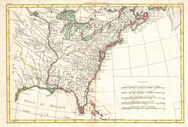
Partie De L'Amerique septentrionale, qui comprend le Canada, La Louisiane, Le Labrador, Le Greenland, La Nouvelle Angleterre, La Floride & C.
sold
- Digital Map Information
- Suitable for large format printing
- DPI: 300
- File Size: 11.86 MB
- File Type: ZIP / TIFF
- ICC color profile embedded
- Delivered instantly via download link
Printed in 1776, on the cusp of the American Revolutionary War, this is Bonne's important map of Louisiana and the British claims in North America. Covers from the Grand Banks south to Florida and westward as far as Mexico and Texas. ... (more details)

Partie De L'Amerique septentrionale, qui comprend le Canada, La Louisiane, Le Labrador, Le Greenland, La Nouvelle Angleterre, La Floride & C.
sold
- Digital Map Information
- Suitable for large format printing
- DPI: 300
- File Size: 7.25 MB
- File Type: ZIP / TIFF
- ICC color profile embedded
- Delivered instantly via download link
This is an important map of the Hudson Bay and the surrounding areas issued in 1776 by the French cartographer Rigobert Bonne. Covers much of what is today northeastern Canada from Lake Winnipeg to Greenland including all of Hudson ... (more details)

L'Amerique divisee Par Grands Etats.
sold
- Digital Map Information
- Suitable for large format printing
- DPI: 300
- File Size: 7.09 MB
- File Type: ZIP / TIFF
- ICC color profile embedded
- Delivered instantly via download link
An altogether fascinating map of North America and South America by Jean Janvier dating to 1862. Covers both continents from the Antarctic circle to the arctic circle, extends westward to New Zealand and eastward as far as Africa ... (more details)

L'Amerique Septentrionale Divisee en ses Principaux Etats.
sold
- Digital Map Information
- Suitable for large format printing
- DPI: 300
- File Size: 7.28 MB
- File Type: ZIP / TIFF
- ICC color profile embedded
- Delivered instantly via download link
An altogether fascinating first edition example of Jean Janvier 1762 map of North America, including one of the most ambitions depictions of the Sea of the West in any map. The map covers the continent from Panama to the Arctic Circle, extends westward to include parts of Asia and eastward as far as Iceland. This map, which is heavily influenced by the theoretical mappings of Guillaume de l'Isle and Philippe Buache, went through several states of which this is the first and possibly the most interesting. Javier divides the continent according to the three colonial powers that controlled it, with England controlling the colonies along the east coast, France occupying Canada and Louisiana, and Spain dominating Mexico, Florida, Cuba and Central America. (more details)

Map of Tientsin.
sold
- Digital Map Information
- Suitable for large format printing
- File Size: 5.14 MB
- File Type: ZIP / TIFF
- ICC color profile embedded
- Delivered instantly via download link
This rare and unusual map depicts the city of Tientsin, the second most important city, following Beijing, in Northern China. Map is entirely in English and comes with a booklet that discusses the various concessions: Japanese, ... (more details)