

Colton's Map of Oregon, Washington, Idaho, British Columbia & Montana.
sold
- Digital Map Information
- Suitable for large format printing
- File Size: 20.05 MB
- File Type: ZIP / TIFF
- ICC color profile embedded
- Delivered instantly via download link
This is a scarce and unusual map of the northwestern part of the United States issued by J. H. Colton in the 1866 edition of his important General Atlas . This map first appeared in the 1865 issue of Colton's Atlas and was subsequently updated in the 1866, 1867 ... (more details)
Rare first edition of Mitchell Jr.'s important New York City map.
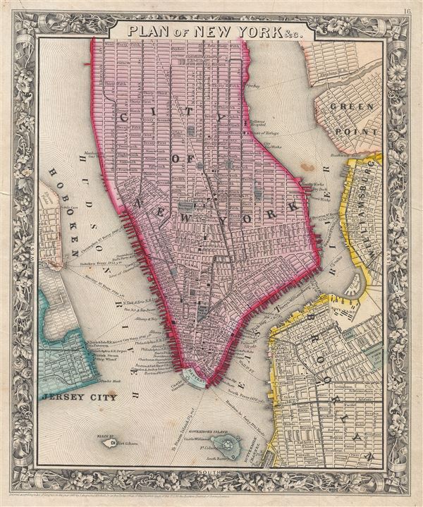
Plan of New York & c.
sold
- Digital Map Information
- Suitable for large format printing
- File Size: 6.11 MB
- File Type: ZIP / TIFF
- ICC color profile embedded
- Delivered instantly via download link
A beautiful example of the first edition of S. A. Mitchell's 1860 map of New York City. The map depicts southern Manhattan, below 45th street, along with parts of Brooklyn, Williamsburg, Greenpoint, Hoboken, and Jersey City. Mitchell offers wonderful detail at ... (more details)
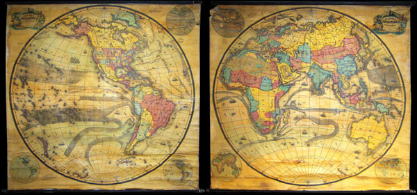
Pelton's Political & Physical Map of the Western Hemisphere. / Pelton's Political & Physical Map of the Eastern Hemisphere.
sold
A mammoth, extremely rare, and highly desirable set of hemisphere wall maps issued by C. Pelton in 1858. These spectacular wall maps rarely appear on the market and almost never as a set. Depicts the entire world on a hemisphere projection. On both maps, ... (more details)
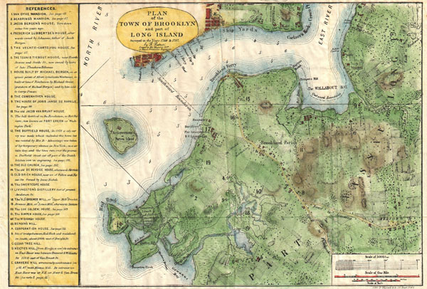
Plan of the Town of Brooklyn and Part of Long Island.
sold
- Digital Map Information
- Suitable for large format printing
- File Size: 5.08 MB
- File Type: ZIP / TIFF
- ICC color profile embedded
- Delivered instantly via download link
A rare and very attractive plan of Brooklyn, New York drawn in 1867 by Samuel Edward Stiles. Designed for Stiles' important History of Brooklyn , this map is based upon surveys of Brooklyn originally taken in 1766 and 1767 by Bernard Ratzer. Includes much ... (more details)

Preliminary Chart of Eastern Entrance to Santa Barbara Channel Claifornia.
sold
- Digital Map Information
- Suitable for large format printing
- File Size: 18.27 MB
- File Type: ZIP / TIFF
- ICC color profile embedded
- Delivered instantly via download link
An extremely attractive hand colored 1857 U.S. Coast Survey chart or map of the Eastern Entrance to Santa Barbara Channel. Depicts the California coast from the Town and Mission of San Buenaventura (Ventura, CA) to Point Mugu. Includes Santa Cruz Island ... (more details)

H No. 3 / Reconnoissance of the Passes of the Delta of the Mississippi, Louisiana, showing the changes since 1839.
sold
- Digital Map Information
- Suitable for large format printing
- DPI: 300
- File Size: 15.35 MB
- File Type: ZIP / TIFF
- ICC color profile embedded
- Delivered instantly via download link
An attractive hand colored 1852 U.S. Coast Survey triangulation chart or map of the Mississippi Delta. This map is in fact a composite of four different maps detailing different parts of the Delta. The first map, in the upper left quadrant details the ... (more details)

Johnson's Map of New York and the Adjacent Cities.
sold
- Digital Map Information
- Suitable for large format printing
- Full resolution TIFF file
- ICC color profile embedded
- Delivered instantly via download link
A fine hand colored map of New York City and Brooklyn dating to 1862. This map represents the first state of the Johnson and Ward map of New York City. Prior editions of the Johnson atlas (1860 & 1861), including the Johnson and Browning editions, did ... (more details)

Johnson's Prussia Norway Sweden and Denmark.
sold
- Digital Map Information
- Suitable for large format printing
- File Size: 36.73 MB
- File Type: ZIP / TIFF
- ICC color profile embedded
- Delivered instantly via download link
This is A. J. Johnson and Ward's 1864 map of Scandinavia. Depicts all of Sweden, Norway, Finland, Denmark and Prussia, as well as parts of Estonia, Latvia and Lithuania. There are two decorative city views, Stockholm in the upper left quadrant and ... (more details)
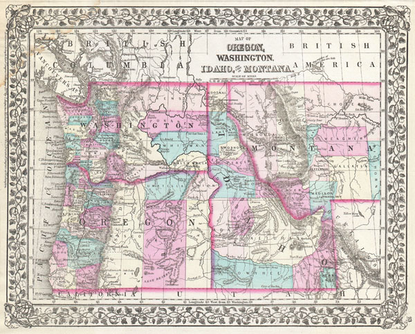
Map of Oregon, Washington, Idaho, and part of Montana.
sold
- Digital Map Information
- Suitable for large format printing
- File Size: 7.43 MB
- File Type: ZIP / TIFF
- ICC color profile embedded
- Delivered instantly via download link
A beautiful example of S. A. Mitchell Junior's 1877 map of Washington, Oregon, Idaho and Montana. Detailed and color coded at the county level with attention to towns, geographical features, proposed railroads, and cities. Features the vine motif ... (more details)
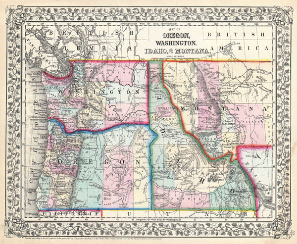
Map of Oregon, Washington, Idaho, and part of Montana.
sold
- Digital Map Information
- Suitable for large format printing
- File Size: 7.44 MB
- File Type: ZIP / TIFF
- ICC color profile embedded
- Delivered instantly via download link
A beautiful example of S. A. Mitchell Junior's 1867 map of Washington, Oregon, Idaho and Montana. Detailed and color coded at the county level with attention to towns, geographical features, proposed railroads, and cities. The Montana-Wyoming ... (more details)

Kingdom of Naples or The Two Sicilies.
sold
- Digital Map Information
- Suitable for large format printing
- DPI: 300
- File Size: 9.09 MB
- File Type: ZIP / TIFF
- ICC color profile embedded
- Delivered instantly via download link
An extremely attractive example of S. A. Mitchell Sr.'s 1853 map of Southern Italy and Sicily. Covers from Rome south to include the boot of Italy and Sicily. Color coded according to region. An inset in the lower right hand quadrant details ... (more details)

Italy, North Part.
sold
- Digital Map Information
- Suitable for large format printing
- DPI: 300
- File Size: 7.23 MB
- File Type: ZIP / TIFF
- ICC color profile embedded
- Delivered instantly via download link
An extremely attractive example of S. A. Mitchell Sr.'s 1853 map of Northern Italy. Covers from Switzerland south to Naples. Includes the Kingdom of Lombardy and Venice, Parma, Modena, Tuscany and the Papal States. Color coded according to ... (more details)

Chili La Plata and Uruguay. / South Part of Patagonia.
sold
- Digital Map Information
- Suitable for large format printing
- DPI: 300
- File Size: 10.42 MB
- File Type: ZIP / TIFF
- ICC color profile embedded
- Delivered instantly via download link
An extremely attractive example of S. A. Mitchell Sr.'s 1853 map of Chili, La Plata and Uruguay. Covers the south part of South America from Bolivia and Paraguay south to Tierra del Fuego. Includes the modern day nations of Chili, ... (more details)

Sketch J. No. 2 Showing the Progress of the Survey of San Francisco Bay and Vicinity Section X From 1850 to 1852.
sold
- Digital Map Information
- Suitable for large format printing
- DPI: 300
- File Size: 3.68 MB
- File Type: ZIP / TIFF
- ICC color profile embedded
- Delivered instantly via download link
An attractive hand colored 1853 U.S. Coast Survey triangulation chart or map of San Francisco Bay, California. Shows the progress of the survey work in this area by date annotated sections. Shows points such as California City, ... (more details)

Sketch E. No. 2, Showing the Progress of the Survey in the Vicinity of Savannah Georgia 1850 - 1852.
sold
- Digital Map Information
- Suitable for large format printing
- DPI: 300
- File Size: 2.51 MB
- File Type: ZIP / TIFF
- ICC color profile embedded
- Delivered instantly via download link
An attractive hand colored 1853 U.S. Coast Survey triangulation chart or map of Savannah Georgia and the Savannah River. Shows the progress of the survey work in this area by date annotated sections. Shows navigation marks such ... (more details)

Sketch H. Showing the progress of the Survey in Section No. 8 1846 - 1852.
sold
- Digital Map Information
- Suitable for large format printing
- DPI: 300
- File Size: 11.79 MB
- File Type: ZIP / TIFF
- ICC color profile embedded
- Delivered instantly via download link
An attractive hand colored 1853 U.S. Coast Survey triangulation chart or map of the Mississippi Delta. Depicts the Mississippi Delta and the Gulf Coast from Lake Pontchartrain, Louisiana eastward past New Orleans, as far as ... (more details)

Mississippi City Harbor, Mississippi.
sold
- Digital Map Information
- Suitable for large format printing
- File Size: 8.19 MB
- File Type: ZIP / TIFF
- ICC color profile embedded
- Delivered instantly via download link
An attractive hand colored 1857 U.S. Coast Survey sea chart or map depicting Mississippi City Harbor, Mississippi. Depicts the Mississippi Coast between Mississippi City and Biloxi, Mississippi. Inland regions are depicted ... (more details)

St. Mary's River and Fernandina Harbor Florida.
sold
- Digital Map Information
- Suitable for large format printing
- File Size: 22.22 MB
- File Type: ZIP / TIFF
- ICC color profile embedded
- Delivered instantly via download link
An attractive hand colored 1857 U.S. Coast Survey sea chart or map depicting St. Mary's River and Fernandina Harbor in Northern Florida. Details the winding course of the St. Mary River Delta from St. Mary's to the Atlantic. ... (more details)

Map of Turkey in Europe together with the Ionian Islands.
sold
- Digital Map Information
- Suitable for large format printing
- DPI: 300
- File Size: 6.59 MB
- File Type: ZIP / TIFF
- ICC color profile embedded
- Delivered instantly via download link
An extremely attractive example of S. A. Mitchell Sr.Â's 1853 map of Turkey in Europe. This map, made when the Ottoman Empire controlled much of the region, covers what is today Turkey, Greece, Macedonia Croatia, Bosnia, ... (more details)

Greece.
sold
- Digital Map Information
- Suitable for large format printing
- DPI: 300
- File Size: 7.66 MB
- File Type: ZIP / TIFF
- ICC color profile embedded
- Delivered instantly via download link
An extremely attractive example of S. A. Mitchell Sr.'s 1853 map of Greece. Covers from Ioannina and Triekhala south to include the Euboea (Negropont) and the Peloponnese (Morea). Color coded according to region. An ... (more details)