

A New Map of the Circle of Swabia, from the Latest Authorities.
sold
- Digital Map Information
- Suitable for large format printing
- DPI: 300
- File Size: 18.78 MB
- File Type: ZIP / TIFF
- ICC color profile embedded
- Delivered instantly via download link
An extremely attractive example of John Cary's 1799 map of the Swabia region of Germany. Covers from the Upper Rhine region south as far as Switzerland, Lake Constance and Tyrol. Extends eastward as far as Bavaria and westward as far as France. Includes the ... (more details)
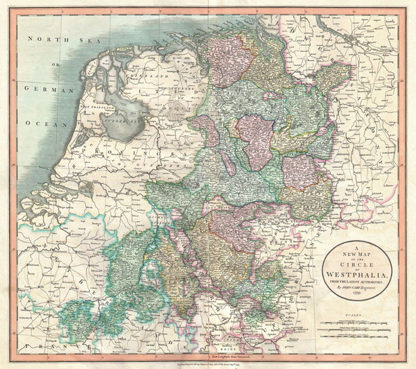
A New Map of the Circle of Westphalia, from the Latest Authorities.
sold
- Digital Map Information
- Suitable for large format printing
- DPI: 300
- File Size: 16.84 MB
- File Type: ZIP / TIFF
- ICC color profile embedded
- Delivered instantly via download link
An extremely attractive example of John Cary's 1799 map of the Westphalia region of Germany. Covers from the North Sea to the Lower Rhine. Includes much of Holland, Belgium and Lower Saxony as well. Highly detailed with color coding according to region. ... (more details)

A New Map of Netherlands, also of that part of Germany westward of the Rhine as ceded to the French and divided into their several departments, from the Latest Authorities.
sold
- Digital Map Information
- Suitable for large format printing
- DPI: 300
- File Size: 16.52 MB
- File Type: ZIP / TIFF
- ICC color profile embedded
- Delivered instantly via download link
Despite being entitled 'the Netherlands,' this map is John Cary's fine and attractive map of Belgium and Luxembourg. Belgium, as we know it today, did not emerge as an independent state until the Belgian Revolution of 1830. Highly detailed with color ... (more details)

A New Map of Spain and Portugal Divided into their respective Kingdoms and provinces from the Latest Authorities.
sold
- Digital Map Information
- Suitable for large format printing
- Full resolution TIFF file
- ICC color profile embedded
- Delivered instantly via download link
An extremely attractive example of John Cary's 1801 map of Spain and Portugal. Consists of the entire region of Iberia including the islands of Minorca, Majorca and Ibiza, parts of northern Africa, and Parts of France. Highly detailed with color ... (more details)
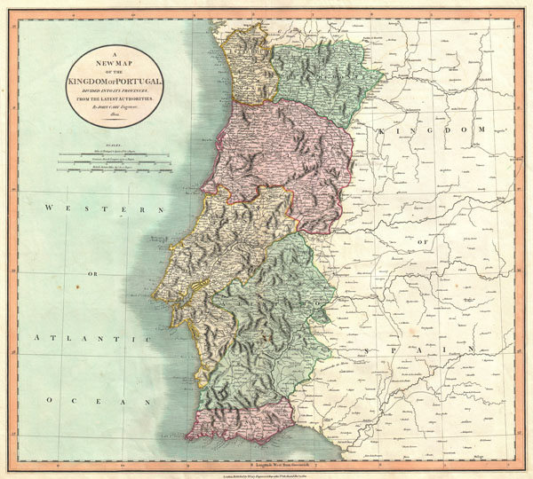
A New Map of the Kingdom of Portugal, Divided into its Provinces, from the Latest Authorities.
sold
- Digital Map Information
- Suitable for large format printing
- DPI: 300
- File Size: 14.32 MB
- File Type: ZIP / TIFF
- ICC color profile embedded
- Delivered instantly via download link
An extremely attractive example of John Cary's 1801 map of Portugal. Highly detailed and color coded according to region. All in all, one of the most interesting and attractive atlas maps Portugal to appear in first years of the 19th century. ... (more details)

A New Map of the United Provinces, comprehending Holland, Zealand, Utrecht, Gelders, Over Yssel, Friesland and Groningen; with the Lands of Drent, Dutch Flanders, & Dutch Brabant &c &c from the Latest Authorities.
sold
- Digital Map Information
- Suitable for large format printing
- DPI: 300
- File Size: 17.62 MB
- File Type: ZIP / TIFF
- ICC color profile embedded
- Delivered instantly via download link
An extremely attractive example of John Cary's 1799 map of the Netherlands. Consists of the provinces of Holland, Zealand, Utrecht, Gelders, Over Yssel, Friesland, and Groningen, as well as Drent, Dutch Flanders, and Dutch Brabant. Shows the ... (more details)
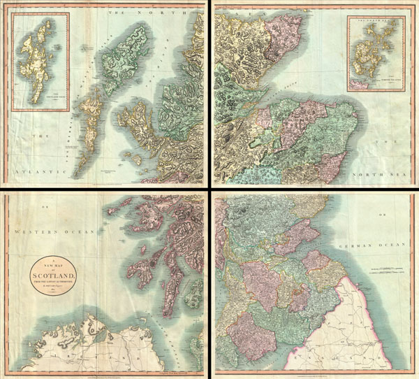
A New Map of Scotland.
sold
- Digital Map Information
- Suitable for large format printing
- DPI: 300
- File Size: 43.33 MB
- File Type: ZIP / TIFF
- ICC color profile embedded
- Delivered instantly via download link
A very attractive example of John Cary's stupendous four sheet 1801 map of Scotland. Covers the entirety of Scotland as well as parts of neighboring England and Ireland. Inset maps detail the Orkney Islands and the Shetland Islands. Offers ... (more details)
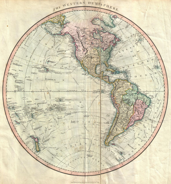
The Western Hemisphere
sold
- Digital Map Information
- Suitable for large format printing
- DPI: 300
- File Size: 13.46 MB
- File Type: ZIP / TIFF
- ICC color profile embedded
- Delivered instantly via download link
An attractive example of John Cary's spectacular 1799 map of the Western Hemisphere. Covers the entirety of North America, South America, the Pacific Ocean and much of Polynesia. Europe is mapped according to early 19th century form. In ... (more details)
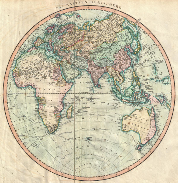
The Eastern Hemisphere
sold
- Digital Map Information
- Suitable for large format printing
- Full resolution TIFF file
- ICC color profile embedded
- Delivered instantly via download link
A very attractive example of John Cary's spectacular 1801 map of the Eastern Hemisphere. Covers the entirety of Europe, Africa and Asia, along with Australia, the Indian Ocean, and parts of Polynesia. Europe is mapped according to early ... (more details)

A New Map of South America, From the Latest Authorities.
sold
- Digital Map Information
- Suitable for large format printing
- DPI: 300
- File Size: 20 MB
- File Type: ZIP / TIFF
- ICC color profile embedded
- Delivered instantly via download link
A fine example of John Cary's spectacular 1807 two sheet map of South America. Covers the entirety of South America on two sheets. The upper sheet details the region from Cuba southwards as far as Lake Titicaca and Porto Bello, Brazil. ... (more details)
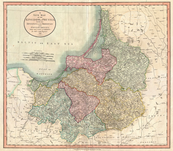
A New Map of the Kingdom of Prussia, with its Divisions into Provinces and Governments; from the Latest Authorities.
sold
- Digital Map Information
- Suitable for large format printing
- DPI: 300
- File Size: 13.65 MB
- File Type: ZIP / TIFF
- ICC color profile embedded
- Delivered instantly via download link
An extremely attractive example of John Cary's 1799 map of Denmark. Covers from Pomerania eastward along the Baltic Coast as far as Poland, extends south to Soldau and north past Lithuania to Memel (modern day Klaipeda). Offers ... (more details)

A New Map of the Kingdom of Denmark, Comprehending North and South Jutland, Zeeland, Fyen, Laaland, and Part of Holstein. From the Latest Authorities.
sold
- Digital Map Information
- Suitable for large format printing
- DPI: 300
- File Size: 16.52 MB
- File Type: ZIP / TIFF
- ICC color profile embedded
- Delivered instantly via download link
An extremely attractive example of John Cary's 1801 map of Denmark. Covers all of Jutland and the islands of Zeeland, Fyen, Laaland. Also includes most of the Duchy of Holstein and parts of Lower Saxony and Pomerania. Offers ... (more details)

A New Map of Bohemia and Moravia, from the Latest Authorities.
sold
- Digital Map Information
- Suitable for large format printing
- DPI: 300
- File Size: 17.56 MB
- File Type: ZIP / TIFF
- ICC color profile embedded
- Delivered instantly via download link
An extremely attractive example of John Cary's 1801 map of Bohemia and Moravia. Covers the territory claimed by the modern day Czech Republic. Offers stupendous detail and color coding according to region. All in all, one of ... (more details)

A New Map of Hungary, with its Divisions into Gespanchafts or Counties; the Principality of Transylvania, Croatia &c. from the Latest Authorities.
sold
- Digital Map Information
- Suitable for large format printing
- DPI: 300
- File Size: 16.6 MB
- File Type: ZIP / TIFF
- ICC color profile embedded
- Delivered instantly via download link
An extremely attractive example of John Cary's important 1799 map of the Hungary. Covers from the Adriatic eastward as far as Transylvania and northward as far as Poland. Includes parts of the modern day nations of Croatia, ... (more details)

A New Map of the County of Tyrol, and the Republic of Venice; Duchy of Mantua &c. &c. from the Latest Authorities.
sold
- Digital Map Information
- Suitable for large format printing
- DPI: 300
- File Size: 18.51 MB
- File Type: ZIP / TIFF
- ICC color profile embedded
- Delivered instantly via download link
An extremely attractive example of John Cary's important 1799 map of the Venetian States. Covers Bergamo and Lake Constance eastward, past Tyrol, Venice, and Mantua to Istria and the Gulf of Trieste. Offers stupendous ... (more details)
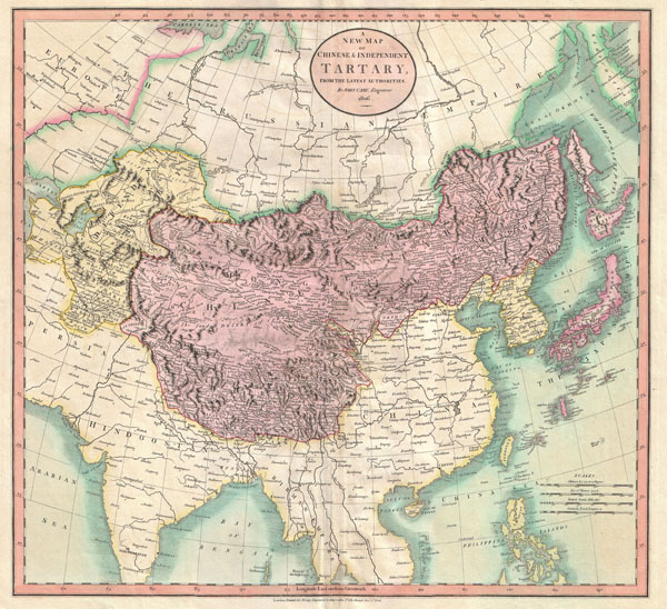
A New Map of Chinese & Independent Tartary , From the Latest Authorities.
sold
- Digital Map Information
- Suitable for large format printing
- DPI: 300
- File Size: 16.51 MB
- File Type: ZIP / TIFF
- ICC color profile embedded
- Delivered instantly via download link
An exceptionally beautiful example of John Cary's important 1806 map of Chinese and Independent Tartary. Covers Central Asia from the Caspian Sea to Japan, extends as far north as the Obskaia Sea and as far south as ... (more details)

A New Map of China, From the Latest Authorities.
sold
- Digital Map Information
- Suitable for large format printing
- DPI: 300
- File Size: 18.95 MB
- File Type: ZIP / TIFF
- ICC color profile embedded
- Delivered instantly via download link
An exceptionally beautiful example of John Cary's important 1801 map of China and Korea. Covers from Tibet and Bhutan eastwards as far as Korea, extends north as far as the Gobi Desert and south to Tonkin (modern ... (more details)
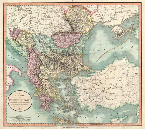
A New Map of Turkey in Europe, Divided into its Provinces, from the Best Authorities.
sold
- Digital Map Information
- Suitable for large format printing
- DPI: 300
- File Size: 18.9 MB
- File Type: ZIP / TIFF
- ICC color profile embedded
- Delivered instantly via download link
An exceptionally beautiful example of John Cary's important 1801 map of Turkey in Europe. Covers from the Adriatic eastward to Crimea and Southwards as far as Crete and Cyprus. While technically a map of ... (more details)

A New Map of Nova Scotia, Newfoundland & c., From the Latest Authorities.
sold
- Digital Map Information
- Suitable for large format printing
- DPI: 300
- File Size: 15.66 MB
- File Type: ZIP / TIFF
- ICC color profile embedded
- Delivered instantly via download link
An exceptionally beautiful example of John CaryÂ's important 1807 map of Nova Scotia and Newfoundland. Covers the Maritime Provinces from New Brunswick and the Mouth of the St. Lawrence eastward as far as ... (more details)

A New Map of America, from the Latest Authorities.
sold
- Digital Map Information
- Suitable for large format printing
- DPI: 300
- File Size: 16.27 MB
- File Type: ZIP / TIFF
- ICC color profile embedded
- Delivered instantly via download link
An exceptionally beautiful example of John Cary's important 1806 Map of North and South America. Covers the entirety of the Western Hemisphere with a focus on North and South America. In North America the ... (more details)