

Australien und Polynesien.
sold
- Digital Map Information
- Suitable for large format printing
- File Size: 2.54 MB
- File Type: ZIP / TIFF
- ICC color profile embedded
- Delivered instantly via download link
This fascinating 1862 map by Justus Perthes and Stieler depicts Polynesia and Australia. There is an inset of southeastern Australia and Tasmania. On the bottom left there is a relative elevation chart. Unlike other cartographic publishers of the period, the ... (more details)

Palestine
sold
- Digital Map Information
- Suitable for large format printing
- Full resolution TIFF file
- ICC color profile embedded
- Delivered instantly via download link
This is an 1845 Map of Palestine or Israel or the Holy Land. Depicts from the Dead Sea in the south to Tyre and Sidon on the north. Full of wonderful details referring to Biblical ... (more details)
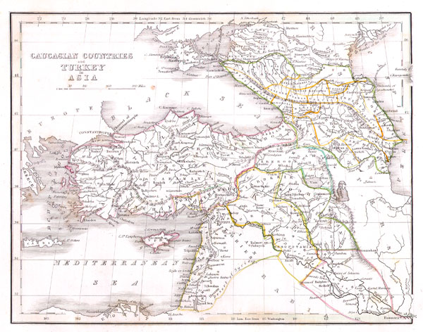
Caucasian Countries and Turkey in Asia.
sold
- Digital Map Information
- Suitable for large format printing
- Full resolution TIFF file
- ICC color profile embedded
- Delivered instantly via download link
This unusual map depicts the Asian portions of Turkey, the Black Sea, the Caucuses (Georgia, Azerbaijan, and Armenia), and what is today Israel/Palestine, Jordan, Syria, Lebanon, ... (more details)

Afrika.
sold
- Digital Map Information
- Suitable for large format printing
- File Size: 1.25 MB
- File Type: ZIP / TIFF
- ICC color profile embedded
- Delivered instantly via download link
This fascinating 1862 map by Justus Perthes and Stieler depicts the, at the time, largely unexplored continent of Africa. Unlike other cartographic publishers of the period, the ... (more details)

Johnson’s Arkansas Mississippi and Louisiana.
sold
- Digital Map Information
- Suitable for large format printing
- File Size: 5.8 MB
- File Type: ZIP / TIFF
- ICC color profile embedded
- Delivered instantly via download link
This is a beautifully hand colored 1864 lithograph map of Arkansas, Louisiana and Mississippi. Shows the states in beautiful detail as they appeared at the close of the American ... (more details)

Johnson’s Arkansas Mississippi and Louisiana.
sold
- Digital Map Information
- Suitable for large format printing
- File Size: 4.93 MB
- File Type: ZIP / TIFF
- ICC color profile embedded
- Delivered instantly via download link
This is Johnson and Browning's 1861 map of Louisiana, Arkansas and Mississippi. Covers the states divided into counties with special attention to transportation, especially ... (more details)
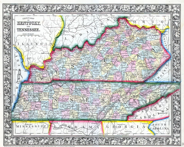
County Map of Kentucky and Tennessee.
sold
- Digital Map Information
- Suitable for large format printing
- File Size: 3.78 MB
- File Type: ZIP / TIFF
- ICC color profile embedded
- Delivered instantly via download link
This hand colored map is a lithographic engraving, dating to 1862 by the legendary American Mapmaker S.A. Mitchell, the younger. It represents the states of Kentucky and ... (more details)

Johnson’s Illinois.
sold
- Digital Map Information
- Suitable for large format printing
- File Size: 4.95 MB
- File Type: ZIP / TIFF
- ICC color profile embedded
- Delivered instantly via download link
This is Johnson and Ward's 1864 map of Illinois. This map shows cities, topographical features, railways, ferries and roads with color coding at the county level. ... (more details)

Johnson’s Indiana.
sold
- Digital Map Information
- Suitable for large format printing
- File Size: 4.95 MB
- File Type: ZIP / TIFF
- ICC color profile embedded
- Delivered instantly via download link
This is A. J. Johnson's 1865 map of Indiana. Covers the state divided into counties with special attention to transportation, especially roads, railroads, and ... (more details)

Johnson’s Delaware and Maryland.
sold
- Digital Map Information
- Suitable for large format printing
- Full resolution TIFF file
- ICC color profile embedded
- Delivered instantly via download link
This is a magnificent 1864 hand colored map of the states of Maryland and Delaware by the important American map Publisher A. J. Johnson. Depicts the two ... (more details)
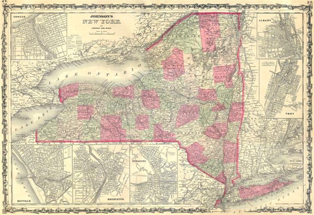
Johnson's Map of New York State.
sold
- Digital Map Information
- Suitable for large format printing
- Full resolution TIFF file
- ICC color profile embedded
- Delivered instantly via download link
This hand colored map is a steel plate engraving, dating to 1862 by the legendary American mapmaker A. J. Johnson. It depicts the state of New York. ... (more details)

Johnson’s New Hampshire and Vermont.
sold
- Digital Map Information
- Suitable for large format printing
- File Size: 3.11 MB
- File Type: ZIP / TIFF
- ICC color profile embedded
- Delivered instantly via download link
This is a beautifully hand colored 1862 map of Vermont and New Hampshire by A. J. Johnson. Depicts the two states in stupendous detail with even ... (more details)

Reconnoissance of Sabine Pass.
sold
- Digital Map Information
- Suitable for large format printing
- Full resolution TIFF file
- ICC color profile embedded
- Delivered instantly via download link
A rare hand colored 1853 coastal chart Sabine Pass, Texas. Sabine Pass forms the outlet of Sabine Lake into the Gulf of Mexico and creates the ... (more details)

Johnson’s Hindostan or British India.
sold
- Digital Map Information
- Suitable for large format printing
- File Size: 2.8 MB
- File Type: ZIP / TIFF
- ICC color profile embedded
- Delivered instantly via download link
A very nice example of A. J. Johnson's 1864 map of India and Southeast Asia. Covers from the Indus River eastward to include all of India, ... (more details)

Johnson’s China.
sold
- Digital Map Information
- Suitable for large format printing
- File Size: 3.21 MB
- File Type: ZIP / TIFF
- ICC color profile embedded
- Delivered instantly via download link
This is A. J. Johnson's 1865 map of China. Covers the region with particular attention to cities and waterways. China at the time this ... (more details)
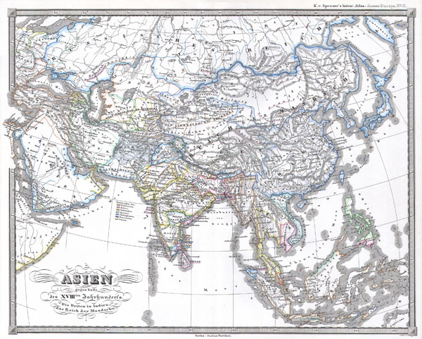
Asien gegen ende des 18th Jahrhunderts. Die Briten in Indien; das Reich der Mandschu.
sold
- Digital Map Information
- Suitable for large format printing
- File Size: 3.27 MB
- File Type: ZIP / TIFF
- ICC color profile embedded
- Delivered instantly via download link
This fascinating hand colored map depicts Asia at the end of the 18th century. The British had established themselves in India and the ... (more details)

Asien am Ausgange des 17th Jahrhunderts.
sold
- Digital Map Information
- Suitable for large format printing
- File Size: 3.51 MB
- File Type: ZIP / TIFF
- ICC color profile embedded
- Delivered instantly via download link
This fascinating hand colored map depicts Asia at the end of the 17th century. The Dutch had established themselves in India and the ... (more details)

City of Allentown.
sold
- Digital Map Information
- Suitable for large format printing
- File Size: 4.46 MB
- File Type: ZIP / TIFF
- ICC color profile embedded
- Delivered instantly via download link
This is a fascinating 1872 map of the city of Allentown, Pennsylvania. Depicts the whole of the town at the street level and in ... (more details)

Italie Ancienne
sold
- Digital Map Information
- Suitable for large format printing
- Full resolution TIFF file
- ICC color profile embedded
- Delivered instantly via download link
This is a beautiful 1837 hand colored lithograph map of Italy in Ancient Roman times. Includes an inset plan of the vicinity of ... (more details)

Bocage's Map of Thessaly in Ancient Greece (the home of Achilles.
sold
- Digital Map Information
- Suitable for large format printing
- Full resolution TIFF file
- ICC color profile embedded
- Delivered instantly via download link
This lovely little map of Thessaly, just south of Macedonia in Ancient Greece, was prepared by M. Barbie de Bocage in 1786 for ... (more details)