

Plan du Port d’Acapulco sur la Cote du Mexique dans la Mer du Sud.
sold
- Digital Map Information
- Suitable for large format printing
- Full resolution TIFF file
- ICC color profile embedded
- Delivered instantly via download link
This beautiful little map of the city and port of Acapulco, Mexico was produced by the French Cartographer Jacques-Nicolas Bellin in 1760. Includes some buildings, the fort, and depth ... (more details)
Humboldt's influential comparative elevation chart.

Physical Geography. Humboldt’s Distribution of Plants in Equinoctial America, According to Elevation Above the Level of the Sea.
sold
- Digital Map Information
- Suitable for large format printing
- DPI: 300
- File Size: 7.17 MB
- File Type: ZIP / TIFF
- ICC color profile embedded
- Delivered instantly via download link
This is Adam and Charles Black's rare 1840 profile view of the Andes Mountains, particularly Ecuador's Mt. Chimborazo, based upon an influential 1805 illustration by the renowned ... (more details)

Carte de L'Arabie, du Golfe Persique et de lat Mer Rouge, avec L'Egypte, La Nubie et L'Abissinie.
sold
- Digital Map Information
- Suitable for large format printing
- Full resolution TIFF file
- ICC color profile embedded
- Delivered instantly via download link
This is an attractive map of Arabia, northwestern Africa, Ethiopia (Absynnia) and the Red Sea by the mapmaker Rigobert Bonne, c. 1780. Towns, churches, cities and mountains are ... (more details)
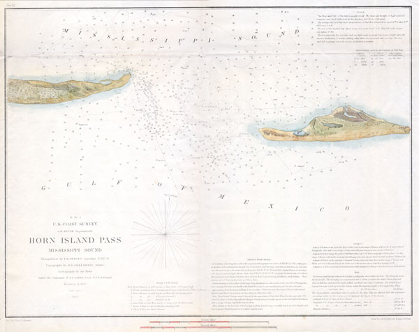
H No. 2 U.S. Coast Survey Horn Island Pass Mississippi Sound.
sold
- Digital Map Information
- Suitable for large format printing
- DPI: 300
- File Size: 2.84 MB
- File Type: ZIP / TIFF
- ICC color profile embedded
- Delivered instantly via download link
A rare hand colored 1853 costal chart of the Horn Island Pass. Horn Island pass is the entrance to the Mississippi Sound and thence the Pascagoula River from the Gulf of ... (more details)

Johnson’s Washington Oregon and Idaho.
sold
- Digital Map Information
- Suitable for large format printing
- File Size: 5.42 MB
- File Type: ZIP / TIFF
- ICC color profile embedded
- Delivered instantly via download link
This is a magnificent 1864 hand colored map depicts Washington state, Oregon and Idaho. This is a rare variant upon the same 1864 Johnson's map issue earlier in 1864, due ... (more details)

New York (Suffolk County) Moriches Quadrangle
sold
- Digital Map Information
- Suitable for large format printing
- File Size: 4.29 MB
- File Type: ZIP / TIFF
- ICC color profile embedded
- Delivered instantly via download link
This beautiful and fascinating topographical chart depicts the Long Island, New York region of Fire Island, Riverhead, and Brookhaven. Shows the beach communities along ... (more details)
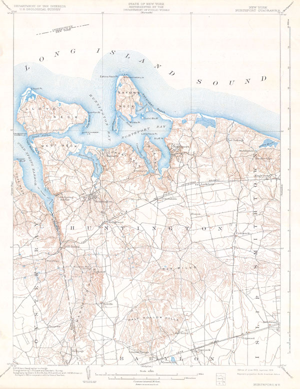
New York Northport Quadrangle
sold
- Digital Map Information
- Suitable for large format printing
- File Size: 3.84 MB
- File Type: ZIP / TIFF
- ICC color profile embedded
- Delivered instantly via download link
This beautiful and fascinating topographical chart depicts Long Island, New York from Oyster Bay through Huntington and Northport to Smithtown, Islip, and Babylon. ... (more details)

(Sketch F No. 2) Preliminary Chart of the Entrance St. John’s River Florida.
sold
- Digital Map Information
- Suitable for large format printing
- DPI: 300
- File Size: 3.71 MB
- File Type: ZIP / TIFF
- ICC color profile embedded
- Delivered instantly via download link
A rare hand colored 1853 costal chart of St. John's River, Florida. Chart offers superb inland detail of Fort George Island, Batton Island, Talbot Island, Long ... (more details)

New York - Connecticut Oyster Bay Quadrangle
sold
- Digital Map Information
- Suitable for large format printing
- File Size: 3.96 MB
- File Type: ZIP / TIFF
- ICC color profile embedded
- Delivered instantly via download link
This beautiful and fascinating topographical chart depicts the Long Island, New York region of Oyster Bay, including North Hempstead, and across the Long Island ... (more details)

New York Hempstead Quadrangle
sold
- Digital Map Information
- Suitable for large format printing
- File Size: 8.76 MB
- File Type: ZIP / TIFF
- ICC color profile embedded
- Delivered instantly via download link
An attractive topographical chart depicting Hempstead, Long Island (New York), including Freeport, Hempstead, and Long Beach. This map includes some submarine ... (more details)
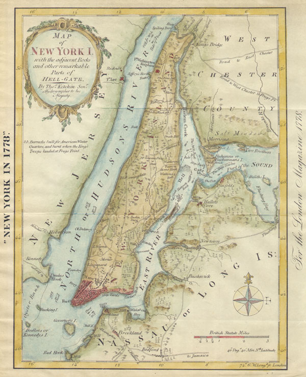
New York in 1778 or Map of New York I.
sold
- Digital Map Information
- Suitable for large format printing
- File Size: 1.38 MB
- File Type: ZIP / TIFF
- ICC color profile embedded
- Delivered instantly via download link
This is an unusual map of New York City in 1778, reduced and reprinted in 1869. The original map was drawn by Thomas Kitchin in his capacity as Hydrographer ... (more details)

Johnson’s Washington, Oregon and Idaho
sold
- Digital Map Information
- Suitable for large format printing
- File Size: 3 MB
- File Type: ZIP / TIFF
- ICC color profile embedded
- Delivered instantly via download link
This magnificent 1864 hand colored map of Washington, Oregon, and Idaho is one of the most important transitional maps of the American Northwest published in ... (more details)

Carte de la Baye de la Table et Rade eu Cap de Bonne Experance.
sold
- Digital Map Information
- Suitable for large format printing
- Full resolution TIFF file
- ICC color profile embedded
- Delivered instantly via download link
This hand colored map is a c. 1764 map of the Cape of Good Hope and Cape Town, South Africa. Attributed to French cartographer Jacques-Nicholas Bellin, this ... (more details)

Carte de la Baye de la Table et Rade eu Cap de Bonne Experance.
sold
- Digital Map Information
- Suitable for large format printing
- Full resolution TIFF file
- ICC color profile embedded
- Delivered instantly via download link
This hand colored map is a c. 1763 map of the Cape of Good Hope and Cape Town, South Africa. Attributed to French cartographer Jacques-Nicholas Bellin, this ... (more details)

New York (Suffolk County) Setauket Quadrangle
sold
- Digital Map Information
- Suitable for large format printing
- File Size: 8.7 MB
- File Type: ZIP / TIFF
- ICC color profile embedded
- Delivered instantly via download link
This beautiful and fascinating topographical chart depicts the Long Island, New York region of Smithtown, Brookhaven and Islip. Shows the beach communities ... (more details)

Preliminary Sketch of Cape Charles and Vicinity.
sold
- Digital Map Information
- Suitable for large format printing
- DPI: 300
- File Size: 1.55 MB
- File Type: ZIP / TIFF
- ICC color profile embedded
- Delivered instantly via download link
A rare hand colored 1853 coastal chart Cape Charles, Virginia. Cape Charles forms the southeastern tip of the peninsula formed by the Chesapeake Bay. At ... (more details)

Sketch Map of Peking drawn for Crows “Handbook for China”.
sold
- Digital Map Information
- Suitable for large format printing
- Full resolution TIFF file
- ICC color profile embedded
- Delivered instantly via download link
This rare map is a plan of Beijing (Peking) China. Published for Carl Crows 'Handbook for China.' Text in ... (more details)

Turkish Dominins in Europe
sold
- Digital Map Information
- Suitable for large format printing
- DPI: 300
- File Size: 5.09 MB
- File Type: ZIP / TIFF
- ICC color profile embedded
- Delivered instantly via download link
This hand colored map is a steel plate engraving, dating to 1814 by the important English mapmaker John ... (more details)
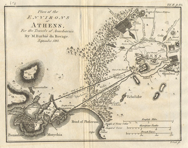
Athens with Piraeus
sold
- Digital Map Information
- Suitable for large format printing
- Full resolution TIFF file
- ICC color profile embedded
- Delivered instantly via download link
This lovely little map or city plan of Athens and Environs in Ancient Greece, was prepared by M. Barbie ... (more details)
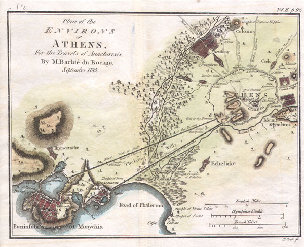
Athens
sold
- Digital Map Information
- Suitable for large format printing
- Full resolution TIFF file
- ICC color profile embedded
- Delivered instantly via download link
This lovely little map or city plan of Athens in Ancient Greece, was prepared by M. Barbie de Bocage in ... (more details)