
Lovely map of Bohemia.
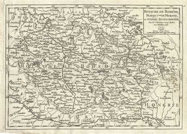
Royaume de Boheme, Marquisat de Moravie, et Silesie Autrichienne.
sold
- Digital Map Information
- Suitable for large format printing
- DPI: 300
- File Size: 2.6 MB
- File Type: ZIP / TIFF
- ICC color profile embedded
- Delivered instantly via download link
This is a fine 1748 map of Bohemia, Moravia and Silesia by Robert de Vaugondy. It covers modern day Czech Republic as well as parts of Germany and Poland and extends from Leipzig, Germany east to Benthen, Poland and south as far as Passau. The entire region is ... (more details)
Includes parts of Slovakia, Serbia and Romania.

Royaume de Hongrie.
sold
- Digital Map Information
- Suitable for large format printing
- DPI: 300
- File Size: 2.27 MB
- File Type: ZIP / TIFF
- ICC color profile embedded
- Delivered instantly via download link
This is a lovely 1749 map of Hungary and Transylvania by Robert de Vaugondy. Covers modern day Hungary, Slovakia and parts of Transylvania (Romania) and Serbia. The entire region is depicted in extraordinary detailed, offering both topographical and ... (more details)
Paris and its suburbs.

Banlieue et Environs de Paris.
sold
- Digital Map Information
- Suitable for large format printing
- DPI: 300
- File Size: 2.27 MB
- File Type: ZIP / TIFF
- ICC color profile embedded
- Delivered instantly via download link
This is a beautiful 1748 map of Paris and its surroundings in France by the French cartographer Robert de Vaugondy. Centered in Paris, the map extends from Forest de St. Germain to Bois de Bondy. Incredibly detailed, notes rivers, towns, suburbs, ... (more details)
Detailed map of the Emerald Isle.

Isle et Royaume D'Irlande.
sold
- Digital Map Information
- Suitable for large format printing
- DPI: 300
- File Size: 1.8 MB
- File Type: ZIP / TIFF
- ICC color profile embedded
- Delivered instantly via download link
This is a nice 1748 map of Ireland by the French cartographer Robert de Vaugondy. It depicts the Emerald Isle and identifies its four provinces of Ulster, Connacht, Leinster and Munster. Incredibly detailed, the map notes provinces, cities, ... (more details)
Scotland with its provinces.

Royaume D'Ecosse divise en Provinces.
sold
- Digital Map Information
- Suitable for large format printing
- DPI: 300
- File Size: 1.95 MB
- File Type: ZIP / TIFF
- ICC color profile embedded
- Delivered instantly via download link
This is a nice 1748 map of Scotland by the French cartographer Robert de Vaugondy. It depicts Scotland including the Western Islands or the Outer Hebrides. Incredibly detailed, the map notes provinces, cities, towns, rivers, mountains and a ... (more details)
Notes Doggers Bank, part of Doggerland.
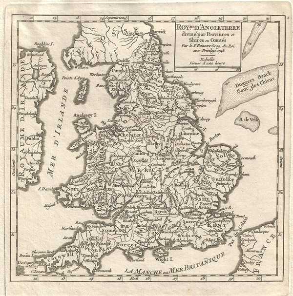
Royme. D'Angleterre divise par Provinces et Shires ou Comtes.
sold
- Digital Map Information
- Suitable for large format printing
- DPI: 300
- File Size: 1.72 MB
- File Type: ZIP / TIFF
- ICC color profile embedded
- Delivered instantly via download link
This is a lovely 1748 map of England and Wales by the French cartographer Robert de Vaugondy. It depicts the entirety of England and Wales including the Isle of Man. Incredibly detailed, the map notes provinces, shires, cities, towns, ... (more details)
Important Japanese Map of Singaore from the pre-War Period.

新嘉坡市街地圖 / Map of Singapore City. / Shingapōru shigai chizu. / 馬來半島旅行案内地圖 / Malay Peninsula Travel Map. / Marē Hontō ryokō annai chizu.
sold
- Digital Map Information
- Suitable for large format printing
- File Size: 32.3 MB
- File Type: ZIP / TIFF
- ICC color profile embedded
- Delivered instantly via download link
A very rare 1938 map of Singapore City and the Malay Peninsula (Malaysia) issued by the Singapore Japanese Club. This curious map is printed on both sides. The recto features a map of Singapore City, what is today generally referred ... (more details)
Classic map of Georgia and Alabama.
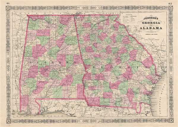
Johnson's Georgia And Alabama.
sold
- Digital Map Information
- Suitable for large format printing
- File Size: 16.33 MB
- File Type: ZIP / TIFF
- ICC color profile embedded
- Delivered instantly via download link
This is A. J. Johnson's beautifully hand colored 1865 map of Georgia and Alabama. This map shows cities, topographical features, railways, ferries and roads with color coding at the county level. Published by A. J. Johnson and Ward ... (more details)
Johnson's map of the animals and industries of the world.
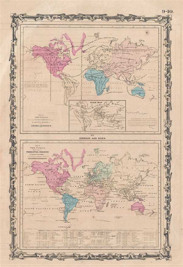
Map of The World showing the Geographical Distribution & Range of The Principal Members of The Animal Kingdom. Map of The World illustrating the Productive Industry Of Various Countries, & exhibiting the principal features of Commerce And Navigation.
sold
- Digital Map Information
- Suitable for large format printing
- File Size: 5.58 MB
- File Type: ZIP / TIFF
- ICC color profile embedded
- Delivered instantly via download link
This is a beautiful example of A. J. Johnson and R. Browning's 1861 map of the World's animal kingdom and the productive industries of various countries. The map is divided into two parts. The upper map shows the geographical ... (more details)
Johnson's map of the ocean currents and tides.

Map of The World Illustrating the principal features of the Land and the Co-Tidal Lines. / Map of the World Showing the principal Ocean Currents and Boundaries of River Systems.
sold
- Digital Map Information
- Suitable for large format printing
- File Size: 5.27 MB
- File Type: ZIP / TIFF
- ICC color profile embedded
- Delivered instantly via download link
This is one of the thematic world map sets from the rare 1861 edition of Johnson and Browning's Illustrated Atlas of the World . Features two maps drawn within a single border. The upper map depicts the world's co-tidal lines ... (more details)
Beautiful map of Egypt.

Egypt etc.
sold
- Digital Map Information
- Suitable for large format printing
- DPI: 300
- File Size: 7.07 MB
- File Type: ZIP / TIFF
- ICC color profile embedded
- Delivered instantly via download link
A fine example of Thomas Cowperthwait and S. A. Mitchell's 1854 map of Egypt. Centered on the Nile Valley, Mitchell's map covers all of Egypt from the Mediterranean to Nubia, as well as the adjacent Sinai, and parts of the Red ... (more details)
Notes the Tribes of Israel.

Palestine and Adjacent Countries.
sold
- Digital Map Information
- Suitable for large format printing
- DPI: 300
- File Size: 7.62 MB
- File Type: ZIP / TIFF
- ICC color profile embedded
- Delivered instantly via download link
This is a fine example of Thomas Cowperthwait and S. A. Mitchell's 1854 map of Palestine, Israel, or the Holy Land. This map is a curious combination of a contemporary and a historic map. The color coding details the region ... (more details)
Mitchell's representation of Mexico in the mid 19th century.

Mexico and Guatemala.
sold
- Digital Map Information
- Suitable for large format printing
- DPI: 300
- File Size: 7 MB
- File Type: ZIP / TIFF
- ICC color profile embedded
- Delivered instantly via download link
This is a fine example of Thomas Cowperthwait and S. A. Mitchell's 1854 map of Mexico and Guatemala. The whole is engraved and colored in Mitchell's distinctive style with green border work and vivid pastels. Political and ... (more details)
Important Japanese Map of Singaore from the pre-War Period.

新嘉坡市街地圖 / Map of Singapore City. / Shingapōru shigai chizu. / 馬來半島旅行案内地圖 / Malay Peninsula Travel Map. / Marē Hontō ryokō annai chizu.
sold
- Digital Map Information
- Suitable for large format printing
- File Size: 25.83 MB
- File Type: ZIP / TIFF
- ICC color profile embedded
- Delivered instantly via download link
A very rare 1938 map of Singapore City and the Malay Peninsula (Malaysia) issued by the Singapore Japanese Club. This curious map is printed on both sides. The recto features a map of Singapore City, what is today ... (more details)
Rare Japanese woodblock map of Beijing.
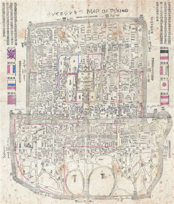
Map of Peking.
sold
- Digital Map Information
- Suitable for large format printing
- Full resolution TIFF file
- ICC color profile embedded
- Delivered instantly via download link
This is an important and rare 1900 Japanese woodblock map of Beijing or Peking. Centered on the Forbidden City, the map depicts the city following the multinational suppression of the Boxer Rebellion (Yihetuan ... (more details)
Scarce map of Charleston Harbor by French Ministry of Public Works.

Charleston.
sold
- Digital Map Information
- Suitable for large format printing
- File Size: 6.88 MB
- File Type: ZIP / TIFF
- ICC color profile embedded
- Delivered instantly via download link
An uncommon 1884 map of Charleston, S.C. and its harbor, prepared by the Ministere des Travaux Publics Atlas des Ports Étrangers . The map covers from the Rebellion Road channel between Sullivan and Morris ... (more details)
Dramatic pictorial ribbon map of the Nile Valley.

The Nile From Alexandria to Aswan Illustrated Guide-Map.
sold
- Digital Map Information
- Suitable for large format printing
- File Size: 23.71 MB
- File Type: ZIP / TIFF
- ICC color profile embedded
- Delivered instantly via download link
A beautiful c. 1935 ribbon map of the Nile Valley by Lehnert and Lanrock. The map folds into its original binder and covers the Nile Valley from Alexandria and the Delta to the site of Aswan Damn and the ... (more details)
Issued shortly after the Black Hawk War which opened southern Minnesota to settlement.

Map of Minnesota Territory.
sold
- Digital Map Information
- Suitable for large format printing
- DPI: 300
- File Size: 6.77 MB
- File Type: ZIP / TIFF
- ICC color profile embedded
- Delivered instantly via download link
This is a fine example of S. A. Mitchell and J. H. Young's important 1854 map of Minnesota Territory. Mitchell's map covers the Minnesota Territory as it existed in 1854, extending from the Missouri River ... (more details)
Early uncommon mapping on Wisconsin by Mitchell.

A New Map of the State of Wisconsin.
sold
- Digital Map Information
- Suitable for large format printing
- DPI: 300
- File Size: 9.26 MB
- File Type: ZIP / TIFF
- ICC color profile embedded
- Delivered instantly via download link
This is a fine example of Thomas Cowperthwait and S. A. Mitchell's 1854 map of Wisconsin. The whole is engraved and colored in Mitchell's distinctive style with green border work and vivid pastels. ... (more details)
Features Lake Michigan.

A New Map of Michigan with its Canals, Roads and Distances.
sold
- Digital Map Information
- Suitable for large format printing
- DPI: 300
- File Size: 7.5 MB
- File Type: ZIP / TIFF
- ICC color profile embedded
- Delivered instantly via download link
This is a fine example of Thomas Cowperthwait and S. A. Mitchell's 1854 map of Michigan. The whole is engraved and colored in Mitchell's distinctive style with green border work and vivid pastels. ... (more details)