
The Ptolemaic World.
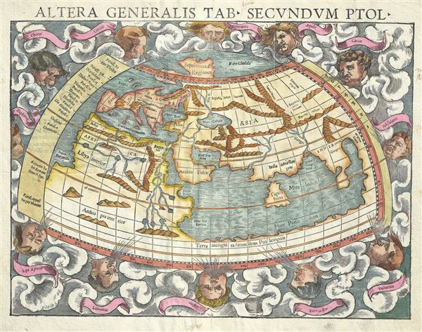
Altera generalis tab. Secundum Ptol.
sold
- Digital Map Information
- Suitable for large format printing
- DPI: 300
- File Size: 6.61 MB
- File Type: ZIP / TIFF
- ICC color profile embedded
- Delivered instantly via download link
An attractive c. 1550 example of Sebastian Munster's map of the world according to Claudius Ptolemy. The map details the world prior to the great age of discovery. As such, it covers only the 'Old World' from the Atlantic (Pillars of Hercules) to Indochina and ... (more details)
An impressive early map of the world.
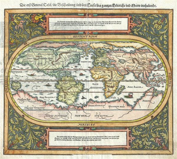
Die erst General Tafel / Die Beschreibung und den Circkel des gantzen Erdtrichs und Deeres innhaltend.
sold
- Digital Map Information
- Suitable for large format printing
- DPI: 300
- File Size: 7.6 MB
- File Type: ZIP / TIFF
- ICC color profile embedded
- Delivered instantly via download link
An attractive example of Sebastian Munster's 1588 map of the world. Munster presents us with an expansive view the world with a number of interested cartographic features. Along the bottom of the map the dramatic unknown southern continent (Terra Australis ... (more details)

China Regio Asie.
sold
- Digital Map Information
- Suitable for large format printing
- DPI: 300
- File Size: 0.71 MB
- File Type: ZIP / TIFF
- ICC color profile embedded
- Delivered instantly via download link
An attractive old color miniature map of Asia from the c. 1598 pocket edition of Ortelius' Theatrum Orbis Terrarum . Oriented to the west and centered on China, this map covers from Malaya and Borneo to the Great Wall, and from the Bay of Bengal to Japan. ... (more details)

New England and New York.
sold
- Digital Map Information
- Suitable for large format printing
- DPI: 300
- File Size: 0.76 MB
- File Type: ZIP / TIFF
- ICC color profile embedded
- Delivered instantly via download link
An attractive 1675 miniature variant on John Speeds rare miniature map of New England and New York issued by Thomas Bassett and Richard Chiswell. This map was included with the popularly termed 'miniature Speed,' an octavo version of Speeds great folio ... (more details)
One of two earliest known maps engraved by Homann - long before he opened his own firm.
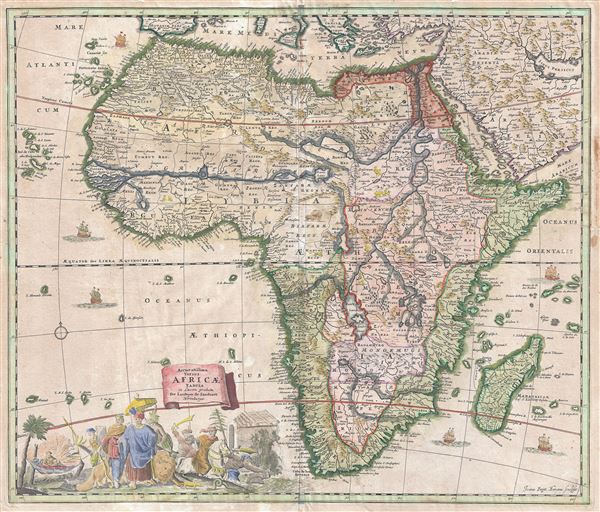
Accuratissima Totius Africae Tabula in Lucem producta per Iacobum de Sandrart Norimbergae.
sold
- Digital Map Information
- Suitable for large format printing
- DPI: 300
- File Size: 17.14 MB
- File Type: ZIP / TIFF
- ICC color profile embedded
- Delivered instantly via download link
An uncommon map, this is Jacob Sandrart's 1697 map of Africa. The map covers the continent in full as well as the adjacent parts of Araba, Europe, and the Cape Verde and Canary Islands. The Prime Meridian runs through Ferro Island. Cartographically ... (more details)

Johnson's World on Mercators Projection.
sold
- Digital Map Information
- Suitable for large format printing
- Full resolution TIFF file
- ICC color profile embedded
- Delivered instantly via download link
This is A. J. Johnson's 1866 map of the world on Mercator's Projection. It depicts the entire world centered on North and South America and offers a fascinating snapshot of the world during a period of rapid globalization and discovery. Updated from ... (more details)

Johnson's North America.
sold
- Digital Map Information
- Suitable for large format printing
- Full resolution TIFF file
- ICC color profile embedded
- Delivered instantly via download link
This is Johnson's 1866 map of the North America. It extends from the Arctic Circle, including Alaska and Greenland south to Panama. Shows, the United State, Canada and Mexico divided into states and provinces. Most of the United States are depicted ... (more details)

Johnson's New York.
sold
- Digital Map Information
- Suitable for large format printing
- Full resolution TIFF file
- ICC color profile embedded
- Delivered instantly via download link
This is A. J. Johnson's beautifully hand colored 1866 map of New York State. This rare map offers a fascinating snapshot of New York following the American Civil War. It covers New York in full with bold and dramatic color coding according to ... (more details)
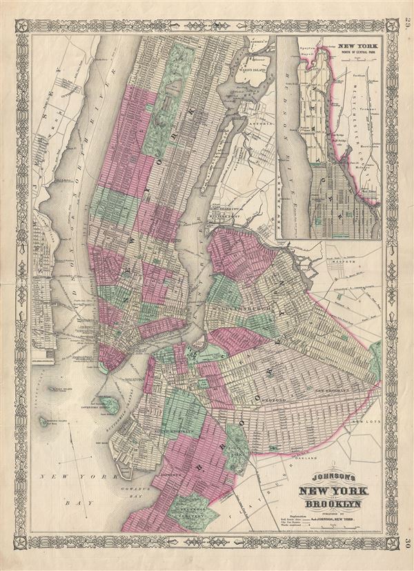
Johnson's New York and Brooklyn.
sold
- Digital Map Information
- Suitable for large format printing
- Full resolution TIFF file
- ICC color profile embedded
- Delivered instantly via download link
This is A. J. Johnson's attractive vertical plan of New York City. It depicts all of Manhattan, Brooklyn as it was at the time and parts of Queens, Long Island City, Astoria, Jersey City and Hoboken. It covers Brooklyn from Greenwood Cemetery ... (more details)

Johnson's Virginia, Delaware, Maryland and West Virginia.
sold
- Digital Map Information
- Suitable for large format printing
- Full resolution TIFF file
- ICC color profile embedded
- Delivered instantly via download link
This is a beautiful example of A. J. Johnson's 1866 map of Virginia, West Virginia, Maryland and Delaware. This map offers a fascinating snapshot of these secessionist states shortly following the close of the American Civil War. The map ... (more details)

Johnson's North Carolina and South Carolina.
sold
- Digital Map Information
- Suitable for large format printing
- Full resolution TIFF file
- ICC color profile embedded
- Delivered instantly via download link
This is a beautiful example of A. J. Johnson's 1866 map of North Carolina and South Carolina. The map offers a fascinating snapshot of these states shortly following the close of the American Civil War. Map shows both states in full with ... (more details)

Johnson's Ohio.
sold
- Digital Map Information
- Suitable for large format printing
- Full resolution TIFF file
- ICC color profile embedded
- Delivered instantly via download link
This is A. J. Johnson's beautifully hand colored first edition 1866 map of Ohio. This map shows cities, topographical features, railways, ferries and roads with color coding at the county level. Johnson introduced this large folio map in ... (more details)

Johnson's Illinois.
sold
- Digital Map Information
- Suitable for large format printing
- Full resolution TIFF file
- ICC color profile embedded
- Delivered instantly via download link
This is a beautiful example of Johnson's 1866 map of Illinois. It covers the entire state along with portions of the adjacent states. Johnson introduced this large folio map in the 1864 edition of his atlas, replacing the single page ... (more details)

Johnson's Wisconsin and Michigan.
sold
- Digital Map Information
- Suitable for large format printing
- Full resolution TIFF file
- ICC color profile embedded
- Delivered instantly via download link
This rare 1866 map by A. J. Johnson offers a fascinating snapshot of Michigan and Wisconsin at the height of the American Civil War. The map depicts both states in full with color coding according to county. Showa excellent Great ... (more details)
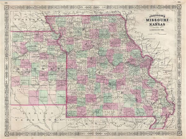
Johnson's Missouri and Kansas.
sold
- Digital Map Information
- Suitable for large format printing
- Full resolution TIFF file
- ICC color profile embedded
- Delivered instantly via download link
This is a beautiful example of A. J. Johnson's 1866 map of Missouri and Kansas. The map offers a fascinating snapshot of these hotly contested states shortly following the outbreak of the American Civil War. Covers Missouri and ... (more details)

Johnson's Oregon and Washington. Johnson's Minnesota.
sold
- Digital Map Information
- Suitable for large format printing
- Full resolution TIFF file
- ICC color profile embedded
- Delivered instantly via download link
This is a beautiful 1866 hand colored map of Washington, Oregon and Minnesota by A. J. Johnson. One of the more interesting Johnson maps, this edition beautifully depicts railroads, wagon toads, Indian tribes, springs and fords, ... (more details)
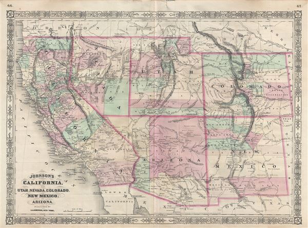
Johnson's California, also Utah, Nevada, Colorado, New Mexico and Arizona.
sold
- Digital Map Information
- Suitable for large format printing
- Full resolution TIFF file
- ICC color profile embedded
- Delivered instantly via download link
This is Johnson's desirable 1866 map of the American south-west. It depicts the state of California and the territories of Nevada, Utah, Colorado, Arizona and New Mexico. Offers superb detail throughout noting mining districts, ... (more details)

Johnson's Italy.
sold
- Digital Map Information
- Suitable for large format printing
- File Size: 18.78 MB
- File Type: ZIP / TIFF
- ICC color profile embedded
- Delivered instantly via download link
A beautiful example of A. J. Johnson's 1866 map of Italy. Johnson first introduced this map in his 1863 atlas and it represents a substantial re-engraving of his original two part plate. Throughout, Johnson identifies various ... (more details)

Johnson's Austria Turkey in Europe and Greece.
sold
- Digital Map Information
- Suitable for large format printing
- Full resolution TIFF file
- ICC color profile embedded
- Delivered instantly via download link
This is a beautiful example of Johnson's 1866 map of Austria, Turkey in Europe and Greece. It covers from Italy eastward to include all of Austria, Hungary, the Balkans (Bosnia, Serbia, Albania, Croatia, Macedonia, Bulgaria, ... (more details)
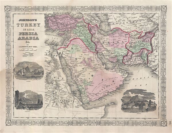
Johnson's Turkey in Asia Persia Arabia etc.
sold
- Digital Map Information
- Suitable for large format printing
- Full resolution TIFF file
- ICC color profile embedded
- Delivered instantly via download link
This is a very nice example of Johnson's 1866 map of Arabia, Persia and Turkey in Asia. It covers from the Mediterranean and Egypt eastwards as far as the Mouths of the Indus River, as well as southward as far as the Horn of ... (more details)