
Homann, Johann Baptist
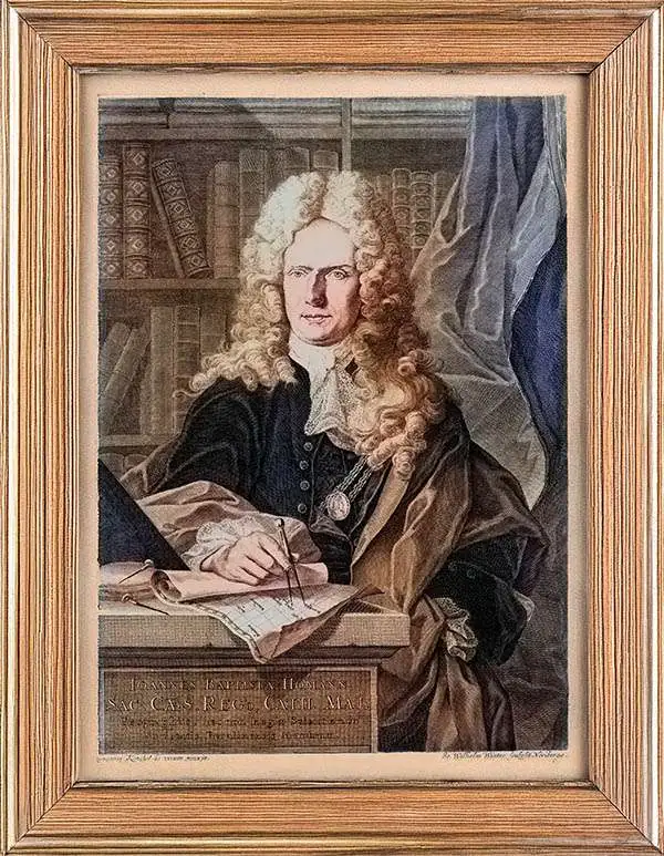
Johann Baptist Homann (March 20, 1664 - July 1, 1724) was the most prominent and prolific map publisher of the 18th century. Homann was born in Oberkammlach, a small town near Kammlach, Bavaria, Germany. As a young man, Homann studied in a Jesuit school and nursed ambitions of becoming a Dominican priest. Nonetheless, he converted to Protestantism in 1687, when he was 23. It is not clear where he mastered engraving, but we believe it may have been in Amsterdam. Homann's earliest work we have identified is about 1689, and already exhibits a high degree of mastery. Around 1691, Homann moved to Nuremberg and registered as a notary. By this time, he was already making maps, and very good ones at that. He produced a map of the environs of Nürnberg in 1691/92, which suggests he was already a master engraver. Around 1693, Homann briefly relocated to Vienna, where he lived and studied printing and copper plate engraving until 1695. Until 1702, he worked in Nuremberg in the map trade under Jacob von Sandrart (1630 - 1708) and then David Funck (1642 - 1709). Afterward, he returned to Nuremberg, where, in 1702, he founded the commercial publishing firm that would bear his name. In the next five years, Homann produced hundreds of maps and developed a distinctive style characterized by heavy, detailed engraving, elaborate allegorical cartouche work, and vivid hand color. Due to the lower cost of printing in Germany, the Homann firm could undercut the dominant French and Dutch publishing houses while matching their diversity and quality. Despite copious output, Homann did not release his first major atlas until the 33-map Neuer Atlas of 1707, followed by a 60-map edition of 1710. By 1715, Homann's rising star caught the attention of the Holy Roman Emperor Charles VI, who appointed him Imperial Cartographer. In the same year, he was also appointed a member of the Royal Academy of Sciences in Berlin. Homann's prestigious title came with several significant advantages, including access to the most up-to-date cartographic information as well as the 'Privilege'. The Privilege was a type of early copyright offered to very few by the Holy Roman Emperor. Though less sophisticated than modern copyright legislation, the Privilege offered limited protection for several years. Most all J. B. Homann maps printed between 1715 and 1730 bear the inscription 'Cum Priviligio' or some variation. Homann was also skilled at cultivated learned relationships throughout Europe, for example, in 1723, documents from the St. Petersburg Academy of Sciences identify him as an 'Agent of Muscovy', indicating an official connection to the cartographic circles in Russia. Following Homann's death in 1724, the firm's map plates and management passed to his son, Johann Christoph Homann (1703 - 1730). J. C. Homann, perhaps realizing that he would not long survive his father, stipulated in his will that the company would be inherited by his two head managers, Johann Georg Ebersberger (1695 - 1760) and Johann Michael Franz (1700 - 1761), and that it would publish only under the name 'Homann Heirs'. This designation, in various forms (Homannsche Heirs, Heritiers de Homann, Lat Homannianos Herod, Homannschen Erben, etc.) appears on maps from about 1731 onwards. The firm continued to publish maps in ever-diminishing quantities until the death of its last owner, Christoph Franz Fembo (1781 - 1848).
Only Homann Map to name New York City.
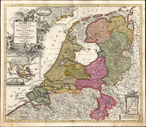
Belgii Pars Septentrionalis communi nomine Vulgo Hollandia nuncupata Continens Statum Potentissime Batavorum Reipublicae seu Provincias VII Foederatas.
$850.00
Acquire
- Digital Map Information
- Suitable for large format printing
- File Size: 25.71 MB
- File Type: ZIP / TIFF
- ICC color profile embedded
- Delivered instantly via download link
A beautiful, original color example of Johann Baptist Homann's 1702 map of the Netherlands, featuring inset maps and city views celebrating the 17th-century global empire of the Dutch. It is the only Homann map to name New York City. (more details)
Ides, not Izmailov.
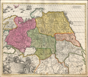
Generalis totius imperii Moscovitici...
$750.00
Acquire
- Digital Map Information
- Suitable for large format printing
- File Size: 23.27 MB
- File Type: ZIP / TIFF
- ICC color profile embedded
- Delivered instantly via download link
This is Eberhard Isbrand Ides' map of the Russian Empire in Asia, revised and engraved in 1707 by Johann Baptist Homann. Ides produced the map in 1704 to accompany the travelogue of his experiences in 1692 as an envoy sent by Peter the Great to Kangxi China in the wake of the 1689 Treaty of Nerchinsk. Although Ides credited his map to Nicolaes Witsen, the present work is more reflective of Russian cartography at the end of the 17th century than Witsen's cartography. Homann's revision of the map - placing it on a conic projection, a sophistication lacking in the Ides - sets this map apart both from its source and from other contemporaneous maps of the region. (more details)
Dark Days for Catalonia.
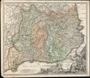
Principatus Cataloniae nec non Comitatuum Ruscinonensisz Et Cerretaniae Nova Tabula.Principatus Cataloniae nec non Comitatuum Ruscinonensis Et Cerretaniae Nova Tabula.
$750.00
Acquire
- Digital Map Information
- Suitable for large format printing
- DPI: 300
- File Size: 154.97 MB
- File Type: ZIP / TIFF
- ICC color profile embedded
- Delivered instantly via download link
A c. 1707 map of Catalonia, Spain, by Johann Baptist Homann. It depicts the region during the War of Spanish Succession (1701 - 1714), a catastrophic event in local history which caused Catalonia to (temporarily) lose its historic autonomy. (more details)
War for Northern Italy.
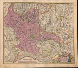
Belli Typus in Italia victricis Aquilae progressus in statu Mediolanensi et Ducatu Mantuae demonstrans.
$350.00
Acquire
- Digital Map Information
- Suitable for large format printing
- File Size: 23.03 MB
- File Type: ZIP / TIFF
- ICC color profile embedded
- Delivered instantly via download link
This is a rare first-state example of Johann Baptist Homann's c. 1707 map of northern Italy, documenting the seesawing battle for the region during the War of the Spanish Succession (1701 - 1714). As with several other Homann maps prepared during the war, it proudly champions the Habsburg cause against their French-Bourbon enemies. (more details)
Shifting fortunes of empires in Eastern Europe.
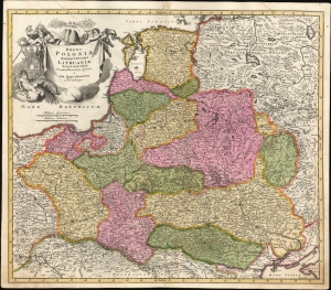
Regni Poloniae Magnique Ducatus Lithuaniae...
$750.00
Acquire
- Digital Map Information
- Suitable for large format printing
- File Size: 25.56 MB
- File Type: ZIP / TIFF
- ICC color profile embedded
- Delivered instantly via download link
A beautiful example of Johann Baptist Homann's 1707 map of the Polish-Lithuanian Commonwealth, covering most of Eastern Europe. One of the works that Homann engraved himself, this map was produced during a transition in the relative balance of power in the region, with Poland-Lithuania, Sweden, and the Ottoman Empire waning, and Russia, Prussia, and Austria on the rise. (more details)
Opening moves in the War or the Spanish Succession.
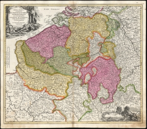
Arena Martis in Belgio Qua Provinciae X Catholicae Inferioris Germaniae cum vicinis Episcopatibus, Coloniensi et Leodiensi.
$750.00
Acquire
- Digital Map Information
- Suitable for large format printing
- File Size: 28.88 MB
- File Type: ZIP / TIFF
- ICC color profile embedded
- Delivered instantly via download link
This is a scarce, early plate of Johann Baptist Homann's 1702 map of Belgium and Luxembourg, then the ten Catholic provinces of the Low Countries, as well as the Bishoprics of Cologne and Liège. As the title states, this is the theater for the opening stages of the War of Spanish Succession (1701 - 1714). (more details)
Savoy Switches from Bourbon to Habsburg.
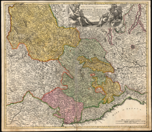
Regiæ celsitudinis Sabaudicæ status in quo ducatus Sabaudiæ principatus Pedemontium et ducatus Montisferrati...
$550.00
Acquire
- Digital Map Information
- Suitable for large format printing
- File Size: 29.93 MB
- File Type: ZIP / TIFF
- ICC color profile embedded
- Delivered instantly via download link
This is an early state of Johann Baptist Homann's 1707 map of the Duchies of Savoy and Montferrat and the Principality of Piedmont. The map illustrates the region during the War of the Spanish Succession (1701 - 1714). Coverage extends from Lake Geneva and Switzerland in the north to Nice and the Mediterranean Sea in the south, including parts of Dauphine and Provence and part of the Duchy of Milan to the east. (more details)
Theatre of War in the French Alps.
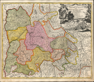
Tabula Delphinatus Vulgo Le Gouvernement General Du Dauphiné: In Suos Ballifiatus et Regiones divisus.
$550.00
Acquire
- Digital Map Information
- Suitable for large format printing
- File Size: 25.56 MB
- File Type: ZIP / TIFF
- ICC color profile embedded
- Delivered instantly via download link
This is an early state of Johann Baptist Homann's 1707 map of the Dauphiné, France, during the War of the Spanish Succession (1701 - 1714). This was an active theater of the war: following Savoy's change of allegiance from Bourbon to Habsburg, Savoy invaded the Dauphiné. (more details)
Reconciling new discovery and Ptolemaic Geography.
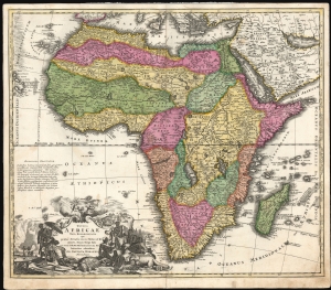
Totius Africae Nova Repraesentatio.
$850.00
Acquire
- Digital Map Information
- Suitable for large format printing
- File Size: 26.08 MB
- File Type: ZIP / TIFF
- ICC color profile embedded
- Delivered instantly via download link
This is the scarce first plate of Johann Baptist Homann's 1707 map of Africa in a beautiful early strike, with rich, original color. Here, Homann attempts to reconcile the discovery of Lake Tana in Abysinna (source of the Blue Nile) with established Ptolemaic geography - and, in doing so, commits a grave error! (more details)
France at the Opening of the War of the Spanish Succession.
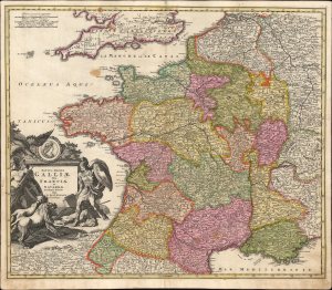
Totius Regni Galliae Sive Francia et Navarrae novissima Tabula edita a Io. Bapt. Homann. Norimbergae.
$550.00
Acquire
- Digital Map Information
- Suitable for large format printing
- File Size: 27.9 MB
- File Type: ZIP / TIFF
- ICC color profile embedded
- Delivered instantly via download link
This is a 1702/1710 Johann Baptist Homann map of France, produced at the opening of the War of the Spanish Succession (1701 - 1714). Its detail and its allegorical cartouche emphasize the might of France during the last years of the reign of Louis XIV (1638 - 1715), which coincided with the war. (more details)
Distances between cities.
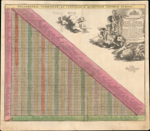
Poliometria Germaniae ac Finitmorum Quorundam Locorum Europae. Curioser Stätt-Zeiger der vornemsten ort in Teutschland, auch einige der berühmtisten Stätt in Europa, wie weit solche von-einander entlegen...
$350.00
Acquire
- Digital Map Information
- Suitable for large format printing
- File Size: 21.7 MB
- File Type: ZIP / TIFF
- ICC color profile embedded
- Delivered instantly via download link
This is a c. 1710 Johann Baptist Homann table of distances, prepared for his Neuer Atlas. As the title and text in the cartouche indicate, the table provides distances between many German cities and major cities outside the German-speaking lands. (more details)
Apparent Retrograde Motion Explained.
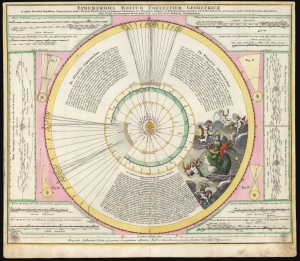
Ephemerides Motuum Coelestium Geometricae.
$750.00
Acquire
- Digital Map Information
- Suitable for large format printing
- DPI: 600
- File Size: 54.09 MB
- File Type: ZIP / TIFF
- ICC color profile embedded
- Delivered instantly via download link
This fascinating 1710 celestial chart is a collaboration between mathematician and astronomer Johan Gabriel Doppelmayr and Johann Baptist Homann. It was produced to explain Copernicus' theories of planetary motion and apparent retrograde motion using data from observations in 1708 and 1709. (more details)
Political and Environmental Shifts in Italy.
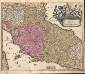
Status Ecclesiastici Magnique Ducatus Florentini Nova Exhibitio.
$600.00
Acquire
- Digital Map Information
- Suitable for large format printing
- File Size: 25.85 MB
- File Type: ZIP / TIFF
- ICC color profile embedded
- Delivered instantly via download link
A striking first edition example of Johann Baptist Homann's c. 1710 map of the Papal States of central Italy, including Rome, Florence, and the other grand cities of Tuscany and nearby regions. It was produced during the War of the Spanish Succession (1701 - 1714), which reshaped the political landscape of much of Italy. (more details)
First Edition Homann Map of Bohemia and Bohemian Lands.
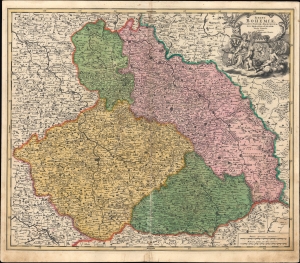
Regni Bohemiae, Ducatus Silesiae, Marchionatus Moraviae et Lusatiae Tabula Generalis.
$450.00
Acquire
- Digital Map Information
- Suitable for large format printing
- File Size: 25.57 MB
- File Type: ZIP / TIFF
- ICC color profile embedded
- Delivered instantly via download link
A fine example of Johann Baptist Homann's c. 1710 map of Bohemia, the Lands of the Bohemian Crown (Silesia, Moravia, Lusatia), and nearby areas. (more details)
Dark Days for Catalonia.
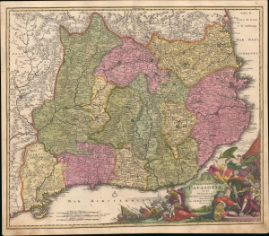
Principatus Cataloniae nec non Comitatuum Ruscinonensisz Et Cerretaniae Nova Tabula.Principatus Cataloniae nec non Comitatuum Ruscinonensis Et Cerretaniae Nova Tabula.
$900.00
Acquire
- Digital Map Information
- Suitable for large format printing
- File Size: 24.92 MB
- File Type: ZIP / TIFF
- ICC color profile embedded
- Delivered instantly via download link
A lovely example of Johann Baptist Homann's c. 1710 map of Catalonia. It depicts the region during the War of Spanish Succession (1701 - 1714), a catastrophic event in local history which caused Catalonia to (temporarily) lose its historic autonomy. (more details)
Early State of Homann's Greece and Balkans map.
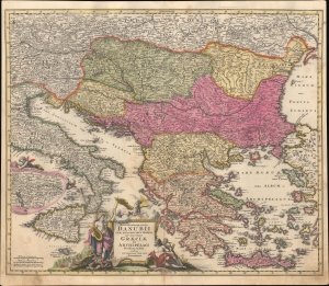
Fluviorum in Europa principis Danubii cum Adiacentibus Regnis nec non totius Graeciae et Archipelagi Novissima Tabula.
$450.00
Acquire
- Digital Map Information
- Suitable for large format printing
- File Size: 24.63 MB
- File Type: ZIP / TIFF
- ICC color profile embedded
- Delivered instantly via download link
An example of Johann Baptist Homann's c. 1710 map of southeastern Europe, with a special focus on the Danube River. (more details)
Staking a Claim to Spain.
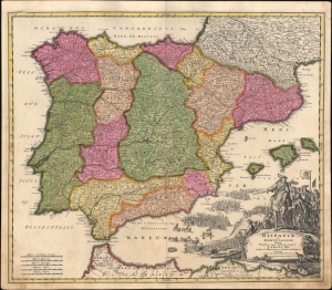
Hispaniae et Portugalliae regna...
$550.00
Acquire
- Digital Map Information
- Suitable for large format printing
- File Size: 23.15 MB
- File Type: ZIP / TIFF
- ICC color profile embedded
- Delivered instantly via download link
An example of Johann Baptist Homann's c. 1710 map of Spain and Portugal, which appeared in his Neuer Atlas. The map, and particularly the powerful illustrations at the bottom-right, refer to the ongoing War of the Spanish Succession (1701 - 1714), a major crisis dividing Europe at the time. (more details)
Portugal's in the War of the Spanish Succession.
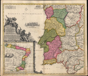
Portugalliæ et Algarbiæ cum finitumus Hispaniæ regnis: Castillæ legionis Andalusiæ, Extrematuræ, Galliciæ [et] Granatæ novissima tabula : qua simul littora Brasiliæ meridional Americæ, Portugallicæ majestatis dominio subjecta nova methodo exhibentur.
$550.00
Acquire
- Digital Map Information
- Suitable for large format printing
- File Size: 22.11 MB
- File Type: ZIP / TIFF
- ICC color profile embedded
- Delivered instantly via download link
An example of Johann Baptist Homann's c. 1710 map of Portugal and Portuguese Brazil, produced for his Neuer Atlas. It reflects the Portuguese presence in South America and the kingdom's delicate position during the War of the Spanish Succession (1701 - 1714). (more details)
Scarce Wartime Edition of Homann's Map of Southern Central Europe.
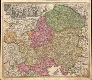
Leopoldi Magni Filio Iosepho I. Augusto Romanorum et Hung: Regi Ad capeßendum Rhenanae Militiae Imperium in Castra proficiscenti Hanc Germaniae Austriacae Generalem Tabulam...
$450.00
Acquire
- Digital Map Information
- Suitable for large format printing
- File Size: 542.52 MB
- File Type: ZIP / TIFF
- ICC color profile embedded
- Delivered instantly via download link
This is a c. 1710 Johann Baptist Homann map of southern Germany, Austria, and environs, produced for his Neuer Atlas. It is essentially wartime propaganda, celebrating the victories of the Habsburgs and their allies in the War of the Spanish Succession and supporting the Holy Roman Emperor Joseph I (r. 1705 - 1711). (more details)
Celebrating the New Emperor.
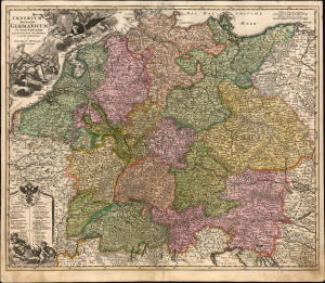
Imperium Romano-Germanicum in suos Circulos Electoratus et Status accurate distinctum a Ioh. Bapt. Homanno Norimbergae.
$750.00
Acquire
- Digital Map Information
- Suitable for large format printing
- File Size: 31.41 MB
- File Type: ZIP / TIFF
- ICC color profile embedded
- Delivered instantly via download link
This is the scarce 1707/10 first plate of Johann Baptist Homann's map of the Holy Roman Empire, produced shortly after the 1705 elevation of Joseph I as Emperor. (more details)
Hungary and the Habsburgs.
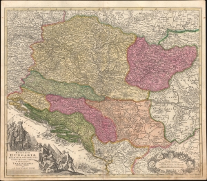
Regnorum Hungariae, Dalmatiae, Croatiae, Sclavoniae, Bosniae, Serviae et Principatus Transylvaniae novissima exhibitio.
$500.00
Acquire
- Digital Map Information
- Suitable for large format printing
- File Size: 26.6 MB
- File Type: ZIP / TIFF
- ICC color profile embedded
- Delivered instantly via download link
A striking example of Johann Baptist Homann's c. 1710 map of the Kingdom of Hungary and environs, produced for his Neuer Atlas. It reflects the most up-to-date information available at a time when this region was bitterly contested and underwent frequent territorial shifts. (more details)
Establishing the Kingdom of Prussia. First Edition!
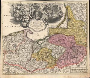
Regnum Borussiae: Gloriosis auspicÿs Serenissimi et Potentissimi Prin Friderici III. Primi Borussiae Regis, March. et Elect. Bran. inauguratum die 18. Ian. A. 1701. Geographice cum vicinis Regionibus adumbratum a Ioh. Baptista Homanno Norimbergae.
$600.00
Acquire
- Digital Map Information
- Suitable for large format printing
- File Size: 28.75 MB
- File Type: ZIP / TIFF
- ICC color profile embedded
- Delivered instantly via download link
This is first edition Johann Baptist Homann's c. 1710 map of the Kingdom of Prussia, produced to commemorate the day (January 18, 1701) on which Elector Friedrich III of Brandenburg crowned himself King Friedrich I in Prussia in Königsberg. The map displays the borders of the Kingdom of Prussia at its inception and presents a portrait of the new king framed by an ornate allegorical cartouche. (more details)
Contested breadbasket of the Mediterranean.
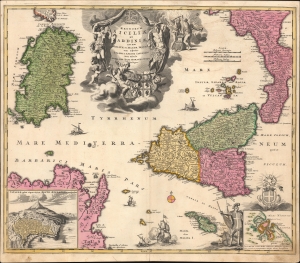
Regnorum Siciliae et Sardiniae nec non Melitae, seu Maltae Insuale cum adjectis Italiae, et Africae Litoribus Nova Tabula.
$950.00
Acquire
- Digital Map Information
- Suitable for large format printing
- File Size: 23.82 MB
- File Type: ZIP / TIFF
- ICC color profile embedded
- Delivered instantly via download link
A beautiful example of Johann Baptist Homann's 1710 map of Sicily and Sardinia, Italy. The map illustrates the islands as they were vigorously contended for by the Spanish Hapsburgs and the French Bourbons during the War of Spanish Succession (1701 - 1714). (more details)
One of the first maps of a unified British Isles.
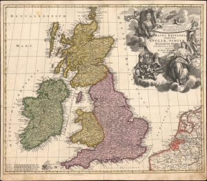
Magna Britannia complectens Angliae, Scotiae et Hiberniae Regna in suas Provincias et Comitatus Divisa.
$300.00
Acquire
- Digital Map Information
- Suitable for large format printing
- File Size: 25.75 MB
- File Type: ZIP / TIFF
- ICC color profile embedded
- Delivered instantly via download link
A beautiful first-edition example of Johann Baptist Homann's 1707-1710 map of Great Britain, including England, Ireland, Scotland, and Wales. The map illustrates the consolidated kingdom of Great Britain formed under Queen Anne by the 1707 Acts of Union. It is one of the first maps of the British Isles united under one monarch. (more details)
Eruption of a new island in the Santorini Caldera.
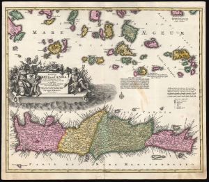
Insula Creta hodie Candia in sua IV Territoria divisa.
$750.00
Acquire
- Digital Map Information
- Suitable for large format printing
- DPI: 600
- File Size: 60.1 MB
- File Type: ZIP / TIFF
- ICC color profile embedded
- Delivered instantly via download link
This is a dramatic 1710 Homann map of Crete and the Greek Islands, in a bold original color example. In terms of the island's topography, it is largely based on the maps of Sanson from the prior century, but this older cartography frames fresh and astonishing information: the emergence of a new island, as part of the Santorini Archipelago. (more details)
A fine decorative map depicting colonial America during the Spanish War of Succession.
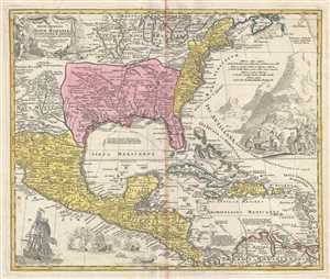
Regni Mexicani seu Novae Hispaniae, Floridae, Novae Angliae, Carolinae, Virginiae et Pensylvaniae, nec non Insularum, Archipelagi Mexicani in America Septentrionali.
$2,400.00
Acquire
- Digital Map Information
- Suitable for large format printing
- Full resolution TIFF file
- ICC color profile embedded
- Delivered instantly via download link
This is a 1715 J. B. Homann's decorative map of Mexico, Florida, New England, the West Indies, and the Mississippi Valley (Louisiana). Centered on the Mississippi River Valley, Homann's map depicts from Sinaloa (Mexico) eastwards to the Atlantic Coast and from the ... (more details)
Country of Seven Cities.
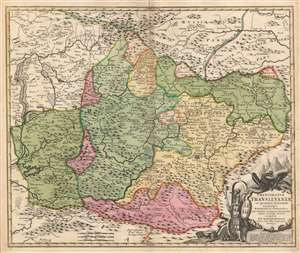
Principatus Transilvaniae in quinque Nationes earum'que Regiones es comitatus cum finitimis vicinorum Statuum Provinciis accuraté divisus.
$650.00
Acquire
- Digital Map Information
- Suitable for large format printing
- DPI: 600
- File Size: 58.16 MB
- File Type: ZIP / TIFF
- ICC color profile embedded
- Delivered instantly via download link
This is a beautiful original color example of Johann Baptist Homann's 1716 map Transylvania, covering what is today the northern part of Romania - from the Bereton River eastward as far as Castle Boza. The map is superbly engraved and detailed, noting villages, cities, forests, rivers, monasteries, castles, and lakes. Topography is indicated pictorially. (more details)
Heart of mercantile, Imperial Germany.
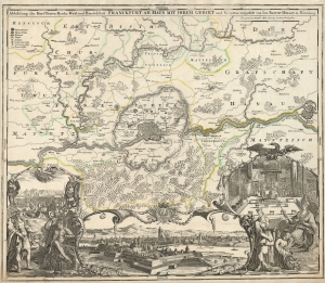
Abbildung der Keysrl. Freyen Reichs, Wahl und Handelstatt Franckfurt am Mayn mit ihrem Gebiet und Gräntzen vorgestelt von Ioh. Baptist Homann in Nürnberg.
$350.00
Acquire
- Digital Map Information
- Suitable for large format printing
- DPI: 600
- File Size: 73.21 MB
- File Type: ZIP / TIFF
- ICC color profile embedded
- Delivered instantly via download link
This is a beautifully engraved Johann Baptist Homann map of Frankfurt and its surrounds, including a magnificent panorama of the city, flanked with allegorical cartouches. Frankfurt am Main (that is, Frankfurt on the river Main, so called to distinguish from Frankfurt an der river Oder) is shown on the north bank of its namesake river. As a riverine city near the physical center of western Europe, Frankfurt was a key city not solely for the Holy Roman Empire, but for Europe overall. (more details)
La Superba.
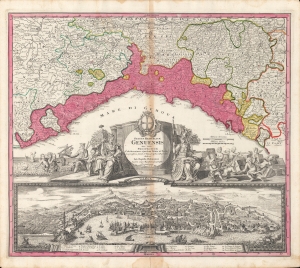
Status Reipublicæ Genuensis nec non Prospectuum Celeberrimæ ejusdem Urbis et Portus Geographica simul et Topographica Descriptio.
$1,000.00
Acquire
- Digital Map Information
- Suitable for large format printing
- Full resolution TIFF file
- ICC color profile embedded
- Delivered instantly via download link
A beautiful old-color example of Johann Baptist Homann's c. 1716 map of the Republic of Genoa. Its appealing layout combines both a map and a view, along with an elaborate cartouche and vignettes. (more details)
The Swedish Empire, Crumbling.
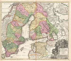
Regni Sueciae in omnes suas Subjacentes Provincias accurate divisi Tabula Generalis edita à Ioh. Bapt. Homanno Noribergae.
$600.00
Acquire
- Digital Map Information
- Suitable for large format printing
- DPI: 600
- File Size: 70.24 MB
- File Type: ZIP / TIFF
- ICC color profile embedded
- Delivered instantly via download link
This is a richly colored example of Johan Baptist Homann's c. 1716 map of the Kingdom of Sweden, which brought what was the dominant mapping of Sweden and its neighbors up-to-date with the events of the Great Northern War. Homann started - almost certainly - with Frederic de Wit's 1680 Regni Sueciae but added detail and place names that did not exist prior to the 1700–1721 Great Northern War between Sweden and Russia, and particularly before the 1703 capture of the island of Kotlin by Russia from Sweden, the 1703 Russian capture of Nyenskans, and the foundation of the city of St. Petersburg. The city of Oresca, also known as Oreshek, was captured by Russia in 1702 and renamed Schlüsselburg by Peter the Great during his administrative reforms. Here it retained its earlier name. (more details)
Territorial Ambitions of Imperial Russia in the Ukraine.
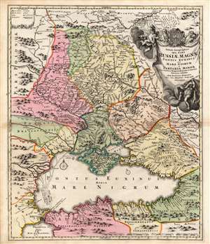
Tabula Geographica qua pars Russiae Magnae, Pontus Euxinus, seu Mare Nigrum et Tartaria Minor cum finitimis Bulgariae, Romaniae, et Natoliae Provinciis exhibitur.
$650.00
Acquire
- Digital Map Information
- Suitable for large format printing
- DPI: 600
- File Size: 30.4 MB
- File Type: ZIP / TIFF
- ICC color profile embedded
- Delivered instantly via download link
This is a beautiful original color example of Johann Baptist Homann's 1716 map of the Black Sea region, including modern-day Ukraine, Moldova, and Russia. The map was produced during the reign of Peter the Great, when Russia actively warred with Sweden, the Crimean Tatars, and the Ottoman Turks. The region from the Don River on north to Moscow is here designated Russiae Maximae - or 'Greater Russia' thus expressing the extent of Peters ambitions. (more details)
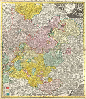
Circuli Franconiae Pars Orientalis et Potior novissime delineata quam . . .
$350.00
Acquire
- Digital Map Information
- Suitable for large format printing
- DPI: 300
- File Size: 23.61 MB
- File Type: ZIP / TIFF
- ICC color profile embedded
- Delivered instantly via download link
A fine example of J. B. Homann's c. 1720 map of Franconia (Franken, part of Bavaria), Germany. Centered on Bamberg, Würtzburg, and Nuremberg, extending north as far as Gotha, south to Swabia, east to Mergentheim and east to Pfreimt (Ober Pfalz). The map is filled ... (more details)
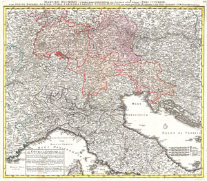
Danubii Fluminus ( a fontibus prope Doneschingam usq Posonium urbem defignati) Pars Superior, in qua Suevia, Bavaria, Asutria, Stiria, Carinthia, Carniola, Tyrolis et Helvetia com magna parte Italiae exhibentur a Ioh. Bapt. Homanno S.C. M. Geographo Norimbergae.
$600.00
Acquire
- Digital Map Information
- Suitable for large format printing
- Full resolution TIFF file
- ICC color profile embedded
- Delivered instantly via download link
A stunning map of the Northern Part of Italy. Switzerland, and parts of Germany. Covers from Rome in the south, north as far as Bavaria and Bohemia, to Provence in the west, and modern day Albania in the east. This highly detailed map was constructed to illustrate ... (more details)
In the Wake of the Age of Greatness.
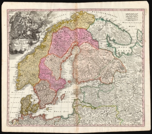
Scandinavia complectens Sueciae, Daniae et Norvegiae Regna ex tabula Joh Bapistae Homanni Norimbergae Cum Privilegio Sac. Caes. Maj.
$850.00
Acquire
- Digital Map Information
- Suitable for large format printing
- DPI: 600
- File Size: 75.1 MB
- File Type: ZIP / TIFF
- ICC color profile embedded
- Delivered instantly via download link
This is Johann Baptist Homann's map of Scandinavia, bringing the dominant 17th-century mapping of the northern parts of Europe up-to-date with the events of the Great Northern War (1700 - 1721). The map is based primarily on Anders Bure's 1626 mapping of the region - the authority for more than a century. The political borders reflect the state of affairs following the disastrous Great Northern War with Russia. (more details)
Bellicose Depiction of the Turkish Empire.
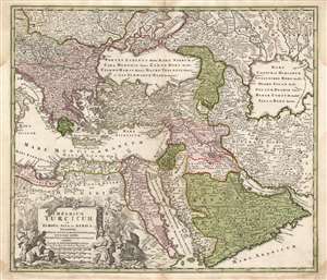
Imperium Turcicum in Europa, Asia et Africa, Regiones Proprias, Tributarias, Clientelares et Sicut et Omnes Praefecturas Generales exhibens.
$850.00
Acquire
- Digital Map Information
- Suitable for large format printing
- Full resolution TIFF file
- ICC color profile embedded
- Delivered instantly via download link
This is a handsome example of the J. B. Homann 1725 map of the Turkish Empire in Europe, Asia and Africa. It shows the extent of the Ottoman Empire encompassing \the Arabian Peninsula, as well as the coastal parts of the empire in North Africa and Egypt. The border with the Persia is shown in the east, along with a considerable part of what is today Iran and Central Asia. The empire's contentious border in Europe, abutting Hungary, Transylvania, and Poland, is also shown. The area north of the Black Sea shows both Tatar territories and those of Muscovy on the Turkish frontier. (more details)
Remarkable mining imagery.
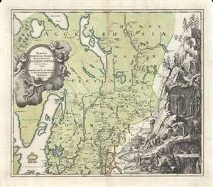
Tractus Norvegiae Danicus Magnam Dioeceseos Aggerhusiensis.
$600.00
Acquire
- Digital Map Information
- Suitable for large format printing
- DPI: 600
- File Size: 61 MB
- File Type: ZIP / TIFF
- ICC color profile embedded
- Delivered instantly via download link
Here is Johann Baptist Homann's 1729 map of the county of Akershus, surrounding Oslo (Christiana), Norway. Aside from its geographic detail, it is distinguished by a large, intricate mining vignette at right - a fascinating insight into 18th-century European mine engineering. (more details)
Southern Italy in the War of the Spanish Succession.
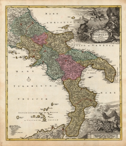
Novissima et exactissima Totius Regni Neapolis Tabula Praesentis Belli Statui Accomodata et Exhibita.
$750.00
Acquire
- Digital Map Information
- Suitable for large format printing
- Full resolution TIFF file
- ICC color profile embedded
- Delivered instantly via download link
This is a beautiful 1730 old-color example of Johann Baptist Homann's map of the Kingdom of Naples, then most of southern Italy. The map was issued to illustrate this theater of the War of the Spanish Succession (1701 - 1714), thus covering from Terracina to the Adriatic Sea and northern Sicily. (more details)
Celebrating the First King of Prussia.
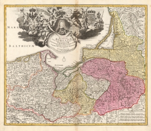
Regnum Borussiae: Gloriosis auspicÿs Serenissimi et Potentissimi Prin Friderici III. Primi Borussiae Regis, March. et Elect. Bran. inauguratum die 18. Ian. A. 1701. Geographice cum vicinis Regionibus adumbratum a Ioh. Baptista Homanno Norimbergae Cum Privilegio Sac: Caes: Maijestatis.
$550.00
Acquire
- Digital Map Information
- Suitable for large format printing
- DPI: 600
- File Size: 67.13 MB
- File Type: ZIP / TIFF
- ICC color profile embedded
- Delivered instantly via download link
This is Homann's 1728 map of the Kingdom of Prussia, produced to commemorate the day (January 18, 1701) on which Elector Friedrich III of Brandenburg, Crowned himself King Friedrich I in Prussia in Königsberg. The map displays the borders of the Kingdom in Prussia at its inception, presents a portrait of the new king framed by an ornate allegorical cartouche. (more details)
Venice and her Neighbors.
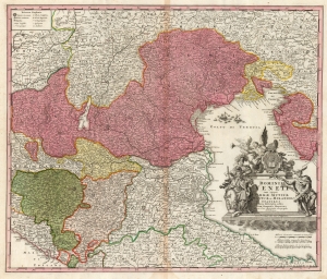
Dominii Veneti cum vicinis Parmae Mutinae Mantuae et Mirandol Statibus Nova Descriptio edita Ioh. Baptista Homanno.
$500.00
Acquire
- Digital Map Information
- Suitable for large format printing
- DPI: 600
- File Size: 65.3 MB
- File Type: ZIP / TIFF
- ICC color profile embedded
- Delivered instantly via download link
This is a handsome c.1730 Homann map of northeast Italy, the region dominated by the Republic of Venice, whose territories are highlighted here in pink. (more details)
A City of Commerce and Science.
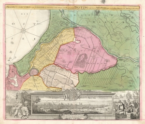
Prospect, Grundris und Gegend der Polnischen vesten Reichs und Handels-Stadt Dantzig und ihrem Werder.
$950.00
Acquire
- Digital Map Information
- Suitable for large format printing
- DPI: 600
- File Size: 54.88 MB
- File Type: ZIP / TIFF
- ICC color profile embedded
- Delivered instantly via download link
This is Johann Baptist Homann's map of Gdansk (here in the German 'Dantzig') and its immediate vicinity, first engraved and published about 1716. The east-oriented map portrays not only the walled city of Gdansk, but also the districts immediately to the East: the Gdansk Werder and the Marienburger Werder. (more details)
Competitor of the Marine Chronometer.
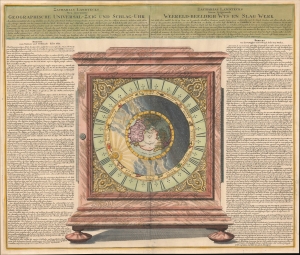
Geographische Universal - Zeig Und Schlag-Uhr.
$2,250.00
Acquire
- Digital Map Information
- Suitable for large format printing
- File Size: 27.03 MB
- File Type: ZIP / TIFF
- ICC color profile embedded
- Delivered instantly via download link
A remarkable 1735 Zacharias Landteck and J. B. Homman diagram of a 'universal clock,' with instructions in German (left) and Dutch (right) on how to use it to determine the time and thus longitude at sea - an age-old problem for mariners. This advertising piece for Landteck's clock, known as Geographische Universal Zeig und SchlagUhr an (Universal Pointing and Chiming Clock), was published in 1735, not by chance, for this was the same year that Englishman John Harrison claimed the Royal 'Longitude Act' prize for his own groundbreaking invention, the marine chronometer. (more details)
Solving the fundamental problem of navigation.
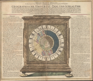
Geographische Universal - Zeig Und Schlag-Uhr.
$600.00
Acquire
- Digital Map Information
- Suitable for large format printing
- DPI: 600
- File Size: 63.8 MB
- File Type: ZIP / TIFF
- ICC color profile embedded
- Delivered instantly via download link
A remarkable c. 1735 Zacharias Landteck and J. B. Homman 'universal clock' with instructions on how to use time to determine longitude at sea - a perennial problem for mariners. The piece advocates for Homann's invention of the universal clock, known as Geographische Universal Zeig und SchlagUhr an (Universal Pointing and Chiming Clock), but this is unverified. (more details)
Quartet of Colonial-America Maps.
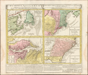
Dominia Anglorum in America Septentrionali. Specialibus Mappis Londini Primum a Mollio Edita, Nunc Recusa ab Homannianis Hered.
$1,600.00
Acquire
- Digital Map Information
- Suitable for large format printing
- Full resolution TIFF file
- ICC color profile embedded
- Delivered instantly via download link
This 1737 Homann Heirs engraving presents a quartet of maps depicting the British Colonies in North America. The four segments present Nova Scotia and Newfoundland, New England, Virginia and Maryland, and the Carolinas, respectively. The maps' detail is drawn closely from the work of Hermann Moll: each of the individual maps appeared as separate maps in Moll's Atlas Minor. Beyond this, the plate includes descriptive text pertaining to three of the four maps and includes a special commentary on the Iroquois Nation. (more details)
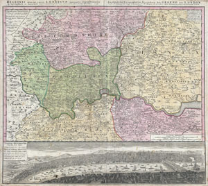
Regionis quae est circa Londinum, specialis representatio geographica, ex autographo majori Londinensi desumta, curantibus HOMANIANIS Heredibus, 1741.
$1,100.00
Acquire
- Digital Map Information
- Suitable for large format printing
- DPI: 300
- File Size: 26.92 MB
- File Type: ZIP / TIFF
- ICC color profile embedded
- Delivered instantly via download link
A fine example of Homann Heirs' iconic 1741 map of London and its environs. Based heavily upon an earlier map of the region by Thomas Bowles, this map covers the London area from Berkshire (including Windsor Castle) in the west to Shamel in the east, extending ... (more details)
Highly decorative mid-18th century map of Turkey.
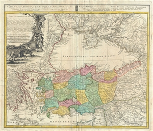
Carte de l'Asie Mineure ou de la Natolie et du Pont Euxin, tiree des Voyages et des Observations des Anciens et Modernes. Asiae Minoris Veteris et Novae, itemque Ponti Euxini et Paludis Maeotidis Mappa val Tabula.
$500.00
Acquire
- Digital Map Information
- Suitable for large format printing
- DPI: 300
- File Size: 19.38 MB
- File Type: ZIP / TIFF
- ICC color profile embedded
- Delivered instantly via download link
This is an attractive 1743 map of Asia Minor by the Homann Heirs. The map depicts Turkey and the regions surrounding the Black Sea including parts of modern day Crimea, Romania, Russia, Ukraine, Georgia and Greece. Centered on the Black Sea, extends south to ... (more details)
Rare Edition Mapping the Spread of Christianity in America.
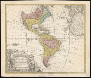
Americae Mappa Generalis.
$1,500.00
Acquire
- Digital Map Information
- Suitable for large format printing
- File Size: 24.72 MB
- File Type: ZIP / TIFF
- ICC color profile embedded
- Delivered instantly via download link
This is an elegant 1746 map of the Americas, prepared for Homann Heirs by the mathematicians and geographers Johann Matthias Hase and A. Gottlob Böhme. The present example includes a color key indicating the dominant religions on the map, a feature unique to an extremely rare 1754 edition of the work. (more details)
The World in Two Hemispheres.
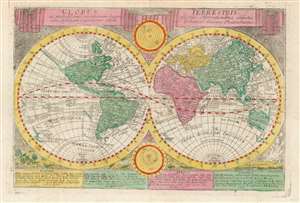
Globus Terrestris: ex probatissimis recentorum Geographorum Observationibus confectus cum Systemate Copernicano atque Tychonico aliisque Phenomenis.
$750.00
Acquire
- Digital Map Information
- Suitable for large format printing
- Full resolution TIFF file
- ICC color profile embedded
- Delivered instantly via download link
This is the double-hemisphere world map from Johann Georg Schreiber's Atlas Selectus, a student published from around 1741 until his death. It presents the world in a pre-Cook form. Australia and New Zealand are only shown by their western coasts as per Abel Tazman, and the American Pacific Northwest is shown as an extended unexplored coastline with California attached. The northeastern coast of Asia is shown with the Anadirskoe Sea separating it from North America. These features tend to identify Homann's Planiglobii Terrestris as Schreiber's source - particularly given certain specific textual elements shared by both maps, such as the identification of an uncertain Pacific coastline as 'Terra quam credit Mendana esse Novam Guineam.' ('The land which Mendaña believed was New Guinea') (more details)