

Le Royaume d'Ecosse divisee en Shires ou Comtes.
sold
- Digital Map Information
- Suitable for large format printing
- Full resolution TIFF file
- ICC color profile embedded
- Delivered instantly via download link
This is an attractive 1751 map of Scotland by Robert de Vaugondy. It depicts Scotland divided into its Shires or Counties and includes the Isles Westernes or the Outer Hebrides and the Orkney Islands. This extremely detailed map notes important cities, towns, ... (more details)
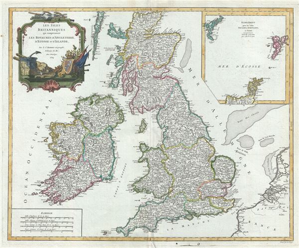
Les Isles Britanniques qui comprennent les Royaumes d'Angleterre, d'Ecosse et d'Irlande.
sold
- Digital Map Information
- Suitable for large format printing
- Full resolution TIFF file
- ICC color profile embedded
- Delivered instantly via download link
This is a beautiful 1754 map of the British Isles by Robert de Vaugondy. Vaugondy's map covers all of England, Wales, Scotland and Ireland. Several important towns, cities, roads, rivers, lakes and other topographical features are noted, with elevation ... (more details)
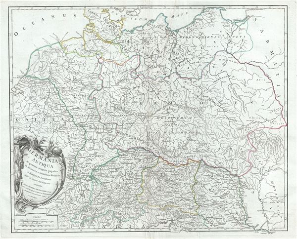
Germania Antiqua in quatuor magnos populos, in minores et minimos distincta, et Regiones Danubium inter et mare Adriaticum contentae.
sold
- Digital Map Information
- Suitable for large format printing
- Full resolution TIFF file
- ICC color profile embedded
- Delivered instantly via download link
This is a fine 1756 map of ancient Germany by Robert de Vaugondy. It covers the lands of the Germanic people prior to the fall of the Roman Empire, from modern day Denmark to the Adriatic Sea and from France to Lithuania. Several important cities and ... (more details)
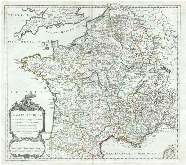
Gallia Antiqua in Provincias et Populos divisa.
sold
- Digital Map Information
- Suitable for large format printing
- Full resolution TIFF file
- ICC color profile embedded
- Delivered instantly via download link
This is an attractive 1750 map of France or Gaul or Gallia by Robert de Vaugondy. It covers Gallia during ancient Roman times and extends from the English Channel south as far as the Pyrenees Mountains and Hispania. It includes the modern day nations ... (more details)
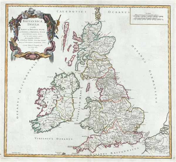
Britannicae Insulae in quibus Albion seu Britannia Major, et Ivernia seu Britannia Minor.
sold
- Digital Map Information
- Suitable for large format printing
- Full resolution TIFF file
- ICC color profile embedded
- Delivered instantly via download link
This is a beautiful 1750 map of the British Isles during the ancient Roman times by Robert de Vaugondy. Vaugondy's map covers all of modern day England, Wales, Scotland and Ireland. Several important roads, rivers, lakes, ancient cities and towns as ... (more details)

Romani Imperii occidentis scilicet et orientis, Tabula Geographica.
sold
- Digital Map Information
- Suitable for large format printing
- Full resolution TIFF file
- ICC color profile embedded
- Delivered instantly via download link
This is a rare and attractive 1752 map of the Roman Empire by Robert de Vaugondy. The map shows the extent of the Roman Empire at its height, including the Western Roman Empire and the Eastern Roman Empire. It extends from the Barbary Coast and ... (more details)

Antiquor? Imperiorum Tabula, in qua prae coeteris, Macedonicum seu Alexandri Magni Imperium et Expeditiones.
sold
- Digital Map Information
- Suitable for large format printing
- Full resolution TIFF file
- ICC color profile embedded
- Delivered instantly via download link
This is Robert de Vaugondy's spectacular 1753 map of the Middle and Near East including Arabia, Asia Minor and Persia showing the expeditions of Alexander the Great. It covers the Middle East and the Arabian Peninsula spanning from the Black Sea ... (more details)
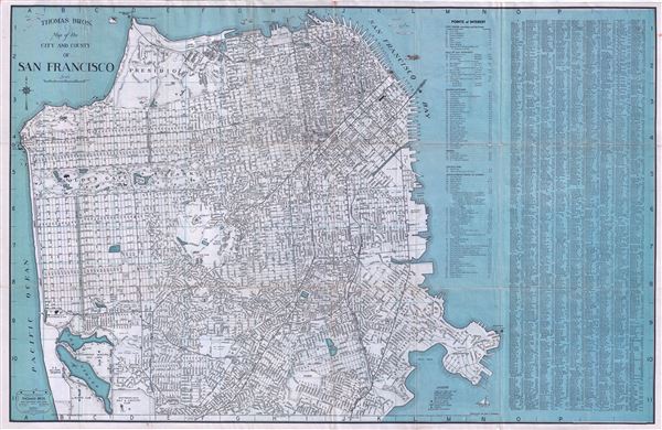
Thomas Bros Map of the City and County of San Francisco.
sold
- Digital Map Information
- Suitable for large format printing
- Full resolution TIFF file
- ICC color profile embedded
- Delivered instantly via download link
This is a fine c.1938 pocket map or plan of the city of San Francisco by Thomas Bros. It covers San Francisco City from Lake Merced in the south to the Golden Gate Bridge in the north and from Great Highway in the west to Avisadero Point in the ... (more details)
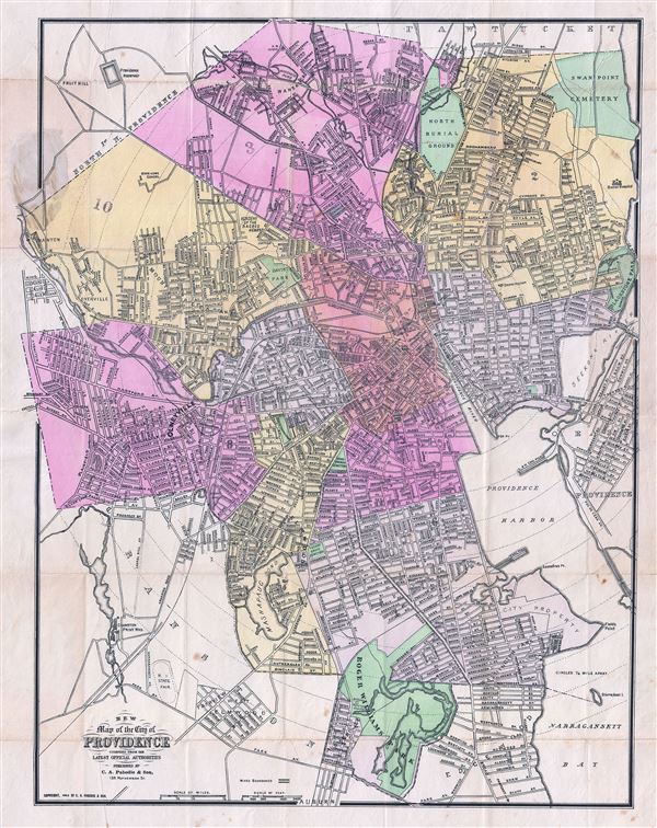
New Map of the City of Providence compiled from the Latest Official Authorities.
sold
- Digital Map Information
- Suitable for large format printing
- Full resolution TIFF file
- ICC color profile embedded
- Delivered instantly via download link
This is a scarce 1903 map or plan of the city of Providence, Rhode Island by Pabodie and Sons. It covers all of downtown Providence as well as much of the surrounding area as far north as Pawtucket, west to Manton, south to Roger Williams Park ... (more details)
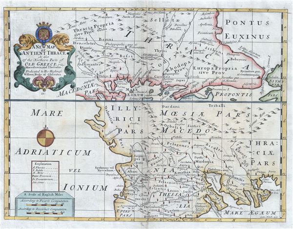
A New Map of Antient Thrace: As also of the Northern Parts of Old Greece, viz. Macedonia, and Thessalia.
sold
- Digital Map Information
- Suitable for large format printing
- Full resolution TIFF file
- ICC color profile embedded
- Delivered instantly via download link
This is a beautiful 1712 map of ancient Thrace or Northern Greece and Bulgaria. Essentially divided into two panels, the top panel depicts from north eastern Greece, with parts of Macedonia and Thrace, to Bulgaria and the Black Sea. The lower ... (more details)
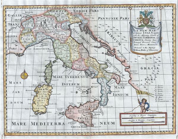
A New Map of Antient Italy, together with the Adjoyning Islands of Sicily, Sardinia, and Corsica, Shewing their Principal Divisions, Cities, Towns, Rivers, Mountains etc.
sold
- Digital Map Information
- Suitable for large format printing
- Full resolution TIFF file
- ICC color profile embedded
- Delivered instantly via download link
This is an uncommon 1712 map of ancient Italy inclusive of the adjoining islands of Sardinia, Corsica and Sicily by Edward Wells of Oxford. It covers all of Italy in the days of the Roman Empire from Cisalpine Gaul to Sicily, noting towns, ... (more details)

New York and Environs.
sold
- Digital Map Information
- Suitable for large format printing
- Full resolution TIFF file
- ICC color profile embedded
- Delivered instantly via download link
A stunning and rare 1868 view of the island of Manhattan, New York City by W. C. Rogers. The view depicts the entire island of Manhattan with Hoboken as well as parts of Brooklyn and Queens. Important buildings, especially churches are ... (more details)
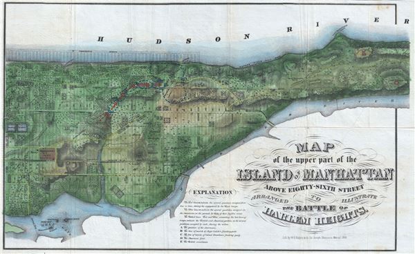
Map of the Upper Part of the Island of Manhattan above eighty-sixth street arranged to illustrate the Battle of Harlem Heights.
sold
- Digital Map Information
- Suitable for large format printing
- Full resolution TIFF file
- ICC color profile embedded
- Delivered instantly via download link
A stunning and rare 1868 Map of the northern part of the island of Manhattan, New York city by W. C. Rogers. The map covers the upper part of Manhattan, above 86th street (including Morningside Heights, Manhattan Valley, Harlem, Inwood, ... (more details)
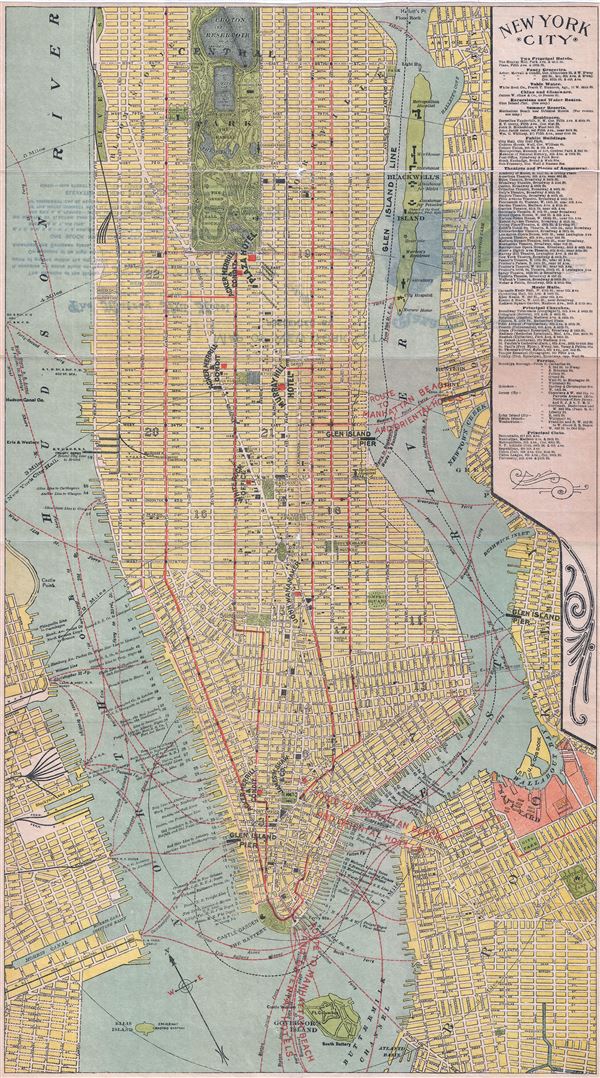
New York City.
sold
- Digital Map Information
- Suitable for large format printing
- Full resolution TIFF file
- ICC color profile embedded
- Delivered instantly via download link
This is a scarce 1894 map or plan of New York City by Geo H. Walker and Company. It covers from 94th street to the Battery and includes parts of Brooklyn and Jersey City. Includes Ellis Island and Governor's Island. Roosevelt Island ... (more details)

Nouveau Plan de Paris Divise en Vingt Arrondissements.
sold
- Digital Map Information
- Suitable for large format printing
- Full resolution TIFF file
- ICC color profile embedded
- Delivered instantly via download link
This is a beautiful 1899 folding map or plan of Paris, France by the French cartographer A. Vuillemin. Centered on the Seine River, it covers embastilled Paris as contained in the Thiers Wall, as well as its immediate vicinity, ... (more details)
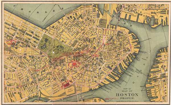
Part of Map of Boston Proper.
sold
- Digital Map Information
- Suitable for large format printing
- Full resolution TIFF file
- ICC color profile embedded
- Delivered instantly via download link
This is a scarce 1894 map or plan of the city of Boston, Massachusetts by Geo H. Walker and Company. It extends from Cambridge and Charleston to East Boston and South Boston. Individual streets, bridges, parks, wharfs, subway ... (more details)

A Tub for the Whale; representing an Empty Barrel tossed out to amuse the great Leviathan - John Bull, in order to divert him from instantly laying violent hands upon ye new Coalition Packet.
sold
- Digital Map Information
- Suitable for large format printing
- Full resolution TIFF file
- ICC color profile embedded
- Delivered instantly via download link
This is a scarce 1806 hand color aquatint and etching of a Tub for the Whale, by James Gillray. The lengthy title references the preface of Jonathan Swift's satire A Tale of a Tub , published in 1704. In the etching, we see ... (more details)
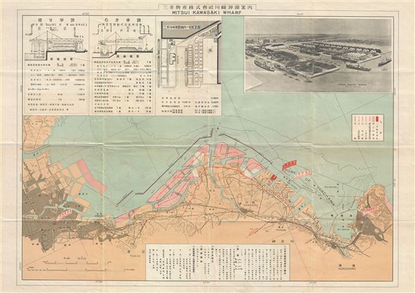
Mitsui Kawasaki Wharf.
sold
- Digital Map Information
- Suitable for large format printing
- Full resolution TIFF file
- ICC color profile embedded
- Delivered instantly via download link
This is a scarce 1928 or Showa 3 Japanese bi-lingual map or plan of the Mitsui Kawasaki Wharf. It covers the region from Tokyo to Yokohama in great detail and notes roads, rivers, towns, railways, ports and a host of other ... (more details)

Australia.
sold
- Digital Map Information
- Suitable for large format printing
- File Size: 21.93 MB
- File Type: ZIP / TIFF
- ICC color profile embedded
- Delivered instantly via download link
This is a beautiful 1943 or Showa 18 large format map of Australia, issued by the Japanese during World War II as part of a series of maps promoting the Japanese imperialist concept of the Greater East Asia Co-Prosperity Sphere. The map depicts the entire continent from southern New Guinea to northern Tasmania and from the Indian Ocean to the Coral Sea and the Tasman Sea. Australian states are shaded different colors to allow for easy differentiation. Numerous locations throughout Australia are identified. Shipping lanes around the continent and further afield are noted by solid red lines, while air routes are marked by dashed lines. An inset in the lower right corner details Tasmania and is mirrored by the map's key, which explains the various notations used. (more details)
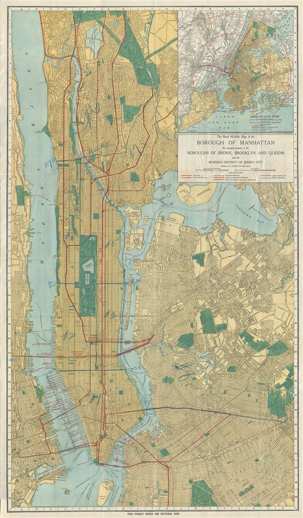
The Rand McNally Map of the Borough of Manhattan the principal portions of the Boroughs of Bronx, Brooklyn and Queens and the Business District of Jersey City.
sold
- Digital Map Information
- Suitable for large format printing
- File Size: 36.61 MB
- File Type: ZIP / TIFF
- ICC color profile embedded
- Delivered instantly via download link
This is a fine 1913 map of New York City by Rand McNally and Company. The map covers the entirety of New York City, including the boroughs of Manhattan, Brooklyn, the Bronx, Queens and part of Hoboken and Jersey City, New ... (more details)