
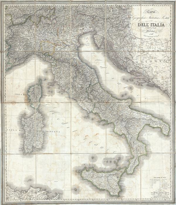
Carta Geografica, Statistica e Postale Dell'Italia.
sold
- Digital Map Information
- Suitable for large format printing
- Full resolution TIFF file
- ICC color profile embedded
- Delivered instantly via download link
This is a stunning 1826 map of Italy by Stanislao Stucchi. It covers the entire Italian peninsula from Switzerland to Sicily and notes postal routes throughout the country. Towns, cities, rivers, forts, ruins, mountains and a host of additional topographical ... (more details)
First printed map to used the Goos Speculation regarding the Pacific Northwest.
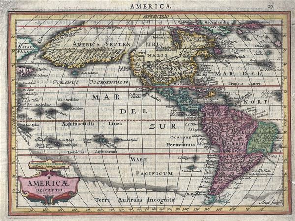
Americae Descriptio.
sold
- Digital Map Information
- Suitable for large format printing
- Full resolution TIFF file
- ICC color profile embedded
- Delivered instantly via download link
A fine first edition first state example of an attractive and important 1628 map of American (North and South) issued by Joannes Jansson and Aberham Goos. Centered on the American continent, this miniature map covers from the Arctic Circle to Tierra del ... (more details)

Florida.
sold
- Digital Map Information
- Suitable for large format printing
- DPI: 300
- File Size: 2.68 MB
- File Type: ZIP / TIFF
- ICC color profile embedded
- Delivered instantly via download link
This is a scarce early map of Florida by the important American mapmaker T. G. Bradford in 1835. The map covers all of Florida as it appeared at the outset of the second Seminole War (1835 - 1842). An early Florida county structure is presented with Mosquito County occupying most of eastern Florida. An inset map illustrates the western part of the Florida Panhandle. (more details)
Early American Revolutionary War plan of Boston closely following the Battle of Bunker Hill.
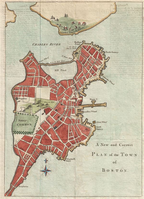
A New and Correct Plan of the Town of Boston.
sold
- Digital Map Information
- Suitable for large format printing
- DPI: 300
- File Size: 3.01 MB
- File Type: ZIP / TIFF
- ICC color profile embedded
- Delivered instantly via download link
An uncommon and attractive 1775 map of Boston issued in the early days of the American Revolutionary War just following the Battle of Bunker Hill. The map covers the original peninsula of Boston as well as the ruins of Charleston just across the river. ... (more details)
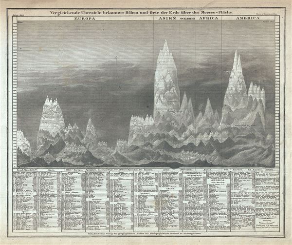
Vergleichende Ubersicht bekannter Hohen und Orte der Erde uber der Meeres-Flache.
sold
- Digital Map Information
- Suitable for large format printing
- Full resolution TIFF file
- ICC color profile embedded
- Delivered instantly via download link
This is an interesting c.1850 comparative chart of the world's mountains by Joseph Meyer. It identifies some 400 mountains drawn in proximity to one another and subdivided by continent. Dhaulagiri, in the Nepali Himalayas is identified as the world's ... (more details)
Uncommon presentation of Texas and highlighting of the California Gold Region.
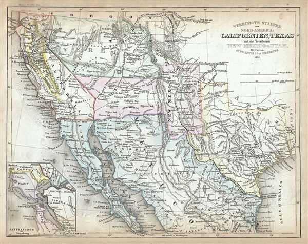
Vereinigte Staaten von Nord-America: Californien, Texas und die Territorien New Mexico u. Utah.
sold
- Digital Map Information
- Suitable for large format printing
- Full resolution TIFF file
- ICC color profile embedded
- Delivered instantly via download link
This is an uncommon and appealing 1852 map of the American southwest by Joseph Meyer. The map covers the greater southwest from the 42nd parallel south to include all of modern day California, Utah, Nevada, Arizona, New Mexico, Texas, Colorado, and ... (more details)
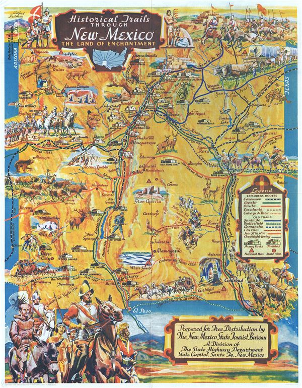
Historical Trails Through New Mexico The Land of Enchantment.
sold
- Digital Map Information
- Suitable for large format printing
- File Size: 18.8 MB
- File Type: ZIP / TIFF
- ICC color profile embedded
- Delivered instantly via download link
This is an extraordinary example of Wilfred Stedman's beautifully illustrated 1940 map of the historical trails through New Mexico. The map covers New Mexico from Shiprock to El Paso. It notes the only point in the United States common to four ... (more details)
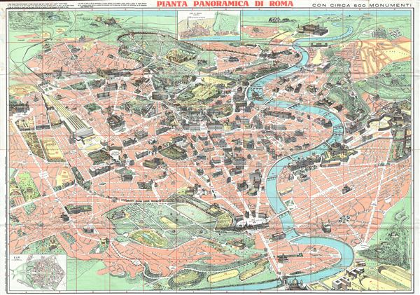
Pianta Panoramica di Roma.
sold
- Digital Map Information
- Suitable for large format printing
- File Size: 40.75 MB
- File Type: ZIP / TIFF
- ICC color profile embedded
- Delivered instantly via download link
This is a beautiful c.1960 panoramic view map of Rome, Italy. It covers the 'Eternal City' in incredible detail, revealing individual streets, parks, historic buildings, piazzas, temples, ancient ruins, bridges, rivers and ecclesiastical ... (more details)

Indochina.
sold
- Digital Map Information
- Suitable for large format printing
- File Size: 24.7 MB
- File Type: ZIP / TIFF
- ICC color profile embedded
- Delivered instantly via download link
This is a beautiful 1943 or Showa 18 large format map of Cambodia, Vietnam, Laos and Thailand issued by the Japanese during World War II. The map offers superb detail regarding topographic features and notes cities, roads, and trade ... (more details)

East Australia.
sold
- Digital Map Information
- Suitable for large format printing
- File Size: 21.12 MB
- File Type: ZIP / TIFF
- ICC color profile embedded
- Delivered instantly via download link
This is a stunning large format Japanese map of eastern Australia dating to World War II. Issued by the Japanese in 1943, this is one of the most beautiful maps of Australia ever produced. It covers the eastern half of the ... (more details)
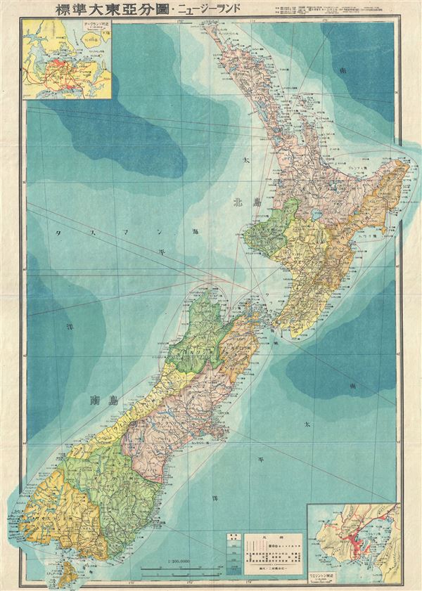
New Zealand.
sold
- Digital Map Information
- Suitable for large format printing
- File Size: 17.15 MB
- File Type: ZIP / TIFF
- ICC color profile embedded
- Delivered instantly via download link
This is a stunning large format Japanese map of New Zealand dating to World War II, and one of the most beautiful cartographic depictions of New Zealand to appear in the 20th century. It covers the entirety of New Zealand, ... (more details)

Shanghai.
sold
- Digital Map Information
- Suitable for large format printing
- File Size: 15.72 MB
- File Type: ZIP / TIFF
- ICC color profile embedded
- Delivered instantly via download link
This is a scarce 1932 or Showa 7 Japanese map of Shanghai, China. Published by the Yubin Hochi Shimbun (Mail Reporting News), it depicts the city of Shanghai in great detail, with the various concessions all clearly ... (more details)
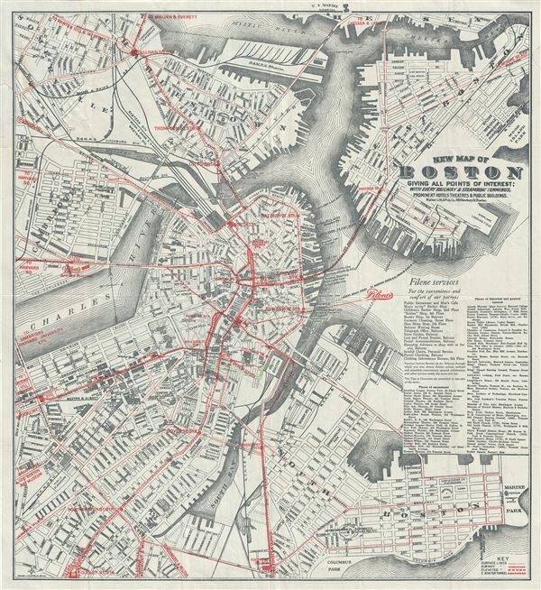
New Map of Boston Giving All Points of Interest : With Every Railway and Steamboat Terminus, Prominent Hotels Theatres and Public Buildings.
sold
- Digital Map Information
- Suitable for large format printing
- Full resolution TIFF file
- ICC color profile embedded
- Delivered instantly via download link
This is a beautiful 1926 map or plan of the city of Boston, Massachusetts by the Walker Lith. and Publishing Company. Published by the Filene's Sons and Company, it covers the city of Boston from Charlestown and ... (more details)
The first English map of the Mississippi River.
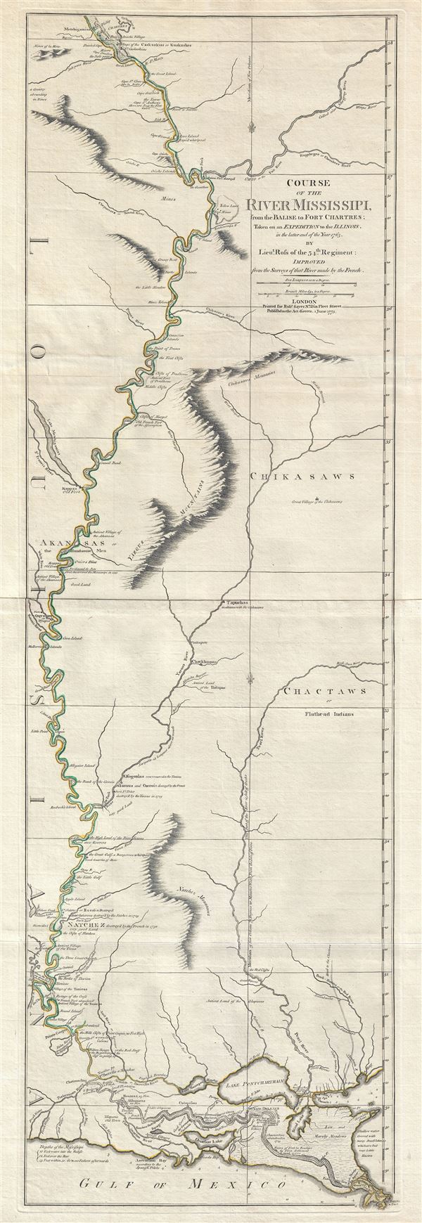
Course of the River Mississipi, from the Balise to Fort Chartres; Taken on an Expedition to the Illinois, in the latter end of the Year 1765.
sold
- Digital Map Information
- Suitable for large format printing
- DPI: 300
- File Size: 15.95 MB
- File Type: ZIP / TIFF
- ICC color profile embedded
- Delivered instantly via download link
A scarce, important, and dramatic map of the Mississippi River Valley from the Gulf of Mexico to Fort Chartres (Illinois). Set on the meridian of New Orleans, this map covers the Mississippi Valley from the ... (more details)
The only true antique wine map we have seen.
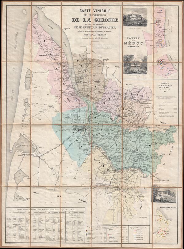
Carte Vinicole du Departement de al Gironde dressee sur les donnees de Mr. Duffour Dubergier President de la Chambre de Commerce de Bordeaux par Unal Serres Desssinateur Geometre de la Ville Bordeaux.
sold
- Digital Map Information
- Suitable for large format printing
- File Size: 138.72 MB
- File Type: ZIP / TIFF
- ICC color profile embedded
- Delivered instantly via download link
This wonderful 1874 map of the Department of the Gironde, France, is the only true antique wine map we have ever seen. It depicts the Gironde on a grand scale with color coding according to wine region and ... (more details)

Distance & Direction of Various Places from New York, As Measured upon the Surface of the Artificial Globe.
sold
- Digital Map Information
- Suitable for large format printing
- Full resolution TIFF file
- ICC color profile embedded
- Delivered instantly via download link
This is a fine example of the 1835 chart of the distances and direction of various places from New York as measured on the surface of the artificial globe by the important American mapmaker T. G. Bradford. ... (more details)

[Astronomical Illustrations].
sold
- Digital Map Information
- Suitable for large format printing
- Full resolution TIFF file
- ICC color profile embedded
- Delivered instantly via download link
This is a fine example of the 1835 chart of various astronomical illustrations by the important American mapmaker T. G. Bradford. It chart illustrates the comparative size of the planets, their distances ... (more details)

Comparative Size of Animals.
sold
- Digital Map Information
- Suitable for large format printing
- Full resolution TIFF file
- ICC color profile embedded
- Delivered instantly via download link
This is a fine example of the 1835 chart of the comparative sizes of the world's animals by the important American mapmaker T. G. Bradford. It shows the distribution of animals based on their size, with ... (more details)

Comparative Height of Monuments. Comparative Height of Edifices.
sold
- Digital Map Information
- Suitable for large format printing
- Full resolution TIFF file
- ICC color profile embedded
- Delivered instantly via download link
This is a fine example of the 1835 chart of the comparative heights of the world's monuments and edifices by the important American mapmaker T. G. Bradford. It shows the dimensions of the most ... (more details)

Comparative Chart, of Different Countries.
sold
- Digital Map Information
- Suitable for large format printing
- Full resolution TIFF file
- ICC color profile embedded
- Delivered instantly via download link
This is a fine example of the 1835 comparative map or chart of different countries of the world by the important American mapmaker T. G. Bradford. It represents the various countries by ... (more details)