
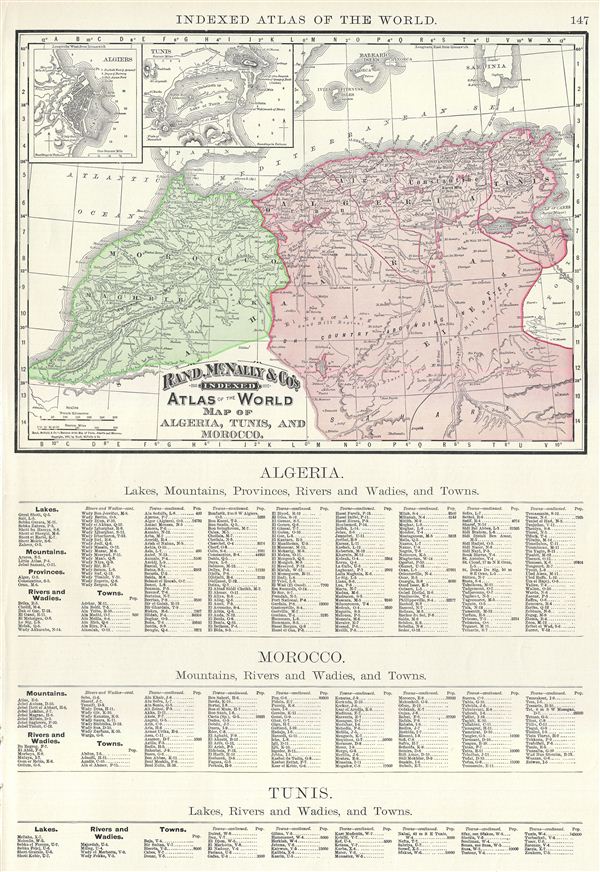
Map of Algeria, Tunis, and Morocco.
sold
- Digital Map Information
- Suitable for large format printing
- File Size: 9.06 MB
- File Type: ZIP / TIFF
- ICC color profile embedded
- Delivered instantly via download link
This is a beautiful example of Rand McNally and Company's 1891 map of northwest Africa. Featuring Algeria, Morocco and Tunisia, it covers from the Mediterranean Sea to the Sahara. Two inset maps in the upper left quadrant feature Algiers and Tunis. After its ... (more details)
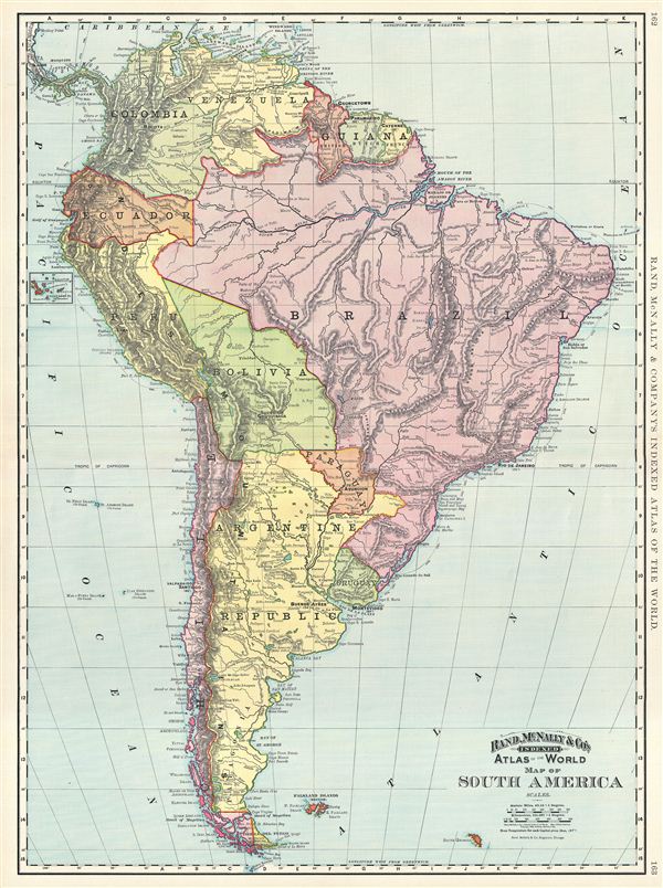
Map of South America.
sold
- Digital Map Information
- Suitable for large format printing
- File Size: 22.86 MB
- File Type: ZIP / TIFF
- ICC color profile embedded
- Delivered instantly via download link
This is a beautiful example of Rand McNally and Company's 1892 map of South America. It covers the entire continent from the Caribbean to Cape Horn and from the Pacific to the Atlantic. The Falkland and South Georgia island groups are included. A small inset ... (more details)
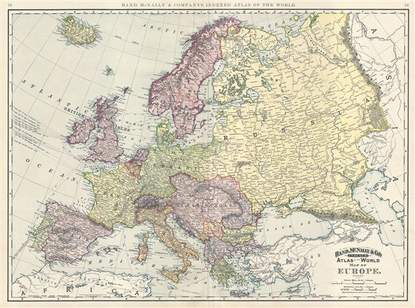
Map of Europe.
sold
- Digital Map Information
- Suitable for large format printing
- File Size: 22.39 MB
- File Type: ZIP / TIFF
- ICC color profile embedded
- Delivered instantly via download link
This is a beautiful example of Rand McNally and Company's 1891 map of Europe. The map covers the continent in its entirety from the Atlantic to the Caspian Sea and from the Arctic Ocean to the Mediterranean Sea and includes Iceland. This map depicts a period ... (more details)

Map of Scotland.
sold
- Digital Map Information
- Suitable for large format printing
- File Size: 21.6 MB
- File Type: ZIP / TIFF
- ICC color profile embedded
- Delivered instantly via download link
This is a beautiful example of Rand McNally and Company's 1891 map of Scotland. It covers Scotland in full from the Orkney Islands to Wigtown in the south, inclusive of the Hebrides. An inset in the upper right quadrant features the Orcades and Shetland ... (more details)
An invaluable reference to the 18th century African Slave trade.
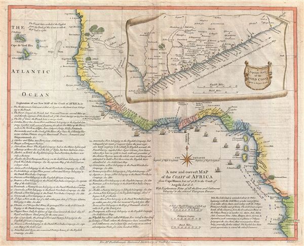
A new and correct Map of the Coast of Africa from Cape Blanco Lat. 20°, 40'. N. to the Coast of Angola, Lat. 11° . S. With Explanatory Notes of all the Forts and Settlements belonging to the several European Powers.
sold
- Digital Map Information
- Suitable for large format printing
- DPI: 300
- File Size: 11.09 MB
- File Type: ZIP / TIFF
- ICC color profile embedded
- Delivered instantly via download link
An important and very interesting 1755 map of western Africa by the english publisher M. Postlethwayte. This map covers the west coast of Africa from Cape Blanco and the Senegal River southwards past Sierra Leone, the Grain Coast, the Ivory Coast, the ... (more details)

L'Alemagne Divisee par Cercles.
sold
- Digital Map Information
- Suitable for large format printing
- DPI: 300
- File Size: 9.77 MB
- File Type: ZIP / TIFF
- ICC color profile embedded
- Delivered instantly via download link
A beautiful 1783 example of Rizzi-Zannoni's decorative map of Germany. Rizzi-Zannoni's map covers from Jutland to the Gulf of Venice and from england to Poland. The map offers excellent detail throughout showing mountains, rivers, forests, national ... (more details)
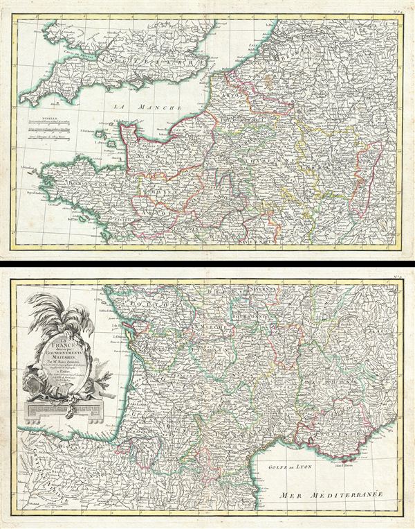
La France divisee par Gouvernements Militaires.
sold
- Digital Map Information
- Suitable for large format printing
- DPI: 300
- File Size: 21.53 MB
- File Type: ZIP / TIFF
- ICC color profile embedded
- Delivered instantly via download link
A beautiful example of Zannoni's 1783 decorative two panel map of France. The lower sheet covers from Valladolid, Spain, eastwards as far as Piedmont and northwards to Navernois. The northern sheet covers from Bretagne eastward as far as ... (more details)

L'Europe divisee en ses Principaux Etats.
sold
- Digital Map Information
- Suitable for large format printing
- DPI: 300
- File Size: 9.95 MB
- File Type: ZIP / TIFF
- ICC color profile embedded
- Delivered instantly via download link
A beautiful example of Jean Janvier's 1782 decorative map of the europe. Janvier's map covers from Iceland to the Caspian Sea and from North Africa to the Arctic. This map is divided into countries and kingdoms with color coding according ... (more details)

Sphere de Ptolomee.
sold
- Digital Map Information
- Suitable for large format printing
- DPI: 300
- File Size: 8.35 MB
- File Type: ZIP / TIFF
- ICC color profile embedded
- Delivered instantly via download link
A beautiful 1783 example of Rigobert Bonne's curious decorative chart of the Spheres. Features five different spheres used in mapmaking and calculating map projections. From top left, Sphere de Ptolomee, Sphere Droite (Right Sphere), ... (more details)
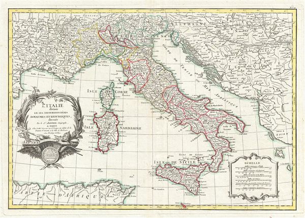
L'Italie divisee en ses differents etats Royaumes et Republiques.
sold
- Digital Map Information
- Suitable for large format printing
- DPI: 300
- File Size: 9.71 MB
- File Type: ZIP / TIFF
- ICC color profile embedded
- Delivered instantly via download link
A beautiful example of Le Sieur Janvier's 1783 decorative map of Italy. Janvier's map covers from the Gulf of eyon eastward to include all of Corsica, Sardinia, Italy, the Adriatic, and parts of Hungary and Turkey in europe. It ... (more details)

Le Royaume de Hongrie Divisee en Haute et Basse Hongrie, Transilvanie, Esclavonie et Croatie.
sold
- Digital Map Information
- Suitable for large format printing
- DPI: 300
- File Size: 8.5 MB
- File Type: ZIP / TIFF
- ICC color profile embedded
- Delivered instantly via download link
A beautiful example of Le Sieur Janvier's 1783 map of southeastern europe. Janvier's map covers much of modern Hungary, Romania, Transylvania, Moldova, Bosnia, Serbia, Croatia, Bulgaria, and parts of Austria, Poland, and Greece. ... (more details)

Les Couronnes du Nord Comprenant Les Royaumes de Suede Danemarck et Norwege divisees par Provinces et Gouvernements.
sold
- Digital Map Information
- Suitable for large format printing
- DPI: 300
- File Size: 10.35 MB
- File Type: ZIP / TIFF
- ICC color profile embedded
- Delivered instantly via download link
A beautiful example of Jean Janvier's 1762 decorative map of Scandinavia. Janvier's map covers from Iceland and england eastward as far as Moscow, north to the Arctic Sea, and south as far as Denmark and Germany. The map includes ... (more details)

Turquie d'Europe et Partie de Celle d'Asie divisee par grandes Provinces et Gouvernemts.
sold
- Digital Map Information
- Suitable for large format printing
- DPI: 300
- File Size: 9.84 MB
- File Type: ZIP / TIFF
- ICC color profile embedded
- Delivered instantly via download link
A beautiful example of Janvier's 1783 decorative map of Turkey in europe. Janvier's map covers from Croatia and the boot of Italy eastward as far as the Crimea, the Black Sea, Cappadocia, and Cyprus. It extends southwards as far ... (more details)

Carte De L'Egypte Ancienne et Moderne Dresse sur plusieurs Cartes Manus crites, assijeties aux observations Astronomique, Combinees avec les Itineraires Anciens et Modernes.
sold
- Digital Map Information
- Suitable for large format printing
- DPI: 300
- File Size: 8.96 MB
- File Type: ZIP / TIFF
- ICC color profile embedded
- Delivered instantly via download link
A beautiful example of Rigobert Bonne's 1762 decorative map egypt. Bonne's map covers from the Nile Delta south as far as Aswan and the border with Nubia and includes the Sinai and parts of the Red Sea. The map identifies both ... (more details)

Carte des Cotes de Barbarie ou Les Royaumes de Marco, de Fez, d'Alger, de Tunis, et de Tripoli avec les Pays Circonvoisins.
sold
- Digital Map Information
- Suitable for large format printing
- DPI: 300
- File Size: 9.17 MB
- File Type: ZIP / TIFF
- ICC color profile embedded
- Delivered instantly via download link
A beautiful example of Rigobert Bonne's decorative 1783 map of the Maghreb or Barbary Coast. Covers northwestern Africa and the western Mediterranean. This region consists of the modern day nations of Tunisia, Libya, Algeria ... (more details)

Les Isles Britanniques Comprenant les Royaumes D'Angleterre, D'Ecosse et D'Irlande divisee en grands provinces.
sold
- Digital Map Information
- Suitable for large format printing
- DPI: 300
- File Size: 8.66 MB
- File Type: ZIP / TIFF
- ICC color profile embedded
- Delivered instantly via download link
A beautiful example of Janvier's 1783 decorative map of the British Isles. Includes all of england, Scotland and Ireland as well as parts of adjacent France, Holland and Belgium. Divided according to provinces. An inset in ... (more details)

Carte des Douze Tribus d'Israel.
sold
- Digital Map Information
- Suitable for large format printing
- Full resolution TIFF file
- ICC color profile embedded
- Delivered instantly via download link
A beautiful example of Rigobert Bonne's 1783 map of Israel (Palestine / Holy Land) divided according to the Biblical Twelve Tribes of Israel. Bonne's map covers Palestine / Israel on both sides of the Jordan River from Sidon ... (more details)

Carte Generale de la Pologne avec tous les Etats qui en dependent.
sold
- Digital Map Information
- Suitable for large format printing
- Full resolution TIFF file
- ICC color profile embedded
- Delivered instantly via download link
A beautiful example of Rizzi-Zannoni's c. 1783 decorative map of the Poland, Lithuania, and their tributaries. This map covers from Denmark and Germany eastward to Russia, northwards to Livonia and south to Hungary. ... (more details)
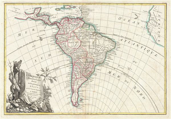
L'Amerique Meridionale divisee en ses principaux Etats.
sold
- Digital Map Information
- Suitable for large format printing
- Full resolution TIFF file
- ICC color profile embedded
- Delivered instantly via download link
A beautiful example of Jan Janvier's 1762 decorative map of South America. Covers from the island of Hispaniola and the Yucatan south to Tierra del Fuego and Cape Horn, east to Africa, and west to Mexico. Details ... (more details)
Identifies the Sea of Korea.
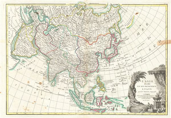
L'Asie divisee en ses Principaux Etats.
sold
- Digital Map Information
- Suitable for large format printing
- DPI: 300
- File Size: 8.4 MB
- File Type: ZIP / TIFF
- ICC color profile embedded
- Delivered instantly via download link
A beautiful example of Le Sieur Janvier's 1783 map of Asia. Covers from Africa and the Mediterranean east to Bering Strait (Detroit du Norte ou d'Anian) and south as far as Java and New Guinea. This map is most ... (more details)