

View of The Old City of Edinburgh, From an original drawing by the Marchionefs of Stafford.
sold
- Digital Map Information
- Suitable for large format printing
- DPI: 300
- File Size: 3.31 MB
- File Type: ZIP / TIFF
- ICC color profile embedded
- Delivered instantly via download link
This is an uncommon example of the 1828 view of edinburgh, Scotland, drawn by W. M. Craig from the original drawing by the Marchionefs of Stafford. It features a lovely view of the old city of edinburgh, nicknamed 'Athens of the North.' This view was engraved by ... (more details)

View of Quebec, the Capital of British America.
sold
- Digital Map Information
- Suitable for large format printing
- DPI: 300
- File Size: 3.02 MB
- File Type: ZIP / TIFF
- ICC color profile embedded
- Delivered instantly via download link
This is an uncommon example of the 1828 view of Quebec, the capital of British America, drawn by W. M. Craig. It features a lovely view of Quebec from across the St. Lawrence. The fortifications of the city can be seen in the background. This view was engraved ... (more details)

Paris from Charllote.
sold
- Digital Map Information
- Suitable for large format printing
- DPI: 300
- File Size: 3.15 MB
- File Type: ZIP / TIFF
- ICC color profile embedded
- Delivered instantly via download link
This is an uncommon example of the 1828 view of Paris, drawn by W. M. Craig. It features a lovely view of Paris. The River Seine is visible in the background. The foreground features a fruit vendor, a woman and a young child. This view was engraved by J. B. ... (more details)

View of Boston from Roxbury.
sold
- Digital Map Information
- Suitable for large format printing
- DPI: 300
- File Size: 2.77 MB
- File Type: ZIP / TIFF
- ICC color profile embedded
- Delivered instantly via download link
This is an uncommon example of the 1828 view of Boston, Massachusetts, drawn by J. R. Smith. It features a lovely view of the city of Boston from Roxbury. The Bulfinch's State House can be seen in the distance. This view was engraved by J. B. Neagle as part ... (more details)

Baltimore.
sold
- Digital Map Information
- Suitable for large format printing
- Full resolution TIFF file
- ICC color profile embedded
- Delivered instantly via download link
This is an uncommon example of the 1828 view of Baltimore, Maryland drawn by J. R. Smith. It features a lovely view of the Baltimore Harbor. A few small boats can be seen in the foreground. The Washington Monument can be seen in the background. This view ... (more details)

Austria.
sold
- Digital Map Information
- Suitable for large format printing
- DPI: 300
- File Size: 3.35 MB
- File Type: ZIP / TIFF
- ICC color profile embedded
- Delivered instantly via download link
This is an attractive example of the 1828 Malte-Brun map of Austria. The map covers the territory of the Austro-Hungarian empire, inclusive of all of Austria, the Italian provinces of Lombardy, Tyrol, Venice, Dalmatia, Hungary, Croatia, the Bohemia, and ... (more details)

Turkey in Europe.
sold
- Digital Map Information
- Suitable for large format printing
- DPI: 300
- File Size: 4.13 MB
- File Type: ZIP / TIFF
- ICC color profile embedded
- Delivered instantly via download link
This is an attractive example of the 1828 Malte-Brun map of Turkey in europe. Representing the european lands claimed by the Ottoman empire in the early 19th century, the map covers the modern day nations of Greece, Macedonia, Albania, Croatia, Bosnia, ... (more details)
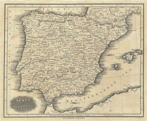
Spain and Portugal.
sold
- Digital Map Information
- Suitable for large format printing
- DPI: 300
- File Size: 3.5 MB
- File Type: ZIP / TIFF
- ICC color profile embedded
- Delivered instantly via download link
This is an attractive example of the 1828 Malte-Brun map of Spain and Portugal. The map covers the Iberian Peninsula from the Bay of Biscay in the north to the Strait of Gibraltar in the south and from the Atlantic Ocean to Catalonia in the east. The ... (more details)
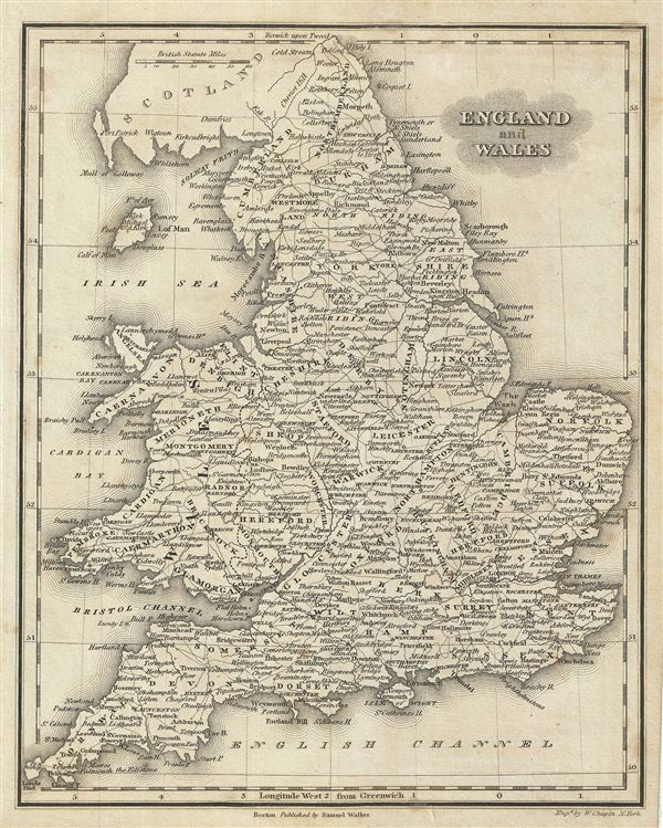
England and Wales.
sold
- Digital Map Information
- Suitable for large format printing
- DPI: 300
- File Size: 3.88 MB
- File Type: ZIP / TIFF
- ICC color profile embedded
- Delivered instantly via download link
This is an attractive example of the 1828 Malte-Brun map of england and Wales. The map covers both england and Wales from Northumberland to Cornwall and includes the Isle of Man. Various, important rivers, islands, cities and other topographical ... (more details)

Turkey in Asia.
sold
- Digital Map Information
- Suitable for large format printing
- DPI: 300
- File Size: 3.86 MB
- File Type: ZIP / TIFF
- ICC color profile embedded
- Delivered instantly via download link
This is an attractive example of the 1828 Malte-Brun map of Turkey in Asia. The map covers from the Black Sea to Arabia, inclusive Cyprus. Centered on the Holy land (Palestine / Israel), the map covers the modern day countries of Turkey, ... (more details)

Sicily.
sold
- Digital Map Information
- Suitable for large format printing
- DPI: 300
- File Size: 3.51 MB
- File Type: ZIP / TIFF
- ICC color profile embedded
- Delivered instantly via download link
This is an attractive example of the 1828 Malte-Brun map of Sicily. Malte-Brun's map covers the entire island of Sicily as well as the nearby Isles of Lipari (Aeolian Islands), part of the volcanic archipelago. Mount etna or Mongirello, ... (more details)

Italy.
sold
- Digital Map Information
- Suitable for large format printing
- DPI: 300
- File Size: 3.58 MB
- File Type: ZIP / TIFF
- ICC color profile embedded
- Delivered instantly via download link
This is an attractive example of the 1828 Malte-Brun map of Italy. It covers the entire Italian peninsula from Switzerland to Sicily. The islands of Corsica and Sardinia are also included. This map predates the Italian solidarity ... (more details)

Ireland.
sold
- Digital Map Information
- Suitable for large format printing
- DPI: 300
- File Size: 3.46 MB
- File Type: ZIP / TIFF
- ICC color profile embedded
- Delivered instantly via download link
This is an attractive example of the 1828 Malte-Brun map of Ireland. It covers the entirety of Ireland with exceptional detail throughout. Various, important rivers, islands, cities and other topographical details are noted. This ... (more details)
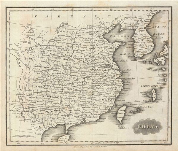
China.
sold
- Digital Map Information
- Suitable for large format printing
- DPI: 300
- File Size: 3.29 MB
- File Type: ZIP / TIFF
- ICC color profile embedded
- Delivered instantly via download link
This is an attractive example of the 1828 Malte-Brun map of China. The map covers the region from Chinese Tartary in the north to Hainan in the south. The North Vietnamese empire of Tonkin (Tungquin), Korea, Formosa or Taiwan, and ... (more details)

Africa.
sold
- Digital Map Information
- Suitable for large format printing
- DPI: 300
- File Size: 3.22 MB
- File Type: ZIP / TIFF
- ICC color profile embedded
- Delivered instantly via download link
This is an attractive example of the 1828 Malte-Brun map of Africa. The map covers the entire continent from the tip of Spain to Cape Colony, including Madagascar. This uncommon map predates the explosion of African exploration ... (more details)

Hindoostan.
sold
- Digital Map Information
- Suitable for large format printing
- DPI: 300
- File Size: 3.46 MB
- File Type: ZIP / TIFF
- ICC color profile embedded
- Delivered instantly via download link
This is an attractive example of the 1828 Malte-Brun map of India or Hindoostan. The map covers the entire subcontinent from the Gobi Desert to Sri Lanka (Ceylon). The Maldives and the Lakshadweep Islands (Laccadivas) are ... (more details)
Identifies the 'Sea of Korea'.

Asia.
sold
- Digital Map Information
- Suitable for large format printing
- DPI: 300
- File Size: 3.55 MB
- File Type: ZIP / TIFF
- ICC color profile embedded
- Delivered instantly via download link
This is an attractive example of the 1828 Malte-Brun map of Asia. The map covers the continent from the Red Sea and Arabia eastward to New Guinea. Australia (New Holland) and Madagascar are also included. The Great Wall ... (more details)

East India Islands.
sold
- Digital Map Information
- Suitable for large format printing
- Full resolution TIFF file
- ICC color profile embedded
- Delivered instantly via download link
This is an attractive example of the 1828 Malte-Brun map of the east Indies. Centered on Borneo, the map covers from Burma in the extreme northwest to New Guinea and east Timor in the southeast. The modern day countries ... (more details)

West India Islands.
sold
- Digital Map Information
- Suitable for large format printing
- DPI: 300
- File Size: 3.09 MB
- File Type: ZIP / TIFF
- ICC color profile embedded
- Delivered instantly via download link
This is an attractive example of the 1828 Malte-Brun map of the West Indies. Centered on Santo Domingo (Hispaniola), the map covers from Florida and the Bahamas south through the Caribbean islands of Cuba and Hispaniola ... (more details)
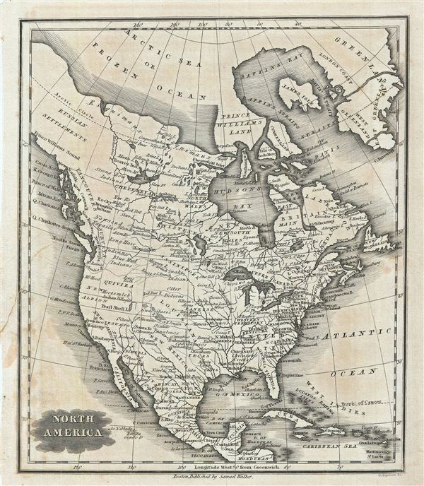
North America.
sold
- Digital Map Information
- Suitable for large format printing
- DPI: 300
- File Size: 3.79 MB
- File Type: ZIP / TIFF
- ICC color profile embedded
- Delivered instantly via download link
This is an attractive example of the 1828 Malte-Brun map of North America. It covers from Baffin Bay (Baffins Bay) to Honduras. This map predates the Mexican American War consequently most of California, New Mexico, ... (more details)