

County map of Virginia and West Virginia.
sold
- Digital Map Information
- Suitable for large format printing
- File Size: 8.41 MB
- File Type: ZIP / TIFF
- ICC color profile embedded
- Delivered instantly via download link
A beautiful example of the American map publisher Samuel Augustus Mitchell Jr.'s 1872 map of the states of Virginia and West Virginia. The map includes all of the territory between the Ohio River and Cumberland Mountains east to the Chesapeake Bay and Atlantic ... (more details)
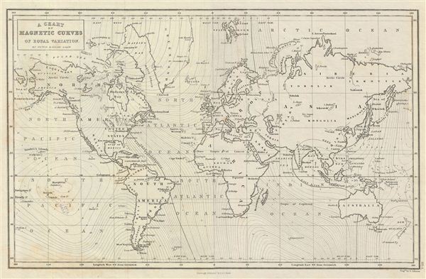
A Chart of Magnetic Curves of Equal Variation.
sold
- Digital Map Information
- Suitable for large format printing
- DPI: 300
- File Size: 5.73 MB
- File Type: ZIP / TIFF
- ICC color profile embedded
- Delivered instantly via download link
This is a fine example of Adam and Charles Black's 1851 map of the world illustrating 'magnetic curves of equal variation'. The map is the product of Peter Barlow's groundbreaking research into magnetic variation. It is based on Barlow's unobtainable larger-scale chart published in 1833, A chart of magnetic curves of equal variation between the latitudes of 60°N and 55°S. (more details)

Italy, North Part.
sold
- Digital Map Information
- Suitable for large format printing
- DPI: 300
- File Size: 6.65 MB
- File Type: ZIP / TIFF
- ICC color profile embedded
- Delivered instantly via download link
A fine example of Adam and Charles Black's 1851 map of northern Italy. The map covers the island of Corsica and Northern Italy, including the territories of Tuscany, Modena, Parma, the Sardinian States, Austrian Lombardy and the State of the Church. It also ... (more details)
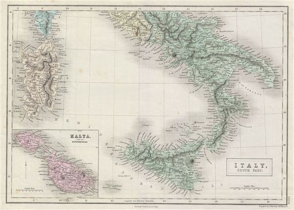
Italy, South Part.
sold
- Digital Map Information
- Suitable for large format printing
- DPI: 300
- File Size: 5.66 MB
- File Type: ZIP / TIFF
- ICC color profile embedded
- Delivered instantly via download link
A fine example of Adam and Charles Black's 1851 map of southern Italy. The map covers the Kingdom of Naples (a common reference for the 'Kingdom of the Two Sicilies'), which extended from the Papal States south to include all of Sicily. It also shows the ... (more details)

Asia.
sold
- Digital Map Information
- Suitable for large format printing
- DPI: 300
- File Size: 6.96 MB
- File Type: ZIP / TIFF
- ICC color profile embedded
- Delivered instantly via download link
A fine example of Adam and Charles Black's 1851 map of Asia. The map covers the entire Asian continent from the Arctic Ocean to the Indian Ocean and from the Mediterranean Sea to the North Pacific Ocean. The map covers Turkey, Arabia, Persia, the Indian ... (more details)
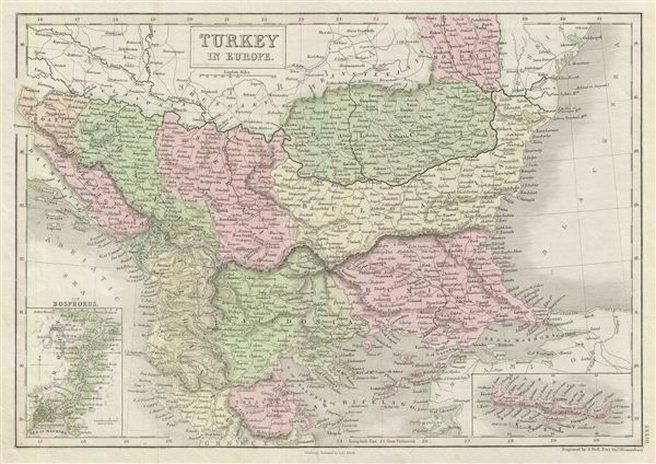
Turkey in Europe.
sold
- Digital Map Information
- Suitable for large format printing
- DPI: 300
- File Size: 6.91 MB
- File Type: ZIP / TIFF
- ICC color profile embedded
- Delivered instantly via download link
A fine example of Adam and Charles Black's 1851 map of the european parts of Turkey. Centered on the Aegean Sea, this map covers from Moldova to Thessaly and from the Adriatic to the Black Sea. This map, drawn when the Ottoman empire controlled much of ... (more details)
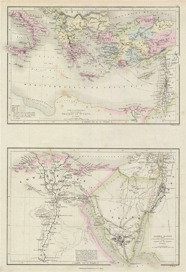
The Countries embraced within the Travels of St. Paul. Lower Egypt with the Peninsula of Mt. Sinai and the Journeys of the Israelites.
sold
- Digital Map Information
- Suitable for large format printing
- DPI: 300
- File Size: 6.9 MB
- File Type: ZIP / TIFF
- ICC color profile embedded
- Delivered instantly via download link
A fine example of Adam and Charles Black's 1851 map of Greece, Italy, Asia Minor and Lower egypt in antiquity. The map is divided into two parts: The upper map covers the countries traveled by St. Paul, which include Italy, Greece and the Balkans and ... (more details)
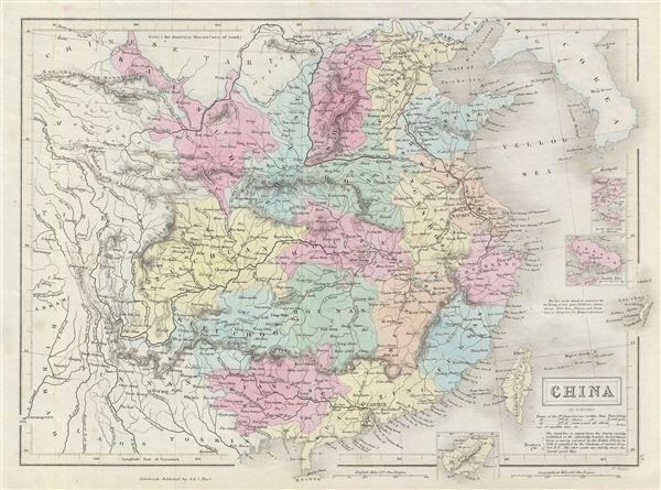
China.
sold
- Digital Map Information
- Suitable for large format printing
- DPI: 300
- File Size: 6.47 MB
- File Type: ZIP / TIFF
- ICC color profile embedded
- Delivered instantly via download link
A fine example of Adam and Charles Black's 1851 map of China. The map covers China from the Chinese Tartary to Hainan and from Assam in India to Korea (Corea), inclusive of Formosa or Taiwan. Four inset maps detail Amoy, Hong Kong, ZhouShan and ... (more details)
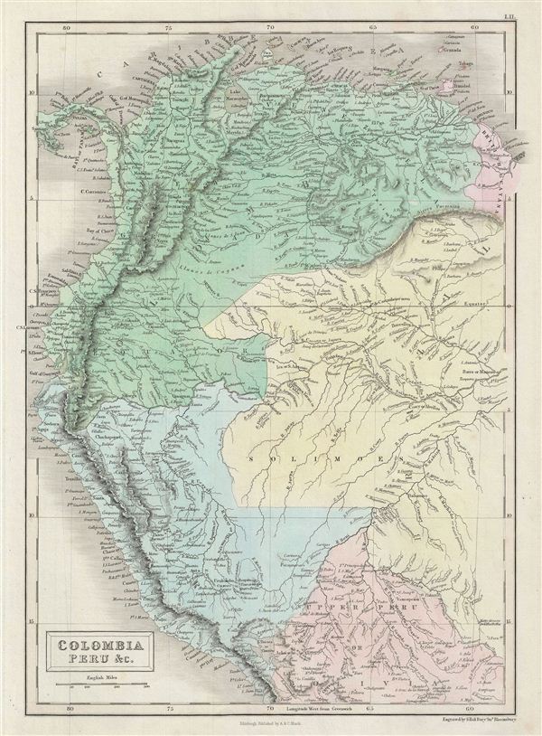
Colombia Peru &c.
sold
- Digital Map Information
- Suitable for large format printing
- DPI: 300
- File Size: 6.16 MB
- File Type: ZIP / TIFF
- ICC color profile embedded
- Delivered instantly via download link
A fine example of Adam and Charles Black's 1851 map of Colombia, Peru, Brazil and British Guyana. The map covers from Panama to Bolivia and east as far as British Guyana. envisioning an independent New World nation comprising all of the ... (more details)

The World as known to the Ancients.
sold
- Digital Map Information
- Suitable for large format printing
- DPI: 300
- File Size: 7.38 MB
- File Type: ZIP / TIFF
- ICC color profile embedded
- Delivered instantly via download link
A fine example of Adam and Charles Black's 1851 map of the world of the Roman empire. The map covers the span of world as known to the ancient Romans, from the Scandinavia south, as far as Sumatra. Includes all of europe, Arabia, part ... (more details)

United States.
sold
- Digital Map Information
- Suitable for large format printing
- Full resolution TIFF file
- ICC color profile embedded
- Delivered instantly via download link
A fine example of Adam and Charles Black's 1849 map of the United States. Covers the populous eastern portions of the United States from Lake Superior in the north to the Florida Keys in the south and from Missouri in the west to Maine ... (more details)
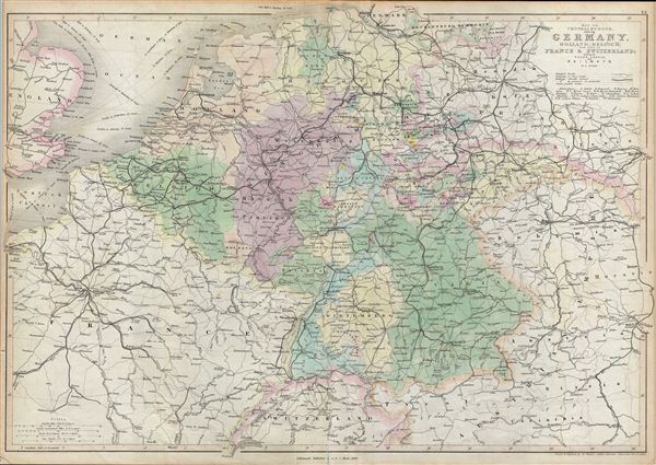
Map of Central Europe embracing Germany, Holland, Belgium, France, Switzerland; showing the Roads, Canals, and Railways.
sold
- Digital Map Information
- Suitable for large format printing
- DPI: 300
- File Size: 15.58 MB
- File Type: ZIP / TIFF
- ICC color profile embedded
- Delivered instantly via download link
A fine example of Adam and Charles Black's 1851 map of central europe. The map covers from Hamburg to Lake Geneva. Includes the modern day countries of Germany, Netherlands, Belgium, France, Poland, the Czech Republic and Austria. ... (more details)
One of the earliest American maps to identify both Mt. Kenya and Mt. Kilimanjaro.

Africa Southern Sheet.
sold
- Digital Map Information
- Suitable for large format printing
- File Size: 27.21 MB
- File Type: ZIP / TIFF
- ICC color profile embedded
- Delivered instantly via download link
A beautiful 1855 first edition example of Colton's map of southern Africa. Like most of Colton's Africa maps, this map is derived from an earlier wall map of the world produced by Colton and D. Griffing Johnson. The map depicts ... (more details)

Africa North Western Sheet.
sold
- Digital Map Information
- Suitable for large format printing
- File Size: 8.92 MB
- File Type: ZIP / TIFF
- ICC color profile embedded
- Delivered instantly via download link
A beautiful 1855 first edition example of Colton's map of north western Africa. Like most of Colton's Africa maps, this map is derived from an earlier wall map of the world produced by Colton and D. Griffing Johnson. The map ... (more details)

Hawaiian Group or Sandwich Islands. New Zealand. Viti Group or Feejee Islands. Society Islands. Marquesas or Washington Is. Galapagos Islands. Samoan or Navigators Is.
sold
- Digital Map Information
- Suitable for large format printing
- File Size: 2.5 MB
- File Type: ZIP / TIFF
- ICC color profile embedded
- Delivered instantly via download link
A beautiful 1855 first edition example of Colton's map of Hawaii, New Zealand, and several Polynesian island groups. The sheet contains seven separate maps. The top map, occupying the upper half of the sheet, details the ... (more details)
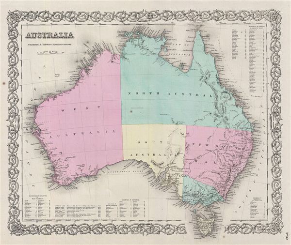
Australia.
sold
- Digital Map Information
- Suitable for large format printing
- File Size: 8.93 MB
- File Type: ZIP / TIFF
- ICC color profile embedded
- Delivered instantly via download link
A beautiful 1855 first edition example of Colton's map of Australia. Like most of Colton's Australia maps, this map is derived from an earlier wall map of the world produced by Colton and D. Griffing Johnson. Colton's ... (more details)
One of the earliest American maps to detail Singapore.

East Indies.
sold
- Digital Map Information
- Suitable for large format printing
- File Size: 10.75 MB
- File Type: ZIP / TIFF
- ICC color profile embedded
- Delivered instantly via download link
An excellent 1855 first edition example of Colton's map of the east Indies. Like most of Colton's Asia maps, this map was derived from an earlier wall map of the world produced by Colton and D. Griffing Johnson. ... (more details)

Hindostan or British India.
sold
- Digital Map Information
- Suitable for large format printing
- File Size: 10.15 MB
- File Type: ZIP / TIFF
- ICC color profile embedded
- Delivered instantly via download link
An excellent 1855 first edition example of Colton's map of India. Like most of Colton's Asia maps, this map was derived from an earlier wall map of the world produced by Colton and D. Griffing Johnson. Covers ... (more details)

Japan Nippon, Kiusiu, Sikok, Yesso and the Japanese Kuriles.
sold
- Digital Map Information
- Suitable for large format printing
- File Size: 9.27 MB
- File Type: ZIP / TIFF
- ICC color profile embedded
- Delivered instantly via download link
An excellent 1855 first edition example of Colton's map of Japan. Like most of Colton's Asia maps, this map was derived from an earlier wall map of the world produced by Colton and D. Griffing Johnson. ... (more details)

China.
sold
- Digital Map Information
- Suitable for large format printing
- File Size: 9.85 MB
- File Type: ZIP / TIFF
- ICC color profile embedded
- Delivered instantly via download link
An excellent 1855 first edition example of Colton's map of China, Korea and Taiwan. Like most of Colton's Asia maps, this map was derived from an earlier wall map of the world produced by Colton and D. ... (more details)