

South America.
sold
- Digital Map Information
- Suitable for large format printing
- File Size: 8.85 MB
- File Type: ZIP / TIFF
- ICC color profile embedded
- Delivered instantly via download link
A beautiful 1855 first edition example of Colton's map of South America. Covers the entire continent from the Caribbean to Tierra del Fuego and from the Pacific to the Atlantic. Includes the Galapagos, Juan Fernandez, Falkland and South Georgia island groups. ... (more details)

Cuba, Jamaica and Porto Rico.
sold
- Digital Map Information
- Suitable for large format printing
- File Size: 9.49 MB
- File Type: ZIP / TIFF
- ICC color profile embedded
- Delivered instantly via download link
A beautiful 1855 first edition example of Colton's map of Cuba, Jamaica, Porto Rico and the Bahamas. Like most of Colton's North America maps, this map was derived from an earlier wall map of North America produced by Colton and D. Griffing Johnson. Centered on ... (more details)

West Indies.
sold
- Digital Map Information
- Suitable for large format printing
- File Size: 9.61 MB
- File Type: ZIP / TIFF
- ICC color profile embedded
- Delivered instantly via download link
An excellent 1855 first edition example of Colton's map of the West Indies. Like most of Colton's North America maps, this map was derived from an earlier wall map of North America produced by Colton and D. Griffing Johnson. Centered on Santo Domingo ... (more details)

Central America.
sold
- Digital Map Information
- Suitable for large format printing
- File Size: 9.07 MB
- File Type: ZIP / TIFF
- ICC color profile embedded
- Delivered instantly via download link
An excellent 1855 first edition example of Colton's map of Central America and Jamaica. Like most of Colton's North America maps, this map was derived from an earlier wall map of North America produced by Colton and D. Griffing Johnson. Covers from ... (more details)

Mexico.
sold
- Digital Map Information
- Suitable for large format printing
- File Size: 9.6 MB
- File Type: ZIP / TIFF
- ICC color profile embedded
- Delivered instantly via download link
An excellent 1855 first edition example of Colton's map of Mexico. Like most of Colton's North America maps, this map was derived from an earlier wall map of North America produced by Colton and D. Griffing Johnson. Covers all of modern day Mexico ... (more details)
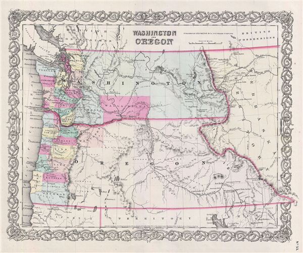
Washington And Oregon.
sold
- Digital Map Information
- Suitable for large format printing
- File Size: 7.85 MB
- File Type: ZIP / TIFF
- ICC color profile embedded
- Delivered instantly via download link
An excellent 1855 first edition example of Colton's map of Washington and Oregon. This is one of the rarest and most desirable of all Colton atlas maps. Like most of Colton's state maps, this map was derived from an earlier wall map of North ... (more details)
An iconic map of the American southwest.
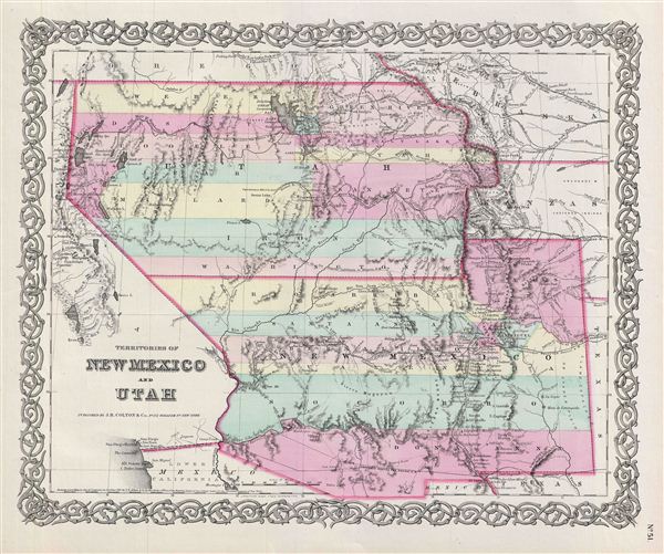
Territories Of New Mexico and Utah.
sold
- Digital Map Information
- Suitable for large format printing
- File Size: 8.28 MB
- File Type: ZIP / TIFF
- ICC color profile embedded
- Delivered instantly via download link
A beautiful 1855 first edition example of Colton's map of territories of New Mexico and Utah. This iconic map is one of the rarest and most desirable of all Colton atlas maps. Like most of Colton's state maps, this map was derived from an ... (more details)
Territorial Nebraska at its fullest extending form 'Kanzas' to Canada.
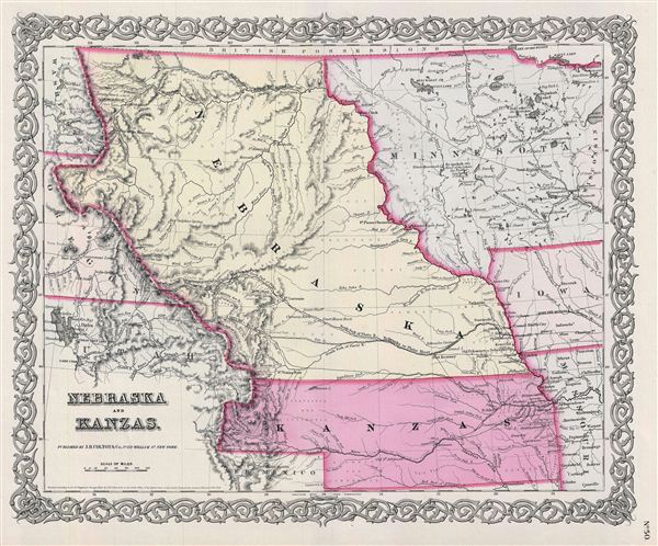
Nebraska and Kanzas.
sold
- Digital Map Information
- Suitable for large format printing
- File Size: 8.24 MB
- File Type: ZIP / TIFF
- ICC color profile embedded
- Delivered instantly via download link
A beautiful 1855 first edition example of Colton's map of Nebraska and Kansas. This is most probably the rarest and most desirable of all Colton atlas maps. Like most of Colton's state maps, this map was derived from an earlier wall map ... (more details)

Minnesota.
sold
- Digital Map Information
- Suitable for large format printing
- File Size: 8.48 MB
- File Type: ZIP / TIFF
- ICC color profile embedded
- Delivered instantly via download link
A beautiful 1855 first edition example of Colton's map of Minnesota. This is one of the most desirable of all Colton atlas maps. Like most of Colton's state maps, this map was derived from an earlier wall map of North America produced ... (more details)

Wisconsin.
sold
- Digital Map Information
- Suitable for large format printing
- File Size: 9.75 MB
- File Type: ZIP / TIFF
- ICC color profile embedded
- Delivered instantly via download link
An excellent 1855 first edition example of Colton's map of Wisconsin. Like most of Colton's state maps, this map was derived from an earlier wall map of North America produced by Colton and D. Griffing Johnson. Covers the entire state ... (more details)
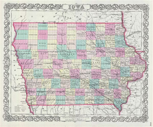
Iowa.
sold
- Digital Map Information
- Suitable for large format printing
- File Size: 9.25 MB
- File Type: ZIP / TIFF
- ICC color profile embedded
- Delivered instantly via download link
An excellent 1855 first edition example of Colton's map of Iowa. Like most of Colton's state maps, this map was derived from an earlier wall map of North America produced by Colton and D. Griffing Johnson. Covers the entire state of ... (more details)
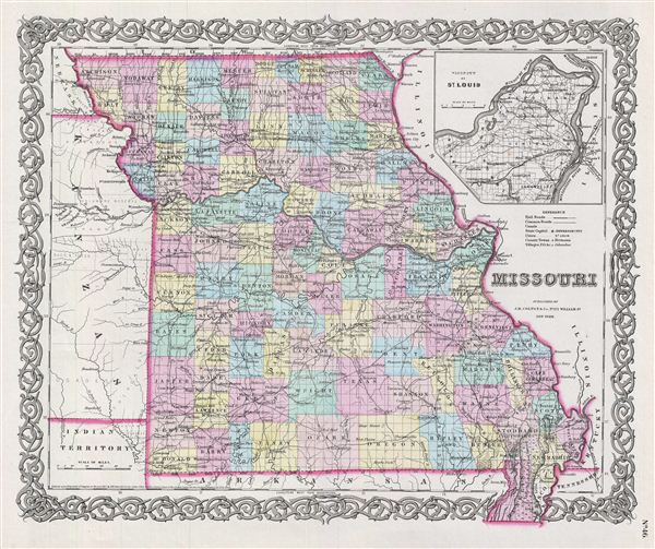
Missouri.
sold
- Digital Map Information
- Suitable for large format printing
- File Size: 8.85 MB
- File Type: ZIP / TIFF
- ICC color profile embedded
- Delivered instantly via download link
An excellent 1855 first edition example of Colton's map of Missouri. Like most of Colton's state maps, this map was derived from an earlier wall map of North America produced by Colton and D. Griffing Johnson. Covers the entire ... (more details)

The City of St. Louis Missouri. The City of Chicago Illinois.
sold
- Digital Map Information
- Suitable for large format printing
- File Size: 8.13 MB
- File Type: ZIP / TIFF
- ICC color profile embedded
- Delivered instantly via download link
An excellent 1855 first edition example of Colton's rare two part map of Chicago, Illinois and St. Louis, Missouri. The map is divided into two sections. The right hand map, Chicago, Illinois, depicts from Reuben Street to Lake ... (more details)

Lake Superior and The Northern Part of Michigan.
sold
- Digital Map Information
- Suitable for large format printing
- File Size: 8.86 MB
- File Type: ZIP / TIFF
- ICC color profile embedded
- Delivered instantly via download link
An excellent 1855 first edition example of Colton's map of Lake Superior and Northern Michigan. Like most of Colton's state maps, this map was derived from an earlier wall map of North America produced by Colton and D. Griffing ... (more details)

Michigan.
sold
- Digital Map Information
- Suitable for large format printing
- File Size: 9.93 MB
- File Type: ZIP / TIFF
- ICC color profile embedded
- Delivered instantly via download link
An excellent 1855 first edition example of Colton's map of Michigan. Like most of Colton's state maps, this map was derived from an earlier wall map of North America produced by Colton and D. Griffing Johnson. Covers lower ... (more details)

Indiana.
sold
- Digital Map Information
- Suitable for large format printing
- File Size: 9.22 MB
- File Type: ZIP / TIFF
- ICC color profile embedded
- Delivered instantly via download link
An excellent 1855 first edition example of Colton's map of Indiana. Like most of Colton's state maps, this map was derived from an earlier wall map of North America produced by Colton and D. Griffing Johnson. Covers ... (more details)
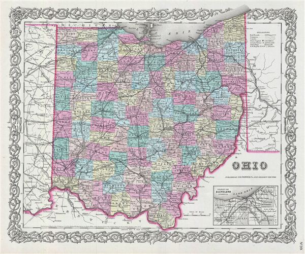
Ohio.
sold
- Digital Map Information
- Suitable for large format printing
- File Size: 9.5 MB
- File Type: ZIP / TIFF
- ICC color profile embedded
- Delivered instantly via download link
An excellent 1855 first edition example of Colton's map of Ohio. Like most of Colton's state maps, this map was derived from an earlier wall map of North America produced by Colton and D. Griffing Johnson. The map ... (more details)

Kentucky And Tennessee.
sold
- Digital Map Information
- Suitable for large format printing
- File Size: 9.79 MB
- File Type: ZIP / TIFF
- ICC color profile embedded
- Delivered instantly via download link
An excellent 1855 first edition example of Colton's map of Kentucky and Tennessee. Like most of Colton's state maps, this map was derived from an earlier wall map of North America produced by Colton and D. Griffing ... (more details)

Arkansas.
sold
- Digital Map Information
- Suitable for large format printing
- File Size: 8.59 MB
- File Type: ZIP / TIFF
- ICC color profile embedded
- Delivered instantly via download link
An excellent 1855 first edition example of Colton's map of Arkansas. Like most of Colton's state maps, this map was derived from an earlier wall map of North America produced by Colton and D. Griffing Johnson. ... (more details)

New Map of the State of Texas compiled from J. De Cordova's Large Map.
sold
- Digital Map Information
- Suitable for large format printing
- File Size: 18.8 MB
- File Type: ZIP / TIFF
- ICC color profile embedded
- Delivered instantly via download link
An excellent 1855 first edition example of Colton's rare map of Texas. Like most of Colton's state maps, this map was derived from an earlier wall map of North America produced by Colton and D. Griffing ... (more details)