

Carte de la Russie d'Europe.
sold
- Digital Map Information
- Suitable for large format printing
- DPI: 300
- File Size: 13.41 MB
- File Type: ZIP / TIFF
- ICC color profile embedded
- Delivered instantly via download link
A fine first edition example of M. Lapie's 1830 map of european Russia. The map covers Russia from the Arctic Ocean to Turkey and from the Kingdom of Sweden to Independent Tartary and Russia in Asia. In 1825, shortly before this map was drawn, Russian army ... (more details)
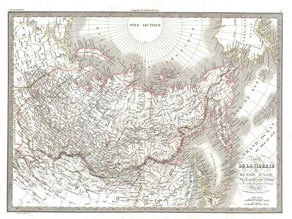
Carte de la Siberie ou Russie d'Asie.
sold
- Digital Map Information
- Suitable for large format printing
- DPI: 300
- File Size: 14.2 MB
- File Type: ZIP / TIFF
- ICC color profile embedded
- Delivered instantly via download link
A fine first edition example of M. Lapie's 1832 map of Russia in Asia. The map Asian Russia from the Arctic Pole to China and from european Russia to, Siberia, the Bering Strait, Pacific Ocean, and Alaska (Russian America). During this time in Russia, ... (more details)

Carte du Perou et du Haut Perou.
sold
- Digital Map Information
- Suitable for large format printing
- DPI: 300
- File Size: 10.69 MB
- File Type: ZIP / TIFF
- ICC color profile embedded
- Delivered instantly via download link
A fine first edition example of M. Lapie's 1829 map of Peru, ecuador, and Bolivia. The map shows all of Peru and Upper Peru (modern day Bolivia) from the Pacific Ocean to Brazil and from Colombia to Argentina (La Plata) and Chile. During this time in ... (more details)

Catre de l'Italie Ancienne.
sold
- Digital Map Information
- Suitable for large format printing
- DPI: 300
- File Size: 11.21 MB
- File Type: ZIP / TIFF
- ICC color profile embedded
- Delivered instantly via download link
A fine first edition example of M. Lapie's 1829 map of Italy during ancient Roman times. The map covers all of Italy in the days of the Roman empire from the Mediterranean Sea to the Adriatic and Ionian Sea, as well as parts of adjacent Numidia, ... (more details)

Catre de l'Inde en Deca et au Dela du Gange.
sold
- Digital Map Information
- Suitable for large format printing
- DPI: 300
- File Size: 13.58 MB
- File Type: ZIP / TIFF
- ICC color profile embedded
- Delivered instantly via download link
A fine first edition example of M. Lapie's 1829 map of India and Southeast Asia. The map covers all of what was once known as Greater and Lesser India, that is to say, all of modern India, Ceylon or Sri Lanka, Afghanistan, Bhutan, Nepal, ... (more details)
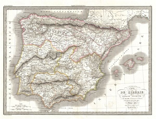
Carte de l'Iberie ou Espagne Ancienne.
sold
- Digital Map Information
- Suitable for large format printing
- DPI: 300
- File Size: 12.86 MB
- File Type: ZIP / TIFF
- ICC color profile embedded
- Delivered instantly via download link
A fine first edition example of M. Lapie's 1831 map of ancient Iberia or modern day Spain and Portugal. The map covers all of Iberia under the Roman Republic from the Atlantic Ocean to the Mediterranean Sea. This includes Hispanic ... (more details)
Reveals Greece after throwing off the Ottoman yolk.

Carte de la Grece, et de L'Archipel.
sold
- Digital Map Information
- Suitable for large format printing
- DPI: 300
- File Size: 13.75 MB
- File Type: ZIP / TIFF
- ICC color profile embedded
- Delivered instantly via download link
A fine first edition example of M. Lapie's 1829 map of Greece and the Balkands. The map covers Greece from and the Balkans from Romania to Crete (Candia) and from Asia Minor to the Ionian Sea. It includes Greece, Morea, Albania, ... (more details)
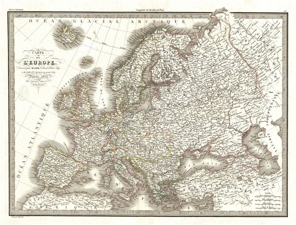
Carte de l'Europe.
sold
- Digital Map Information
- Suitable for large format printing
- DPI: 300
- File Size: 15.28 MB
- File Type: ZIP / TIFF
- ICC color profile embedded
- Delivered instantly via download link
A fine first edition example of M. Lapie's 1833 map of europe. The map covers all of europe from the Atlantic Ocean to the eastern edges of Siberia and Independent Tartary, and from the Arctic Ocean to northern Africa and Turkey. ... (more details)
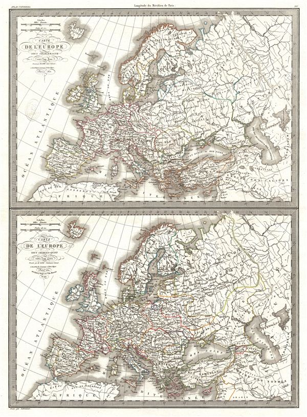
Carte de l'Europe sous Charlemagne vers l'an 800. Carte de l'Europe sous Charles-Quint vers l'an 1500.
sold
- Digital Map Information
- Suitable for large format printing
- DPI: 300
- File Size: 14.17 MB
- File Type: ZIP / TIFF
- ICC color profile embedded
- Delivered instantly via download link
A fine first edition example of M. Lapie's map contrasting europe under Charlemagne in 800 versus europe under Charles V in 1500. The map is divided into two parts, with the upper showing europe under Charlemagne in 800 AD and ... (more details)
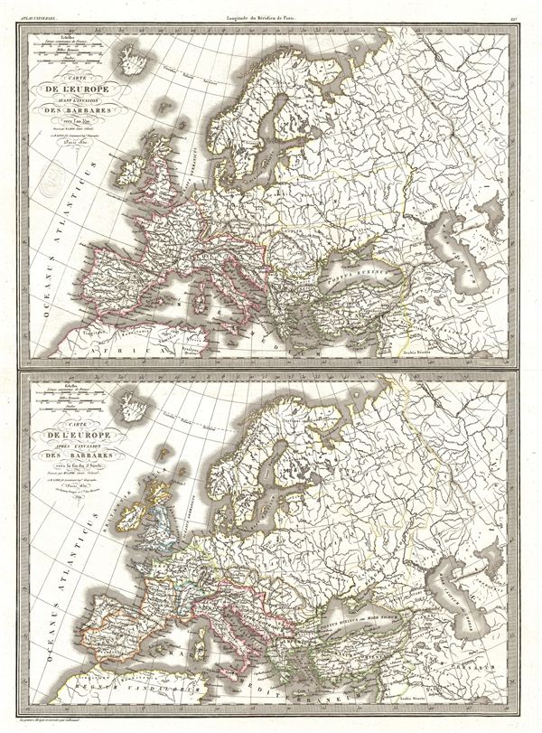
Carte de l'Europe avant l'invasion des Barbares vers l'an 350. Carte de l'Europe apres l'invasion des Barbares vers la fin du 5e siecle.
sold
- Digital Map Information
- Suitable for large format printing
- DPI: 300
- File Size: 12.33 MB
- File Type: ZIP / TIFF
- ICC color profile embedded
- Delivered instantly via download link
A fine first edition example of M. Lapie's map depicting europe before and after the so-called Barbarian Invasions, which saw the western Roman empire fall to Goths, Visigoths, and Vandals, and much of central and northern ... (more details)

Carte de l'Europe en 1789. Carte de l'Europe en 1813.
sold
- Digital Map Information
- Suitable for large format printing
- DPI: 300
- File Size: 13.29 MB
- File Type: ZIP / TIFF
- ICC color profile embedded
- Delivered instantly via download link
A fine first edition example of M. Lapie's maps of europe in 1789 and 1813. The sheet is divided into two parts: the upper half maps europe on the eve of the 1789 French Revolution; the lower half maps Napoleonic europe ... (more details)
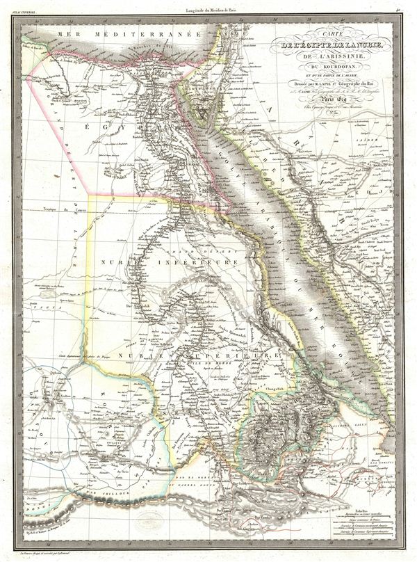
Carte de l'Egypte de la Nubie, de l'Abissinie, du Kourdofan.
sold
- Digital Map Information
- Suitable for large format printing
- DPI: 300
- File Size: 11.32 MB
- File Type: ZIP / TIFF
- ICC color profile embedded
- Delivered instantly via download link
A fine first edition example of M. Lapie's 1829 map of egypt. The map covers the lower Nile valley including egypt and Nubia, as well as the adjacent Arabian Gulf or Red Sea, Mediterranean Sea, Arabia, Kordofan, Sudan, ... (more details)
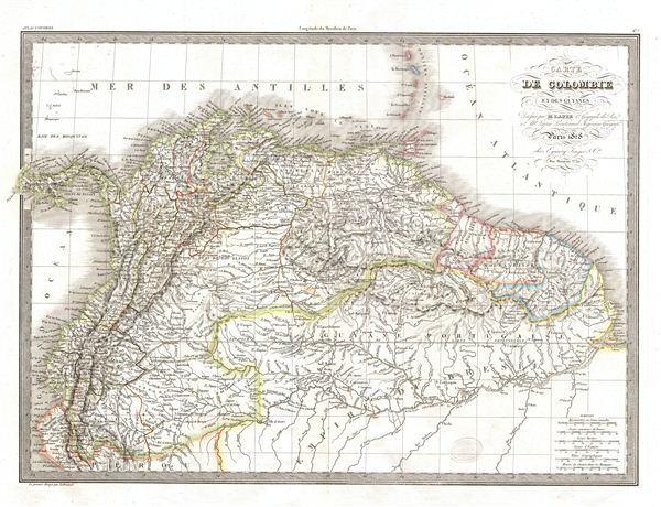
Carte de Colombie et des Guyanes.
sold
- Digital Map Information
- Suitable for large format printing
- DPI: 300
- File Size: 12.82 MB
- File Type: ZIP / TIFF
- ICC color profile embedded
- Delivered instantly via download link
A fine first edition example of M. Lapie's 1828 map of Colombia and Guyana. The map covers all of Colombia from the Caribbean Sea in the north to Peru and the Brazil in the south. Lapie's map offers fine detail ... (more details)
Identifies both the Sea of Korea and the Sea of japan.
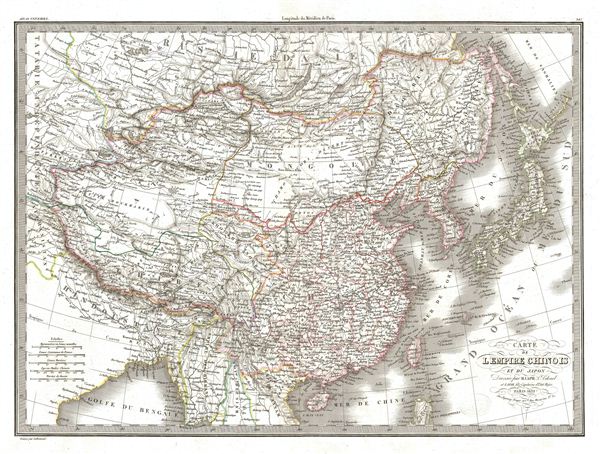
Carte de l'Empire Chinois et du Japon.
sold
- Digital Map Information
- Suitable for large format printing
- DPI: 300
- File Size: 13.64 MB
- File Type: ZIP / TIFF
- ICC color profile embedded
- Delivered instantly via download link
A fine first edition example of M. Lapie's 1832 map of the Chinese empire and Japan. The map covers all of China, Korea, and Japan from Asiatic Russia to India and the Sea of China and from Independent Tartary to ... (more details)

Carte du Bresil.
sold
- Digital Map Information
- Suitable for large format printing
- DPI: 300
- File Size: 11.63 MB
- File Type: ZIP / TIFF
- ICC color profile embedded
- Delivered instantly via download link
A fine first edition example of M. Lapie's 1829 map of Brazil. The map shows all of Brazil from Colombia to the Atlantic Ocean as well as adjacent parts of Chile, Peru, the Caribbean Sea and the Atlantic Ocean. ... (more details)
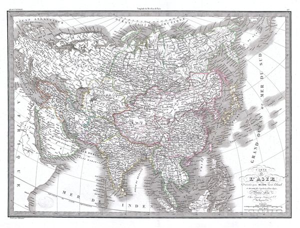
Carte de l'Asie.
$225.00
Acquire
- Digital Map Information
- Suitable for large format printing
- Full resolution TIFF file
- ICC color profile embedded
- Delivered instantly via download link
A fine first edition example of M. Lapie's 1832 map of Asia. In the early 19th century Asia was coming under increasingly imperial european sway. In India full British rule allowed england to attain naval and ... (more details)

Carte de la Turquie d'Asie de la Perse de l'Afghanistan et de l'Arabie.
sold
- Digital Map Information
- Suitable for large format printing
- DPI: 300
- File Size: 13.13 MB
- File Type: ZIP / TIFF
- ICC color profile embedded
- Delivered instantly via download link
A fine first edition example of M. Lapie's 1831 map of Turkey in Asia. Detailing the declining years of the Ottoman empire, this map includes all of Arabia, Turkey in Asia, Persia, Afghanistan, and Independent ... (more details)
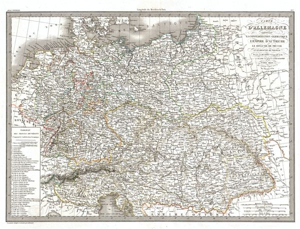
Carte d'Allemagne comprenant la Confederation Germanique l'Empire d'Autriche le Royaume de Prusse et le Royaume de Pologne.
sold
- Digital Map Information
- Suitable for large format printing
- DPI: 300
- File Size: 14.13 MB
- File Type: ZIP / TIFF
- ICC color profile embedded
- Delivered instantly via download link
A fine first edition example of M. Lapie's 1831 map of Germany including the Germanic Confederation, the Austrian empire, the Kingdom of Prussia and the Kingdom of Poland. The map covers all of Germany, ... (more details)

Carte d'Afrique.
sold
- Digital Map Information
- Suitable for large format printing
- DPI: 300
- File Size: 13.26 MB
- File Type: ZIP / TIFF
- ICC color profile embedded
- Delivered instantly via download link
A fine first edition example of M. Lapie's 1831 map of Africa. Medieval maps had long depicted kingdoms throughout Africa, often represented as icons accompanied by textual descriptions that accompanied ... (more details)
The only Civil War Era wall map of the United States issued by the U.S. Government.
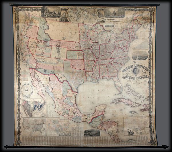
The Washington Map of the United States.
sold
This is the 1861 second edition of Matthew Fontaine Maury's important wall map of the United States, published by simultaneously by Taintor & Company in Philadelphia and Holmes Harrison & Company ... (more details)