

The Seven United Provinces from the best Authorities.
sold
- Digital Map Information
- Suitable for large format printing
- DPI: 300
- File Size: 3.41 MB
- File Type: ZIP / TIFF
- ICC color profile embedded
- Delivered instantly via download link
A finely detailed first edition 1794 map of what is now the northern Netherlands by Robert Wilkinson. The 'Republic of the United Provinces' was officially recognized in the Peace of Westphalia (1648), and lasted until a year after this map was made, when ... (more details)

Hungary and Transilvania, Drawn from the Latest Authorities. [sic]
sold
- Digital Map Information
- Suitable for large format printing
- DPI: 300
- File Size: 3.66 MB
- File Type: ZIP / TIFF
- ICC color profile embedded
- Delivered instantly via download link
A finely detailed first edition 1794 map of Hungary and Transylvania on the eve of Napoleonic invasion, by Robert Wilkinson. Covers modern day Hungary, Rumania, and Moldova. engraved by Thomas Conder for the 1794 first edition of Robert Wilkinson's ... (more details)

A Map of the Dutchy of Silesia, Drawn from the Best Authorities.
sold
- Digital Map Information
- Suitable for large format printing
- DPI: 300
- File Size: 2.83 MB
- File Type: ZIP / TIFF
- ICC color profile embedded
- Delivered instantly via download link
A finely detailed first edition 1794 map of Silesia by Robert Wilkinson, in what was then part of the Holy Roman empire. The map details the principalities within this duchy, which was bordered by Poland, Hungary, Moravia, Bohemia and Lusatia. ... (more details)

A Map of Bohemia and Moravia, Drawn from the Best Authorities.
sold
- Digital Map Information
- Suitable for large format printing
- DPI: 300
- File Size: 2.72 MB
- File Type: ZIP / TIFF
- ICC color profile embedded
- Delivered instantly via download link
A finely detailed first edition 1794 map of Bohemia and Moravia Germany by Robert Wilkinson. Today this is the Czech Republic. In 1794 Bohemia was in the midst of the Czech National Revival, in which Czech language, culture, and national ... (more details)

The Circle of Swabia, Drawn from the Best Authorities.
sold
- Digital Map Information
- Suitable for large format printing
- DPI: 300
- File Size: 3.54 MB
- File Type: ZIP / TIFF
- ICC color profile embedded
- Delivered instantly via download link
A finely detailed first edition 1794 map of Swabia, Germany by Robert Wilkinson. Prior the French Revolutionary Wars and the Congress of Vienna, the Holy Roman empire's Circle of Swabia was bordered by Franconia, Bavaria, Palatinate, ... (more details)
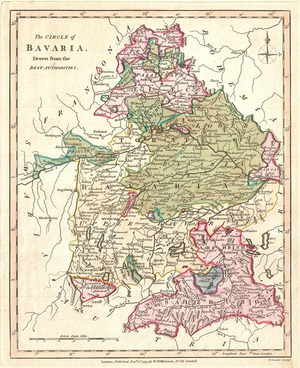
The Circle of Bavaria, Drawn from the Best Authorities.
sold
- Digital Map Information
- Suitable for large format printing
- DPI: 300
- File Size: 3.05 MB
- File Type: ZIP / TIFF
- ICC color profile embedded
- Delivered instantly via download link
A finely detailed first edition 1794 map of Bavaria, Germany, by Robert Wilkinson. Prior to the French Revolutionary War and the Congress of Vienna, the Holy Roman empire's Circle of Bavaria included the Archbishopric of Salzburg, ... (more details)

The Circle of Lower Saxony, Drawn from the Latest Authorities.
sold
- Digital Map Information
- Suitable for large format printing
- DPI: 300
- File Size: 3.45 MB
- File Type: ZIP / TIFF
- ICC color profile embedded
- Delivered instantly via download link
A finely detailed first edition 1794 map of Lower Saxony in what is now north central Germany, by Robert Wilkinson. As shown here, Lower Saxony was bordered by Denmark and the Baltic Sea to the north, Westphalia to the west, ... (more details)
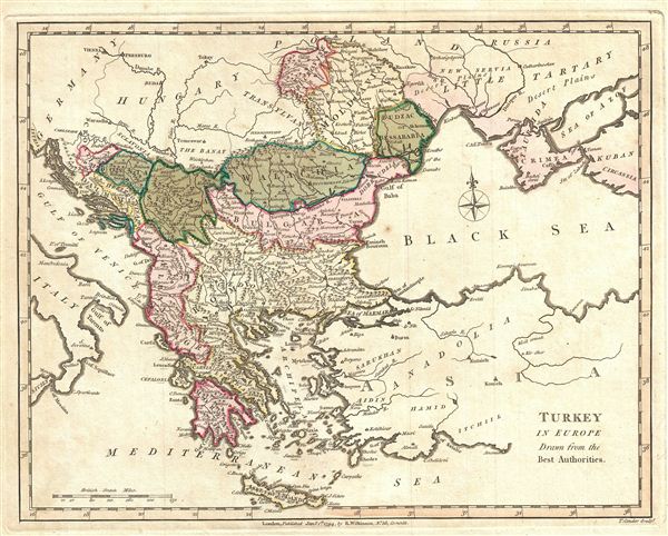
Turkey in Europe, Drawn from the Best Authorities.
sold
- Digital Map Information
- Suitable for large format printing
- DPI: 300
- File Size: 3.18 MB
- File Type: ZIP / TIFF
- ICC color profile embedded
- Delivered instantly via download link
A finely detailed first edition 1794 map of Turkey in europe by Robert Wilkinson. Wilkinson's map covers from Germany to the eastern Black Sea and surrounding areas. A great companion map to Turkey in Asia in the same ... (more details)

An Accurate Map of Hindoostan, Drawn from the Latest Authorities.
sold
- Digital Map Information
- Suitable for large format printing
- DPI: 300
- File Size: 3.64 MB
- File Type: ZIP / TIFF
- ICC color profile embedded
- Delivered instantly via download link
A finely detailed first edition 1794 map of India by Robert Wilkinson. Wilkinson's map covers from Kabul and Persia in the northwest, to Cape Comorin, Ceylon and the Maldive Islands in the south, and from 'Thibet' in ... (more details)

A New and Accurate map of the Southern Provinces of Hindoostan, showing The Territories ceded by Tippoo Saib, to the Different Powers.
sold
- Digital Map Information
- Suitable for large format printing
- DPI: 300
- File Size: 3.51 MB
- File Type: ZIP / TIFF
- ICC color profile embedded
- Delivered instantly via download link
A finely detailed first edition 1794 map of southern India by Robert Wilkinson. Covers from Mumbai to Cape Comorin. This exquisite map is absolutely invaluable for those interested in colonial or Indian history, as ... (more details)
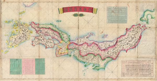
Great Japan Mileage Map
sold
- Digital Map Information
- Suitable for large format printing
- File Size: 43.16 MB
- File Type: ZIP / TIFF
- ICC color profile embedded
- Delivered instantly via download link
A rare, monumental, and beautiful 1876 or Meiji 9 Map of Japan. Oriented to the west, this beautifully engraved map covers the Japanese islands of Honshu, Shikoku and Kyushu, with parts of adjacent Hokkaido and ... (more details)
One of the earliest Japanese maps of Taiwan.

Taiwan.
sold
- Digital Map Information
- Suitable for large format printing
- File Size: 18.82 MB
- File Type: ZIP / TIFF
- ICC color profile embedded
- Delivered instantly via download link
An extremely rare and early Meiji 29 or 1896 Japanese Map of Taiwan or Formosa Island. Covers the entire island in considerable detail showing cities, towns, roads, railways, and topographical features. Some ... (more details)

Mt. Fuji and the Five Lakes.
sold
- Digital Map Information
- Suitable for large format printing
- File Size: 2 MB
- File Type: ZIP / TIFF
- ICC color profile embedded
- Delivered instantly via download link
This is an attractive 1927 (Showa 2) Japanese Panoramic View Map of Mt. Fuji, Japan and the Five Lakes at its base. At 3, 775 Meters, Mount Fuji is the highest mountain in Japan and is considered to be one of ... (more details)

Atami.
sold
- Digital Map Information
- Suitable for large format printing
- File Size: 10.51 MB
- File Type: ZIP / TIFF
- ICC color profile embedded
- Delivered instantly via download link
This is a stunning 1935 art deco panoramic view of Atami, Shizouka Prefecture, Japan. View shows streets, important buildings, ferry routes, roads, tunnels, and parks with Mount Fuji rising in the distance. ... (more details)
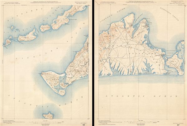
Massachusetts Gay Head Sheet. Massachusetts (Dukes County) Marthas Vineyard Sheet.
sold
- Digital Map Information
- Suitable for large format printing
- File Size: 15.98 MB
- File Type: ZIP / TIFF
- ICC color profile embedded
- Delivered instantly via download link
An uncommon U.S. Geological Survey map, in two sheets, of Marthas Vineyard, Massachusetts, from 1917. The left sheet details Gay Head and Chilmark as well as parts of Buzzard Bay and the elizabeth Islands. ... (more details)

Sicilia.
sold
- Digital Map Information
- Suitable for large format printing
- DPI: 300
- File Size: 3.52 MB
- File Type: ZIP / TIFF
- ICC color profile embedded
- Delivered instantly via download link
An obscure little map of Sicily, Italy, of unknown origins. Stylistically this map is late 18th century. Decorative cartouche in the lower left depicts a Volcano under which blacksmiths hard at work, ... (more details)
The first accurate western European maps of the Caucuses.
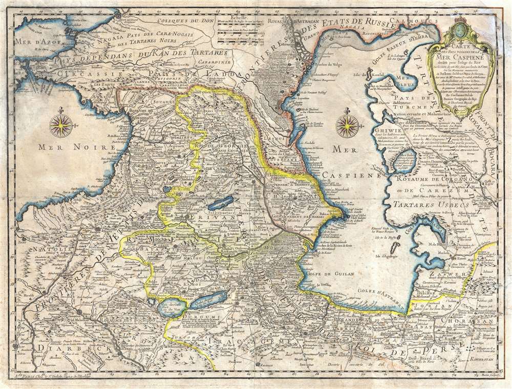
Carte des Pays Voisins de la Mer Caspiene, dressee pour l'usage du Roy. Sur la carte de cete Mer, faite par l'ordre du Czar, sur les Memoires manuscrits de Soskam-Sabbas, Prince de Georgie, sur ceux de Mrs. Crusius, Zurabek, et Fabritius Ambassadeurs a la Cour de Perse, et sur les eclaircissemens tirez d'un grand nombre de persones intelligentes du pais. Assujetie aux observations astronomiques. Par Guillaume Delisle, Premier Geographe du Roy, de l'Academie Royale des Sciences. 15 Aout 1723.
sold
- Digital Map Information
- Suitable for large format printing
- DPI: 300
- File Size: 17.86 MB
- File Type: ZIP / TIFF
- ICC color profile embedded
- Delivered instantly via download link
An example of Guillaume de L'Isle's 1723 map of the Caucuses. Covering from the Black Sea to Independent Tartary and from Russia to Persia, inclusive of the entire Caspian Sea, and the modern day ... (more details)
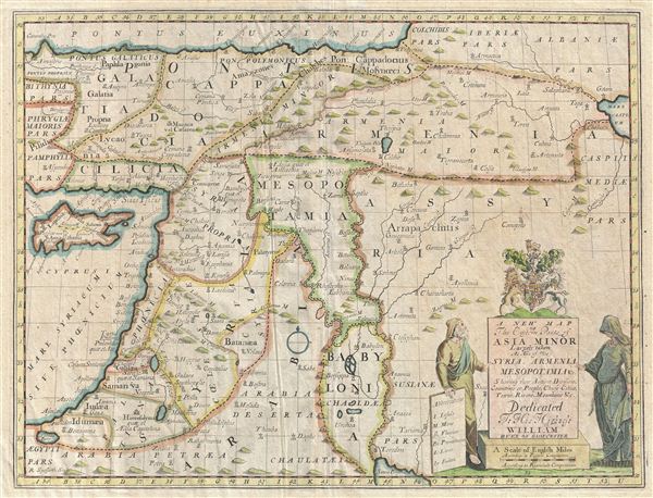
A New Map of the Eastern Parts of Asia Minor Largely taken: As Also of Syria, Armenia, Mesopotamia and c. Showing their Antient Divisions, Countries or People, Chiefe Cities, Towns, Rivers, Mountains, and c. Dedicated to His Highness William Duke of Gloucester.
sold
- Digital Map Information
- Suitable for large format printing
- Full resolution TIFF file
- ICC color profile embedded
- Delivered instantly via download link
An unusual 1712 map of the Middle East in antiquity by Edward Wells of Oxford. Covers from the Black Sea to the Persian Gulf and from Cyprus to the Caspian Sea. Includes the modern day countries ... (more details)
Rare chromolithographic view of Beijing.

An Illustration of the Places to See in Peking.
sold
- Digital Map Information
- Suitable for large format printing
- File Size: 11.44 MB
- File Type: ZIP / TIFF
- ICC color profile embedded
- Delivered instantly via download link
An unusual and attractive 1956 view map of Beijing or Peking, China. This view covers all of Beijing (as it was in 1956) including the walled center, the Forbidden City, the Summer Palace, and the ... (more details)
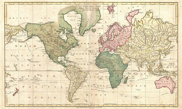
A New Mercator's Chart Drawn from the Latest Discoveries.
sold
- Digital Map Information
- Suitable for large format printing
- DPI: 300
- File Size: 6.01 MB
- File Type: ZIP / TIFF
- ICC color profile embedded
- Delivered instantly via download link
A finely detailed first edition 1794 map of the world on a Mercator projection by Robert Wilkinson. Wilkinson's map covers the entire world with color coding by continent. The exploratory routes ... (more details)