
De L'Isle Family (Delisle)

The De L'Isle family (fl. c. 1700 - c. 1760) (also written Delisle) were, in composite, a mapmaking tour de force who redefined early 18th century European cartography. Claude De L'Isle (1644 -1720), the family patriarch, was Paris based a historian and geographer under Nicholas Sanson. De L'Isle and his sons were proponents of the school of "positive geography" and were definitive figures, defining the heights of the Golden Age of French Cartography. Of his twelve sons, four, Guillaume (1675 - 1726), Simon Claude (1675 - 1726), Joseph Nicholas (1688 - 1768) and Louis (1720 - 1745), made a significant contributions to cartography. Without a doubt Guillaume was the most remarkable member of the family. It is said that Guillaume's skill as a cartographer was so prodigious that he drew his first map at just nine years of age. He was tutored by J. D. Cassini in astronomy, science, mathematics and cartography. By applying these diverse disciplines to the vast stores of information provided by 18th century navigators, Guillaume created the technique that came to be known as "scientific cartography", essentially an extension of Sanson's "positive geography". This revolutionary approach transformed the field of cartography and created a more accurate picture of the world. Among Guillaume's many firsts are the first naming of Texas, the first correct map of the Mississippi, the final rejection of the insular California fallacy, and the first identification of the correct longitudes of America. Stylistically De L'Isle also initiated important changes to the medium, eschewing the flamboyant Dutch style of the previous century in favor of a highly detailed yet still decorative approach that yielded map both beautiful and informative. Guillaume was elected to the French Academie Royale des Sciences at 27. Later, in 1718, he was also appointed "Premier Geographe du Roi", an office created especially for him. De L'Isle personally financed the publication of most of his maps, hoping to make heavy royalties on their sales. Unfortunately he met an untimely death in 1728, leaving considerable debt and an impoverished child and widow. De L'Isle's publishing firm was taken over by his assistant, Phillipe Buache who became, posthumously, his son in law. The other De L'Isle brothers, Joseph Nicholas and Louis De L'Isle, were employed in the Service of Peter the Great of Russia as astronomers and surveyors. They are responsible for cataloguing and compiling the data obtained from Russian expeditions in the Pacific and along the northwest coast of America, including the seminal explorations of Vitus Bering and Aleksei Chirikov. The De L'Isles, like their rivals the Vaugondys , must be considered speculative geographers. Speculative geography was a genre of mapmaking that evolved in Europe, particularly Paris, in the middle to late 18th century. Cartographers in this genre would fill in unknown areas on their maps with speculations based upon their vast knowledge of cartography, personal geographical theories, and often dubious primary source material gathered by explorers and navigators. This approach, which attempted to use the known to validate the unknown, naturally engendered many rivalries. The era of speculatively cartography effectively ended with the late 18th century explorations of Captain Cook, Jean Francois de Galaup de La Perouse, and George Vancouver.
AKA: Delisle
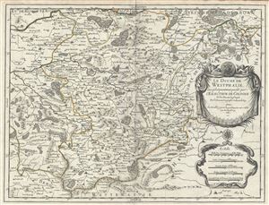
Le Duche de Westphalie ainsi qu'il est presentement possede par L'Eslecteur De Cologne.
$550.00
Acquire
- Digital Map Information
- Suitable for large format printing
- DPI: 300
- File Size: 15.23 MB
- File Type: ZIP / TIFF
- ICC color profile embedded
- Delivered instantly via download link
This is a fine 1681 map of Westphalia, Germany by Alexis-Hubert Jaillot. It covers the Westphalia region in northwest Germany from Hamm south to Ferndorf and from Wipperfurth east as far as Menne. The map renders the entire region in extraordinary detail offering ... (more details)
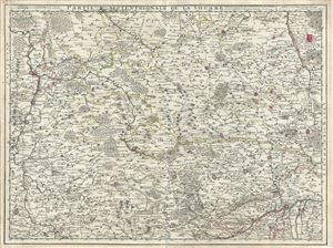
Partie Septentrionale de la Souabe.
$350.00
Acquire
- Digital Map Information
- Suitable for large format printing
- DPI: 300
- File Size: 20.04 MB
- File Type: ZIP / TIFF
- ICC color profile embedded
- Delivered instantly via download link
This is a fine example of the 1704 Guillaume De L'isle map of Swabia, Germany. It covers the northern portion of the Holy Roman Empire's Circle of Swabia from Nuremberg south to Wertingen and from Stuttgart east as far as Rain. The map renders the entire region ... (more details)
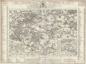
Carte Topographique du Diocese de Senlis.
$350.00
Acquire
- Digital Map Information
- Suitable for large format printing
- DPI: 300
- File Size: 18.7 MB
- File Type: ZIP / TIFF
- ICC color profile embedded
- Delivered instantly via download link
This is an attractive example of the 1709 Guillaume De L'isle topographical map of the Diocese of Senlis, France. It covers the region north of Paris from Pont-Sainte-Maxence south to Dammartin-en-Goele and from Gouvieux east as far as Bonneuil-en-Valois. The ... (more details)
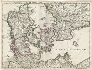
Carte du Royaume de Danemarc.
$400.00
Acquire
- Digital Map Information
- Suitable for large format printing
- DPI: 300
- File Size: 18.22 MB
- File Type: ZIP / TIFF
- ICC color profile embedded
- Delivered instantly via download link
This is a beautiful 1710 map of Denmark by Guillaume De L'isle. It covers all of Jutland and the islands of Zealand, Funen and Lolland. Parts of southern Sweden and northern Germany are also included. The map renders the entire region in extraordinary detail ... (more details)
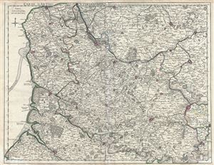
Carte d'Artois et des environs, ou lon voit le Ressort du Conseil Provincial d'Artois.
$350.00
Acquire
- Digital Map Information
- Suitable for large format printing
- DPI: 300
- File Size: 22.74 MB
- File Type: ZIP / TIFF
- ICC color profile embedded
- Delivered instantly via download link
This is a beautiful 1711 Guillaume De L'isle map of Artois region and its environs in northern France. It covers from Calais to Bouchain and from Abbeville north as far as Gravelines. Includes the southwestern parts of modern day Belgium. The map renders the ... (more details)
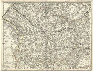
Partie Meridionale de Picardie.
$350.00
Acquire
- Digital Map Information
- Suitable for large format printing
- DPI: 300
- File Size: 19.88 MB
- File Type: ZIP / TIFF
- ICC color profile embedded
- Delivered instantly via download link
A beautiful 1712 map of southern Picardy, France by Guillaume De L'Isle. It depicts the French region of Picardy and covers from Bouchain, south to Soisson and from Beauvais north as far as Le Crotoy. Includes parts of the French departments of Nord, Aisne, ... (more details)
De l'Isle's British Isles.
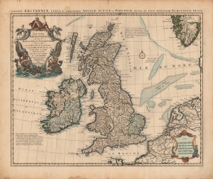
Les Isles Britanniques ou sont le Rme d'Angleterre tiré de Sped, celuy d'Ecosse tiré de Th. Pont, etc. et celuy d'Irlande tiré de Petti. Le tout rectifié par diverses Observations.
$500.00
Acquire
- Digital Map Information
- Suitable for large format printing
- Full resolution TIFF file
- ICC color profile embedded
- Delivered instantly via download link
A c. 1718 example of Covens and Mortier's issue of De l'Isle's map of the British Isles. Combining terrestrial and maritime information in splendid detail, this example is also distinguished by old color, refreshed, and heightened with gold. (more details)
'A foundation map.' -Tooley
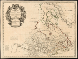
Carte du Canada ou de la Nouvelle France et des Decouverts qui y ont été faites...
$1,800.00
Acquire
- Digital Map Information
- Suitable for large format printing
- Full resolution TIFF file
- ICC color profile embedded
- Delivered instantly via download link
This is Guillaume de l'Isle's groundbreaking 1703 / 1718 map of Canada - one of the most important maps of the northern parts of North America. When De l'Isle first issued this map, it was the most sophisticated cartographic representation of this region yet published, referencing the most recent explorations, including the Jesuit Relations, Pierre Le Moyne d'Iberville, Pierre Le Sour, and Baron de Lahontan. (more details)
First accurate map of the Caspian Sea.
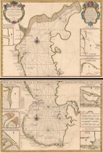
Carte Marine de la Mer Caspiene.
$900.00
Acquire
- Digital Map Information
- Suitable for large format printing
- Full resolution TIFF file
- ICC color profile embedded
- Delivered instantly via download link
A seminal production, this is Guillaume Delisle's 1721 map of the Caspian Sea according to the surveys of Van Verden and S. I Soimonov. It is the first printed map of the Caspian Sea based upon actual survey work. Although other cartographers also copied the work of Van Verden and Soimonov, Delisle was the first, and his mapping is the finest and truest to the original manuscript. (more details)
One of the best French maps of Hispaniola.
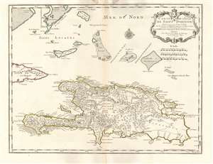
Carte de l'Isle de Saint Domingue.
$650.00
Acquire
- Digital Map Information
- Suitable for large format printing
- Full resolution TIFF file
- ICC color profile embedded
- Delivered instantly via download link
This is a 1745 Phillipe Buache edition of Guillaume De l'Isle's beautifully engraved 1725 map of the island of Hispaniola or Saint Domingue, modern-day Haiti and the Dominican Republic. It is considered one of the best and most detailed maps of the island if its generation. (more details)
Notes the legendary El Dorado.
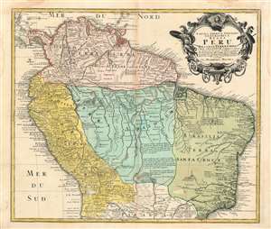
Tabula Americae Specialis Geographica Regni Peru Brasiliae, Terrae Firmae, and Reg: Amazonum.
$400.00
Acquire
- Digital Map Information
- Suitable for large format printing
- DPI: 300
- File Size: 17.41 MB
- File Type: ZIP / TIFF
- ICC color profile embedded
- Delivered instantly via download link
This is an extraordinary example of Homann Heirs’ magnificent c.1728 map of northern South America. It covers from Costa Rica and Barbados south roughly to the Tropic of Capricorn, or more precisely, 50 degrees south latitude. The map renders the entire ... (more details)
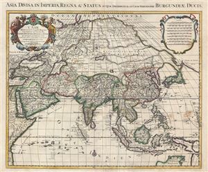
L' Asie divisee en ses principales regions, et ou se peuvent voir l'estendue des empires, monarchies, royaumes, et estats qui partagent presentement L'Asie / Asia divisa in imperia, regna & status in quae distributur.
$950.00
Acquire
- Digital Map Information
- Suitable for large format printing
- Full resolution TIFF file
- ICC color profile embedded
- Delivered instantly via download link
An attractive and large map of Asia issued by the Dutch firm of Covens and Mortier c. 1730. Covens and Mortier based this map upon an earlier map by Guillaume Delisle, which was in turn based upon the Sanson-Jaillot model of 1692. Presented on Sanson's ... (more details)
Scarce first state.
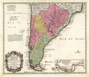
Typus Geographicus Chili Paraguay Freti Magellanici etc.
$650.00
Acquire
- Digital Map Information
- Suitable for large format printing
- DPI: 600
- File Size: 70.49 MB
- File Type: ZIP / TIFF
- ICC color profile embedded
- Delivered instantly via download link
This is an early example of the 1733 Homann Heirs map of southern South America, in a rare first state example. It covers roughly from 18 degrees south latitude south to Tierra del Fuego, and includes the modern-day nations of Paraguay, Chile, Uruguay, and Argentina, along with the southern portions of Brazil and Bolivia. The map renders the entire region in extraordinary detail offering both topographical and political information with forest and mountains beautifully rendered in profile. (more details)
A beautifully engraved educational map of France.
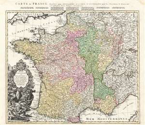
Regni Galliae seu Franciae et Navarrae Tabula Geographica in usum Elementorum Geographiae Schaziano rum accomodata Per Homannianos Heredes 1741. / Carte de France dressee par Guillaume de L'Isle et accommodee par les Heritiers d'Homann a l'instruction de la Jeunesse Norimb. 1741.
$450.00
Acquire
- Digital Map Information
- Suitable for large format printing
- Full resolution TIFF file
- ICC color profile embedded
- Delivered instantly via download link
A beautifully detailed 1741 Homann Heirs map of France, specially engraved for inclusion in Johann Schatz's school atlas. Depicting the Kingdoms of France and Navarre, along with parts of Italy, Switzerland, Spain, and Germany, the map offers excellent detail, illustrating fortified cities, villages, roads, bridges, forests, and castles. Topography is illustrated pictorially. (more details)
Sea of the West, El Dorado, a Maelstrom, and more.
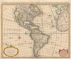
America Accurate in Imperia, Regna, Status and Populos Divisa, ad Usum Ludovici XV, Galliarum Regis. / Carte d'Amerique Dressee pour l'Usage du Roy.
$1,400.00
Acquire
- Digital Map Information
- Suitable for large format printing
- DPI: 600
- File Size: 27.87 MB
- File Type: ZIP / TIFF
- ICC color profile embedded
- Delivered instantly via download link
An uncommon 1755 variant on Guillaume Delisle's map of America. The map offers much of interest, including theories regarding the Sea of the West, cities of gold in North America, El Dorado, and a magnificent whirlpool in the South Atlantic. (more details)
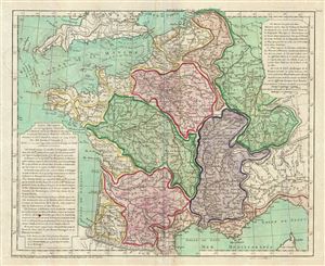
Carte Physique de ou Geographie Naturelle de la France, divisee par Chaines de Montagnes et aussi par Terreins de Fleuves et Rivieres.
$300.00
Acquire
- Digital Map Information
- Suitable for large format printing
- DPI: 300
- File Size: 13.6 MB
- File Type: ZIP / TIFF
- ICC color profile embedded
- Delivered instantly via download link
A scarce 1770 physical map of France by Philippe Buache. The map covers all of France highlighting the various river basins, including Rhine, Rhone, Meuse, Seine, Loire, Garonne, and its coastal basins. Various rivers, mountain ranges, gulfs, lakes, ... (more details)
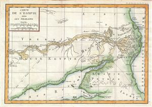
Carte de l'Egypte sous les Pharaons.
$200.00
Acquire
- Digital Map Information
- Suitable for large format printing
- DPI: 300
- File Size: 3.58 MB
- File Type: ZIP / TIFF
- ICC color profile embedded
- Delivered instantly via download link
This is a fascinating example of the 1770 Jean-Baptiste-Claude Delisle de Sales' historical map of Egypt. The map depicts Egypt under the rule of the Pharaohs and, centered on the Nile Valley, covers from the Mediterranean Sea to the Elephantine ... (more details)
The mythical lands of Jean de Gama.
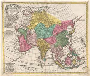
Asia Concinnata Secundum Observationes Academiae Regalis Scientiarum et nonnullas alias, et iuxta annotationes recentissimas.
$850.00
Acquire
- Digital Map Information
- Suitable for large format printing
- DPI: 300
- File Size: 13.36 MB
- File Type: ZIP / TIFF
- ICC color profile embedded
- Delivered instantly via download link
A rare and attractive old color 1770 map of Asia by Tobias Conrad Lotter. Centered on Independent Tartary, this map covers the entire continent from Africa and the Mediterranean east to the Bering Sea and south as far as Java and New Guinea. The map renders the entire region in detail offering both topographical and political information with forests and mountains beautifully rendered in profile. (more details)
A Boldly Presented Northwest Passage.
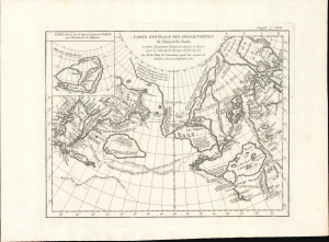
Carte Generale des Decouvertes de l'Amiral de Fonte et Autres Navigateurs Espagnols, Anglois et Russes pour la Recherche du Passage a la Mer du Sud.
$750.00
Acquire
- Digital Map Information
- Suitable for large format printing
- File Size: 12.15 MB
- File Type: ZIP / TIFF
- ICC color profile embedded
- Delivered instantly via download link
This is Robert de Vaugondy's 1772 map of the northern Pacific Ocean, after that of Joseph De l'Isle, combining two of the most elaborate fallacies to be presented on a map: the Sea of the West and the Northwest Passage attributed to the fictitious Admiral de Fonte. Both fictions fueled avid speculation throughout the latter part of the 18th century. When this map was produced for inclusion in Diderot's Encyclopédie, the question of the possible existence of a Northwest Passage was a great cartographic cause célèbre. (more details)
Speculating on a Northwest Passage and a Sea of the West.
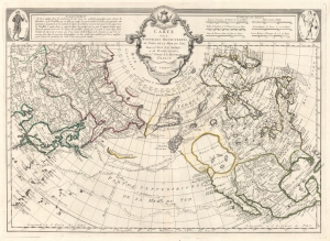
Carte Des Nouvelles Decouvertes au Nord de la Mer de Sud, tant a l'Est de la Syberie et du Kamtchatka, qu'a L'Ouest de la Nouvelle France.
$1,700.00
Acquire
- Digital Map Information
- Suitable for large format printing
- DPI: 600
- File Size: 29.72 MB
- File Type: ZIP / TIFF
- ICC color profile embedded
- Delivered instantly via download link
The 1776 Francois Santini Venice edition of Joseph Nicolas De l'Isle's extraordinary 1752 map of North America, Siberia, the Arctic, and the North Pacific. The map is a study in contrasts, setting J. N. De L'Isle's accurate mapping of the Asian northeast based on data absconded from the Russian 'Academy of Sciences', against J. N. Buache's speculations on the feasibility of a Northwest Passage. Among other points, this map is significant for reviving the 'Sea of the West' hypothesis, and must be considered one of the most influential maps of the region issued in the mid-18th century. (more details)
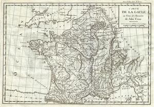
Carte de la Gaule au Tems de l'Invasion de Jules Cesar.
$175.00
Acquire
- Digital Map Information
- Suitable for large format printing
- DPI: 300
- File Size: 4.43 MB
- File Type: ZIP / TIFF
- ICC color profile embedded
- Delivered instantly via download link
This is a scarce 1782 map issued by Jean- Baptiste-Claude Delisle de Sales depicting Gaul or France at the time of the invasion by Julius Caesar. The map covers from the English Channel south as far as the Mediterranean and Florence in modern ... (more details)
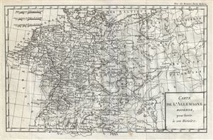
Carte de l'Allemagne Moderne.
$200.00
Acquire
- Digital Map Information
- Suitable for large format printing
- DPI: 300
- File Size: 4.78 MB
- File Type: ZIP / TIFF
- ICC color profile embedded
- Delivered instantly via download link
A fine 1782 map of Germany and Poland by Jean- Baptiste-Claude Delisle de Sales. The map covers Germanic territories from the Baltic Sea to the Gulf of Venice and from France to Russia. Includes Germany, Austria, Bohemia (Czech Republic), ... (more details)
First of this series to recognize the United States.
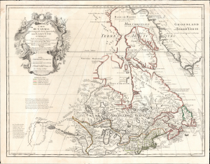
Carte du Canada Qui Comprend la Partie Septentrionale des Etats Unis D'Amerique.
$1,200.00
Acquire
- Digital Map Information
- Suitable for large format printing
- File Size: 30.38 MB
- File Type: ZIP / TIFF
- ICC color profile embedded
- Delivered instantly via download link
This is the 1783 Dezauche issue of Guillaume de l'Isle's map of Canada and the Northern United States. Published after the close of the American Revolutionary War (1775 - 1783), this is one of the first French maps to formally recognize the United States. (more details)
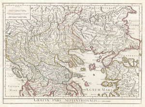
Graeciae Pars Septentrionalis.
$450.00
Acquire
- Digital Map Information
- Suitable for large format printing
- DPI: 300
- File Size: 19.22 MB
- File Type: ZIP / TIFF
- ICC color profile embedded
- Delivered instantly via download link
A large and dramatic Delisle map of the northern Greece, the Balkans, and Macedonia. Covers from Dalmatia east to the Black Sea (Pontus Euxinus) and south as far as Achaia, Cyprus, and Asia Minor. Includes much of the Aegean Sea and ... (more details)