
1662 Jansson and Hornius Map of the Holy Land, Israel, and Palestine

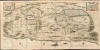
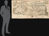
[Situs Terrae Promissionis.]
Finest 17th century large-scale map of the Holy Land.
- Digital Map Information
- Suitable for large format printing
- File Size: 118.78 MB
- File Type: ZIP / TIFF
- ICC color profile embedded
- Delivered instantly via download link
Finest 17th century large-scale map of the Holy Land.
Commonly known as the 'Hornius Map', this is the 1662 Johannes Jansson and Georgius Hornius 6-sheet map of the Holy Land in a beautifully colored, joined example. This map is an expansion on the allegorical Holy Land cartography pioneered by Christian van Adrichem around 1590. Jansson expanded and embellished Adrichem's map to illustrate the text composed by Georgius Hornius (George Horn) for volume six of his Novus Atlas, Accuratissimia Orbis Antiqui Delineatio.A Closer Look
Oriented to the east, coverage embraces the Holy Land (modern-day Israel / Palestine) from the southern tip of the Dead Sea and Edom to the Golan Heights and modern-day Lebanon. The map is embellished with countless vignettes and other images drawn from Biblical tradition. The smoking ruins of Sodom and Gomorrah appear in the Dead Sea, Jonah is drawn being devoured by the whale, Jesus is shown being tempted by Satan (for the third time) atop a mountain, etc. Each of the tribes of Israel is named and associated with its traditional lands. Mountains and forests are illustrated in profile.The Set
Although joined here, the maps also appear separately and can be studied individually. Short descriptions of each sheet follow:- Tribus Ruben, et Gad et partes orientales tribuum Beniamin, Ephraim, et dimidiae Manasse intra Iordenem
- The first panel in the series, showing the territories of Ruben and Gad, as well as the eastern lands of Benjamin, Ephraim, and part of Manasseh beyond the Jordan River.
- Includes Biblical scenes such as Jesus and Satan arguing on a mountaintop, Moses viewing the Promised Land, the Hebrews entering the land of Milk and Honey, and a stairway ascending to heaven.
- Displays the western part of the Dead Sea. - Tribuum Ephraim, Beniamin, et Dimidiae Manasse intra Iordanem partes occidentales, et partes septentrionales Dan et Iuda
- Shows the territories of Ephraim, Benjamin, and part of Manasseh west of the Jordan River, as well as northern areas of Dan and Judah.
- Features Biblical imagery, including Jonah being cast from a ship into the mouth of a whale.
- Depicts the broader region of Palestine with various armies. - Tribus Aser, et partes occidentales tribuum Zabulon et Isachar
- One of the two larger panels, illustrating the land of Asher and the western territories of Zebulon and Issachar.
- Contains notable Biblical and historical scenes, such as St. George slaying the Dragon, the city of Tyre, Nazareth, and the Tabernacle of Abraham. - Dimidia Tribus Manasse Ultra Iordanem, Tribus Neptalim et partes orientales tribuum Zabulon et Isachar
- The second large panel, showing parts of Manasseh along the Jordan River, the lands of Naphtali, and eastern portions of Zebulon and Issachar.
- Highlights the Sea of Galilee (Lake Tiberius) with several scenes from the life of Jesus, including walking on water and preaching from a boat.
- Includes an inset map titled Peregrinatio Abrahae, tracing Abraham's journey from Ur to Canaan. - Pars maxima Tribus Iusa Versus Orientem
- The southeasternmost panel, depicting much of the Dead Sea and the lands of the tribe of Judah.
- Shows the smoking ruins of Sodom, Gomorrah, Adaima, and Seboim.
- Contains an inset titled Itinera et Mansiones Deserti, which illustrates the Hebrews' Exodus route, including the parting of the Red Sea. - Tribus Simeon et pars meridionalis Tribus Dan, et orientalis Tribus Idua
- The final panel, focusing on the lands of Simeon, with southern Dan and eastern Judah.
- Identifies the territory of the Philistines and surrounding timber lands rich in cedar.
Publication History and Census
While these panels occasionally appear on the market separately, they are rarely seen as a cohesive set and display dramatically as such. Some cartobibliographers identify this as a seven-panel set, but they are merely referring to the two enlarged panels, which each contain half of a 7th sheet.Cartographers
Jan Jansson or Johannes Janssonius (1588 - 1664) was born in Arnhem, Holland. He was the son of a printer and bookseller and in 1612 married into the cartographically prominent Hondius family. Following his marriage, he moved to Amsterdam, where he worked as a book publisher. It was not until 1616 that Jansson produced his first maps, most of which were heavily influenced by Blaeu. In the mid-1630s, Jansson partnered with his brother-in-law, Henricus Hondius, to produce his important work, the eleven-volume Atlas Major. About this time, Jansson's name also begins to appear on Hondius reissues of notable Mercator/Hondius atlases. Jansson's last major work was his issue of the 1646 full edition of Jansson's English Country Maps. Following Jansson's death in 1664, the company was taken over by Jansson's brother-in-law Johannes Waesberger. Waesberger adopted the name of Jansonius and published a new Atlas Contractus in two volumes with Jansson's other son-in-law, Elizée Weyerstraet, with the imprint 'Joannis Janssonii Haeredes' in 1666. These maps also refer to the firm of Janssonius-Waesbergius. The name of Moses Pitt, an English map publisher, was added to the Janssonius-Waesbergius imprint for maps printed in England for use in Pitt's English Atlas. Further Details...
Georg Horn (1620 - 1670) or has he was otherwise known, Georgius Hornius, is a Germany born historian and professor active in the central part of the 17th century. Hornius spent most of his life in Holland, where the cosmopolitan atmosphere offered him greater academic freedom. As an academic Hornius was known for his unconventional approach that encouraged looking at important historical events from multiple angles. He, for example, advocated the uncommon view that Attila the Hun was actually a much loved and beneficent ruler. Hornius composed a number of historical essays but is best known for composing the text to accompany Johannes Jansson's monumental mapping of the Holy Land in 1658. This six part map is today generally referred to as the "Hornius Map" in his honor. A number of other historical maps, also associated with volume VI of Jansson's Atlas Novus. Further Details...
Christian Kruik van Adrichem (February 13, 1533 - June 20, 1585), alternatively known as Christianus Crucius Adrichomius was a Dutch theologian active in the second half of the 16th century. Adrichem was born in Delft of a wealthy family - at one point his father, Adriaen Claesz, was mayor of Delft. Adrichem was ordained in 1566. He served as the director of the Convent of St. Barbara in Delft until expelled by the Protestant Reformation. Fleeing the anti-Catholic sentiment of the Reformation, Adrichem reestablished himself in Cologne (Koln) where compiled various religious works including his important historical atlas, the Theatrum Terrae Sanctae et Biblicarum Historiarum. Adrichem's important atlas was published posthumously by his associate Gerardis Brunius in 1590. The work went through numerous editions and served as the foundation of most subsequent maps of the Holy Land well into the 18th century. Further Details...
Source
Jannson, J. and Hornius, G., Atlas Novus, volume VI (Accuratissimia Orbis Antiqui Delineatio), (Amsterdam) 1662.
Condition
Very good. Each sheet exhibits original fold lines. Upper right margin expertly extended. Joined. All sheets exhibit slight printed scratches, caused by printing residue on the copper plate, generally indicative of a very early strike. Blank on verso.
References
Laor, E., Maps of the Holy Land: Cartobibliography of Printed Maps, 1475 - 1900, #343-349. Keuning, J., 'The Novus Atlas of Johannes Janssonius', Imago Mundi, vol. 8, pp. 71-79.