
Archar / Travel Graphics (sold)

Archar / Travel Graphics (1973 - Present) is a Canadian and U.S. publishing company initially based in Toronto, Ontario. The firm is best known for its 'City Character Prints' - cartoonish view style maps intended to express the 'character' of a city. The firm employed a host of in house art directors, as well as a host of freelance illustrators. We find no trace of the company after 1983. Variants of the imprint include 'Archer Western' based in British Columbia and the St. Paul, Minnesota based 'Archar International'. Around 1984, the Minnesota firm was renamed Travel Graphics - Archer International, often printing under the 'Travel Graphics' imprint. Travel Graphics later relocated to Hawaii, where they remain active.
Anticipating the 1976 Montreal Olympics.
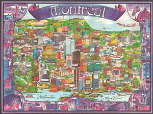
This is a large-scale loosely cartographical 'city character print' 1974 Swaena Lavelle pictorial map of Montréal, Canada, published two years before the Montréal hosted the 1976 Summer Olympics. The view overlooks the city from the west from across the Saint Lawrence River. Buildings throughout are illustrated, including several department stores, banks, hotels, and the headquarters of the Montreal Star. Two Olympic venues, the Olympic Stadium and Arena Maurice Richard, appear near the right border. Wonderful artistic illustrations of sites around Montreal create a fantastic pictorial border. (more details)
First landing of the Concorde in New Orleans.
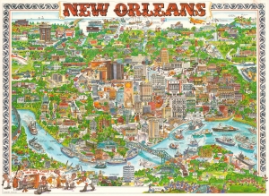
This is a 1976 Tom Dodds 'City Character Print' view map of New Orleans, Louisiana. (more details)
Tampa area businesses and sites.
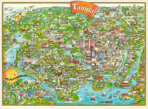
This is a 1977 Barbara Spurll / Archar pictorial map of Tampa, Florida. Spurll highlights local businesses and cultural institutions offering amusing commentary. (more details)
Boston's universities, museums, and businesses.
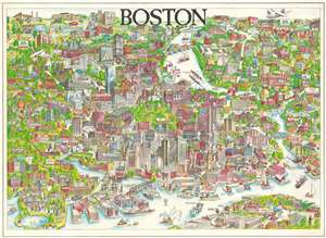
This is a large-scale, loosely cartographical 1977 Barbara Spurll 'city design print' pictorial view map of Boston, Massachusetts. Buildings throughout are rendered pictorially and identified, including churches, museums, hotels, restaurants, and other businesses. Northeastern University, Boston University, Harvard University, Tufts University, the University of Massachusetts, MIT, and Boston College appear. The Boston Globe's headquarters occupies space along the left border. (more details)
Pictorial view of San Francisco.
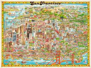
This is a large-scale loosely cartographical 1978 Barbara Spurll 'city character view' map of San Francisco, California. The map looks south on San Francisco, with the Golden Gate Bridge taking pride of place in the foreground. The Presidio marks the farthest point west, and the Bay Bridge, the farthest point east - although the East Bay appears in the distance. The San Francisco International Airport appears in the distance as well. Some of San Francisco's most iconic buildings are evident, including the Transamerica Pyramid, Palace of Fine Arts, City Hall, Grace Cathedral, and the Painted Ladies, among many others. Comparatively dry annotations throughout offer historical facts. The whole is surrounded by a floral border. (more details)
Island of Remarkable Contrasts.
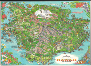
This is a colorful, large-format 1979 pictorial view of the Island of Hawai'i drawn by Kim Forrest of Archar for United Airlines. It reflects the island's remarkable ecological and cultural diversity. (more details)
Jacksonville - Healthcare, Banking, Beach Life.
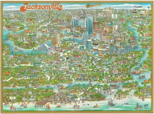
This is a 1979 Archar Inc. 'City Character Print' pictorial map of Jacksonville, Florida, playfully promoting the city's history, identity, and businesses - particularly banking and healthcare. This is among the rarest Archar views, with no other cataloged examples known. (more details)
Live music capital of the world.
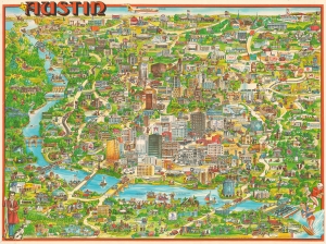
This is a 1979 humorous pictorial map of Austin, Texas by Susan Dewar and Robert Van Nood. The view captures the city as it was becoming known as the 'Live Music Capital of the World.' (more details)
Fun in sunny LA.
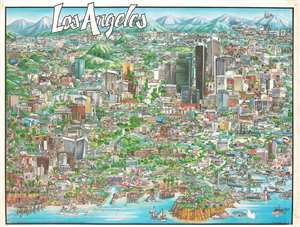
This is a 1979 Swaena Lavelle and Barbara Spurll pictorial map of Los Angeles. Depicting the city in a comic manner, L.A.'s residents populate office buildings, convenience stores, museums, and freeways. The Huntington Library, Los Angeles County Art Museum, and Griffith Observatory appear alongside the Rose Bowl, the Forum, Dodger Stadium, and the Hollywood Bowl. The University of Southern California, the California Institute of Technology, and the University of California-Los Angeles are illustrated, with buildings and stadiums appearing on the campuses of both USC and UCLA. L.A.'s residents provide commentary for the viewer, expressing their love of the city and its history. The Pacific Ocean occupies the foreground, with the Santa Monica Pier and the Manhattan Pier jutting. (more details)
Yachts and Ewoks.
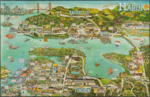
This is a rare 1988 pictorial view of Sausalito, Tiburon, and environs in southern Marin County, California, prepared by the firm City Design. While primarily intended to promote local businesses, the view also celebrates the area's culture and history, particularly its maritime connections and magnificent bayside views. (more details)