
Baker, Benjamin (sold)

Benjamin Baker (1766 - June 29, 1841) was British engraver active in the late 18th and early 19th centuries. Baker was born in London, the son of instrument maker Edward Baker (1730 - 1797). As a young map he was apprenticed to Thomas Beresford, a watchmaker. This likely did not work out, as he was turned over to the engraver, mapmaker, and globemaker William Palmer (1739 - 1812). Baker rose to prominence as an engraver for the British Admiralty and British Ordnance Survey. In time he became the principal engraver for the Ordnance Survey, not only engraving himself, but overseeing the entire team of Ordnance engravers. His son, Benjamin Richard Baker (1792 - 1876) was also a mapmaker, engraver, draughtsman, lithographer, and printer.
One of history's most important diplomatic failures.
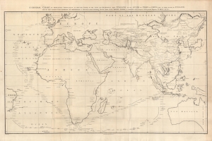
A general chart on Mercators projection to shew the track of the Lion and Hindostan from England to the Gulph of Pekin in China and their return to England.
sold
- Digital Map Information
- Suitable for large format printing
- Full resolution TIFF file
- ICC color profile embedded
- Delivered instantly via download link
This large 1796 John Barrow nautical map of the Atlantic and Indian Oceans was produced to accompany George Leonard Staunton's account of the first British diplomatic embassy to China, led by George Macartney on behalf of George III. It was drawn by John Barrow, who had served as the comptroller to Lord Macartney's mission. (more details)
Recognizing British Honduras.
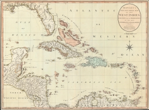
Bowles's New One-Sheet Map of the West Indies, Laid Down from the Observations of Celebrated Geographers.
sold
- Digital Map Information
- Suitable for large format printing
- File Size: 27.66 MB
- File Type: ZIP / TIFF
- ICC color profile embedded
- Delivered instantly via download link
An exceptional example of Bowles and Carver's c. 1798 map of the West Indies - this is one of the first maps to recognize formal British claims over Belize (British Honduras). (more details)
Celebrating the exploratory explosion of late 18th century.
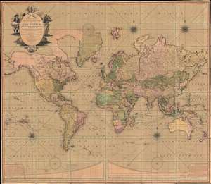
Bowles's New Four-Sheet Map of The World on Mercator's Projection Exhibiting the Several Quarters of the Globe divided into their respective Empires, Kingdoms, States, and c. agreeable to the latest Treaties and Political Regulations now existing; Together with all the New Discovers and most interesting Tracks of those eminent Circumnavigators Cook, Byron, Bougainville, Perouse, Vancouver and c.
sold
- Digital Map Information
- Suitable for large format printing
- Full resolution TIFF file
- ICC color profile embedded
- Delivered instantly via download link
A beautiful old-color example of the Bowles and Carver 1801 large-format wall map of the world, on a Mercator Projection. The map celebrates the great strides forward made in world-exploration in the late 18th century - particularly by British navigators. The striking cartouche, situated in the upper left, features a sea captain consulting a nautical chart on the left, and a navigator with a sextant on the right. The cartouche is surmounted by a large anchor, the symbol of the British Admiralty. At the base of the map trade goods pile up, signifying wealth. Within the title area itself, a trumpet and telescope are crossed like swords, equating exploration with conquest. (more details)