
Barnes, Rufus L. (sold)

Rufus L. Barnes (fl. c. 1840 - 1867) was an American map publisher and seller based in Philadelphia during the early to mid-19th century. Barnes opened a map shop in Philadelphia in 1840 from which issued numerous maps on his account as well as reselling the work of others. Rufus' manuscript ledger, which is preserved in the Newbury Library, reveals connections to most of the prominent map publishers and cartographers of his period, including Robert Pearsall Smith, C.K. Stone, A.R.Z. Dawson, A. Pomeroy & Co., D.J. Lake and Company, Henry F. Walling, S. Willard Treat, John Homer French, R.S. Taintor, Jr. and Co., William Otis Shearer, surveyor Silas N. Beers, engravers Worley and Bracher, A.D. Ellis, Green and Wilbur, and O.W. Gray and Son. His work was used by both sides during the American Civil War and included some of the best Pennsylvania county maps available at the time. Barnes notably partnered with William Ellis Morris to reissue John Melish's important wall map of Pennsylvania in 1848. Barnes sold his business to his assistant John L. Smith in 1867.
Uncommon flag chart showing the flag for the Republic of Texas.
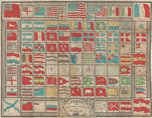
The Flags of the Principal Nations in the World.
sold
- Digital Map Information
- Suitable for large format printing
- DPI: 300
- File Size: 9.33 MB
- File Type: ZIP / TIFF
- ICC color profile embedded
- Delivered instantly via download link
A beautiful 1837 flag chart issued by R. L. Barnes including the martime ensign of the Republic of Texas. The chart features a total of 98 flags associated with countries in Asia, Africa, America, and Europe. In some cases, both merchant and naval ensigns are included. The chart also includes the ensigns of merchant companies, including the British East India Company and the Russian-American Company. (more details)
Toll roads, plank roads, and railroads.
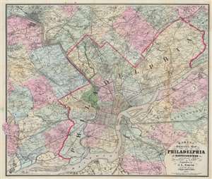
Barnes' Driving Map of Philadelphia and Surroundings.
sold
- Digital Map Information
- Suitable for large format printing
- Full resolution TIFF file
- ICC color profile embedded
- Delivered instantly via download link
This 1874 John L. Smith map of Philadelphia presents a detailed picture of the city and vicinity, covering from Media and King of Prussia east to Delanco and Riverside and from Norristown south to the Delaware River. Philadelphia's streets are illustrated and labeled, and its city squares identified. Outside Philadelphia, many towns are illustrated with street grids. Individual homes are labeled by last name throughout. (more details)
Pocket map of Pennsylvania.
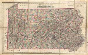
Pennsylvania.
sold
- Digital Map Information
- Suitable for large format printing
- Full resolution TIFF file
- ICC color profile embedded
- Delivered instantly via download link
This is a c.1890 pocket map of Pennsylvania issued by J. L. Smith. It covers the state of Pennsylvania in its entirely, noting rivers, roads, railways, canals, towns, cities and other topographical features. The eastern counties on Pennsylvania are curiously ... (more details)
A charming pictorial map of old New Orleans.
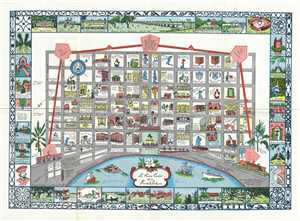
Le Vieux Carre de la Nouvelle Orleans.
sold
- Digital Map Information
- Suitable for large format printing
- Full resolution TIFF file
- ICC color profile embedded
- Delivered instantly via download link
This is a charming 1942 pictorial map of New Orleans, Louisiana. It covers the original fortified settlement of New Orleans along the Mississippi River and inland as far as modern day N Rampart Street. Individual streets are noted, with buildings, ... (more details)
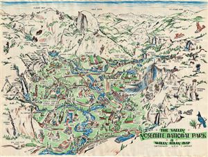
The Valley. Yosemite National Park. A Willy Nilly Map.
sold
- Digital Map Information
- Suitable for large format printing
- File Size: 12.07 MB
- File Type: ZIP / TIFF
- ICC color profile embedded
- Delivered instantly via download link
This is a whimsical 1946 pictorial map of the Yosemite National Park, California by C. Barnes. This beautifully illustrated 'Willy Nilly Map' covers the Yosemite National Park noting several landmarks and places of interest, including Half Dome, ... (more details)