
Belcher, Sir Edward (sold)
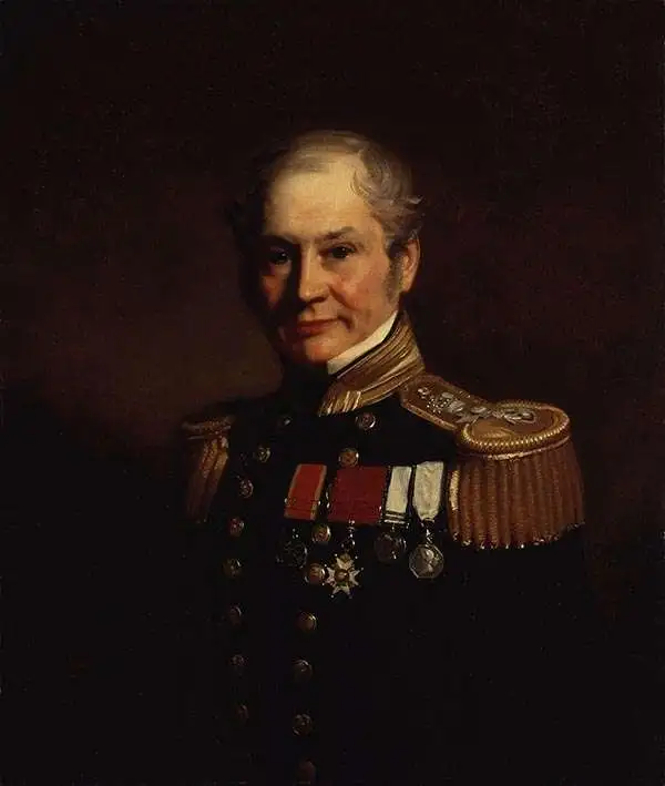
Sir Edward Belcher (February 27, 1799 – March 18, 1877) was a British naval officer, scientist, explorer, and marine surveyor active in the middle part of the 19th century. Belcher was born in Halifax, Nova Scotia, to a proud seafaring family. He entered the Royal Navy in 1812, at just 13 years of age. Thirteen years later, in 1825, he was assigned as official surveyor to the Frederick William Beechey expedition to the Pacific and the Bering Strait. By 1836 he was in command of his own surveying (and bombing) ship, the H.M.S. Sulphur in western Africa and the Pacific coast of South America. The Sulphur was ordered back to England via the Trans-Pacific Route in 1839. On the way, he was delayed and reassigned to China to take part in the First Opium War (1839 – 1842). During this period, on January 26 of 1841, he landed on Possession Point on the northern shore of Hong Kong Island. During this visit he made the influential first British survey of Hong Kong Harbor. On returning to England he was Knighted for his services and reassigned to the HMS Samarang to complete survey work throughout the East Indies, but most specifically in the Philippines. In 1852 he commanded the last and largest Admiralty expedition in search of the lost Arctic Explorer Sir John Franklin. The expedition had five ships, four of which were lost to the Arctic ice. Like all British naval officers who lose a ship, he was court-martialed on his return to England. Although exonerated, he never received another command. He died in London at the age of 78. Belcher is commemorated in Hong Kong through Belcher's Street, Belcher Bay and The Belcher's in Kennedy Town. His name is also commemorated in the Belcher Islands, in the Canadian Arctic. He is also commemorated with a plaque in the Admiralty Garden. Following his last active service, he was appointed Knight Commander of the Order of the Bath in 1867 and an admiral in 1872.
The Earliest Scienific Charting of Okinawa and the Ryukyu Islands
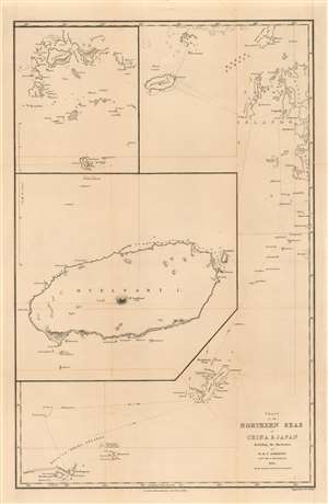
Chart of the Northern Seas of China and Japan Including the Discoveries of H. M. S. Samarang Captn, Sir E, Belcher C.B. 1845. All the shaded parts have been Surveyed.
sold
- Digital Map Information
- Suitable for large format printing
- Full resolution TIFF file
- ICC color profile embedded
- Delivered instantly via download link
This is an extremely rare 1848 Edward Belcher nautical map of the East China Sea, presenting the first scientific survey of the Ryukyu Islands and Okinawa (沖縄本島), Jeju Island (제주도) and Goheung Island (거금도). It was the result of the 1843-46 voyage of Captain Sir Edward Belcher aboard H.M.S. Samarang, which was noted and celebrated not only for thoroughly surveying the islands but also for conducting detailed socio-political and natural studies of them. Belcher was already a famous man prior to this expedition, having been knighted for his service in the First Opium War and having produced the first British survey of Hong Kong harbor. Belcher's expedition aboard the Samarang was explicitly intended to survey the approaches to the five Chinese ports that had been opened to the British in the 1842 Treaty of Nanking, which marked the end of the war. (more details)
Hardly Easy Sailing.
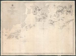
China Eastern Coast Sheet I, From Mongchow to Hong Kong. / [Admiralty Chart No.] 2212.
sold
- Digital Map Information
- Suitable for large format printing
- DPI: 600
- File Size: 620.66 MB
- File Type: ZIP / TIFF
- ICC color profile embedded
- Delivered instantly via download link
An important blueback nautical map of the southern coast of China in the vicinity of Hong Kong and Macao, published in 1853 by the British Admiralty. It reflects increasing familiarity with these waters in the era immediately following the First Opium War (1839 - 1842). (more details)
Hardly Easy Sailing.
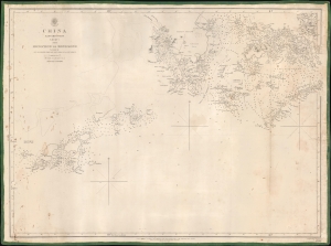
China Eastern Coast Sheet I, From Mongchow to Hong Kong. / [Admiralty Chart No.] 2212.
sold
- Digital Map Information
- Suitable for large format printing
- DPI: 600
- File Size: 575.08 MB
- File Type: ZIP / TIFF
- ICC color profile embedded
- Delivered instantly via download link
An important blueback nautical map or chart of the southern coast of China in the vicinity of Hong Kong and Macao, published in 1853 by the British Admiralty. It reflects increasing familiarity with these waters in the era immediately following the First Opium War (1839 - 1842). (more details)
Belcher's influential chart is considered the first British Map of Hong Kong.
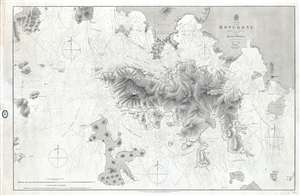
China Hong Kong Surveyed by Captn. Sir Edward Belcher in H.M.S. Sulphur 1841.
sold
- Digital Map Information
- Suitable for large format printing
- File Size: 25.14 MB
- File Type: ZIP / TIFF
- ICC color profile embedded
- Delivered instantly via download link
An iconic map of the utmost importance and rarity, this is the 1864 issue of Edward Belcher's 1843 nautical map of Hong Kong (香港) and vicinity. Belcher's 1841 study is the first detailed British survey of Hong Kong and played a significant role in the British ... (more details)
The height of the China Trade on one chart! Belcher's Hong Kong! Collinson's survey!
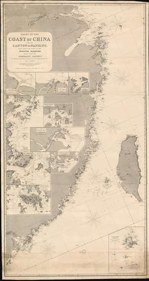
Chart of the Coast of China from Canton to Nanking, with particular plans of the principal Harbors, Drawn from the Admiralty Surveys by Captains R. Collinson, H. Kellett and Sir Edwad Belcher, R. N.
sold
- Digital Map Information
- Suitable for large format printing
- Full resolution TIFF file
- ICC color profile embedded
- Delivered instantly via download link
An exceptionally rare and important 1865 nautical chart or maritime map of the coast of China compiled by John Purdy from the surveys of Sir Edward Belcher (Hong Kong), Richard Collinson (China Coast), and Henry Kellett (China Coast) - probably the best general map of the China coast then obtainable. The map's coverage extends from mouth of the Yangtse River (Nanjing and Shanghai) south as far as Hong Kong and Macao, and east to include Taiwan (Formosa). The chart includes nine insets, among them a large representation Collinson's update of Belcher's First Opium War Hong Kong survey of 1841. This map, made after the second opium war, represents the high point of the China Trade when cities like Shanghai and Hong Kong were transforming into global centers of trade and commerce, largely at the expense of an increasing angry and frustrated Chinese populace (more details)
Belcher's influential chart is considered the first British Map of Hong Kong.
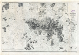
China Hong Kong Surveyed by Captn. Sir Edward Belcher in H.M.S. Sulphur 1841.
sold
- Digital Map Information
- Suitable for large format printing
- File Size: 31.4 MB
- File Type: ZIP / TIFF
- ICC color profile embedded
- Delivered instantly via download link
An iconic map of the utmost importance and rarity, this is the 1890 issue of Edward Belcher's nautical map of Hong Kong (香港) and vicinity. Belcher's 1841 study is considered to be the first British survey of Hong Kong and played a significant role in the ... (more details)
Post-War Hong Kong.
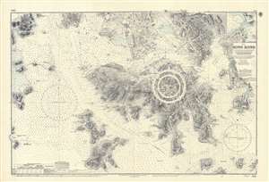
China. Hong Kong. Surveyed by Captn. Sir E. Belcher, H.M. Surveying Ship Sulphur, 1841...
sold
An iconic map of the utmost importance and rarity, this is the 1966 issue of Edward Belcher's 1843 nautical map of Hong Kong (香港) and vicinity. The map covers all of Hong Kong Island (香港島) as well as the Kowloon (九龍) Peninsula and, either in part or full, the adjacent island of Lan Tao (大嶼山), Peng Chau (坪洲), Hei Ling Chau (喜靈洲), Lamma (南丫島), Sheung Sze Mun (雙四門), Po Toi (蒲苔羣島), and Tung Lung Chau (東龍洲). Detail throughout is impressive, refined to the level of individual buildings, especially Victoria, Central, and on the Kowloon Peninsula. Belcher's work was so impressive that, although updated countless times, the base map, as here, remained unchanged for over 100 years. (more details)