
Blome, Richard (sold)
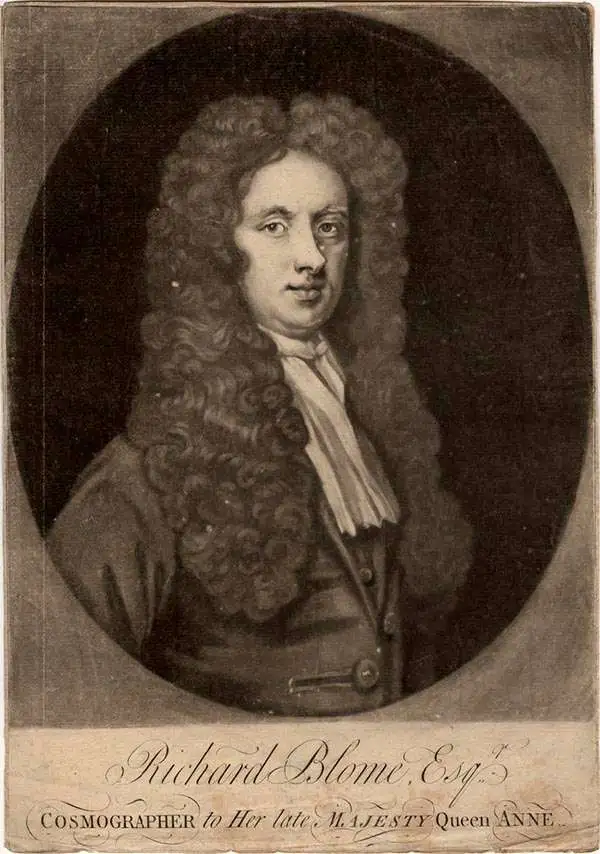
Richard Blome (1635 - 1705) was an important English illustrator, publisher, and cartographer active throughout the late 17th and early 18th century. Blome's father, Richard Bloome (Blome changed the spelling), was a member of the London Stationer's Company, to which Blome was admitted by patrimony. He established himself independently in 1663, producing multiple engravings for various travel narratives and histories. He produced several atlases based on the works of French cartographers, most notably Nicholas Sanson, as well as the re-edited issued of the cartographic works of John Speed, William Camden, and others. Blome was harshly criticized in his lifetime (and later) for not producing original work though it is likely that this stems from the financial difficulties in publishing atlas works without a significant backer. It is not by chance that many cartographers died bankrupt, as engraving, copper plates, and original survey work were expensive propositions. Scholar Ashley Baynton-Williams comments (Map Forum, vol.9)
It would be hard to claim a successful career for Blome, but he occupies a very important position in the history of the English map-trade of the seventeenth century. He was the first publisher in England for 40 years to prepare a new folio world atlas, the first in over sixty years to publish a new set of (albeit small) folio county maps, the first to seriously plan an illustrated description of London, and the first to plan a series of volumes related to the various Continents of the World. Moreover, all this from one who came from a publishing rather than cartographic background.
First Acquirable Map of the British Colonies from Virginia to New England.
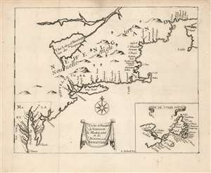
Costes et Rivieres de Virginie de Mariland et de Nouvelle Angletere.
sold
- Digital Map Information
- Suitable for large format printing
- Full resolution TIFF file
- ICC color profile embedded
- Delivered instantly via download link
This is the 1674 Justel edition of Richard Blome's map of Virginia, Maryland, and New England. Blome's rare 1672 A Draught of the Sea Coast and Rivers of Virginia, Maryland and New England Taken from the latest Surveys was the first English map to focus on the British colonies in North America from Virginia up through New England, just preceding the explosion of geographical knowledge represented by the works of Herrman (1673) and Seller (1676.) This French edition of the map is also scarce, but more acquirable to the collector than the Blome. It is a valuable addition to any collection pertaining to colonial Virginia and New England, in that it shows the starting point for the expansion of those colonies that followed in the late seventeenth century. (more details)
First Acquirable Map of the British Colonies from Virginia to New England.
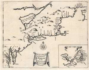
Costes et Rivieres de Virginie de Mariland et de Nouvelle Angletere.
sold
- Digital Map Information
- Suitable for large format printing
- Full resolution TIFF file
- ICC color profile embedded
- Delivered instantly via download link
This is the 1674 Justel edition of Richard Blome's map of Virginia, Maryland, and New England. Blome's rare 1672 edition of this work was the first English map to focus on the British colonies in North America, Virginia up through New England; it just preceded the explosion of geographical knowledge represented by the works of Herrman (1673) and Seller (1676.) This French edition of the map is also scarce, but more acquirable to the collector than the Blome, and is a faithful copy of its precursor. It is a valuable addition to any collection pertaining to colonial Virginia and New England, in that it depicts the starting point for the expansion of those colonies that followed in the late seventeenth century. (more details)
One of the First Maps of China engraved in England.
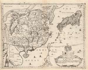
A New Mapp of y Empire of China With its severall Provinces or Kingdomes Together with the adjacent Isles of Japon or Niphon Formosa Hainan etc.
sold
- Digital Map Information
- Suitable for large format printing
- Full resolution TIFF file
- ICC color profile embedded
- Delivered instantly via download link
This is the scarce 1682 Richard Blome map of China, Korea, and Japan. This richly-detailed and surprisingly unique map was engraved in 1669 by the great Bohemian artist and etcher, Wenceslaus Hollar, who for most of his adult life practiced in his adopted England. Although most of the maps appearing in Blome's A Geographical Description of the Four Parts of the World were undisguised renditions of the work of the French geographer Nicolas Sanson, this map is derived from the work of Martino Martini, at least in part, via the atlas of China printed by Joan Blaeu in 1655.
Superficially, the map resembles the 1655 Blaeu Imperii Sinarum Nova Descriptio but this is no slavish copy. First, the area in focus differs: the western limits of this map extend perhaps five degrees less than the Blaeu, ending in the region of Pegu, where the Blaeu continues to Bengal; the southern limit of the Blome is five degrees north, whereas the Blaeu ends just beyond fifteen degrees. As a result, the Blome exchanges Blaeu's western expanses of blank desert for a more complete depiction of the Philippines, and a fuller treatment of the region of Southeast Asia (Siam / Thailand and Cochinchina / Vietnam). (more details)
Superficially, the map resembles the 1655 Blaeu Imperii Sinarum Nova Descriptio but this is no slavish copy. First, the area in focus differs: the western limits of this map extend perhaps five degrees less than the Blaeu, ending in the region of Pegu, where the Blaeu continues to Bengal; the southern limit of the Blome is five degrees north, whereas the Blaeu ends just beyond fifteen degrees. As a result, the Blome exchanges Blaeu's western expanses of blank desert for a more complete depiction of the Philippines, and a fuller treatment of the region of Southeast Asia (Siam / Thailand and Cochinchina / Vietnam). (more details)
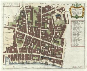
Tower Street Ward With its Division into the Parishes, Taken from the last Survey with Corrections.
sold
- Digital Map Information
- Suitable for large format printing
- DPI: 300
- File Size: 7.65 MB
- File Type: ZIP / TIFF
- ICC color profile embedded
- Delivered instantly via download link
A fine c. 1720 map of the Tower Street Ward, London, england by Richard Blome and John Strype. The map covers the region between and St. Mary's Hill and the Tower of London and from the Clothworkers Hall (still present) to the Thames River, including the gardens ... (more details)