
Bracher, William (sold)

William Bracher (June 29, 1829 - May 14, 1912) was a Philadelphia based engraver and lithographer active in the late 19th century. Bracher was born in Göppingen, Badan-Württemberg, Germany. He was a 48er, who emigrated to the United States in 1848 with his wife Amelia A. M. Bracher (born Naigele), fleeing the failed Springtime of the Peoples Revolutions (1848 - 1849). He settled in Philadelphia, where he established himself as line and stipple engraver as early as 1861. He was naturalized as a U.S. citizen on March 27, 1854. Around 1858, Bracher partnered with George Worley and Benjamin Matthais to from the printing firm of 'Worley, Bracher and Matthias'. They were active at 600-602 Chestnut Street, Philadelphia, until 1860, when Matthias left the firm. At this time, the firm was renamed 'Worley and Bracher'. In 1866, they relocated to 104 Hudson Street (rear 320 Chestnut Street) and remained until 1873. From 1873 to 1875, the firm rented at 31 South Sixth Street and then at 27 South Sixth Street until 1891. The firm appears to have shared space and often worked with a variety of private Philadelphia engravers, including Frederick Bourquin (1808 - 1897), William Hart, James McGuigan, F. C. Paxson, Henry J. Toudy (fl. c. 1857 - c. 1877), and Thomas S. Wagner.
Monumental map of Boston.
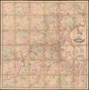
Map of the City of Boston and its Environs.
sold
- Digital Map Information
- Suitable for large format printing
- Full resolution TIFF file
- ICC color profile embedded
- Delivered instantly via download link
This is an 1867 Henry Francis Walling and Ormando W. Gray map of Boston, Massachusetts, and environs. Boston appears to the right of center, with East Boston and South Boston both labeled. Boston Common and the Public Garden are labeled in Boston, along with streets, wharves, railroad lines, and a handful of buildings. Outside Boston, the map depicts from Wilmington, Danvers, and North Beverly south to West Medway and Walpole Centre and from Ashland Center east to Marblehead, Salem, and Beverly. Hundreds (if not thousands) of private residences are identified by the owner's name throughout, along with banks, schools, railroad stations, churches, and cemeteries. Roads, railroads, hills, lakes, rivers, and other physical features are noted. (more details)
A rare city plan of Farmington, Maine.
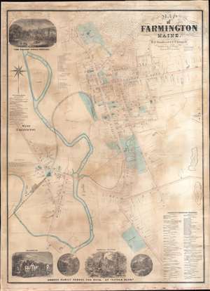
Map of Farmington Maine.
sold
- Digital Map Information
- Suitable for large format printing
- Full resolution TIFF file
- ICC color profile embedded
- Delivered instantly via download link
This is an 1874 E.F. Sanford and C.T. Leggett city plan or map of Farmington, Maine. Created by soliciting subscriptions from the town's businesspeople and residents, the map depicts from the Willows Female Seminary to S. Norton's house south of the cemetery on Main Street and from the railroad shops in West Farmington to the slate quarries east of town. Houses throughout town are illustrated and identified by the owner's name and the lots are delineated. Schools (including the State Normal School), churches, and offices are labeled throughout town as well. Other illustrated locations around town include the railroad depot (serviced by the Androscoggin Division of the Maine Central Railroad), the sweet corn factory, the brick yard, the cattle yards, S.R. Leland's Apple Orchard, and the H.R. Butterfield shovel handle factory. References for thirty-five numerically identified locations along Main Street and Broadway in Farmington occupy a space in the upper left quadrant. A directory for West Farmington appears along the left border. A view of the Willows Female Seminary occupies the upper left corner. A series of four views along the bottom border highlight different scenes associated with the Abbott Family School for Boys. (more details)
Best and largest map of Mount Desert Island at the height of its Gilded Age.
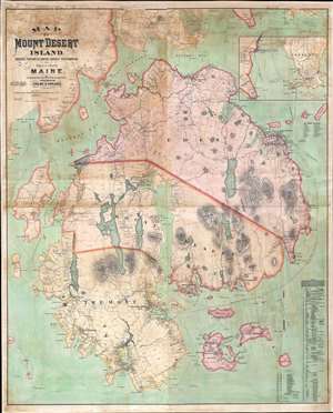
Map of Mount Desert Island, Sorrento, Portions of Lamoine, Hancock, and Frenchman's Bay, and Adjacent Islands, Maine.
sold
- Digital Map Information
- Suitable for large format printing
- File Size: 146.81 MB
- File Type: ZIP / TIFF
- ICC color profile embedded
- Delivered instantly via download link
The largest, rarest, and most important map of Mount Desert Island, Maine, to appear in the 19th century. Published by Colby and Stuart in 1887, this wall map captures Mount Desert Island and Bar Harbor at the height of its gilded age, when it rivaled Newport as a haven for the moneyed elite. The map embraces the island in exceptional detail, showing topography and roads, as well as property lots, the named estates of the wealthy, grand hotels, lodges, restaurants, and more. Today, most of Mount Desert Island is part of Acadia National Park, one of America's most beloved and beautiful national parks. (more details)