
Bretez, Louis (sold)

Louis Bretez (fl. 1700 - 1740) was French born sculptor and painter active in the early 18th century. Bretez was a member of the Academie Royale de Peinture et Sculpture in Paris where he specialized in perspective with regard to architecture. Bretez's greatest achievement was his production, with Claude Lucas, of the monumental Turgot Plan of Paris. This spectacular map, one of history's greatest achievements of urban cartography, occupied Bretez from 1734 to 1739. It depicts Paris from a bird's eye perspective with extraordinary detail to the level of individual buildings and trees.
Important and monumental 20 panel map of Paris.
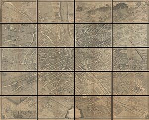
Plan de Paris.
sold
- Digital Map Information
- Suitable for large format printing
- File Size: 38.63 MB
- File Type: ZIP / TIFF
- ICC color profile embedded
- Delivered instantly via download link
This is the c. 1900 Taride edition of Louis Bretez and Michel-etienne Turgot's monumental 1739 map of Paris. Turgot's map of Paris is possibly the most ambitious urban mapping ever undertaken. Shows the whole of 18th century Paris and offers a wonderful ... (more details)
Important and monumental 20 panel map of Paris.
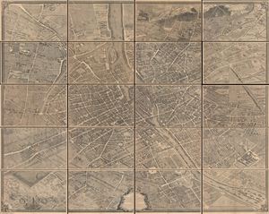
Plan de Paris.
sold
- Digital Map Information
- Suitable for large format printing
- File Size: 30.4 MB
- File Type: ZIP / TIFF
- ICC color profile embedded
- Delivered instantly via download link
This is the c. 1900 Taride edition of Louis Bretez and Michel-Etienne Turgot's monumental 1739 map of Paris. Turgot's map of Paris is possibly the most ambitious urban mapping ever undertaken. This map shows the whole of 18th century Paris and offers a wonderful perspective on the city before Baron Georges Eugène Haussmann's 19th-century redesign. Turgot, who held the mayor-like office of Prevôt des Marchands de Paris , commissioned Louis Bretez and Claude Lucas to produce this map in 1734. Oriented to the east on an axonometric projection, this map is best understood as an aerial view where in every building, window, tree, shadow, and park are shown. It took the team nearly five years of exhaustive sketching and surveying to assemble this masterpiece. In order to produce the thousands of sketches and surveys required to complete this map, Bretez was issued a permit to enter every building in Paris. (more details)
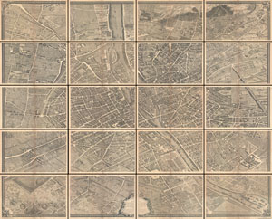
Plan de Paris.
sold
- Digital Map Information
- Suitable for large format printing
- File Size: 39.19 MB
- File Type: ZIP / TIFF
- ICC color profile embedded
- Delivered instantly via download link
This is the c. 1900 Taride edition of Louis Bretez and Michel-Etienne Turgot's monumental 1739 map of Paris. Turgot's map of Paris is possibly the most ambitious urban mapping ever undertaken. Shows the whole of 18th century Paris and offers a wonderful ... (more details)
Important and monumental 20 panel map of Paris, France.
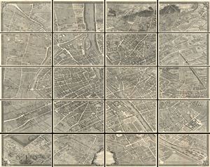
Plan de Paris.
sold
- Digital Map Information
- Suitable for large format printing
- File Size: 17.85 MB
- File Type: ZIP / TIFF
- ICC color profile embedded
- Delivered instantly via download link
This is the c. 1900 Taride edition of Louis Bretez and Michel-Etienne Turgot's monumental 1739 map of Paris. Turgot's map of Paris is possibly the most ambitious urban mapping ever undertaken. Shows the whole of 18th century Paris and offers a wonderful ... (more details)
The Finest Engraved Plan of Paris in its Sole Original Edition.
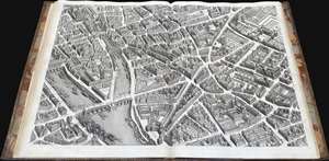
Plan de Paris Commence l’Annee 1734.... Leve et Desine par Louis Bretez Grave par Claude Lucas / Et Ecrit par Aubin.
sold
This is Louis Bretez and Michel-Etienne Turgot's monumental 1739 map of Paris, in a beautiful, bound example. Turgot's map of Paris - possibly the most ambitious urban mapping ever undertaken - shows the whole of 18th century Paris, offering an unparalleled view of the city prior to the 19th century redesign by Baron Georges Eugène Haussmann: every structure within the city at the time is here depicted. Turgot, who held the mayor-like office of Prevôt des Marchands de Paris , commissioned Louis Bretez and Claude Lucas to produce this map. Oriented to the east on an axonometric projection, this map is best understood as an aerial view in which every building, window, tree, shadow, and park are shown from an equidistant aerial perspective. In order to produce the thousands of sketches and surveys required to complete this map, Bretez was issued a permit to enter every building in Paris. It took the team nearly five years of exhaustive sketching and surveying to assemble this masterpiece. (more details)
Important and monumental 20 panel map of Paris.
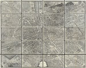
Plan de Paris.
sold
- Digital Map Information
- Suitable for large format printing
- File Size: 32.16 MB
- File Type: ZIP / TIFF
- ICC color profile embedded
- Delivered instantly via download link
This is the c. 1900 Taride edition of Louis Bretez and Michel-Etienne Turgot's monumental 1739 map of Paris. Turgot's map of Paris is possibly the most ambitious urban mapping ever undertaken. This map shows the whole of 18th century Paris and offers a wonderful perspective on the city before Baron Georges Eugène Haussmann's 19th-century redesign. Turgot, who held the mayor-like office of Prevôt des Marchands de Paris , commissioned Louis Bretez and Claude Lucas to produce this map in 1734. Oriented to the east on an axonometric projection, this map is best understood as an aerial view where in every building, window, tree, shadow, and park are shown. It took the team nearly five years of exhaustive sketching and surveying to assemble this masterpiece. In order to produce the thousands of sketches and surveys required to complete this map, Bretez was issued a permit to enter every building in Paris. (more details)
Magnificent, iconic, and highly detailed twenty page wall map of Paris, France.
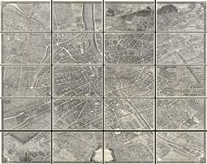
This is the c. 1900 Taride edition of Louis Bretez and Michel-Etienne Turgot's monumental 1739 map of Paris. Turgot's map of Paris is possibly the most ambitious urban mapping ever undertaken. This map shows the whole of 18th century Paris and offers a wonderful perspective on the city before Baron Georges Eugène Haussmann's 19th-century redesign. Turgot, who held the mayor-like office of Prevôt des Marchands de Paris , commissioned Louis Bretez and Claude Lucas to produce this map in 1734. Oriented to the east on an axonometric projection, this map is best understood as an aerial view where in every building, window, tree, shadow, and park are shown. It took the team nearly five years of exhaustive sketching and surveying to assemble this masterpiece. In order to produce the thousands of sketches and surveys required to complete this map, Bretez was issued a permit to enter every building in Paris. (more details)