
Brown, Grafton Tyler (sold)
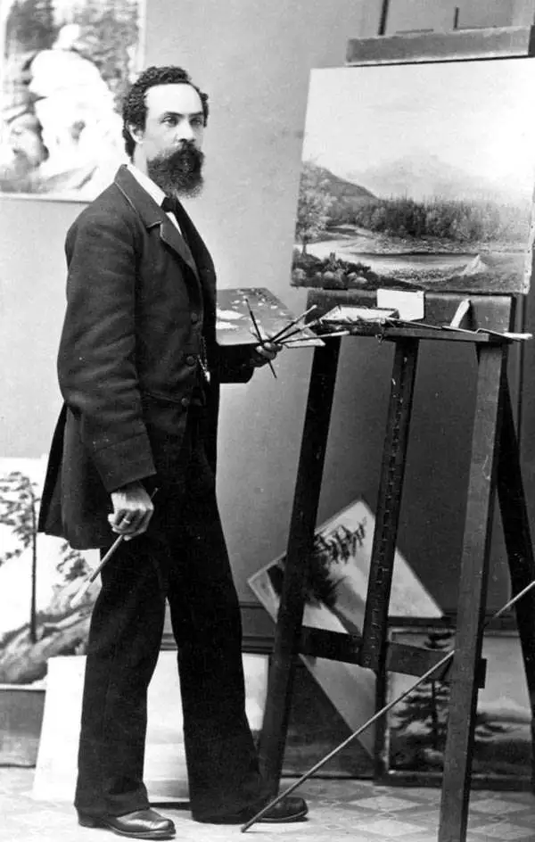
Grafton Tyler Brown (February 1841 – March 2, 1918) was an American painter, lithographer, viewmaker, and cartographer active in California and the Pacific northwest. Brown was one of the few African American lithographers and viewmakers active in the 19th century. He was born in Harrisburg, Pennsylvania and was the son of free blacks involved with the abolitionist movement. He studied printing in Philadelphia from 14 years of age, mastering lithography by the time he reached his maturity. Brown relocated to San Francisco in 1858, when he was just seventeen, and just prior to the outbreak of the American Civil War (1861 - 1865). He initially took work as a steward at the St. George Hotel in Sacramento, but quickly earned a reputation as an excellent artist. Meanwhile in 1850 San Francisco, the viewmakers, Charles C. Kuchel (1820 - 1865) and his artist Emil Dresel, operating as 'Kuchel and Diesel', split ways. Dresel, the artist, moved to Sonoma to open a vineyard. Kuchel needed a new artist and had heard of Grafton Brown through his connections. Grafton accepted the position and moved to San Francisco, where he worked with Kuchel from 1861 to 1865. When Kuchel died in 1865, Grafton purchased the business. Curiously, while he appears in Sacramento directories as 'colored', in San Francisco there is no such designation, later, in Minnesota census records, he is recorded as 'white'. In fact, being very light skinned, he could pass as either race depending on the viewer's expectations. Literature of the period suggests that his true ethnicity was an open secret that most chose to willfully ignore in the face Brown's competence and business acumen. Brown was a lithographer, while most of his San Francisco competitors were letterpress printers. The versatility of lithography gave him a natural advantage in terms of both price and versatility over letterpress. Among his earliest work are advertisements for such prominent firms as Levi Strauss. By 1870 he had a staff of 4, expanding to 8 in 1880. Some of his best customers were mining companies, who issued decorative stock certificates printed by Brown. Through these, he became involved with producing bird's-eye views to promote mining boomtowns. He issued the first and second views of Virginia City, as well as the first and only view of Silver City, Idaho Territory. He also issued a wealth of real-estate maps, primarily focused on Oakland, California. By the 1880s, the silver loads and Oakland real estate business began to decline and, along with it, Brown's business. In 1882, he sold his company and relocated to Victoria, British Columbia, Canada, to work with Amos Bowman in the national Geological Survey. He worked with the survey as a draftsman and landscape artist. Leveraging his history of view making, many of Brown's landscapes were based upon photographs he took. In 1884 he returned to the United States and settled in Portland, Oregon, where he worked as a landscape painter. Brown moved again in 1893, this time to Saint Paul, Minnesota, where he once again worked as a draughtsman, this time for the United States Army Corps of Engineers, as well as for the city of St. Paul. In the 1890s, he worked extensively in Yellowstone, producing photographs, paintings, and views. Brown remained in Minnesota until his death in 1918.
Silver boomtown by the first African American Lithographer.
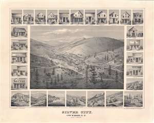
Silver City, Owyhee, I.T.
sold
- Digital Map Information
- Suitable for large format printing
- File Size: 52.62 MB
- File Type: ZIP / TIFF
- ICC color profile embedded
- Delivered instantly via download link
A remarkable 1866 bird's-eye view of Silver City, Idaho Territory, issued by Grafton Tyler Brown, America's first African American lithographer, and presenting the mining boomtown at its height of prosperity. Silver City experienced one of America's richest mineral strikes, producing gold and silver for more than 40 years. This view is one of only two known examples, significant not only for its historic illustration of a pop-up boomtown in full bloom, but also for being one of the few surviving views engraved and printed by Grafton T. Brown. Unlike many views, it has the unique distinction of being drawn from daguerreotype photographs taken by Philip Frederick Castleman, who visited with a supply caravan in 1866. (more details)
Mining claims of the Comstock Lode.
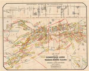
Map of the Comstock Lode and the Washoe Mining Claims in Storey and Lyon Counties, Nevada.
sold
- Digital Map Information
- Suitable for large format printing
- Full resolution TIFF file
- ICC color profile embedded
- Delivered instantly via download link
This is an 1875 T.D. Parkinson and Grafton Tyler Brown map of the Comstock Lode in Nevada. Boxes outlined in several different colors highlight individual mining claims from Silver City north to the North Virginia Townsite and Flowery Ridge. The Virginia and Truckee Railroad winds its way toward Virginia City and the Silver City Branch connects that railroad with Silver City. Streets are illustrated in Virginia City, although none are named. Numerous mills, mine shafts, toll houses, and other sites are identified, including the graveyard and county hospital. The Sutro Tunnel is prominently labeled to the right of center. A longitudinal view of the Comstock Lode appears above the map and illustrates where the silver strikes were located, the depth of many of the mine shafts, and the depth of the Sutro Tunnel. (more details)
Exeptional view of San Francisco, California by early African American publisher.
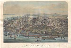
San Francisco. Looking South from North Point.
sold
- Digital Map Information
- Suitable for large format printing
- Full resolution TIFF file
- ICC color profile embedded
- Delivered instantly via download link
A view of San Francisco, California originally published in 1877 by G. T. Brown and company. The present example is a 20th century reproduction issued by John Howell Books, a now defunct California bookstore active from 1912 - 1985. The view bears signs of age ... (more details)