
Bruff, Joseph Goldsborough (sold)
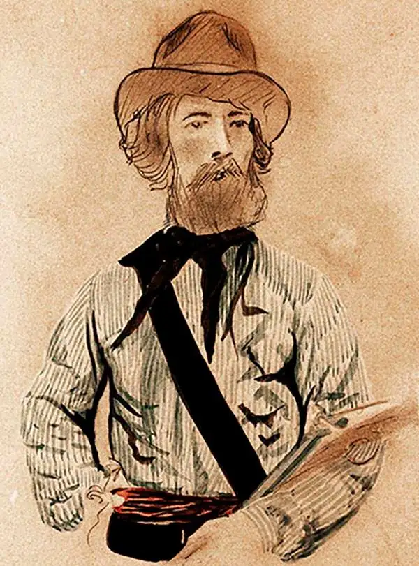
Joseph Goldsborough Bruff (October 2, 1804 - April 14, 1889) was an American artist, adventurer, surveyor, and cartographer active in the mid to late 19th century. Bruff was born in Washington D.C., the son of a wealthy physician, dentist, and inventor (coffee grinder). At 16 he was sent to West Point, but shortly afterwards dismissed for dueling. He subsequently signed on a merchant ship as cabin boy, initiating a five-year career as an itinerant seaman. In 1927 he returned to Washington, taking a position as a draughtsman at the Norfolk Naval Shipyard. Shortly thereafter he transitioned to a higher paid position at Fort Monroe, where he remained for 2 years. Gruff had an arrogant entitled character, but his work was exacting and much admired, enough so that in 1839, he was hired as a draftsman for the Army Bureau of Topographical Engineers. There he compiled and published numerous maps from hand-drawn field maps prepared by explorers. His work from this period includes drafting the important exploration maps of John C. Frémont (who became a personal friend), and the first map of Florida after statehood. In 1849, Bruff, like many Americans caught gold fever. He leveraged his connections in Washington to finance the Washington City and California Mining Association. The well-funded expedition traveled overland in a caravan of sixty-six men and 14 wagons. While Bruff did not discover gold in California, he did travel extensively throughout he gold region producing numerous important maps and diagrams. He returned to Washington via ship, landing in New York in July of 1851. Back in Washington he took work with the Treasury department in the Office of the Supervising Architect. He helped in the design and construction of the DC Treasury Building as well as Treasury offices around the country. Bruff continued his position with the treasury until his death in 1889, at which time he was the oldest active U.S. Government employee. Bruff is interred at the National Congressional Cemetery in Washington. D.C.
The most important map of Florida, issued 1 year after statehood at the end of the Second Seminole War.
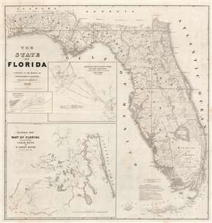
The State of Florida.
sold
- Digital Map Information
- Suitable for large format printing
- Full resolution TIFF file
- ICC color profile embedded
- Delivered instantly via download link
The first official map of the State of Florida, this spectacular production was issued in 1846, on year after statehood and at the end of the Second Seminole War, by the Army Bureau of Topographical Engineers. The map was drawn by Joseph Goldsborough Bruff, an adventurer, playboy, and civilian contractor working with the Topographical Engineers. It illustrates the state of the Florida survey as of 1846, as well as major events, routes, and settlements associated with the First and Second Seminole Wars. Moreover, the map includes holdover grants from the Spanish era, including Arredondo's Grant and Forbes' Purchase. With unsurpassed detail and scale, this map became the foundational map for most subsequent maps of Florida through the end of the 19th century. (more details)
The most important map of Florida, issued 1 year after statehood at the end of the Second Seminole War.
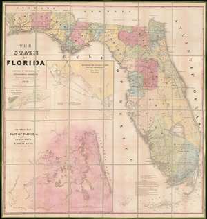
The State of Florida.
sold
- Digital Map Information
- Suitable for large format printing
- DPI: 600
- File Size: 81.56 MB
- File Type: ZIP / TIFF
- ICC color profile embedded
- Delivered instantly via download link
The first official map of the State of Florida, this spectacular production was issued in 1846, on year after statehood and at the end of the Second Seminole War, by the Army Bureau of Topographical Engineers. Here the map is presented in deluxe full color format, dissected and mounted on linen. The map was drawn by Joseph Goldsborough Bruff, an adventurer, playboy, and civilian contractor working with the Topographical Engineers. It illustrates the state of the Florida survey as of 1846, as well as major events, routes, and settlements associated with the First and Second Seminole Wars. Moreover, the map includes holdover grants from the Spanish era, including Arredondo's Grant and Forbes' Purchase. With unsurpassed detail and scale, this map became the foundational map for most subsequent maps of Florida through the end of the 19th century. (more details)
Created from a captured Mexican map.
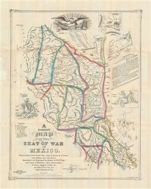
A Correct Map of the Seat of War in Mexico. Being a Copy of General Arista's Map, taken at Resaca de la Palma, with additions and Corrections; Embellished with Diagrams of the Battles of 8th and 9th May, and Capture of Monterey, with a memorandum of forces engaged, results, etc. and Plan of Vera Cruz and Castle of San Juan de Ulua.
sold
- Digital Map Information
- Suitable for large format printing
- Full resolution TIFF file
- ICC color profile embedded
- Delivered instantly via download link
This is a rare first-edition 1847 John Disturnell and Joseph Goldsborough Bruff map of the Mexico during the Mexican-American War (1846 - 1848). Depicting the region from Chihuahua to the Gulf of Mexico and from the Rio Grande to Mexico City, this map represents the most detailed cartography available to the United States Army at the beginning of the war. (more details)