
China Cartographic Publishing House (sold)

China Cartographic Publishing House (中国地图出版社; 1954 - present) is the only national-level publisher of maps in the People's Republic of China and is by far the largest publisher of maps in China. The firm was formed with the consolidation of the state-run Xinhua Map Agency and 15 other private press agencies, among them some of the earliest known modern Chinese map publishers dating to about 1900. Its official English name has been changed to Sino Map Press.
China on the eve of the Cultural Revolution.
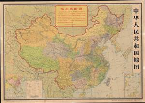
This is a rare 1966 second edition of the China Cartographic Publishing House's 1965 map of the People's Republic of China. It was published on the eve of the Great Proletarian Cultural Revolution, one of the most consequential events in modern Chinese history. (more details)
Modernist railroad schmatic map of China.
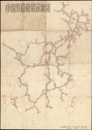
中国铁路路线示意图 / Chinese Railroad Schematic Route Map.
sold
- Digital Map Information
- Suitable for large format printing
- File Size: 24.09 MB
- File Type: ZIP / TIFF
- ICC color profile embedded
- Delivered instantly via download link
An interesting 1966 Schematic map of the railroad systems of China, including Taiwan, issued by China Cartographic Publishing House (中国地图出版社). This starkly modern map exhibits no geographical content, rather, in the spirit of London Underground maps of the 1920s and 1930s, focuses exclusively on the railroad network and connections. (more details)
Mao's support of African American civil rights.
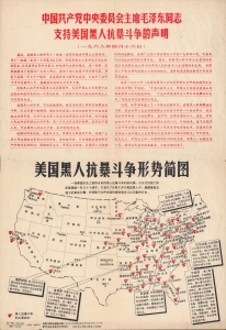
A fascinating example of transnational persuasive cartography from the Cold War era, this is a Chinese propaganda piece touting support for the American Civil Rights Movement in the wake of Martin Luther King's 1968 assassination. The lettersheet was issued following the assassination of Martin Luther King, Jr. on April 4 of that year. Directed at a domestic audience, it reflects the wider political and geopolitical context in which it was produced. (more details)
One of the Cold War's Most Curious Alliances.
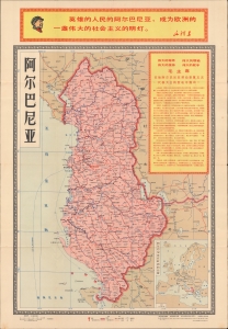
An interesting piece of Cold War persuasive cartography, this Chinese-language map of Albania was produced in 1968 by the China Cartographic Publishing House. It is a relic of the oddly bizarrely close Cold War alliance between Mao Zedong's People's Republic of China and Enver Hoxha's People's Republic of Albania. (more details)
China's rail network.
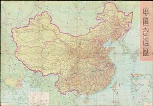
This is an exhaustive 1974 China Cartographic Publishing House transportation map of China. The verso is a map of China's railway network at the time (中国铁路路线示意图). The maps provide a good sense of China's infrastructure and degree of international connections on the eve of opening up in the late 1970s. (more details)
Geological diversity of China.
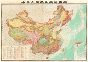
A very large-format 1976 map of the People's Republic of China, including claimed territory in the South China Sea, Taiwan, and along the border with India, produced by the Chinese Academy of Geological Sciences. It was published in the waning days of the Cultural Revolution and can be seen as representative of a wider revival of the sciences in the mid-1970s following the ideological attacks of the late-1960s and early 1970s. (more details)