
Copley, Charles (sold)

Charles Copley (1800 - November 17, 1880), was an American nautical chart and globe publisher based in Brooklyn, New York and active in the middle part of the 19th century. He was born in England and emigrated to the United States in the 1840s. He became a citizen in 1844. Charles Copley's earliest work is associated with the firm of E. and G. W. Blunt and his name appears as hydrographer or engraver on several of Blunt's c. 1840 charts – so he must have began working the Blunt shortly after emigrating. Around 1847 Copley began publishing independently, advertising himself as an engraver and map publisher. Most of his independent work was published in the 1850s. By 1860, the firm renamed itself Charles Copley and Son's, accommodating Charles John Copley Jr. (1826 - 18xx) and Frederick S. Copley (1827 - 18xx). From this point forward, most charts are copyrighted by 'C.C.J and F.S. Copley.' All Copley charts are extremely rare.
An extremely scarce privately issued nautical chart of Long Island, New York.
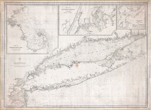
[Long Island, 1860]
sold
- Digital Map Information
- Suitable for large format printing
- File Size: 60.03 MB
- File Type: ZIP / TIFF
- ICC color profile embedded
- Delivered instantly via download link
An extremely rare 1860 blueback nautical chart or maritime map of Long Island by the Brooklyn chart publisher Charles Copley. Copley's chart covers from Staten Island to Montauk, inclusive of the Connecticut coast, Long Island Sound, Long Island itself, New York City, and parts of adjacent New Jersey and Rhode Island. Moreover, the map features three large insets detailing Cape Cod and vicinity, New York City's East River, and New York City's Hell Gate. (more details)
Running the Union Blockade during the Civil War.
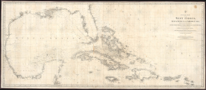
A General Chart of the West Indies, Gulf of Mexico and Caribbean Sea, showing the adjacent Coasts of the United States, Mexico, Central America, and the Spanish Main, to the Mouths of the Orinoco...
sold
- Digital Map Information
- Suitable for large format printing
- File Size: 79.4 MB
- File Type: ZIP / TIFF
- ICC color profile embedded
- Delivered instantly via download link
This is Charles Copley and Sons' huge Civil War 1863 nautical map of the West Indies or Caribbean. Although printed in New York, Copley's charts were the best available privately published nautical charts of these waters. As such, they were coveted by Confederate Blockade Runners, who acquired them through the lucrative trade of intermediary sellers in Bermuda or the West Indies. This map was likely used by Confederate blockade runners in navigating between the Confederacy and the West Indies. (more details)
Made for blockade running.
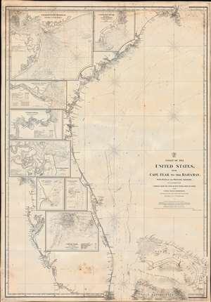
Coast of the United States from Cape Fear to the Bahamas, with plans of the Principal Harbors on an Enlarged Scale; Compiled from the most Recent Surveys, Made by order of the United States Government, and Adjusted by the Latest Astronomical Observations.
sold
- Digital Map Information
- Suitable for large format printing
- File Size: 48.52 MB
- File Type: ZIP / TIFF
- ICC color profile embedded
- Delivered instantly via download link
This is a rare 1865 Civil War Era Charles Copley 'blockade runner's' nautical chart or maritime map of the southeastern coast of the United States extending roughly from Cape Fear, North Carolina, to Miami, Florida, and the northern Bahamas. (Miami does not yet exist, but the Miami River and the Cape Florida Light, built in 1860, are illustrated.) Insets within the peninsula of Florida detail the most important southern harbors: Charleston, Georgetown Harbor, the Savannah River, Jacksonville (St. John's River), Fernandina Harbor, Cape Canaveral, Turtle Harbor, and Cedar Keys. The northern Bahamas are covered in some detail, but the chart does not extend as far south as Nassau. (more details)