
Cram, George Franklin

George Franklin Cram (May 20, 1842 - 1928) was an American map publisher active in the late 19th and early 20th centuries. During the American Civil War, Cram served as a staff cartographer for the Union General Ulysses S. Grant and participated in Sherman's 'March to the Sea'. In 1867, after being discharged from the army, George Cram moved to Chicago, where he founded 'Blanchard and Cram' with his uncle Rufus Blanchard Evanston. Blanchard and Cram was a supply house for the book trade - though they also published a few maps during this period. This short lived business was destroyed in the 1871 by the Great Chicago Fire. After the fire, recognizing a business opportunity in the burgeoning railroad industry, Cram reinvented himself as cartographic publisher, opening the Cram Map Depot. Like fellow Chicago publisher Rand McNally, Cram took advantage of the economical wax engraving processes to inexpensively produce maps in vast quantities. His signature publication, the Unrivaled Atlas of the World became the world's best-selling atlas and was published from the 1880s to 1952. On retiring in 1921, Cram sold his company to Edward A. Peterson of the National Map Company (Scarborough Company). Peterson moved the company to Indianapolis where, following Cram's death, he rebranded the National Map Company as the George F. Cram Company, surely thinking to capitalize on the established identity of the firm. In 1930 he entered the globe market for which the firm was best known from the mid-20th century. In time the firm expanded globally passing becoming a major concern. Loren B. Douthit became company president in 1968 and the Douthit family ran the business until Herff Jones, Inc., bought the company in 2005.
The Fight for the Philippines.
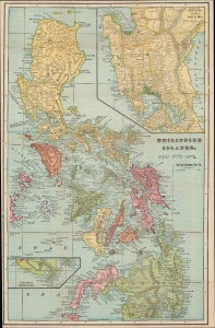
Philippine Islands.
$450.00
Acquire
- Digital Map Information
- Suitable for large format printing
- Full resolution TIFF file
- ICC color profile embedded
- Delivered instantly via download link
A rare c. 1899 pocket map of the Philippines or Philippine Islands coinciding with the American occupation of the archipelago and the resulting conflict with Filipino independence fighters. It was published in Chicago by the Fort Dearborn Publishing Company and issued on behalf of a local business in Portsmouth, New Hampshire. (more details)
Mining the Gem State.
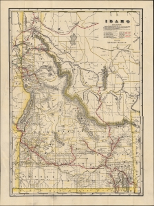
Idaho. / Cram's Indexed Township County Map and Shipper's Guide of Idaho.
$850.00
Acquire
- Digital Map Information
- Suitable for large format printing
- File Size: 19.07 MB
- File Type: ZIP / TIFF
- ICC color profile embedded
- Delivered instantly via download link
This is rare first edition of George Cram's separate-issue 1902 pocket map of Idaho, that appeared in that year's Indexed Township County Map and Shipper's Guide for the state. (more details)
A 'most unblushing fraud upon the government'.
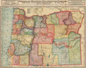
Oregon. Oregon and Western Colonization Company.
$950.00
Acquire
- Digital Map Information
- Suitable for large format printing
- Full resolution TIFF file
- ICC color profile embedded
- Delivered instantly via download link
This is a 1911 George Cram map of Oregon published for the Oregon and Western Colonization Company (OWC). The grant lands offered for sale here were the fruit of a 'most unblushing fraud upon the government' perpetrated in the late 19th century by the Willamette Valley and Cascade Mountain Wagon Road Company. (more details)
'There is an opportunity for everybody, rich and poor.'
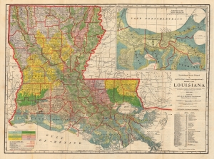
The Louisiana State Board of Agriculture and Immigration's Map of Louisiana. A Phytogeographic Map Showing the Principal Vegetation Areas, all Principal Commercial Points, Town Populations and Railway Distances.
$450.00
Acquire
- Digital Map Information
- Suitable for large format printing
- Full resolution TIFF file
- ICC color profile embedded
- Delivered instantly via download link
This is a 1913 thematic map of Louisiana illustrating terrain and agricultural potential issued by by George F. Cram for the Louisiana State Board of Agriculture and Immigration, under E. O. Bonner. After the American Civil War (1861 - 1865), Louisiana saw its many massive plantations largely abandoned, impossible to maintain and operate without slave labor. Their solution, from the late 19th century, was to encourage immigration through a series of broadside and cartographic publications. (more details)
From Praha to Chicago.
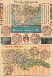
Mapa Spojených států S. A. s označením českých osad a Republiky Československé.
$1,200.00
Acquire
- Digital Map Information
- Suitable for large format printing
- Full resolution TIFF file
- ICC color profile embedded
- Delivered instantly via download link
A scarce, impressive bilingual (Czech-English) c. 1928 sheet containing two maps, one of the United States and one of Czechoslovakia, prepared by journalist Rudolf Jaromír Pšenka and published in Chicago by the 'Bohemian Daily' Svornost (meaning 'Unity'). The broadsheet map celebrates Czech immigration to the United States. (more details)
Texas on the eve of World War II.
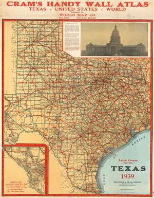
Texas.
$450.00
Acquire
- Digital Map Information
- Suitable for large format printing
- File Size: 64.02 MB
- File Type: ZIP / TIFF
- ICC color profile embedded
- Delivered instantly via download link
This is a 1939 George Cram map of Texas, providing a detailed look at the state on the eve of World War II. Highways, illustrated by thick red lines, snake their way into almost every part of Texas. Roads of lesser grades, gravel and stone roads for example, are also marked, as are unimproved roads, which the key states are only good in dry weather. Federal and state highways are identified, with the Federal shield used for Federal highways and circles used for state highways. Cities and towns all across the state are labeled, and counties are outlined in blue and named with big block lettering. An inset of extreme western Texas, from El Paso to Reeves and Brewster Counties, is situated in the lower left corner. A photograph of the Texas State Capital Building in Austin is included in the upper right corner and is accompanied by a description of the Capital building. (more details)