
Danckerts Family (sold)

The Danckerts family (fl. 1628 - 1717) were a Dutch engraving and cartographic publishing firm active in Amsterdam during the latter half of the 17th and early 18th centuries. The firm was founded by Cornelis Dankerts II (1603-1656) and his brother Dancker Danckerts (1614-16?). Cornelius and Dancker published few maps, but did pass the business on to Cornelius' son Justus Danckerts (1635 - 1701) and grandsons Theodorus Danckerts (1663-1727) and Cornelius Danckerts III (1664-1717). The firm was most active in this period between 1680 and 1700 when a number of atlases and maps appeared bearing either the Justus Danckerts or Theodorus Danckerts imprint. At the time, it was in vogue in Amsterdam to leave maps undated, which makes Danckerts maps particularly difficult to ascribe. Similarly, there is a considerable corpus of maps signed as Cornelius Danckerts. When dated we can correctly attribute these to either Cornelius II or Cornelius III, though, typically, most are undated and consequently difficult to attach to the correct Danckerts family member. The Danckerts family is well known for its highly detailed and graphic engraving style. In addition to numerous atlas maps, they also produced a number of spectacular Dutch wall maps. In the early 18th century, the Danckerts map plates were purchased by R. and J. Ottens, who reprinted many of them under their own imprint. (Ref: Keuning, J., "Cornelis Danckerts and his "Niew Aerdsh Pleyn"", Imago Mundi, Vol. 12 (1955), pp. 136-139.)
Roads and Shipping in the Holy Roman Empire.
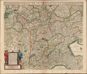
Carta Noua accurata del Passagio et strada dalli Paesi Bassi per via de Allemagna per Italia et per via di Paesi svizeri à Geneva, Lione et Roma per servizio delli Marchanti et viagianti in Genāle ad instanza delli Ss. scherer et sdi Momforti speditori delli Marchantie in Bregens. Dato in luce da Frederico de Wit di Amsterdam l'anno 1671.
sold
- Digital Map Information
- Suitable for large format printing
- DPI: 600
- File Size: 57.46 MB
- File Type: ZIP / TIFF
- ICC color profile embedded
- Delivered instantly via download link
This is a scarce road map engraved by Cornelis Danckerts in 1651, embellished and completed by Frederic De Wit for its most attractive edition, printed in 1671. It illustrates the land routes throughout the Holy Roman Empire connecting the Netherlands, France, Germany, Italy, Switzerland, Austria and Bohemia. It is a remarkable instance of a map commissioned by a specific mercantile concern, in this case the shippers Scherer and Montefort of Bregenz, on the Boden Zee in modern-day Austria. Maps depicting roads, particularly at this level of detail and at this scale, are unusual for this period; this one provides a unique glimpse on the business of transporting goods, and of travel in general, in the seventeenth century. (more details)
The rare propaganda-ish 'Farm Animal' variant on the Visscher-Jansson Series map of New York, Virginia, and New England.
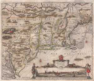
Novi Belgii Novaeque Angliae Nec Non Pennsylvaniae et Partis Virginiae Tabula multis in locis emendata.
sold
- Digital Map Information
- Suitable for large format printing
- Full resolution TIFF file
- ICC color profile embedded
- Delivered instantly via download link
An attractive old color example of Justus Danckerts' 1684 Novi Belgii or map of New York, New England, Pennsylvania, and Virginia. Some call this the 'farm animal map' for its novel incorporation of farm animals, ranging from horses and cows to chicken and sheep, ... (more details)
Dramatically Decorative World Map.
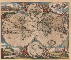
Nova Totius Terrarum Orbis Tabula Amstelodami per I. Danckerts Cum Privil.
sold
- Digital Map Information
- Suitable for large format printing
- File Size: 30.79 MB
- File Type: ZIP / TIFF
- ICC color profile embedded
- Delivered instantly via download link
This is an original color example of Justus Danckerts' classic c. 1685 double-hemisphere map of the world. The map combines the aesthetics of the Dutch Golden Age with updated cartography derived from the French authority Nicolas Sanson. Danckerts had, in 1680, produced a world map copied from Frederic De Wit 1668 Nova Totius Terrarum Orbis Tabula. While the present work retains many of De Wit's decorative elements, it introduces a range of geographical improvements over the original. (more details)
The rare propaganda-ish 'Farm Animal' variant on the Visscher-Jansson Series map of New York, Virginia, and New England.
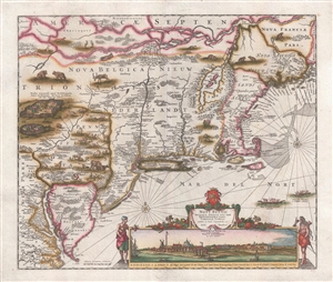
Novi Belgii Novaeque Angliae Nec Non Pennsylvaniae et Partis Virginiae Tabula multis in locis emendata.
sold
- Digital Map Information
- Suitable for large format printing
- DPI: 300
- File Size: 10.83 MB
- File Type: ZIP / TIFF
- ICC color profile embedded
- Delivered instantly via download link
A magnificent example of Justus Danckerts' 1690 Novi Belgii or map of New York, New England, Pennsylvania, and Virginia. Some call this the 'farm animal map' for its novel incorporation of farm animals, ranging from horses and cows to chicken and sheep, in its ... (more details)
Stunning and important early map of Florida and the West Indies.
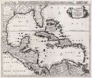
Insulae Americanae, Nempe: Cuba, Hispaniola, Jamaica, Pto Rico, Lucania, Antillae vulgo Caribae, Barlo -Et Sotto - Vento. Etc.
sold
- Digital Map Information
- Suitable for large format printing
- Full resolution TIFF file
- ICC color profile embedded
- Delivered instantly via download link
An absolutely stunning example of Cornelius Danckerts' important 1696 map of Florida, the West Indies, Central America, the Caribbean, and the Spanish Main. Cartographically influenced by Blaeu's 1636 map of the same region, this map covers from Mexico to the ... (more details)