
Danet, Guillaume (sold)

Guillaume Danet (1670 – 1732) was a Paris based French bookseller and map publisher active in the late 17th and early 18th century. Danet married Marguerite-Geneviève De Fer becoming the son-in-law of the cartographer and map publisher Nicolas De Fer (1646 – 1720). Along with his brothers and brothers-in-law, Jacques-François Bénard (Besnard) Danet (husband of Marie-Anne De Fer and engraver to the King of Spain) and Remi Richer (an engraver who sold portion of the De Fer business to his brothers in 1721), Guillaume Danet inherited a portion Nicolas De Fer's publishing business in 1720. Both Danet and Bénard used the De Fer name and signage concurrently. Danet maintained a book and map shop on the Pont Notre-Dame. After Danet's own death in 1732, the business was continued by his widow, Marguerite-Geneviève, until about 1746. Marguerite-Geneviève died in 1746 after which many of the De Fer / Danet plates were acquired by Louis Charles Desnos.
Charismatic and highly decorative map of Hispaniola or Santo Domingo.
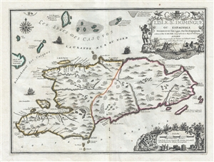
L'Isle St. Domingue ou Espagnole Decouverte l'an 1492 par les Espagnols.
sold
- Digital Map Information
- Suitable for large format printing
- DPI: 300
- File Size: 6.22 MB
- File Type: ZIP / TIFF
- ICC color profile embedded
- Delivered instantly via download link
A stunning large format example of Nicolas De Fer and Guillaume Danet's map of the island of Santo Domingo or Hispaniola. The map coves the island in full as well as parts of adjacent Cuba and Turks and Caicos. The island is shown with colored boundaries derived from the 1697 Treaty of Ryswick dividing the island into the western French portion (modern Haiti) and the larger eastern lands of Spain (Dominican Republic). Topography is drawn in profile according to De Fer's idiosyncratic style. (more details)
Charismatic and highly decorative map of Hispaniola or Santo Domingo.
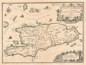
L'Isle St. Domingue ou Espagnole Decouverte l'an 1492 par les Espagnols.
sold
- Digital Map Information
- Suitable for large format printing
- DPI: 600
- File Size: 23.99 MB
- File Type: ZIP / TIFF
- ICC color profile embedded
- Delivered instantly via download link
A stunning large format example of Nicolas De Fer and Guillaume Danet's map of the island of Santo Domingo or Hispaniola. The map coves the island in full as well as parts of adjacent Cuba and Turks and Caicos. The island is shown with colored boundaries derived from the 1697 Treaty of Ryswick dividing the island into the western French portion (modern Haiti) and the larger eastern lands of Spain (Dominican Republic). Topography is drawn in profile according to De Fer's idiosyncratic style. (more details)
Rare separate issue map of Asia with interesting Kamtschatka content.
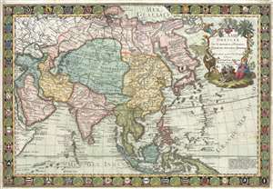
L'Asie Dressée sur de Nouveaux Mémoires Assujettis aux Observations Astronomique.
sold
- Digital Map Information
- Suitable for large format printing
- DPI: 300
- File Size: 17.4 MB
- File Type: ZIP / TIFF
- ICC color profile embedded
- Delivered instantly via download link
A highly decorative separate issue map of 1732 Asia issued by Guillaume Danet. The map is distinctively striking with a scallop shells and armorial shield border and elaborate decorative cartouche. Cartographically the map was derived from Guillaume De L'Isle ... (more details)